
Te Araroa: St. Arnaud to Hurunui Hut

Te Araroa through Nelson Lakes National Park is simply breathtaking. The sharp looking mountains and deep blue, crystalline lakes reminded me of Southwestern Colorado, though, the mountains in New Zealand seemed steeper and lakes, perhaps, more vast.
I hiked the following section with Tom for two days, and then on my own the remaining days into Boyle Village and beyond.
I reached a crossroads within myself when I arrived in Hanmer Springs for a zero day, regarding my intentions for Te Araroa—did I want to continue my journey as part of a group? Or in solitude? Did I want to embrace the spirit of flexibility and have company? Or hike mostly solo?
I hadn’t hiked a social trail since the Appalachian Trail in 2017 and half again in 2018. In hind sight, I think I allowed the number of people on Te Araroa to overwhelm me; the trail begged the questions, “How do you like to thru-hike? What sort of experience are you looking for from this particular trail?”
The truth was, I wasn’t actually sure. Maybe I wanted to experience a little bit of everything?
Day 64 (2/11/24): 6.55mi, + 600ft // 11km, +183m
St. Arnaud to Lake Shore Hut
To no avail, I washed my backpack with regular detergent in the washing machine at The Alpine Lodge and it came out smelling equally as cheesy as before. Sighing, I hung it out on the clothes line with my hiking outfit, and the liner bag I’d tried scrubbing with dish soap. It would have to do. At least the spread of grease was staunched.
That was yesterday afternoon.
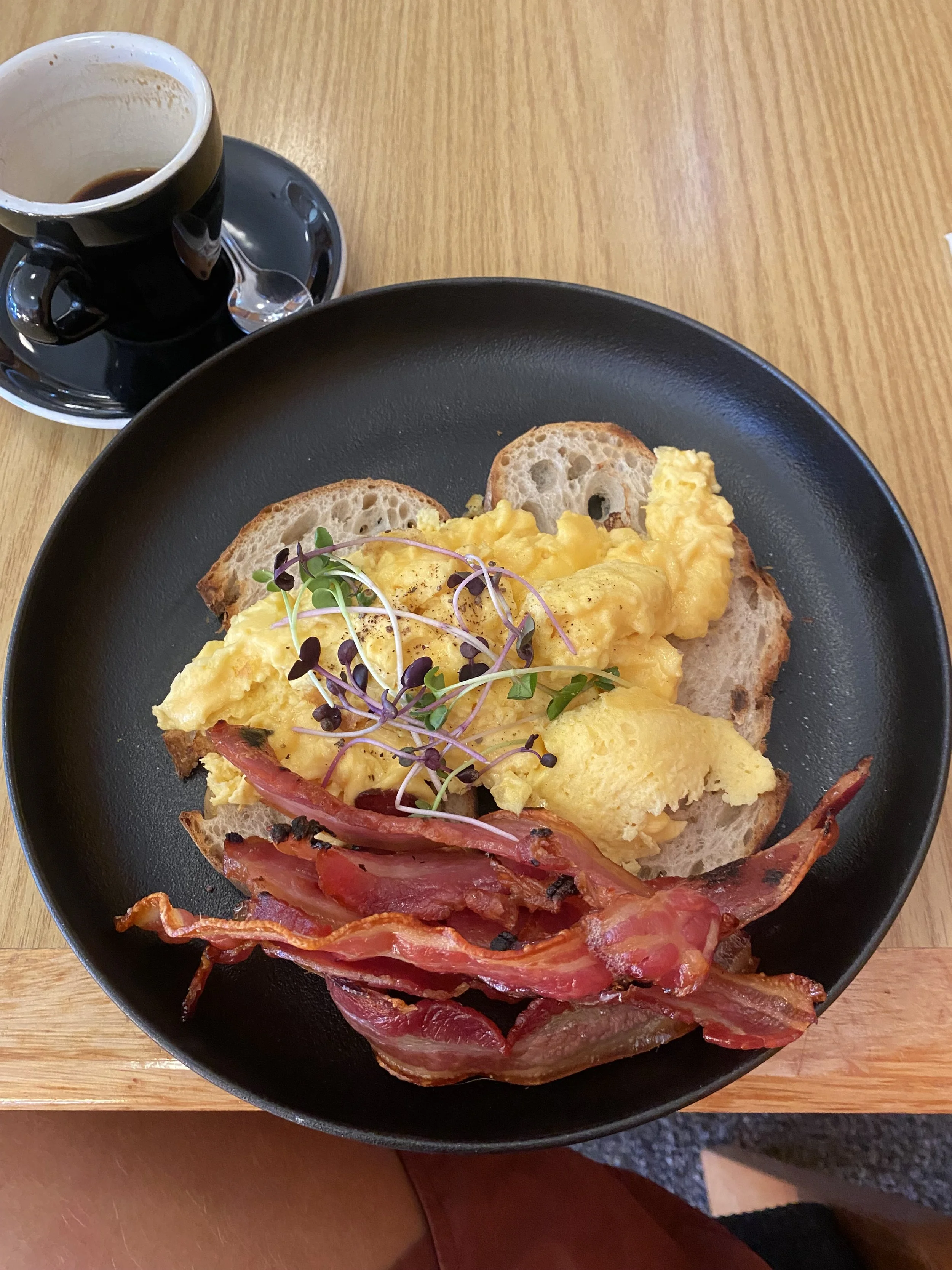
This morning I ate another delicious New Zealand breakfast heaped with bacon, and packed up my gear slowly. Tom had arrived in town the day before and persuaded me to hike two shorter days with him while he tested out his knees, making it so that we’d camp on Travers Saddle a night from now, at a tarn just off the TA.
I was happy enough to do that; my body felt slow and tired from the Richmond Ranges, and sunset and sunrise were sure to be stunning from the pass.
Back in my room, I organized the resupply I’d mailed myself and made sure I had enough food to get to Boyle Village—I had plenty.

I let Tom know I was hitting the trail, that I’d take my time and hang out by Lake Rotoiti for a while, then meet him at Lake Shore Hut this evening.
Tom waited back in town for Kez, Eva, and Curtis, to make a plan to rejoin them for after Travers Saddle. According to the WhatsApp chat they were going to take the afternoon in town and then head out tomorrow morning, putting Tom and I about a half day ahead of them.
Curtis’ shoes had blown out in the Richmonds—the soles were literally flapping—and the state of his footwear gave him shin splints. He was unsure if the new pair he’d ordered would make it in time to St. Arnaud and he was considering waiting in town and extra day if they hadn’t.
I found a nice shady spot on the stony shore, with a good breeze to keep the sandflies at bay, and sat down. My legs were lead and my head hurt. It was only 6 miles to the hut but, man, I felt depleted.
The water lapped calmly on the rocks; I wondered over my plans for the rest of the trail. I sensed I wanted some alone time, but my body wasn’t in a state for me to push big miles and achieve it. I also wasn’t prepared to ask for it directly from the group, being that I really did enjoy everyone’s company.
I massaged my forehead in my hands; the TA was such a social trail! I hadn’t been prepared for that aspect of it, not after spending an entire week alone in the dark on the Benton MacKaye trail in October, not after my solitude-filled, late season, 35-day thru-hike of the Arizona Trail two years prior, or my exceedingly quiet thru-hike of the Long Trail a year before that. I was used to just… being alone?
Wow. I sounded like a hermit.

When I started walking again an hour later, I found Tom sitting on the beach a little ways down the trail. My spirits were low when I dropped down onto the rocks beside him, but I had no idea how to explain what I was feeling.
I was probably making a bigger deal out of things than necessary; I was probably just tired.
We swam and I drank a Radix protein shake, figuring the calories would do me some good, then we headed for Lakeshore Hut.
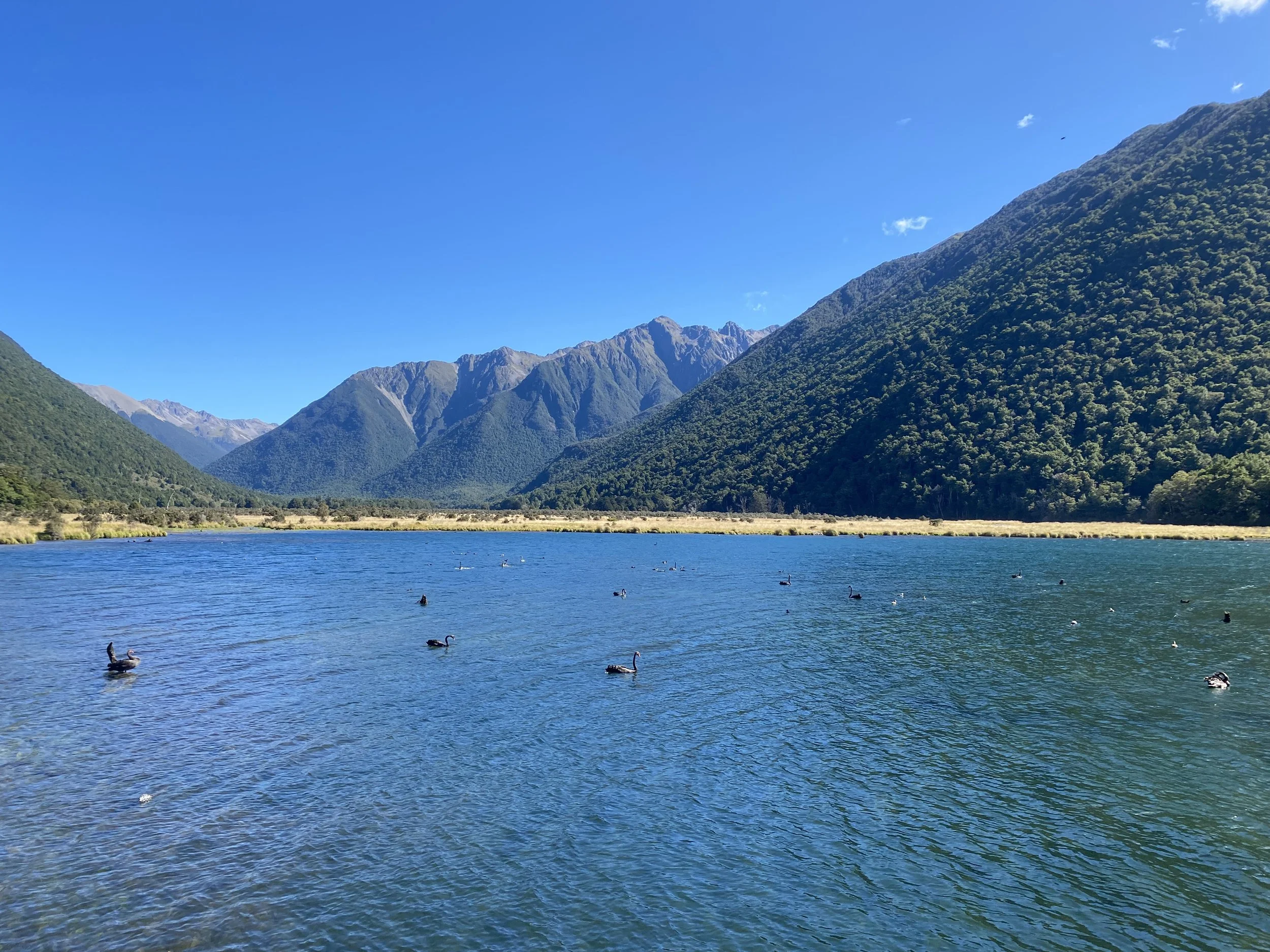
On our walk we passed a gaggle of black swans. They were incredible, their delicate necks arched so that their orange bills just grazed the surface of the water, not a care in the world for us as we stood on the pier watching.
When we arrived at the hut—to my utter dismay—I re-encountered the odd man from Red Hills Hut, his hair just as lank and unkempt as before, his eyes just as wild.
This time he lectured me about hypothermia, of all things, as I stood outside the hut, sweating and batting off a dozen or more sandflies. I nodded passively, uncertainly, unable to get a word in edgewise. And as soon as I was able to extricate myself, I did.
That night I slept harder and longer than I had since I started the trail. I did not wake up once, which is highly unusual for me; the sleep was much needed.
Day 65 (2/12/24): 15.67mi, +4806ft // 26km, +1465m
Lake Shore Hut to Unofficial Campsite on Travers Saddle
We got a late start from Lake Shore Hut because I had slept for such a long time—until 8AM! I couldn’t believe it—and then we began weaving our way up the valley. I felt a million times better after getting some quality sleep.
Tom and I chatted about life and long trails, I spoke about Logan compulsively because I missed him, and talking about him made it seem like here was there, with us.
When we reached the junction for Travers Falls around noon, I could not resist taking the steep side trail towards the sound of thundering water.

I climbed down roots like ladders, slipping deeper into a cavernous grove of trees and mosses, moist with the spray of the waterfall. Ferns grew from the damp walls, leaning out over the roiling turquoise pool. The air danced with electrifying energy, chilling my skin and mussing my hair.
I was terrified to get in—the pool looked chaotic and arctic—the pounding of the water set my teeth on edge. But in I went and so did Tom. We swam back and forth across; I cried out each time I banged my numb feet on sunken debris, an ear-splitting grin on my face.
The only thing that warmed me after the frigid plunge was the long climb back up to the trail.

The forested climb to Upper Travers Hut was beautiful, but I was eager to get up above tree-line. I took off power-hiking, leaving Tom to focus on his more cautious pace in order to protect his knees.
When the hut came into view, my pace slowed. I walked across the tussock meadow with care, doing my best not to trip on the hidden mounds of grass; Tom caught up while I was seated on the porch steps, eating an OSM Bar. He looked tired.
“Do you still want to go up to the saddle?” I asked him.
“Oh yeah,” He said definitively.
It was already 4PM, though, and he was moving slowly, limping at times. I felt bad and I wasn't sure what I could do to help. I was surprised he had insisted on leaving town with me, before the rest of the group, when taking another day might have helped his situation. But then again, maybe another day wouldn’t have made a difference.
My need for alone time buzzed to the forefront of my mind, but again I found myself without the words to express how I was feeling.

Leaving the hut, I hiked hard and fast up to the saddle, happy to be moving well and feeling a little more energetic. The view at the top of the saddle was stunning. Tom was not far behind. Travers summit rose to a near perfect pyramid, and as the sun dropped, its angles were painted with peach alpenglow.

My entire being felt lighter when I reached the sparkling emerald tarn only a short walk further. I was thrilled to be camping off trail, and even more excited when I saw that someone else was already set up on the rocky hill overlooking the water.

It was Irena from my bunk room in St. Arnaud! I really liked her witty personality and her presence relieved some of the tension I was feeling. We all cooked dinner together and talked about Te Araroa, our experiences on this trail and some of our other adventures.

After watching the sunset, we all called it a night. Tom opted to cowboy camp—to sleep in the open without his tent—but I preferred the comfort of my tent, regardless of the lack of bugs, so I crawled inside and got cozy in my quilt. It was a windless night, but as soon as the sun went down, the temperature plummeted sharply.
I was so grateful to be on the South Island. I’d imagined what it would be like to walk in these mountains for such a long time, since last January, really; I’d fantasized about my arrival the whole time I was melting on the North Island roads.
To finally be in Nelson Lakes National Park was surreal.

Day 66 (2/13/24): 18.25mi, +5304ft // 30km, +1617m
Travers Saddle to Caroline Bivy (Derelict)

The sky was powder pink when I opened my eyes again, and Travers Peak glowed a brilliant orange.
I crawled out of my tent and gathered my ingredients for breakfast, chosing a flat-ish rock to perch on while I boiled water for coffee and oatmeal. Today was the day I would set off on my own, I was excited to walk my own pace without a care of moving too quickly or taking too few breaks.
Tom seemed a bit melancholy. I considered him a good friend, and perhaps by leaving the group I was disappointing him, I really couldn’t be sure, though, and this was what I wanted.
I took a few pictures of the alpenglow dazzling the peaks around me, and then set my phone down in my lap to eat breakfast. I had a vague thought that I should put it in a pocket, but I was distracted by hunger.

When I was finished eating, I stood up thoughtlessly—
Clunk-craaack!
I looked down at my feet and saw my phone laying facedown on a rock. I cringed as I reached for it, flipping it over in my hand to survey the damage.
The screen bore a quarter-sized spiderweb of cracks, glass was coming through the clear plastic case; the portion of screen visible around the crack was all black squares and rainbows. I could only see about 3/4 of my apps and I worried over how quickly the blot would spread.
Tom did me the favor of googling phone repair shops in any of our upcoming resupply towns, but there were none, all the towns were too small. I tried calling my mom to ask her if she could order me a phone and have it delivered to Arthurs Pass in a week, but my reception was terrible. I resolved to find better service later in the day, but for now, all I could do was pack up and get moving.
The idea of being on portions of the TA without a GPS made me nervous, the trail had been hard to follow at the best of times.

I said good-bye to Tom and started walking; I was distracted enough by my busted phone that the murderously steep descent to the West Branch of the Sabine River flew right by. People had talked up this descent as being one that was excruciatingly steep and prolonged, but I did not find it so unpleasant as some of the descents in the Richmonds.
The climb upstream along the Sabine River after West Sabine Hut was gradual at first, but grew steeper the closer I got to Blue Lake Hut. I passed through deeply moss covered trees, clambered over startlingly white granite boulders, and stared into pools of water so minty blue they made my teeth ache.
I began to weave in and out of bush line, gawking at the many waterfalls cascading down the rock faces above me. What a stunning place!

I dipped back into the trees briefly—suddenly I stood before the hut. When I pressed the door open it was a million degrees inside, but aside from a couple of backpacks, it was empty. I hadn’t seen Blue Lake // Rotomairewhenua yet, it was famous on the TA, but under no circumstances was anyone permitted to swim in it. The ecosystem was fragile and, conceptually, the lake was sacred.
I signed the intention book and exited the hut, determined to catch a glimpse of the lake.
Following a path away from the hut, I began to hear voices. It was Rebecca and Kristy, my other two bunk mates from St. Arnaud. They were lounging on some grass next to the most startlingly blue water I’d ever seen.
“Hey!” I said as I approached. “How are you guys?”
“Oh, great! Just enjoying the lake from a respectful distance,” Kristy noted without a trace of irony.
I nodded and stuffed a piece of died mango in my mouth, “Totally,” I dropped my pack near them and pulled my tent out to dry it on a nearby rock.
But just as I reached for my tortillas and tuna to make lunch, we were interrupted.

“Hey hey,” A voice said. “I am assuming you all don’t know, so I am going to educate you, if that’s okay.”
I turned around, tortillas in one hand, tuna packet in the other, and noted the DOC (department of conservation) ranger standing at the edge of the path I’d just walked down.
“This is technically the lakebed that you are sitting on, the water level is lower than usual, and your heavy boots—” I looked down at mine, Rebecca’s and Kristy’s trailrunners, “—are damaging the grasses. You aren’t supposed to walk there.”
Kristy immediately capitulated, apologizing profusely, but made no move to get up. Rebecca sat there staring at the DOC worker with a look of confusion, glancing at the lake every so often.
Without saying a word, I started throwing things back into my pack; I could tell we weren’t going to win this one regardless of how much Kristy apologized.
I walked my gear 20 feet away, and dropped it in front of an informational sign, tossing my damp tent over the sign since no one was around to read it. I was starving at this point and feeling a bit hangry.
The DOC worker abandoned Kristy and Rebecca, who were finally packing up, and followed me to continue their lecture, “You can’t hang your tent there, then no one can read the sign.”
I sighed, not even trying to hide my frustration, “There is no one around to read it and my tent will be dry in about 5 minutes.”
They raised their hands in a placating manner, “Where did you camp last night?”
Now their arms were crossed.
I thought about lying because I didn't like their tone, but it was easier to tell the truth given how hungry and depleted I felt, plus, there was nothing illegal about where I had camped.
“Travers Saddle.”
“Hmm,” They surveyed me like I was a problem, like I was somehow hurting this place simply by being here. “How many people were there?”
Now I was getting mad. I was hungry, this was my lunch break, and this person was interrogating me like I was in trouble. I hadn’t touched the lake! I’d barely even looked at it.
“I don’t know,” I breathed, turning away to pack. I could tell they were not going to leave, it would have to be me.
“Well, I’d like to know what kind of impact everyone is making up there—” They stopped short and shrugged, annoyance showing.
Go take a hike then, I thought. See for yourself.
I wanted to tell them there was no visible impact, yet, that very few people probably camped up there each summer. I didn’t see any toilet paper or trash or trampled plants. It was a mostly rock and sand environment. But I could tell my opinion did not matter.
I’d never felt so unwelcome.
The DOC worker finally walked away after making a few more comments about the lake and the rules, and the further away they walked, the more relaxed I felt.

The climb to Lake Constance // Rotopōhueroa was way hotter and longer than I expected, and doing it on a mostly empty stomach was less than ideal. At this point I really needed a proper lunch break—an actual “sit down”—my intention was to make it all the way to the lake shore to do so, that way I could eat with a great view.
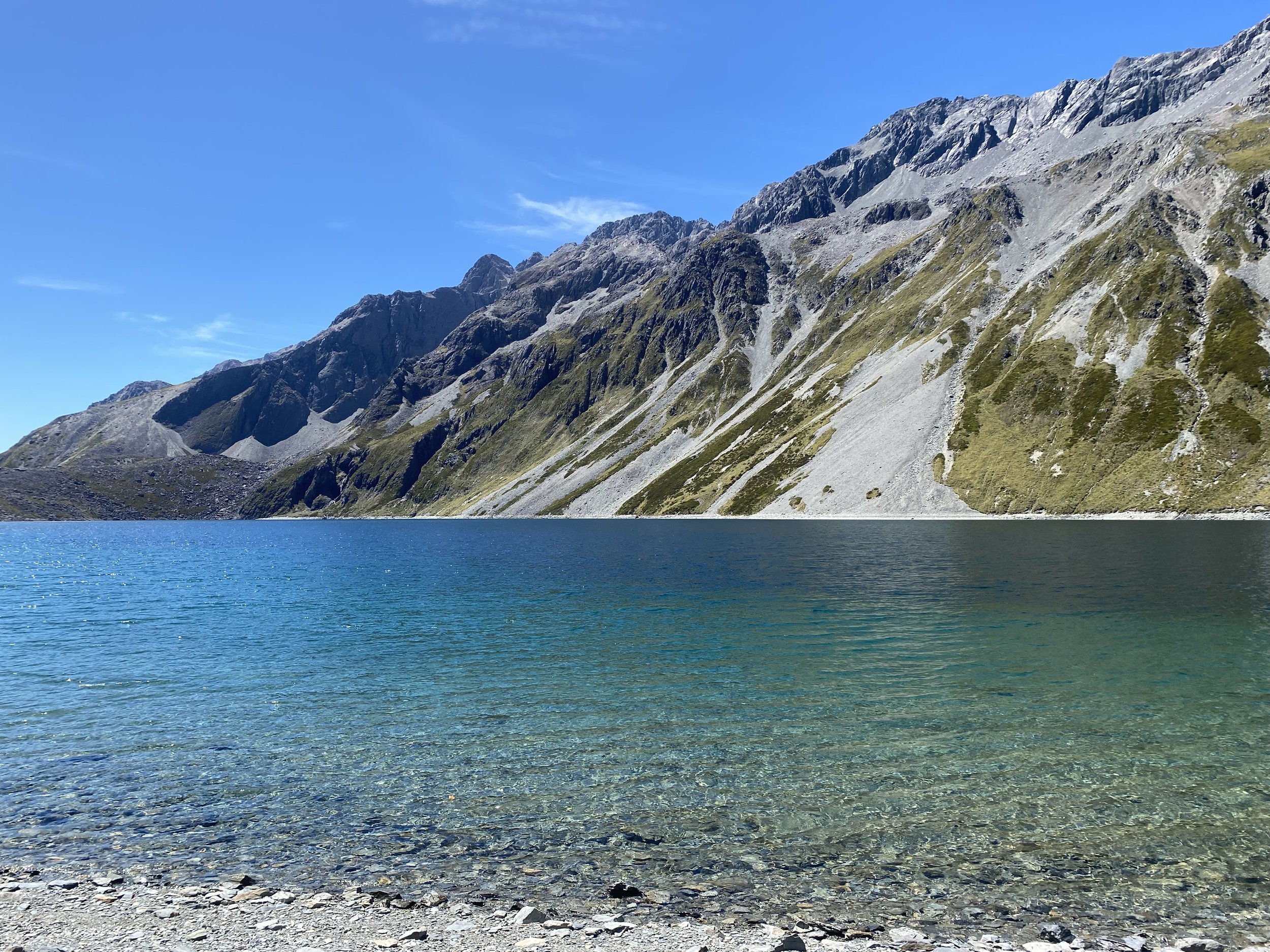
Lake Constance was massive, one of the more gigantic alpine lakes I’d ever seen. The water was sapphire blue and after an age of walking the narrow, eroded trail above it, gazing into its cool depths, I was positive I was going plunge into it. Rules be damned.
I was fed up with DOC, I wasn’t wearing perfumes or bug spray or sunscreen, I wasn’t sick or—god forbid, on my period (don’t even get me started arguing against that antiquated frame of thought)—my body was not “impure” like all these rules made it out to be, the lake was genuinely massive, and I was getting in.
As I submerged my exhausted body in the lake’s vast, blue one, I did so with as much gratitude and reverence as I could muster—while I didn’t feel any warmth towards the DOC ranger, I did care about respecting the lake, even if my way of respecting it was different than the formal expectation—then I sat on the shore and made a de-hy meal of eggs and chives, which I rolled up into a tortilla and savored, looking out over the glittering surface of the water as I ate.
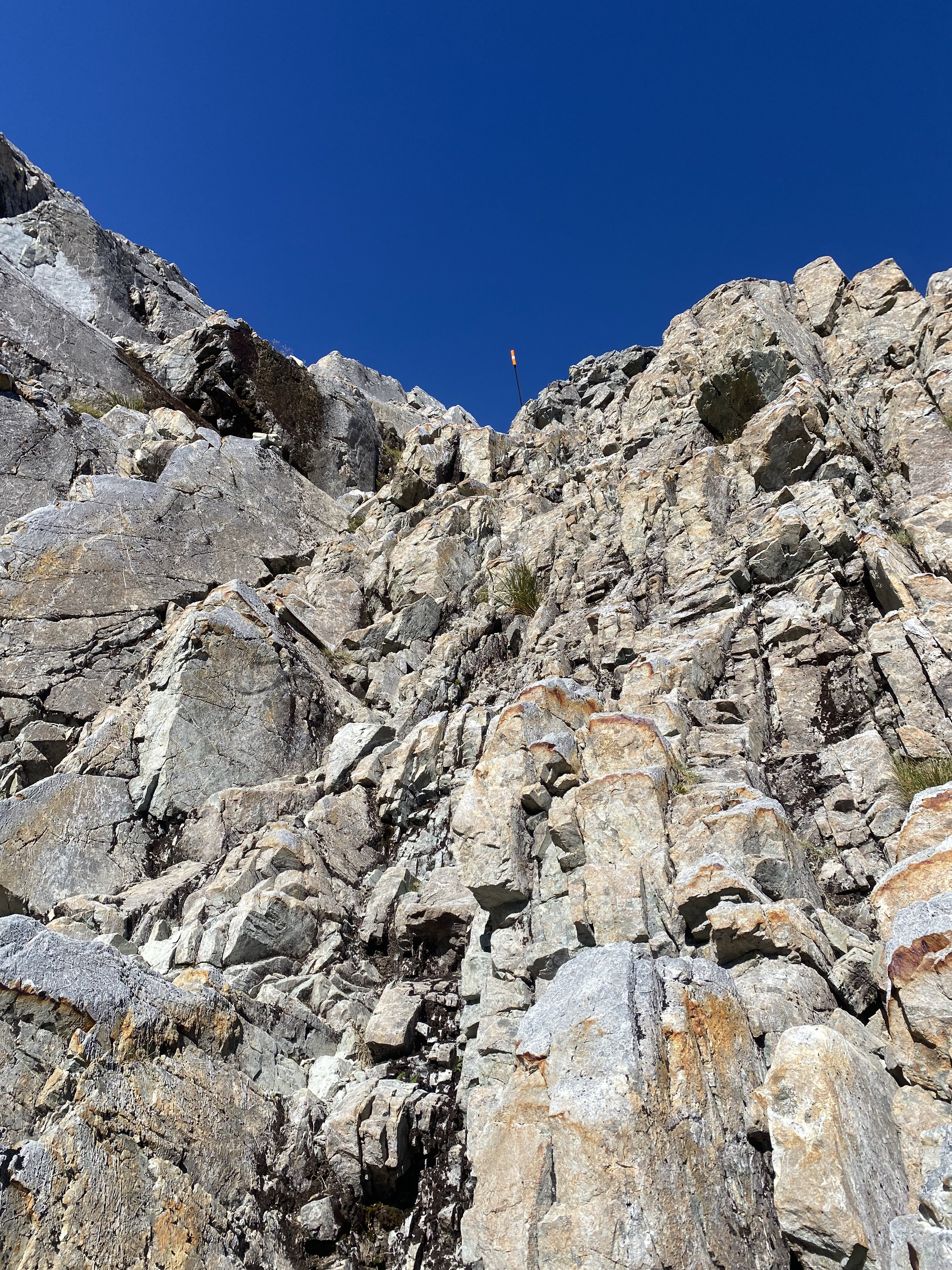
The climb to Waiau Pass was straight up a nearly vertical wall of scree. Towards the top the angle slackened, and I took a breather to stare back the way I’d come. As much as I’d enjoyed Nelson Lakes National Park, I was eager to cross over Waiau and start afresh on the other side.
Over the past two days I’d felt so much inner turmoil over wanting to hike alone, I’d smashed my phone on a rock, I’d been chastised by DOC for no good reason—quite frankly, I was ready to put a little distance between me and my problems.

I called Logan from the top of pass and caught up briefly, he would order a phone on my behalf and have it sent to Arthurs Pass Village, I’d be there in about a week. His help was a relief because the obscuring rainbow pixilation on my screen was spreading at an alarming rate, and the shattered glass caused me to worry about water damage if my phone were to get even slightly damp.
After Logan and I said our good-bye’s, I began the infamous descent off the pass.
I was prepared for the scrambling sections to challenge me, I’d heard the down climbs were scary for some, but it wound up being nothing more than a really fun puzzle. Sure, my backpack was bulky and made the otherwise straightforward moves feel a little harder, but all in all, on a good weather day, the descent off the south side of Waiau Pass was really fun.
Looking back up the way I'd come.The hardest part of my day was the final stretch down valley to Caroline Bivvy (a derelict hut, turned campsite).
I was taken down to my knees, then to my back, by a vicious and never ending rock garden, full of unsettled debris and rickety boulders. I cracked my right knee cap on a rock after rolling my left ankle, then collapsed into a bush backpack first, so that, like a turtle, I was relatively stuck. A large spider crawled out from a dark cavern in the rocks between my legs and I stifled a scream.
My knee was throbbing. I lay still, despite the many spiders now appearing out from under the disturbed rocks around me, and caught my breath. Had I cracked my patella? A wave of nausea rolled over me when I tried to weight my leg; there was a sharp pang in my injured knee and the tissue around it was already starting to swell.
I had to make it to camp and I had to make it out of the valley the next day, there was no other option in my mind, so I kept walking, a bit more carefully this time.

Each step hurt, and my knee felt quite stiff by the time I hobbled into camp. I was the only one there besides a ravenous hoard of sandflies. I tried not to think too much about my knee, which throbbed dully as I set up camp. I would feel better in the morning, I told myself.
It was a peaceful spot in the trees, with perfectly flat ground, and I ate dinner standing up, pacing slowly back and forth to try and throw the sandflies off my trail. It worked, to an extent.
Once in my tent, bedded down, a Robin came to visit just before the sun set. The bird jumped back and forth, nabbing sandflies from the bug mesh—at least one of us was benefiting from the pests.
I took some Ibuprofen, threw on my CEP knee sleeve, and closed my eyes. Tomorrow would be a new day.
Day 67 (2/14/24): 24mi, +2492ft // 40km, +760m
Caroline Bivy to Anne Saddle

I slept until 7AM and ate breakfast inside my tent so as not to get absolutely massacred by sandflies. Several robins hopped outside my mesh door, eating bugs and watching me curiously. They were quickly becoming my favorite birds on Te Araroa.
I started walking with my knee taped, but quickly realized I did not like the way it felt, so I ripped the tape off and left my patella free to move about as it would, it ached with each bouncing step but I did my best to ignore it. Luckily the terrain was uncomplicated and relatively flat.
The TA followed the Waiau Uwha River downstream for many miles, crossing several of the large tributaries which fed it. One crossing was shockingly wide and deep, though the river bottom was comprised of smooth, palm sized stones which made for good footing.
I marveled at the mountains on all sides, and the sea of golden grass through which I waded.

Not long after departing the Waiau River and turning upstream along the Henry RIver, I reached Anne Hut—a very new, very nice structure, situated in the middle of yet another field of tall, golden grass.
Inside the hut I met Sam from Brisbane, he was planning to stay at Anne Hut for the night. I was tempted to call it a day, too, but after eating a late lunch I felt energized enough to carry on. We were both headed into Hanmer Springs from Boyle Village the next day.
The rest of my walk that afternoon was uneventful, and the climb to Anne Saddle was mild. I made camp a ways above the saddle, off trail, and despite the unexpectedly gusty winds, I slept quite well.
The pain in my knee had grown no worse, I was glad the injury had stabilized.

Day 68 (2/15/24): 14.3mi, +1437ft // 23.8km, +438m
Anne Saddle to Boyle Village (hitch to Hanmer Springs)

I woke to grey skies and more wind. I stared balefully at the day’s gloomy disposition, glad I was headed into town.
I packed up quickly and hiked downhill through lichen covered trees, back to the TA. I only had 14miles to cover before Boyle Village; I didn't expect the walk to be very challenging, but I could tell I was tired and my knee still ached with movement, so I knew it could feel long and slow.
After about 6 miles of casual descending through forest and open river valley, I arrived at Boyle Flats Hut. The hut was empty and provided a great reprieve from the sandflies. I ate a tuna tortilla, signed the intention book, and swept the hut out just because it felt like the right thing to do.
I crossed the drooping swing bridge over the Boyle River to get to the hut, and now I had to cross it once more to return to the trail. I did not like this bridge, not the way it sagged precipitously over the canyon and rapids bellow, nor the way it shimmied and teetered wildly with each of my steps. I inched steadily across and refused to look down.

The trail entered the forest in earnest for the remaining 7 miles to the highway, and I zoned out as I bobbed and weaved, up and down—mostly downhill—through the trees.
Suddenly my ears tuned into a high-pitched t-ching, I’d never heard before.
Riflemen birds // tītipounamu!
I slammed on the breaks and craned my neck to see them. Their tiny, ping-pong ball shaped bodies bounced around the narrow trunk of a beech tree to my right, little beaks picking delicately at the sooty fungus splattered across the silver bark. They did not have any tail feathers, which made them look all the more cute.
As soon as they noticed me noticing them, they flew off, deeper into the trees.
Then my InReach dinged, which I found immediately odd because it was set to silent, it had been for the entire trip. I’d been thinking about Logan just before seeing tītipounamu, and sure enough, it was a message from him wishing me happy Valentine’s Day.
Later, after reaching Boyle Village and catching a hitch at Lewis Pass Road (hwy 7) into Hanmer Springs, I would do a bit of research on tītipounamu.
In Maori culture, tītipounamu is considered to be a messenger of the forest—how fitting then, that Logan’s message should find me in their presence and that I would receive it immediately and without delay.

Dinner for two? No way. Just me, and I finished it all. Day 69 (2/16/24): zero day
Kakapo Lodge, Hanmer Springs

I never tried to capture tītipounamu on camera, it felt impossible because of how quickly they move and I didn't want to miss out on a moment of watching. They are New Zealand's smallest endemic bird, and they are in the wren family.My day off in Hanmer Springs was lovely. I resupplied at the Four Square grocery, printed some maps at the library incase my phone kicked the bucket between Boyle and Arthur’s Pass, and went to the Hot Springs twice (I recommend paying a little extra for the ‘return’ day pass, so that you can leave, get lunch, and go back for a second soak later in the day).
Leaving Hanmer Springs the next day, my pack was full to bursting. As usual, I had bought too much food.
The swelling in my knee had gone down and it only hurt to the touch—horribly though, if I accidentally banged it on something—kneeling was out of the question, but aside from pitching my tent, or cooking with my camp stove, I didn't often need to.
Day 70 (2/17/24): 29mi, +3458ft (+ 4mi road walk to hitch) // 48km, +1054m (+ 6.6km)
Boyle Village to Unofficial Campsite 1 km before Hurunui Hut

The morning out of Hanmer Springs, I walked 4 miles on the road in the fog before I was able to secure a hitch back to the trail. The walk felt long and disheartening, but as soon as a car stopped for me, any feelings of desolation I harbored left me, and I was happy once more.
That’s just the way hitching works—you don’t get a ride until you do, it’s disheartening until it isn’t, it doesn’t work out until it does, and it’s usually worth the wait.

The couple who picked me up dropped me back off at Boyle Village—they had been hiking Te Araroa until one of them broke their wrist, now they were roadtripping across the South Island, traveling a different way.
I opted to walk the 7 mile detour on the highway to Windy Point, instead of the actual TA. The highway was not particularly fun to walk on, and I would feel regretful of my choice to detour later on, but at the time I was nervous the Doubtful River would be too high to cross after the rain the mountains had received over the last two days.

From the Windy Point Trailhead, all the way to Hope Halfway Hut, the Harper Pass Track was easy walking. I took a short break at the hut until a father and daughter showed up, ready to camp there. I chatted with them for a few moments and then hit the trail once more.
The next hut I came to in the wide river valley was Hope Kiwi Lodge. Taki was there!
He and I caught up while he cooked dinner and I ate a snack. It was early evening, but I wanted to make it a ways further that night. There were two older men in the hut, clearly having a boys weekend, clearly bent on being crude and boisterous. I glared at them when they dared make a comment about how I was “being cheap” for not wanting to pay to stay at the hut—Hope Kiwi, like the huts in Nelson Lakes NP, was not included on the $120NZD backcountry hut pass—but that wasn’t the reason I was hiking on.
I corrected them without hesitation, shutting down their rude, presumptuous banter with a few words and an icy look, then said my goodbyes to Taki, unsure of how much of the disagreement he had picked up on. God, I was tired of old men who [thought they] knew everything.

I marched steadily on, down stream along the Kiwi River to Summer Lake. I thought about camping somewhere near the lake, but saw a group of non-thru-hikers camped close by and thought better of it. I knew there was private land somewhere around here, and I worried it might be the actual landowners spending a night out on their property.
I did not want to cause any trouble.

Past Summer Lake, I joined the Hurunui River and began to walk up valley. I decided I would cross the swing bridge over the river and camp along its shore. I was so close to Hurunui Hut, but there was supposedly limited camping outside of it, and I didn’t want to risk not getting a spot.
I chose a flat spot in the trees, out of the way of the trail, just as the sun was going down. Today had been a long day. I pitched my tent and cooked dinner quickly, batting off sandflies as I did so.
I was alone, but I wasn’t lonely. I felt at peace about my hike and its trajectory. I’d had a chance to see Eva, Kez, and Tom in Hanmer, they were taking a zero day the day I hiked out, Curtis was a day behind, still hoping to intersect his new shoes at some point, either in Hanmer or by making a special trip to Christchurch.
Laying in my tent that night, I felt really grateful for my life, for being able to walk Te Araroa. I didn’t know what would come next—even as I write this entry, I still don’t really know—but I was happy to be in my tent next to the Hurunui River, on this incredible journey. The rest I would figure out when I had to, one way or another.
