
Te Araroa: Whanganui Holiday Park to Paekakariki Holiday Park
Finishing the Whanganui River section of my walk felt like a huge milestone, it meant I was getting so very close to the end of the North Island.
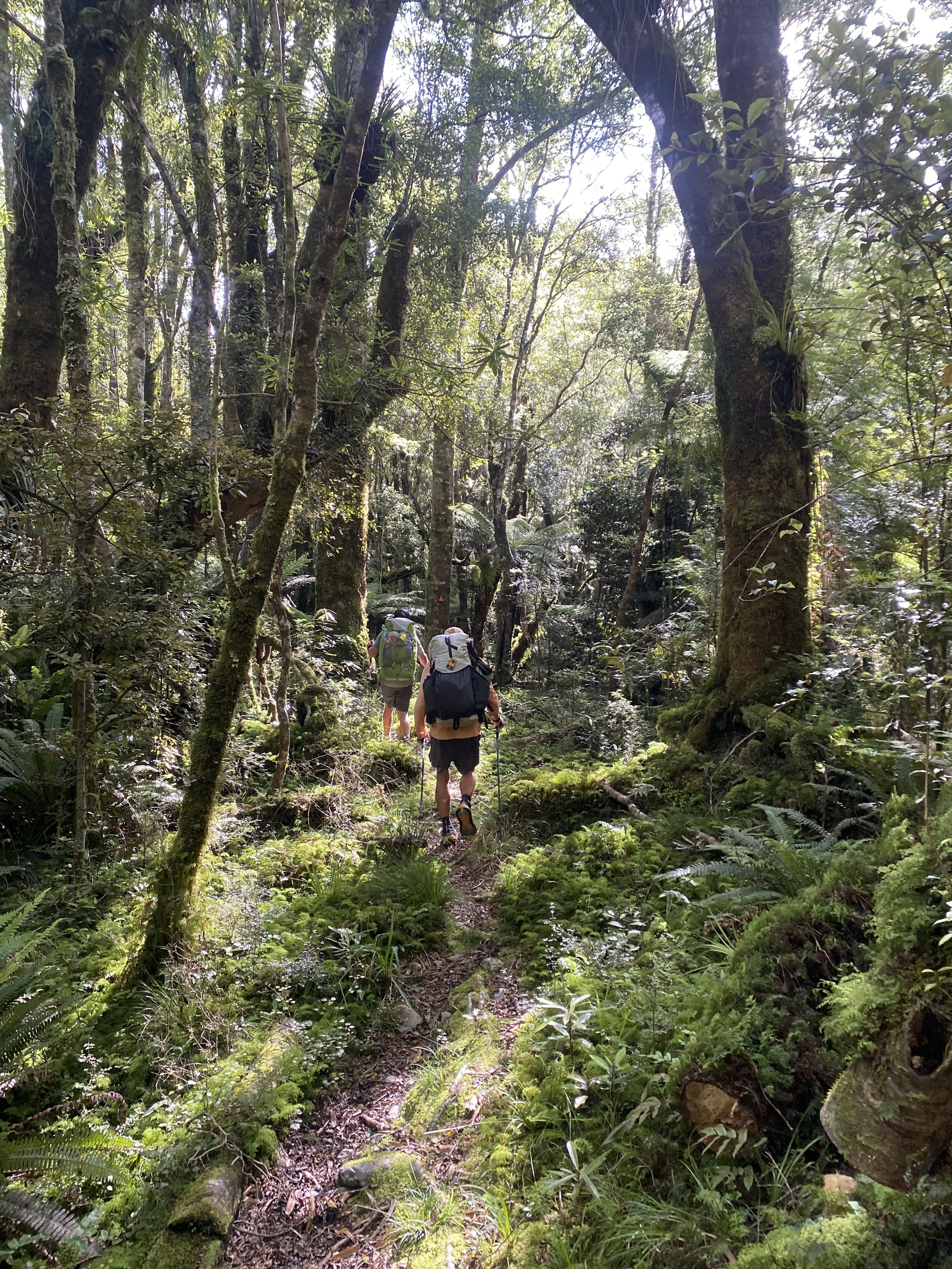
But first… I needed to survive the Tararua Ranges, mountains known for slippery mud, changeable weather, wicked storms, and steep as (NZ slang, not a typo) trails. I was a little intimidated by the stories I’d heard about these mountains, I’ll be honest.
But mostly I was ready to get to the South Island, and if tramping through the Tararuas would get me closer to that goal, I was going to do whatever it took to make it through unscathed.
Day 43 (1/21/24): 25.6mi, +758ft // 42.6km, 231m
Whanganui to Koitiata Campground
A tidal crossing of the Whangaehu River set the pace for the day—fast—I needed to get to there fast. And of course the river was in the last 3km of the 43km walk.
I didn’t let my need for speed stop me from calling my mom on my way out of Whanganui, though. She and I power-walked many a morning when I lived in Maryland and any time she or I would visit each other, and we never found ourselves too out of breath for talking.
It was so nice to catch up, it made the road walking fly by. Plus I’d done a quick resupply before leaving town, just enough to get me to Bulls the next day, and my pack was mercifully light.
Later in the afternoon I hiked into the picnic area off highway 3 for a lunch break, and who do I see sitting at the table? Jonne and Mikel.
Annoyance prickled my scalp. It wasn’t that I wasn’t happy to see them… I was! But I was tired of hikers who I know walk shorter days than me, that I’d passed, suddenly showing up in front of me again. It was childish of me, I know.
It felt like I was on an impossible treadmill walking every mile of trail, but no matter how hard I walked, I was still getting passed by people who were walking less. Welcome to the TA, the trail very few people actually walk end to end.
I knew that I shouldn’t let other people’s hikes have any impact on how I viewed mine, but I was feeling hot and tired and, quite frankly, a little cranky.
“Where did you all come from?” I asked mildly.
“We walked the highway,” Jonne said a bit defensively.
“Yeah, I mean before that. Did you do the Tongariro Crossing?” I pressed.
“Oh, yeah, the weather was bad,” Mikel shrugged. “Maybe we will go back later and do it.”
“Oh,” Weather. Anything less than sunshine and people bail on even the best parts of the trail.
We chatted in a strained yet amicable fashion, until Reanna and Chris, the couple from Australia who had been on the Whanganui River at the same time as me, showed up and diffused the tension.
They had been close behind me all day and I was relieved to see them.
I ate a banana and a tuna tortilla before packing up and hitting the road again.
My quick pace was such that I wound up hiking the beach with Reanna and Chris; they were very fast hikers and also totally committed to walking the whole trail. I admired their resolve and neutrality when it came to dealing with hikers who were hitching. At least on the surface, it didn’t seem to bother them. It made me want to be more open minded and accepting.
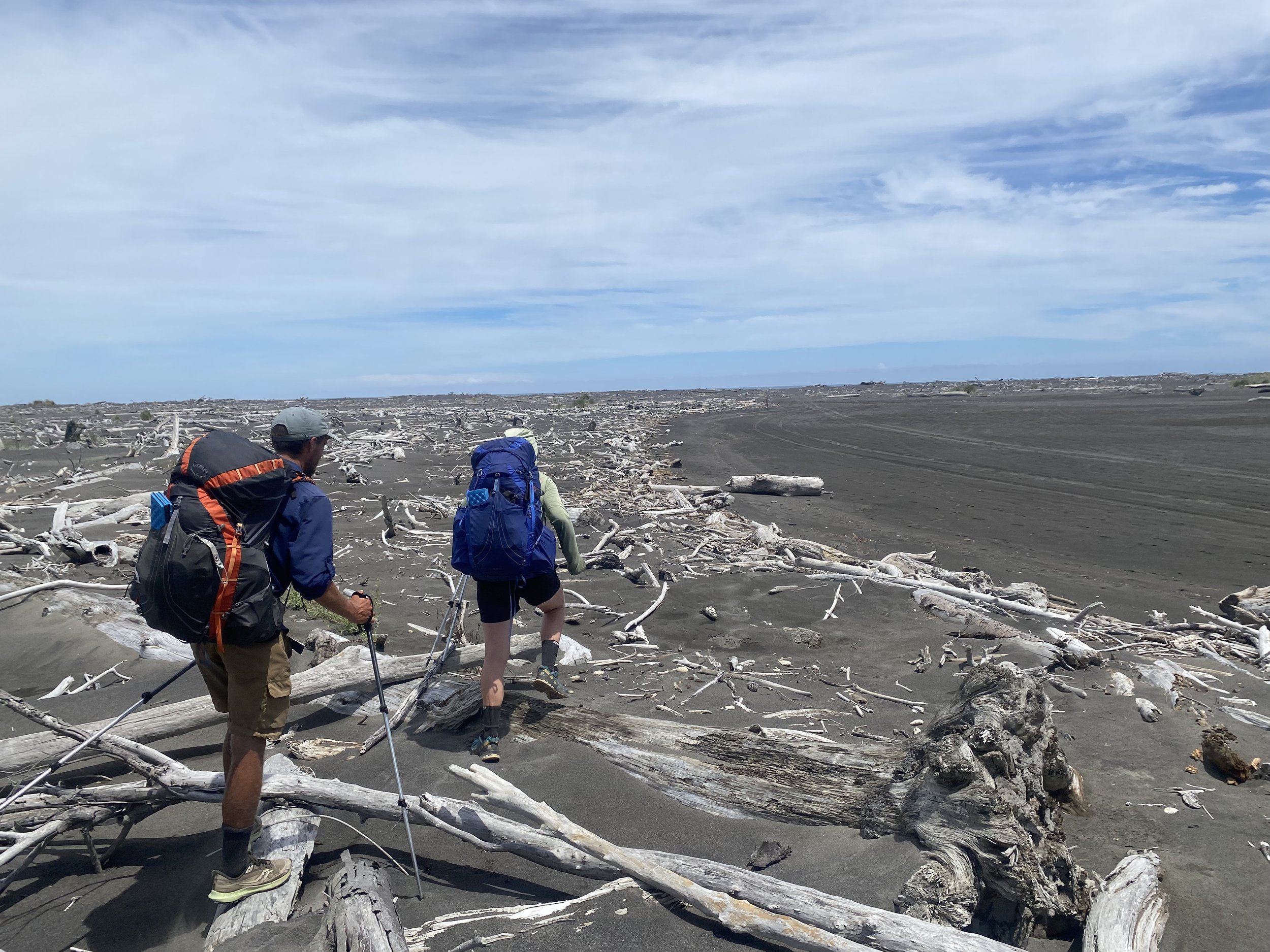
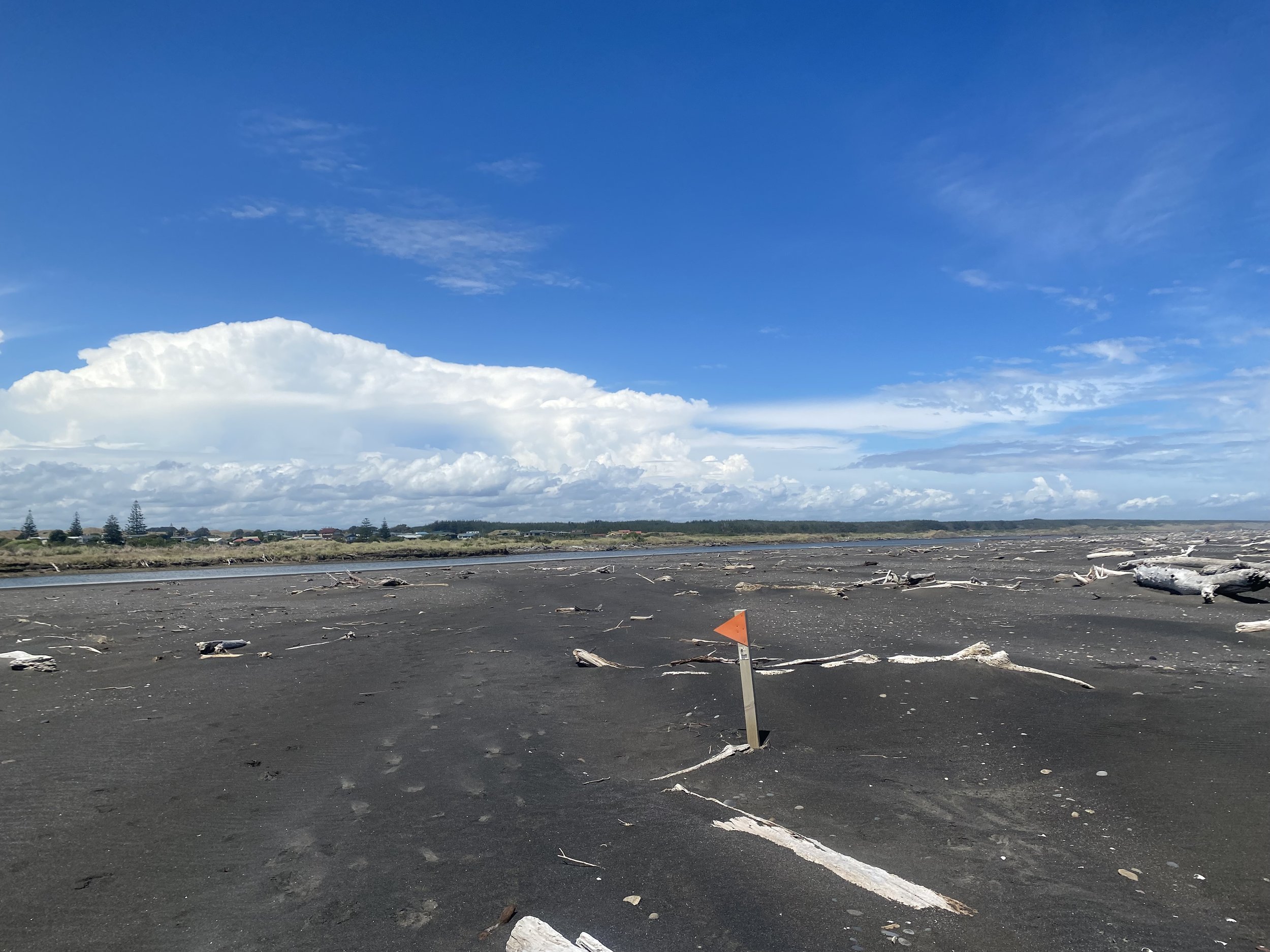
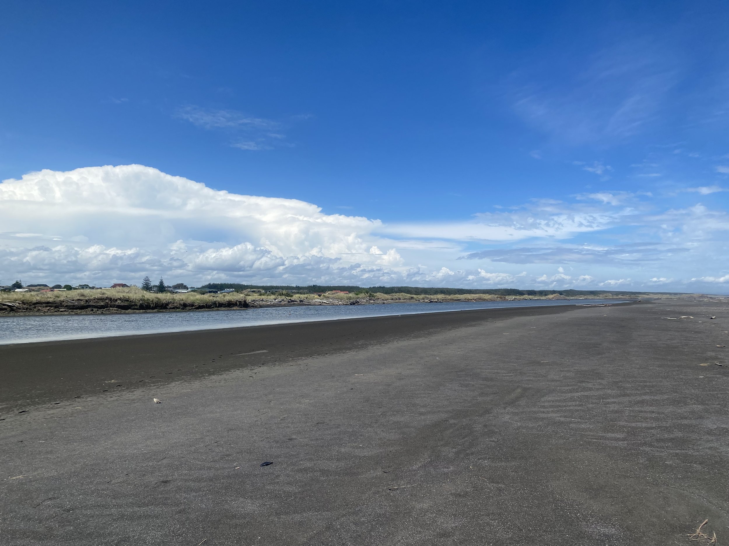
The beach looked like a disaster zone with the dark sand and all the bleached white driftwood piled up against the high tide line. I loved it.
The river crossing weighed on our minds, though, would we catch low tide? It appeared the tide was already on its way back in.
But when we arrived, the river was more like a hip deep tidal pool, without any current at all, a very easy crossing—if not a little creepy for the lack of clarity and squishy bottom.
When I got to camp I saw that Logan had tried calling me a few times on WhatsApp and I panicked. He never called back to back.
When I got him on the line I asked him if he was okay, “What happened? Is everything alright?”
“Oh, it’s fine,” He laughed. “I’m sorry, Ueli was sick all over the house and I was supposed to go to Vail tonight to stay with Jonathan and Miranda—Katie was going to dog sit—for the race, but I’ve already decided not to go. I just wanted advice.”
I was flattered, honored, really, that Logan had called me in a moment of indecision. This was something I would’ve done, called him, that is; he always seemed to have the answers, the fact that he thought I might have some, too, made me feel essential, it made me feel loved.
“I’m so sorry, I didn’t have service,” I said. “And I’m sorry you aren’t going to do the race, but I think you’ve made the right choice—a really nice choice—for Ueli.”
“Yeah, it’s okay. There will be other races. I just feel like my ski season isn’t panning out the way I’d hoped.”
We talked a while more; I had to stand on top of this one picnic table in a very specific corner (while trying not to tip it over) to get service. When we said our goodbyes I felt a pang of homesickness.
There were a ton of hikers at camp that night, basically everyone from the canoe trip, plus some, so I was forced to be social. I kind of enjoyed it.
Jonne and Mikel were there too, I finally stepped off my high horse and caught up with Jonne—I’d actually really enjoyed walking with her for the time I did—and found out that her feet were really bothering her. She seemed a bit low, and I hoped her experience on the trail improved, especially with the Tararuas coming up.
Day 44 (1/22/24): 34mi, +892ft // 56.6km, +272m
Koitiata to Trail Angel in Fielding (Allison and John Bebner)
Ralf (from Austria) and I had convened the night before and decided we would walk all the way to Fielding today. I’d coordinated with a trail angel from the Facebook page, arranging for us to camp at their house along with Jordan. Jordan had gotten hung up in Whanganui, waiting for his rainfly to catch up to him. He’d mistakenly left it at Whakahoro, at the start of the canoe trip and the canoe hire was going to bring it to him if he waited a day.
It was a tall order to walk all the distance to Fielding in a day in the heat—the day was guaranteed to be another scorcher—but we were eager to get into the Tararuas at the same time as several other hikers from the canoe trip and go in as a group.
I know what you are thinking, a group!? Ivey in a group, go figure—and not just any group, a group of people who were skipping sections, well, all except for me and Ralf, hence why we needed to walk 34mi today to “keep up”.

Ralf was a very fast hiker. Like, together we averaged a 6km/hr pace. People jog at that pace. That’s about 4mph for my fellow Americans.
Not only is he a speedy walker, Ralf is lightening fast packing up in the morning, too. It’s safe to say there was no time for my one hour routine of waking up, packing up, drinking coffee, eating oatmeal etc., so I settled for hastily assembling a bagel with Nutella and cream cheese, which I proceeded to inhale messily as we power walked in deep sand toward sunrise. I didn’t choke but I really thought I might.
And I gotta hand it to Ralf, he is a great photographer:
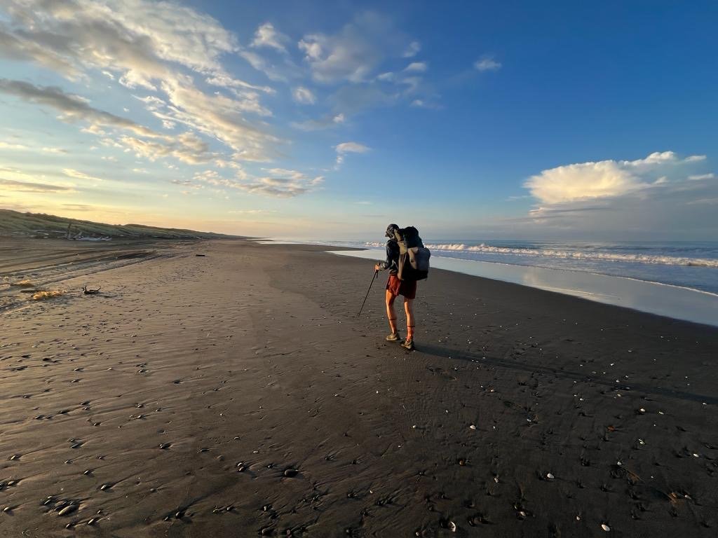
Photo by Ralf PolkeAfter 10 miles on the beach, our terrain switched to road. We conversed every so often but mostly we hiked in silence, which I appreciated. I didn’t have much energy for talking in the heat.
When we did talk, we commiserated over the skipping culture on the TA, we related over how it made us feel. Ralf also talked about his history of competitive wind-surfing, how he’d traveled all over the world chasing wind and waves.
I shared about my history with horses and eventing, how I missed the horses, but not the competing—that’s not to say I’ve lost my competitive edge, I haven’t, if anything now it is sharper.
When we arrived in Bulls we stopped for toasties and cold beverages at the Four Square and sat in the shade of the building eating them as people practically stepped over our legs to run their errands. I didn’t care, the shade was precious and I wasn’t going to cede the space until I had to.
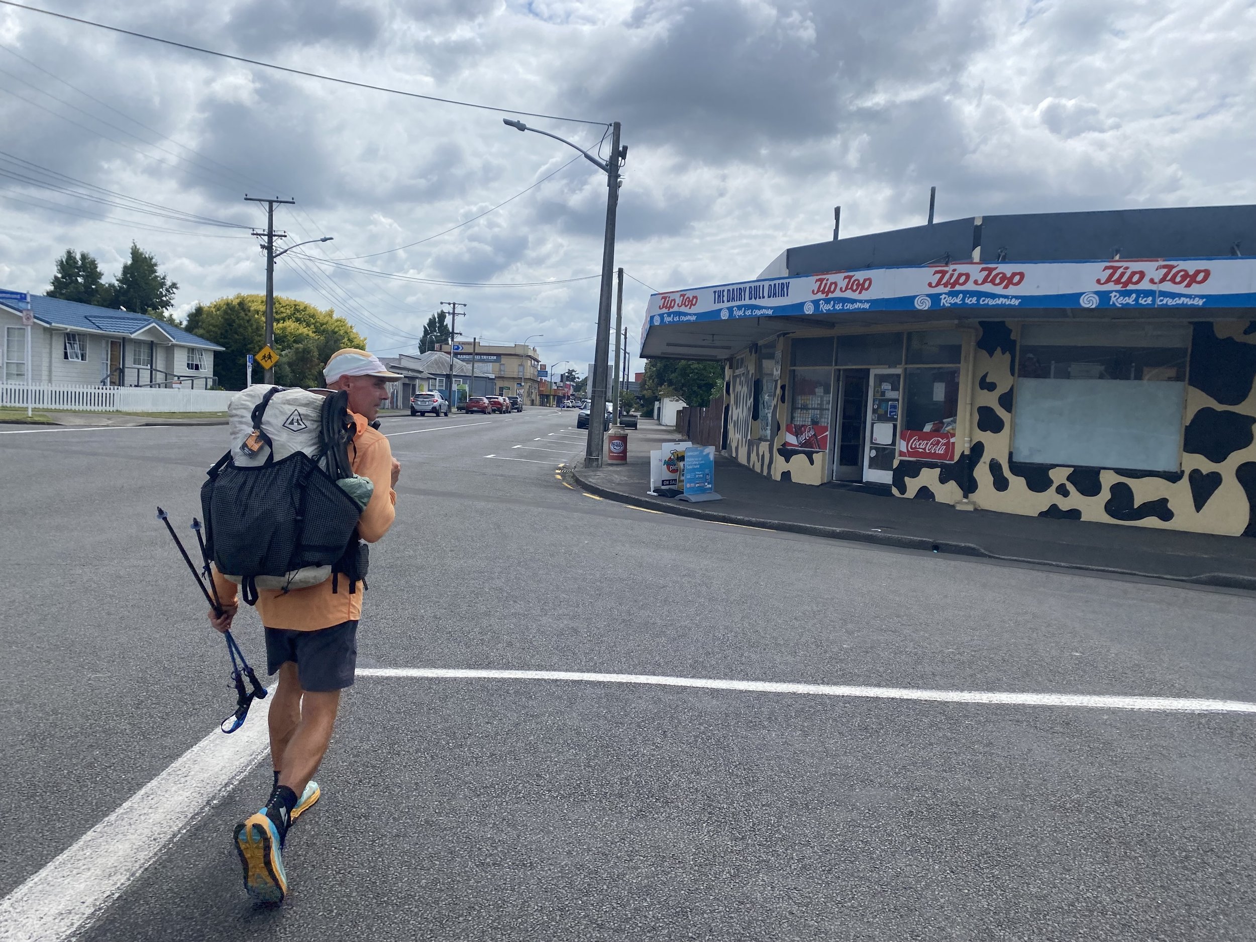
Leaving Bulls, the day got even hotter, if that was possible. The tips of my trekking poles were covered in melted tar from the road as were the soles of my shoes, each step felt like I was peeling my feet off a tacky surface.
Heat radiated off the pavement in liquid waves. We sweltered. Our clothes, soaked in sweat, clung heavily to our skin and without a breeze to dry them, there was no relief.
I fantasized about jumping in a bathtub full of ice. I closed my eyes while I walked—dangerous—and imagined the cold relief I would feel as I broke through a frozen surface and frigid water bit into my skin.
I would’ve sold my soul for such sweet bliss.
Reaching for my water bottle I realized I was almost out. My panic lessened when I remembered there was a reserve and campground ahead; I told Ralf I needed to stop there for a break.
When we reached Mt. Lee’s I promptly stuck my head under the spigot and let cool water pour over my face and hair. It was amazing how much more bearable the temperature was just off the road, under the trees, it had to be 10 degrees F cooler.
When we arrived in Fielding at 4PM we were welcomed into the Bebner’s home for coffee and then shown the backyard where we could camp for the night. It was a lovely spot, and I was even able to take a shower!
I felt baked, fried, even, and was relieved to lay down in my tent that night and close my eyes against the world.
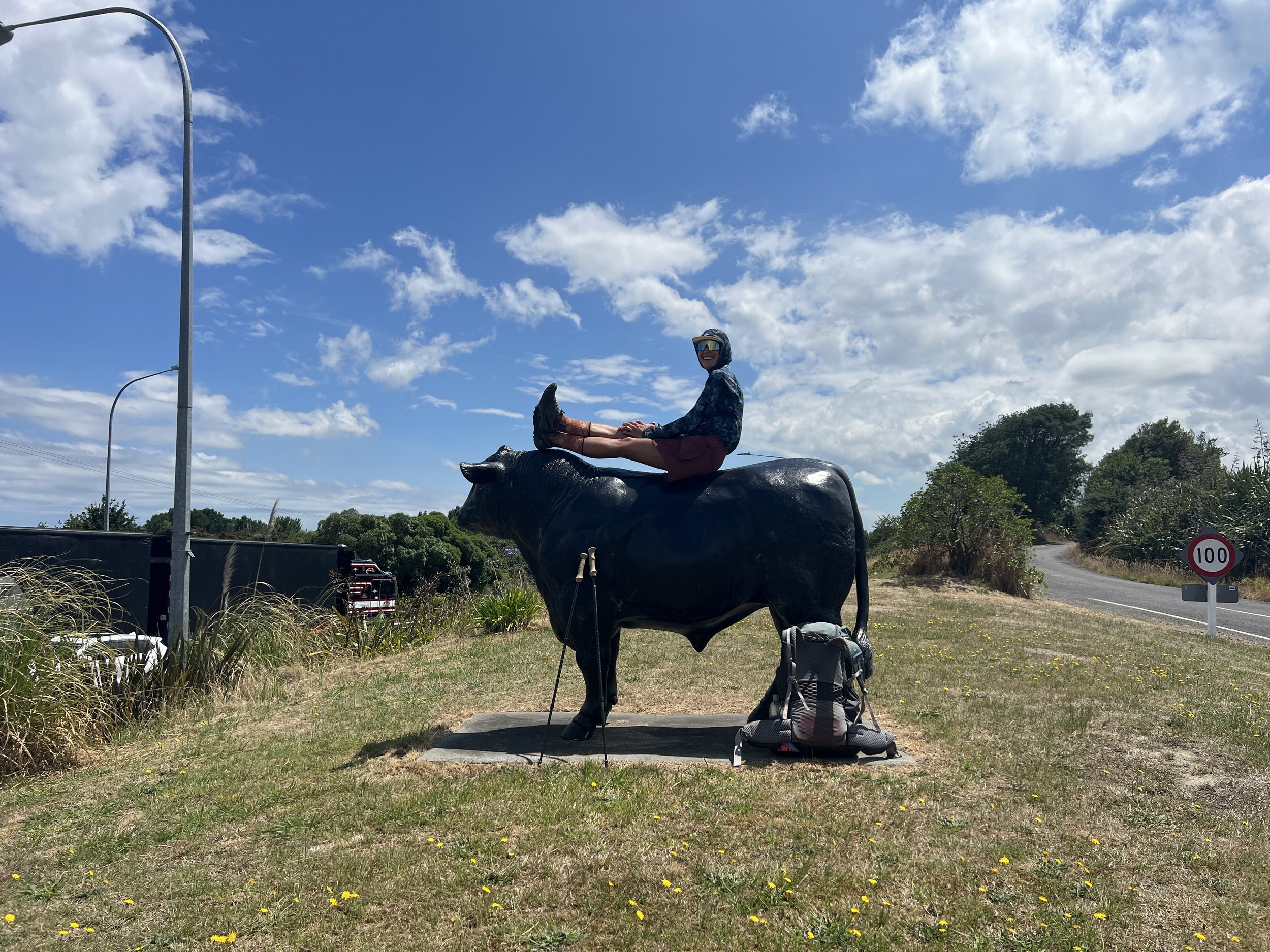
Photo by Ralf PolkeDay 45 (1/23/24): 28mi, +2233ft // 46.6km, +681m
Fielding to Kahuterawa Car Park and campground (the start of the Tararua Ranges)

The morning sky was an ominous bruise, it over promised and under delivered, though, as it only rained a small amount on our walk from Fielding to Bunnythorpe.
The scenery was a bit industrial and chaotic for my taste, but Ralf and I were walking so fast I didn’t have much time to look around.
When we arrived in Palmerston North I decided it was time…
“It’s time!” I announced outside of the New World Grocery.
I unceremoniously pulled off my beat up Topos, salvaging the nearly flattened—but not quite—SuperFeet insoles, and promptly chucked them in a trash can.
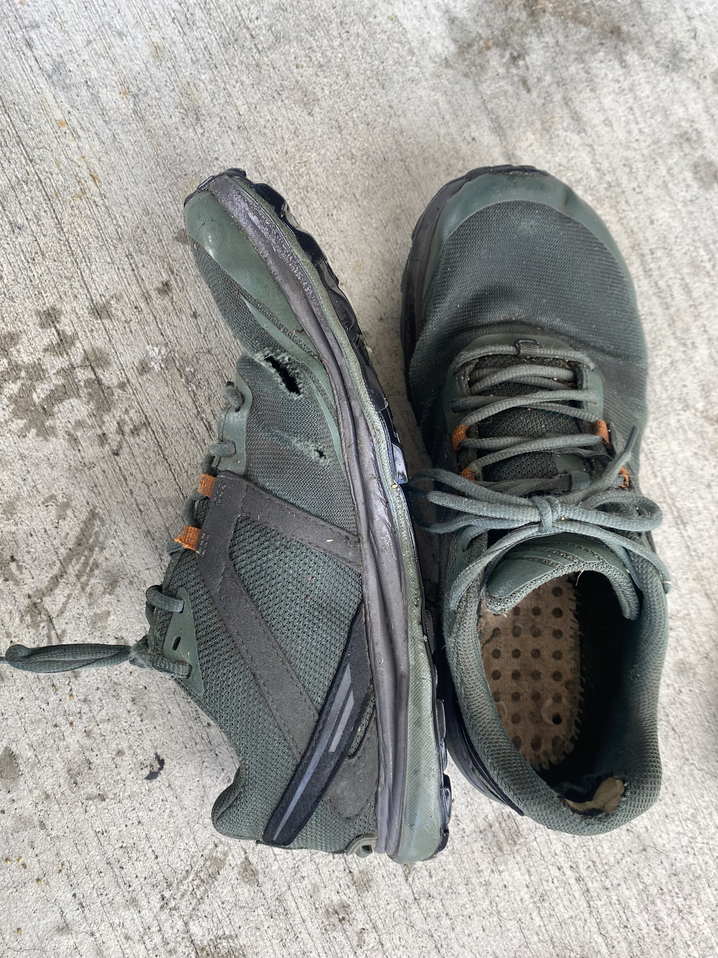
“Good-bye shoes,” I waved, then pulled out the new pair of Altra’s I’d been carrying for the last THREE HUNDRED MILES in the outside mesh pocket of my backpack, lined them with my ratty insoles, and stuck my feet inside.
“Wow,” I whispered reverently. “Like clouds.”
Ralf laughed and didn’t bother asking me why I hadn’t mailed them ahead, which was good because I didn’t have an answer for that particular question.
I’d dealt with so many logistics already, when I had thought about mailing shoes ahead the task felt monumental, I couldn’t do it. I just couldn’t. It was easier to carry the extra weight.
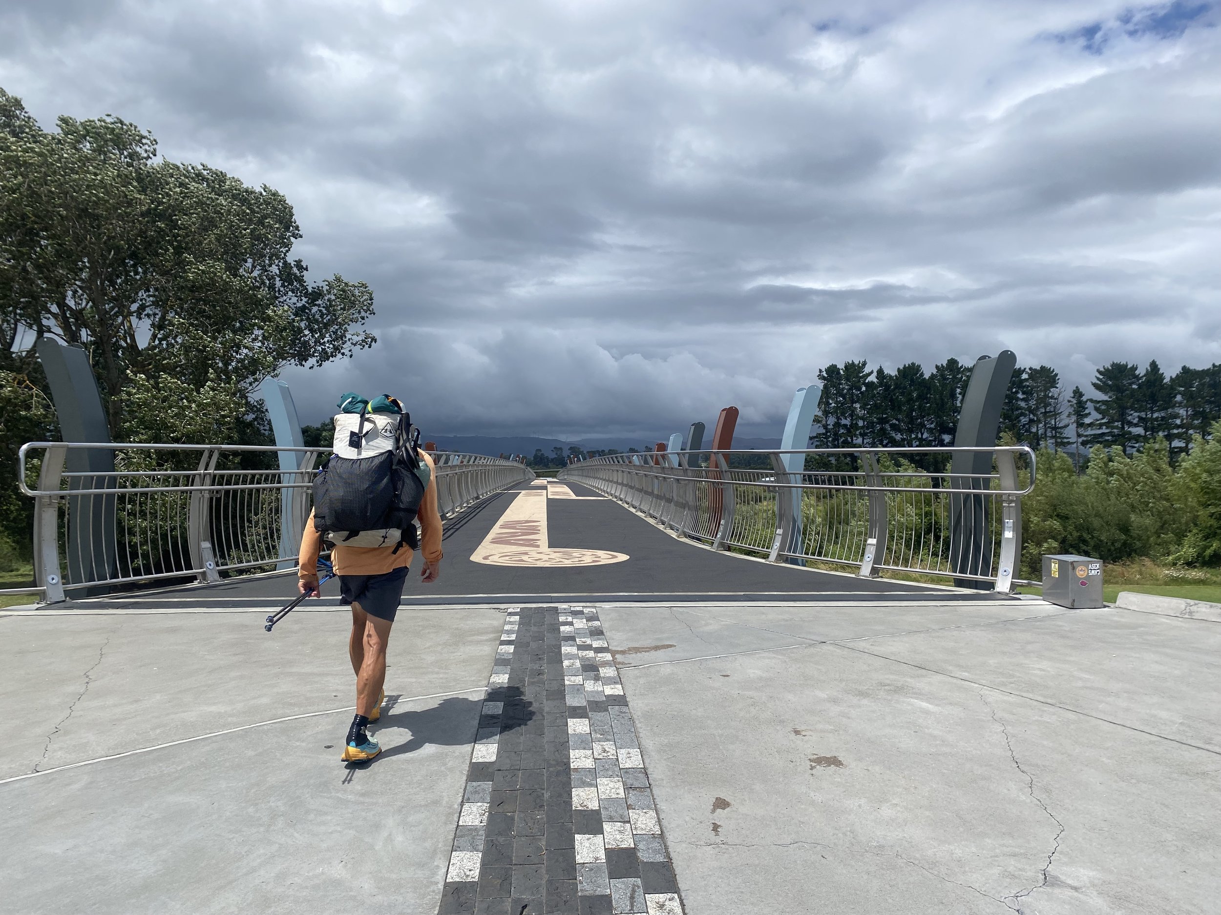
After resupplying in Palmerston North, we walked a bike path out of town towards the stormy looking foothills.
I felt ready to get there already, to get out of town and into the mountains. I wanted to be swallowed by wilderness once more, to look up and see nothing but trees and sky.
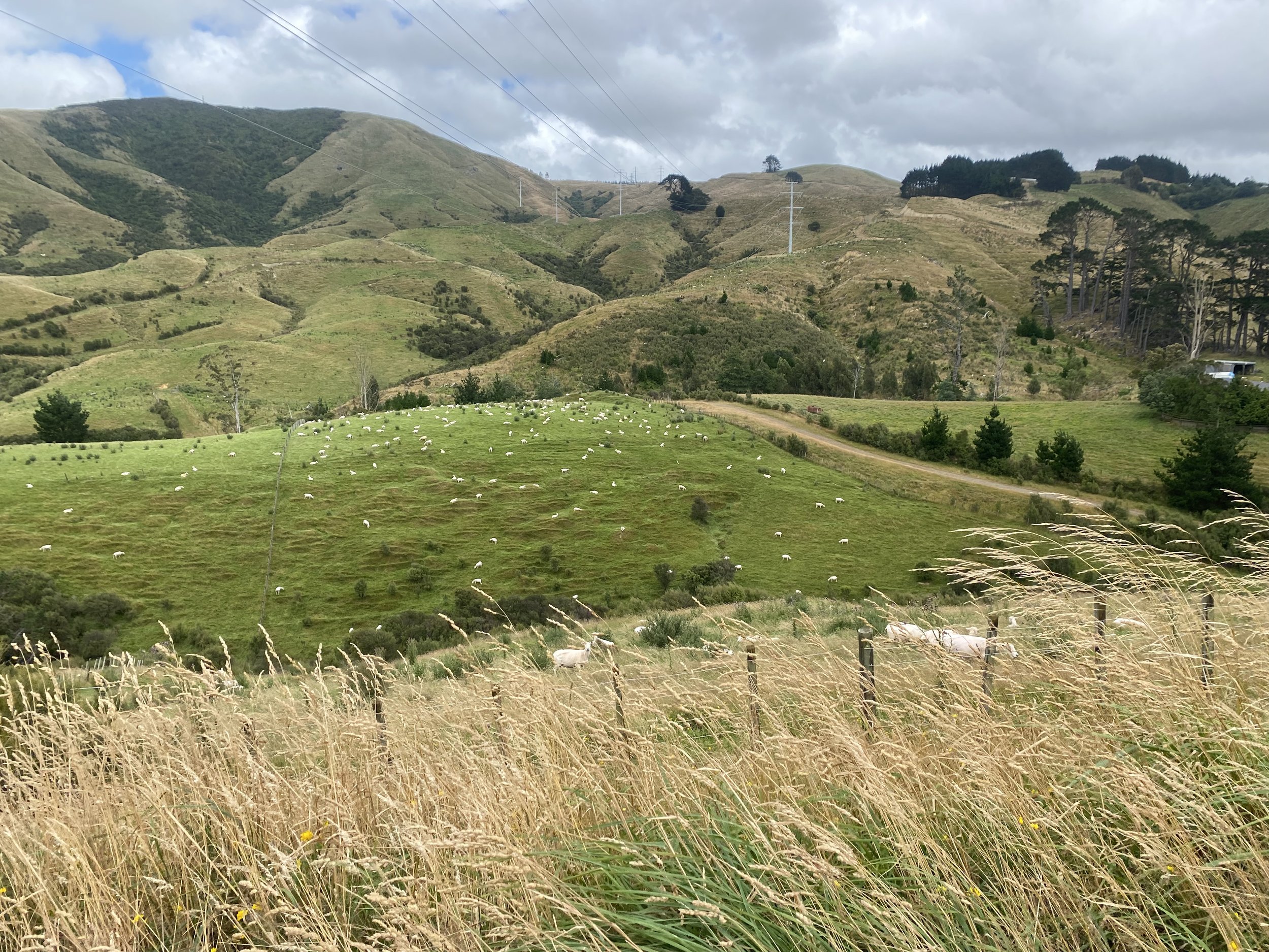
As we wound our way through grassy hills, past fields of sleepy sheep with windmills spinning languidly in the distance, I shoved moist hunks of sourdough bread into my mouth, silently wishing I’d bought more than one loaf. Alas, I already had too much food in my pack as it was.
I sighed gratefully. I was happy to be alive and walking; in that moment it didn’t even matter where I was headed, it just felt good to be moving.
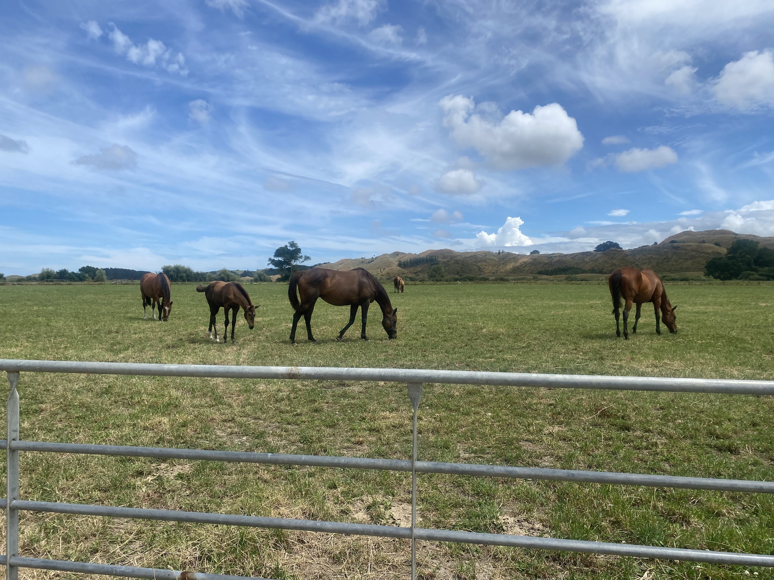
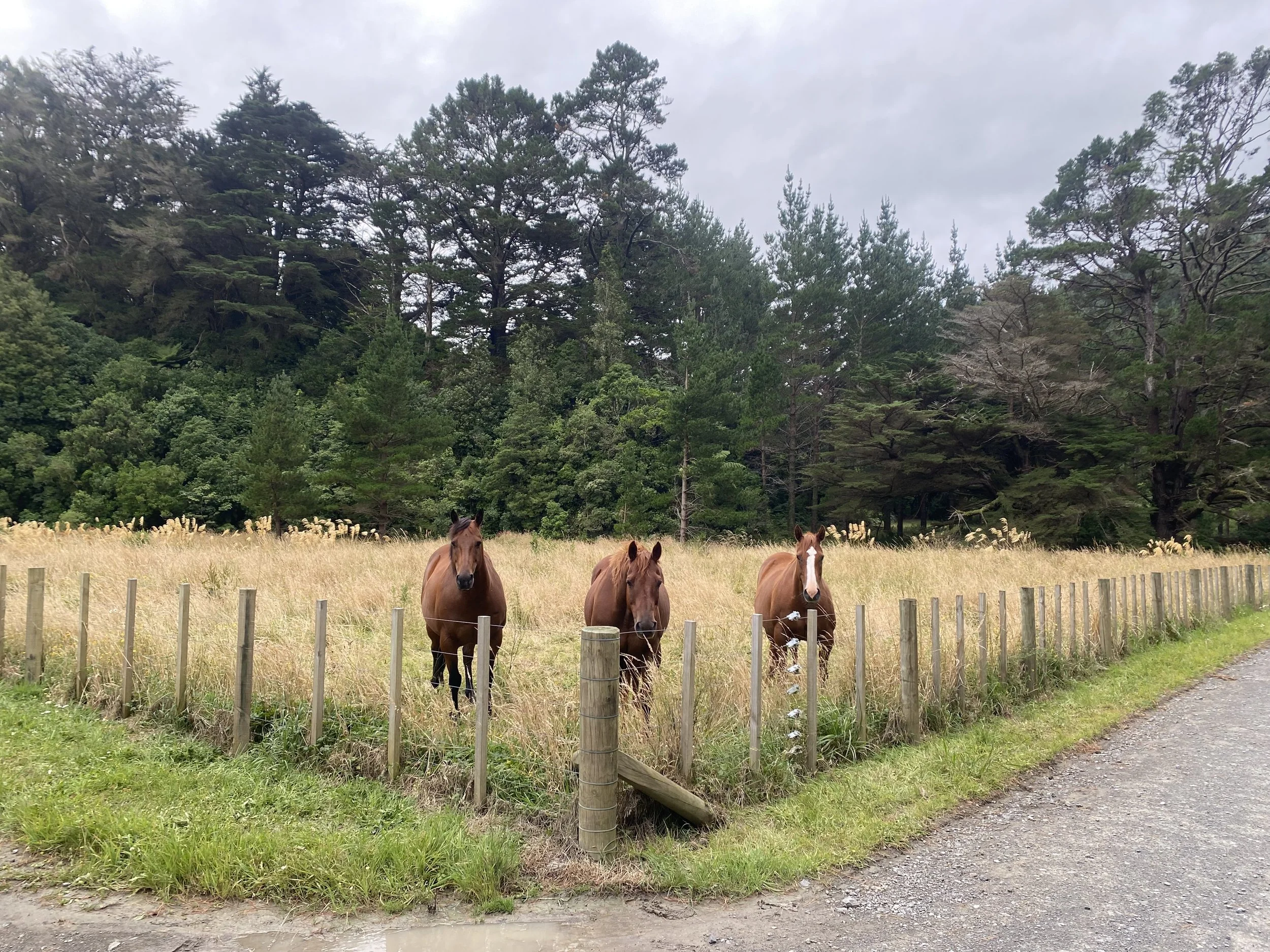
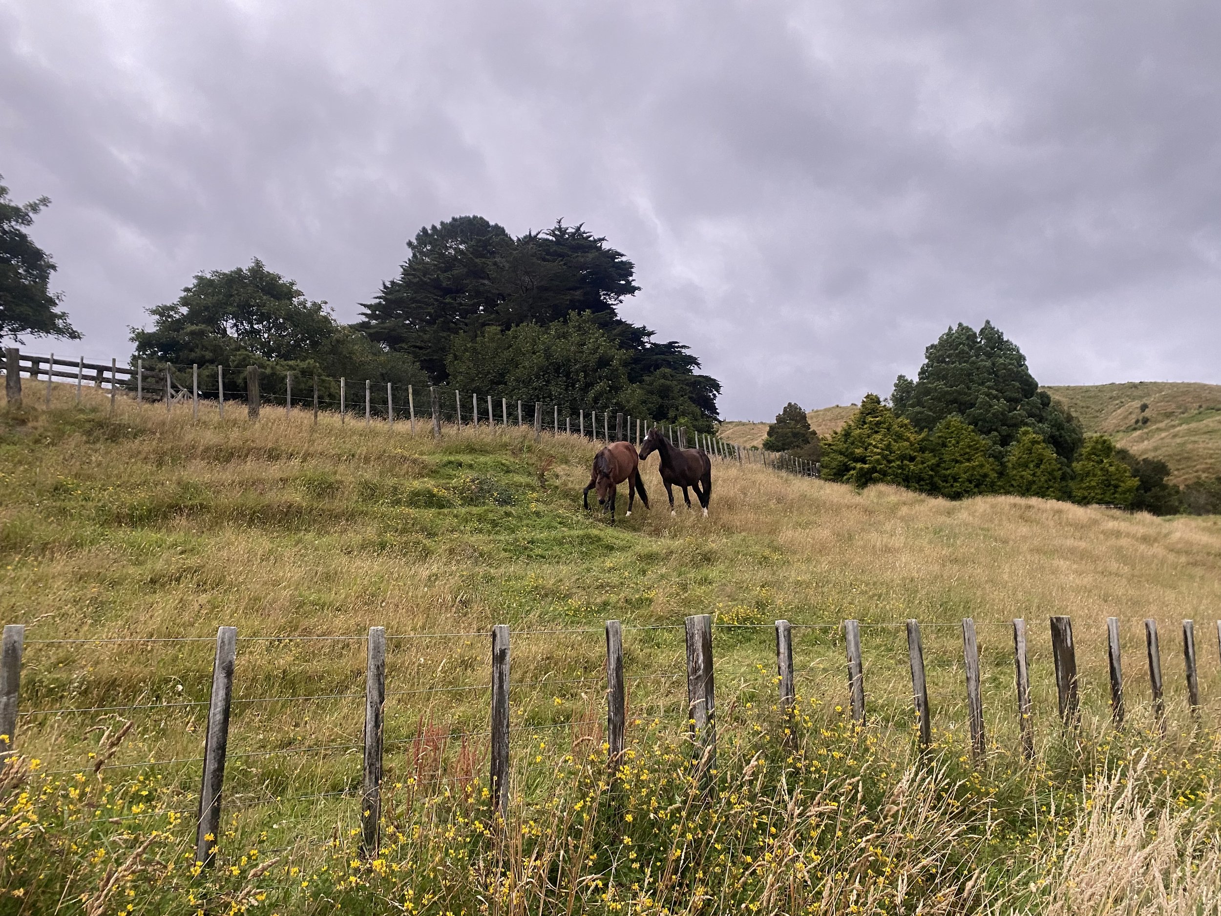
When we arrived at the car park I made friends with three horses and pitched my tent close to the trees.
Jordan hadn’t arrived yet, but Tom, Curtis, Kez, Eva, Taki, and JJ showed up shortly after us.
JJ pounded hard ciders at the long, wooden picnic table while the rest of us cooked and made dinner. He had hiked for about 2 weeks on the TA a month ago, gone home to Texas, and now was back for the Tararua Ranges.
He and Taki had become good friends, but I wasn’t sure how I felt about him. the way he drank made me feel uncomfortable. I used to drink like that, like I was on a mission to numb.
Eventually I finished eating and made a beeline for my tent.
Day 46 (1/24/24): 30mi, +6270ft // 50km, +1912m
Car Park to Mangahao Flats Hut (on the Makahika Track)
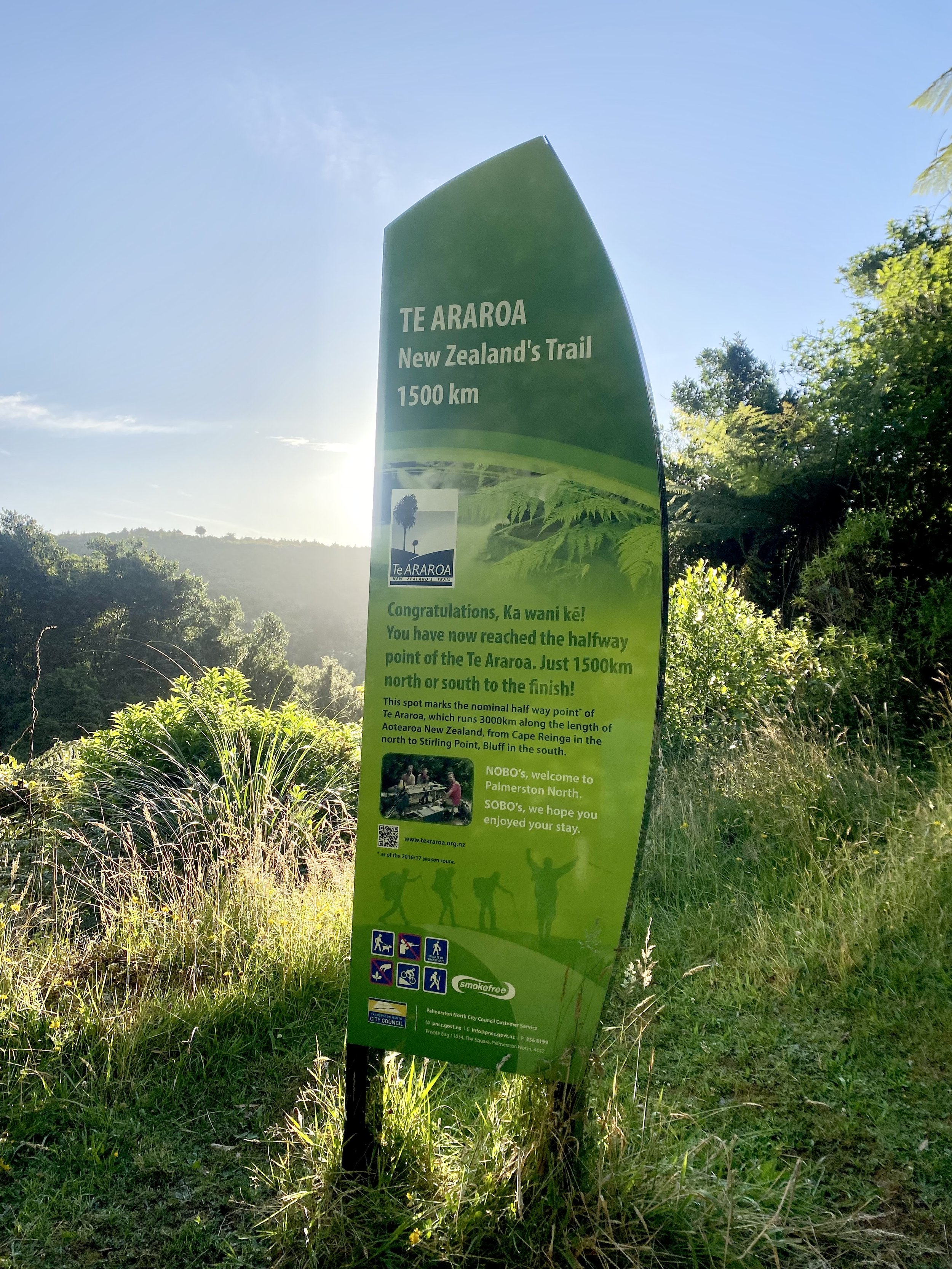
1500KM // HALF WAY TO BLUFF
It’s funny, I didn’t feel particularly excited when I saw the sign marking Te Araroa’s halfway point. I didn’t trust it. What did “halfway” even mean on a trail like this?
Maybe I had covered half the distance, but I knew most of the work still lay ahead. The South Island would be rugged beyond belief, that much I was certain of, and what of the Tararuas we had yet to survive? Plus—not to beat a dead horse (terrible expression)—most of the people around me had not actually hiked 1500km, so collectively we weren’t really halfway to anywhere.
I marched quickly on the gravel forest roads that morning, alone and grateful for the solitude. I contemplated parts of the trail I had already walked. I felt… nothing? Everything? Mostly just tired.

We took a break for lunch when we all convened at Tokomaru Shelter and chatted about the trail ahead.
As a group we had decided to take an alternative route instead of swinging wide to Levin. None of us needed to resupply so soon after Palmerston North, so we wanted to stay deep in the Tararuas and walk the Makahika Track along the Mangahao River, rejoining the TA on the main ridge climb further south.
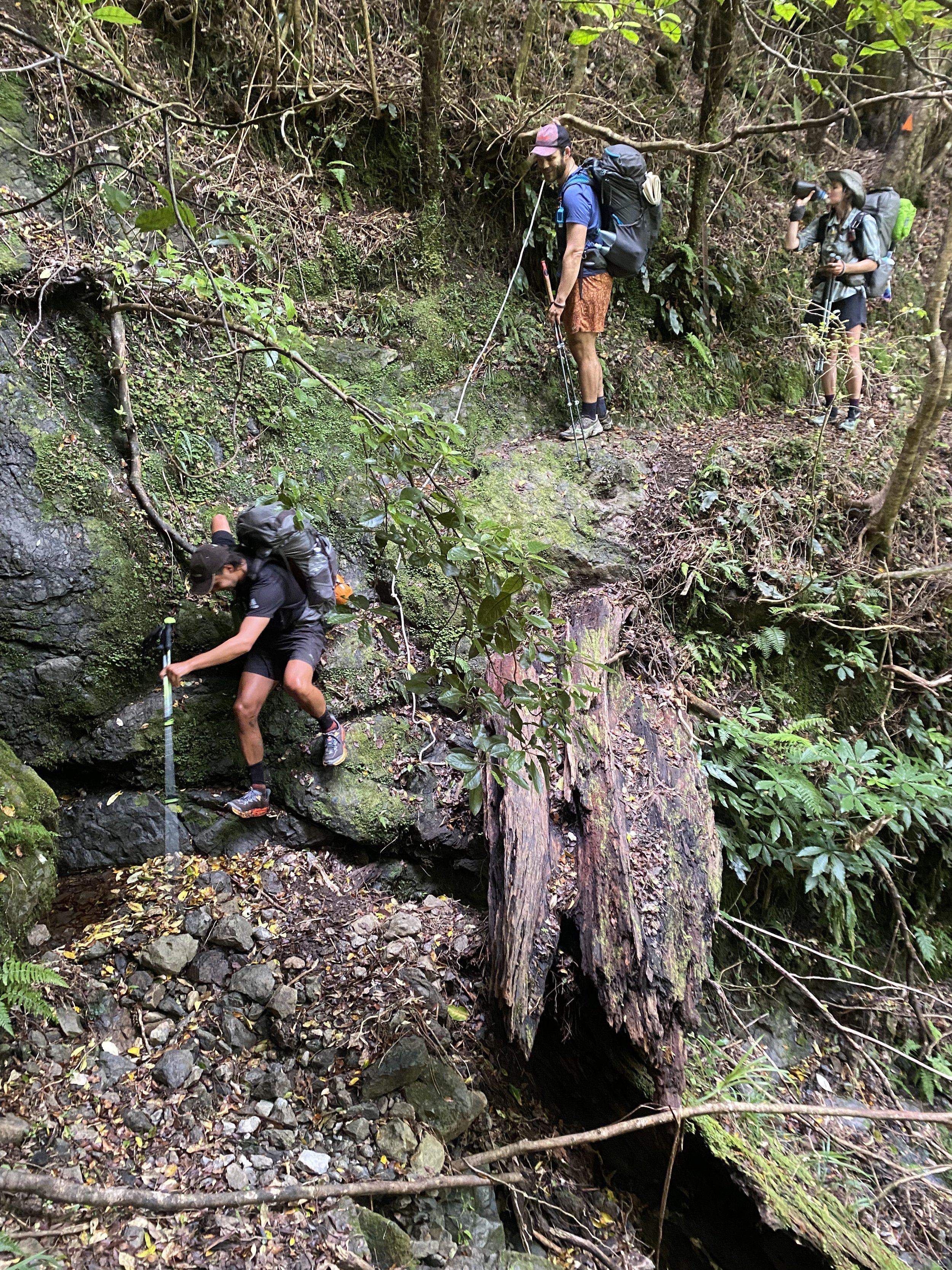
Sounds lovely, right? A river track. A nice walk along the river. As we entered the forest after passing the Upper Mangahao Reservoir, we encountered a silver haired trail crew carrying chainsaws.
“Hey, didn’t expect to see anyone hiking this track today!” A man towards the front exclaimed. It was late afternoon at this point and the sky was looking grey.
“Taking the long-cut, are you?” A woman smiled knowingly.
“We just finished a whole bunch of work clearing trees, you’re our first customers!” Another man laughed and winked as he passed.
“Enjoy the Makahika!” They all called over their shoulders as they exited the woods.
We all looked at each other thinking the same thing—it can’t be that hard of a track if this trail crew of much older adults hauled their heavy chainsaws through the forest and back, right?
WRONG. We were so wrong.

I would like to begin by saying I have so much respect for the trail crew that I so wildly and unfairly underestimated based purely on their age and appearance.
I was eating my thoughts as I clawed my way over mossy boulders and slick, wet root systems, hanging out over 50–70ft drops on narrow dirt shelves that were fast eroding; I clambered around one obstacle after another, quaking in my trail-runners.
I slipped and stumbled through bogs, fell into dense clumps of ferns seemingly eager to eat me whole, bones and all. I careened up and down through the dizzyingly green woods and wondered just how the hell anyone got a chainsaw back here.

Chartreuse, vermillion, emerald, moss—leaves shivered and what sunlight filtered through the dense canopy dripped off the vegetation like molten gold beads as the sun began to set.
Mesmerizing, this world of pure green. Everything around me seemed to glow with life, intent on reaching—always reaching—for a drink of the sun. Competing, climbing, twisting, bending, wrapping, higher and higher, for a little more light.
If I wasn’t careful, I might become part of this place, I thought. A determined vine might wrap itself around my ankle if I stopped to take a break, a stealthy bed of moss might inch over my shoes, a heavy branch might drape across my shoulders and begin to flower until I was suffocated with petals and pollen.
I shivered to think.
The walk became kinder a kilometer from the hut and I basked in the gentle evening light. I’d finally caught Ralf and Tom and no longer felt like the last person left on the face of the earth.
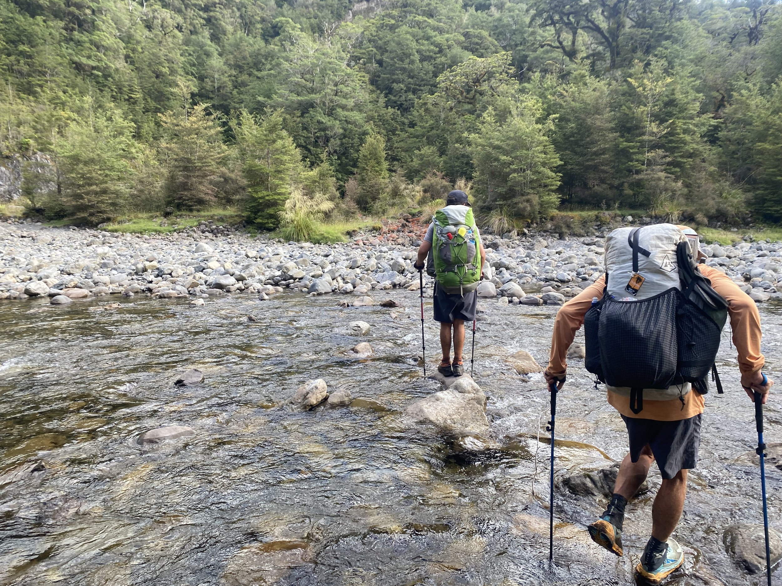
We crossed a river twice and while the boys were determined to keep their feet dry, I was too far past caring to rock hop.
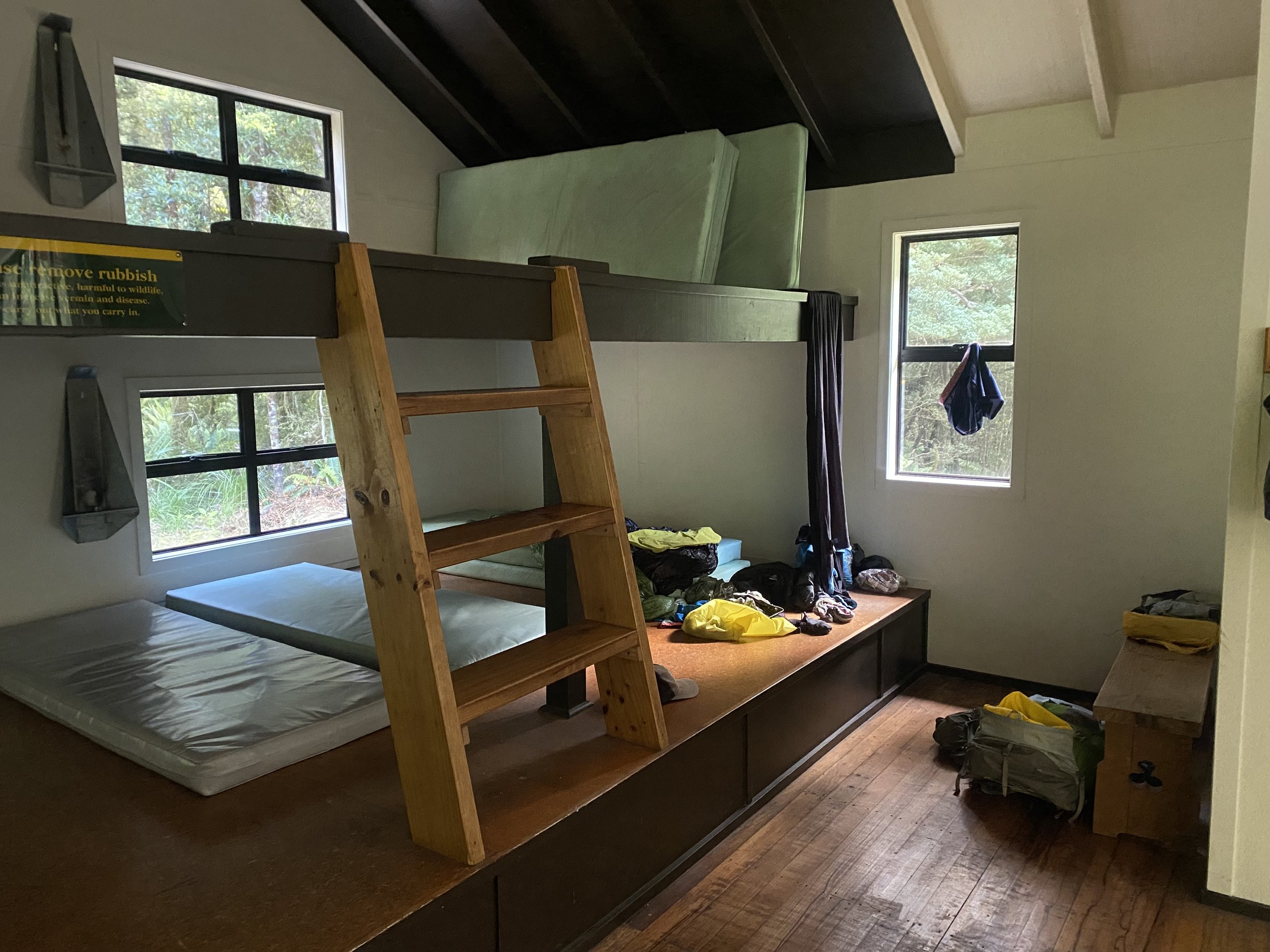
Eventually everyone—Kez, Eva, Tom, Ralf, Curtis and I—made it to the hut. It seemed Jordan, Taki and JJ must have stuck with the true TA route, since we hadn’t seen any of them all day.
As night fell around us, tucked snug in our sleeping bags on the comfy mattresses in a hut in the middle of nowhere, Kez spoke into the dark, “Goodnight tramily.”
And even though I knew he was joking around like he always did, I felt like I was part of something in a way I hadn’t before. And that was pretty cool.

Day 47 (1/25/24): 12.7mi, +7018ft // 21km, 2140m
Mangahao to Nichols Hut

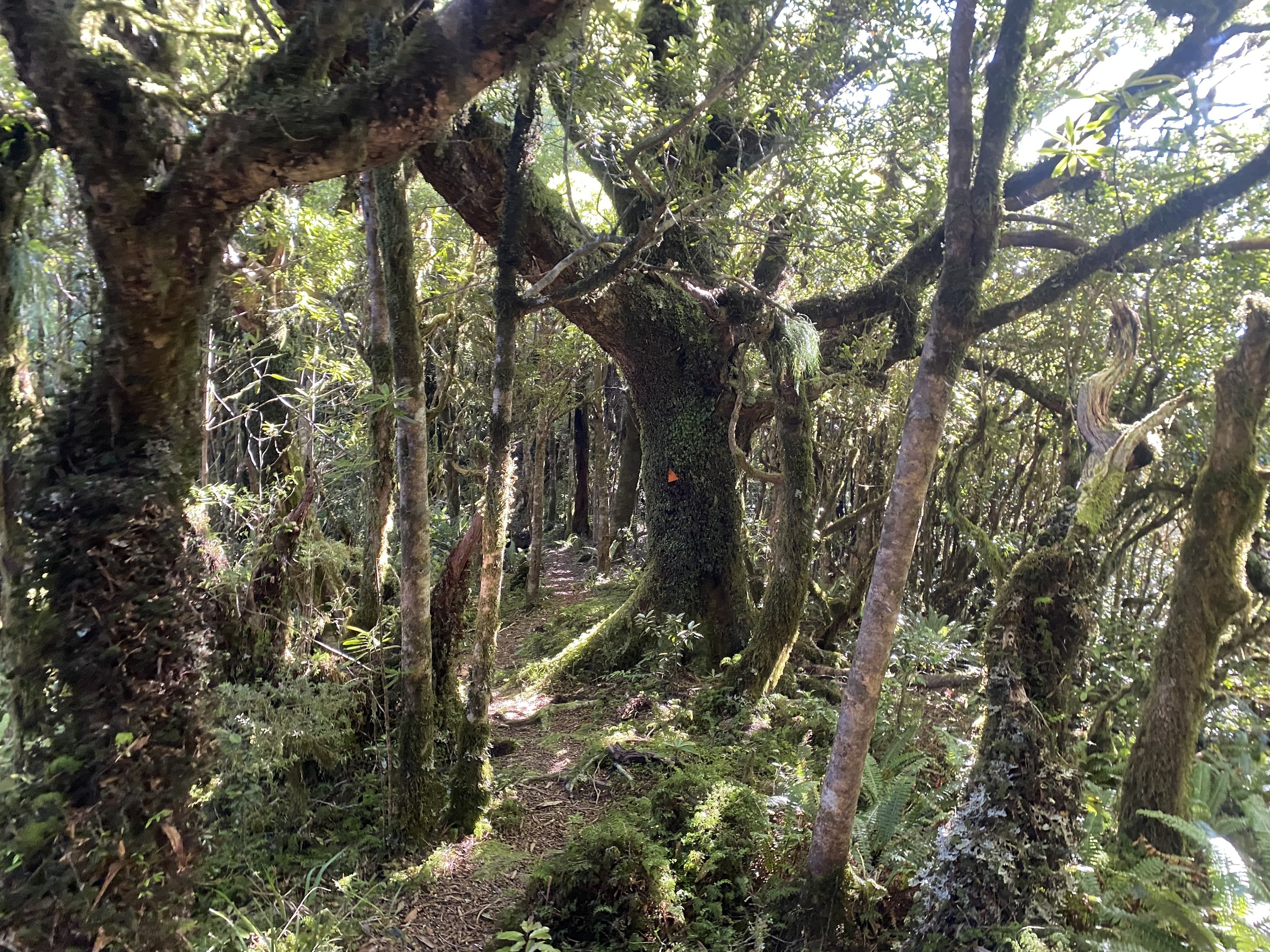
The climb out of the Mangahao River drainage was steep and similarly lush to the day before—maybe even more so.
I was in awe of my surroundings and lived for the climbing. I felt rested and happy to be walking, a little less tired than the day before.
We walked along mossy logs like bridges, crossed thundering streams, wound our way through draping vines, aiming upwards, ever towards the sky.

I used my hands plenty that morning, climbing up and down steep embankments.

Though we hiked as a group with only a little space between each of us, I felt alone in a good way. I didn’t want to talk, I just wanted to sweat and breath and climb.
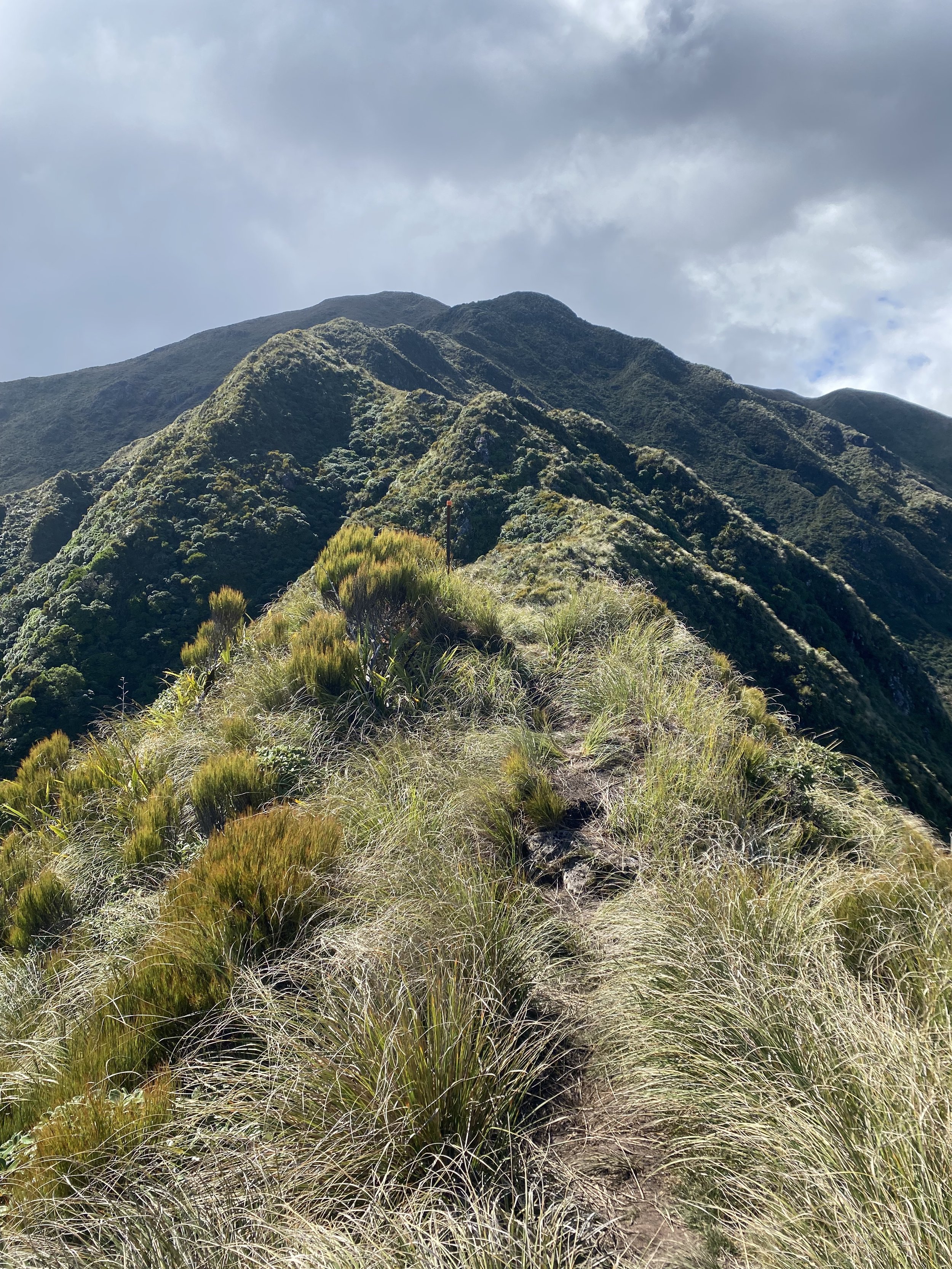
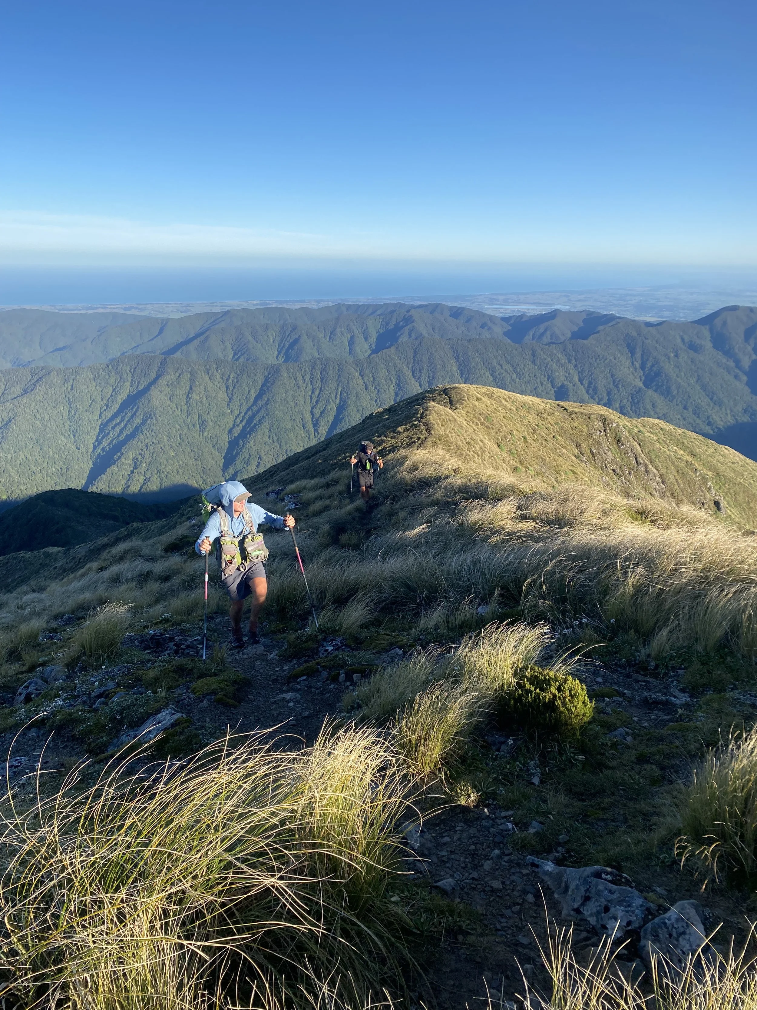
Clearing treeline stole what little air I had left in my lungs, clean away. The view was unbelievable, and we’d climbed so high, far away from the river below over such a short distance!
The Tararua Ranges were blanketed in emerald and sage, like a course wool sweater draped over the angular spine of some hulking beast.
My mouth hung open, and a smile gradually stretched across my lips until I was beaming.
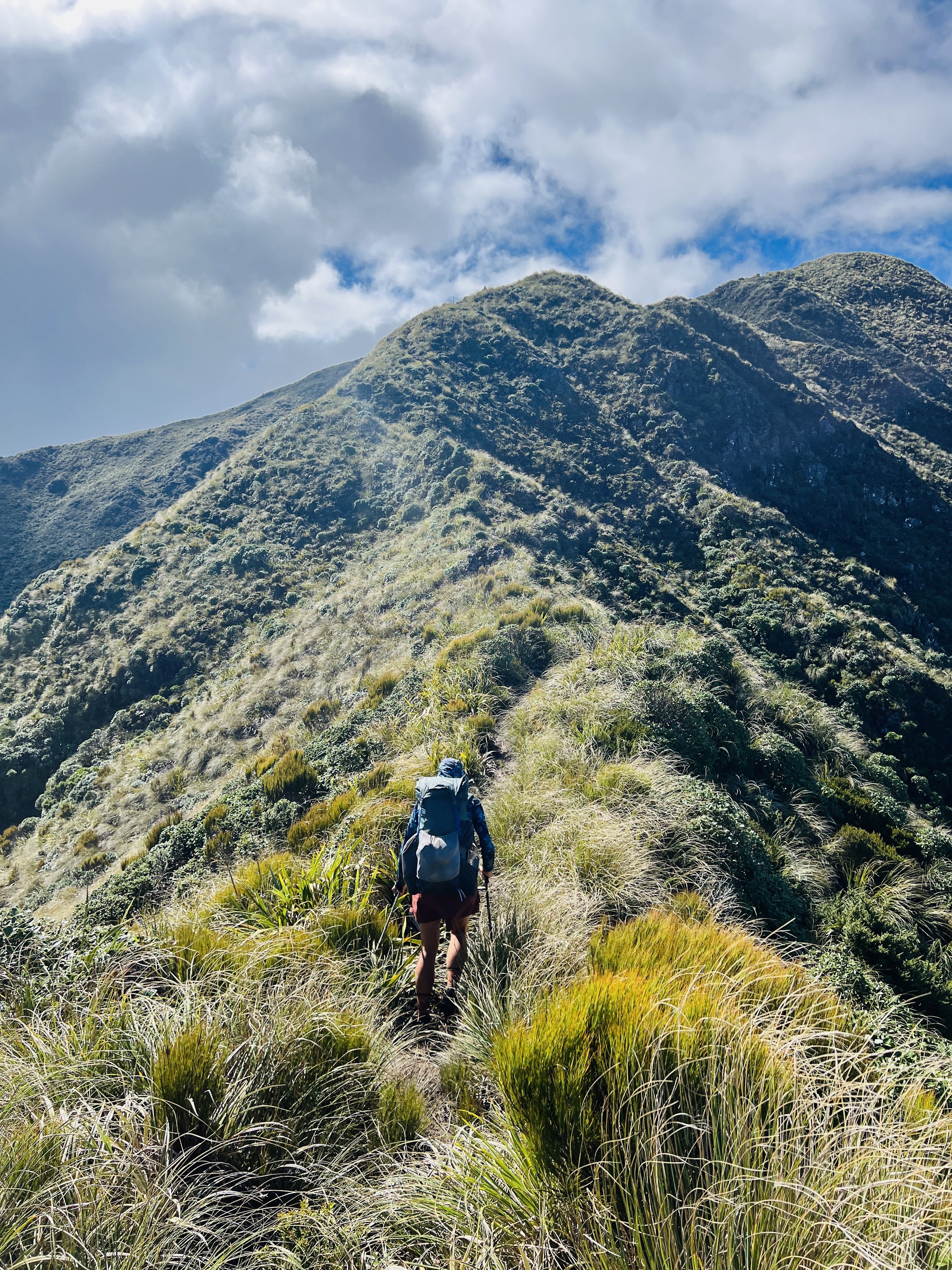
Photo by Ralph Polke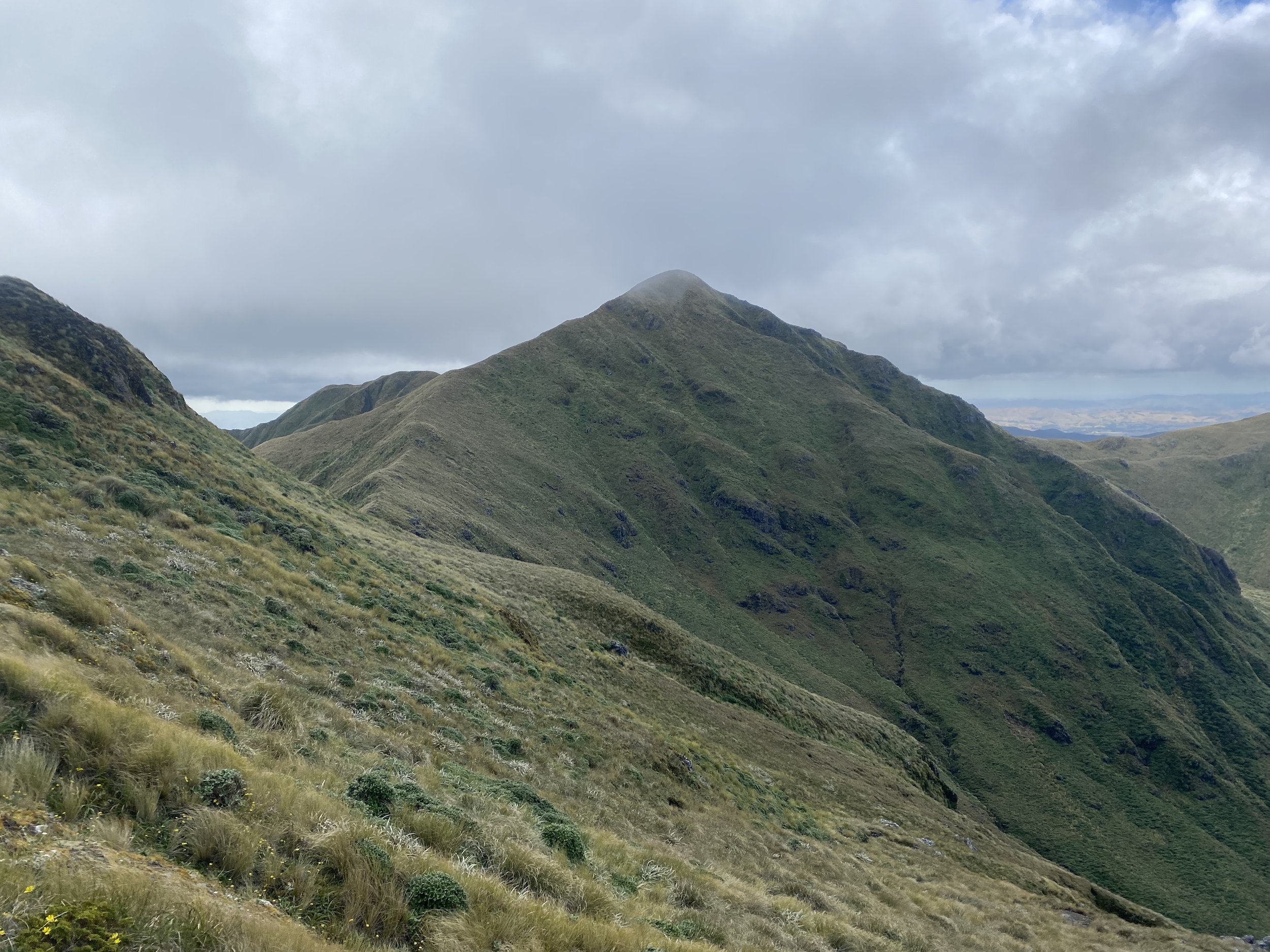
Mountain joy. Pure. Mountain. Joy.
The world was my oyster; I felt alive, electrified, invigorated, like I could run across the vivid green crest before me and never stop.
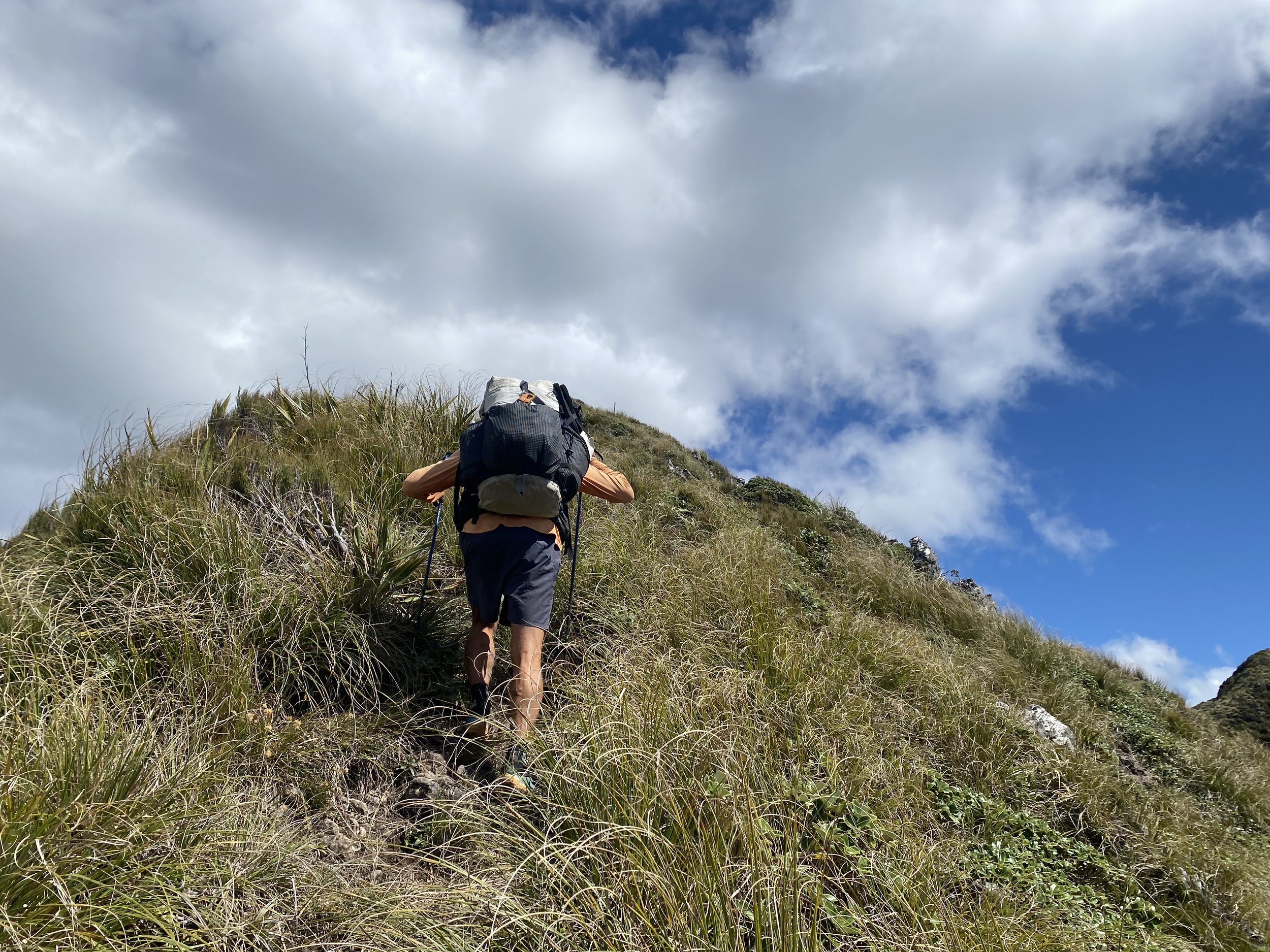
Well, until I tripped on my first tussock mound, that is. Let’s just say a “course wool sweater” is an apt description for the texture of the terrain in the Tararuas.
Tussock hid slippery mud; strands of it caught around my shins and shoes and knees and threatened to trip me right off the side of the ridge.
I powered on despite hidden obstacles and leaned into the blustery wind side-walling me as I hiked. Rain drops from a neighboring storm blew into the side of my face aggressively, but when I looked up, I was relieved to see blue sky still crowned the airspace above me.

The trail took us into forests whose trees had club-like branches, coated in plush moss—the magic of this place was not lost on me.
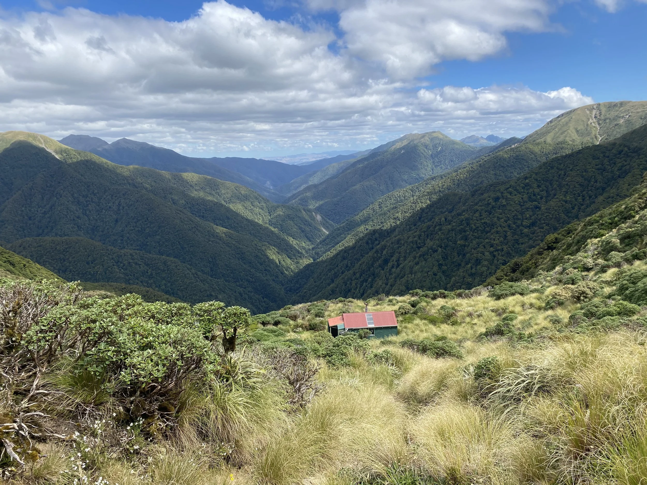
Out of the forest we climbed skywards again, to one final high point before Nichol’s Hut.
I felt relief as we gazed down upon its red roof. It was a small hut, and we’d run into another group of hikers who were also planning to stay there. I had already decided I would camp in my tent as long as I could find a flat spot, so I didn’t care much. But I did feel a little stressed from being around so many other hikers at once. I had never been in a group encountering another group before, it felt overwhelming.
As it turned out, there would be nine people in the hut total and everyone fit just fine, but the smell of mud and sweat and feet was pretty overwhelming.
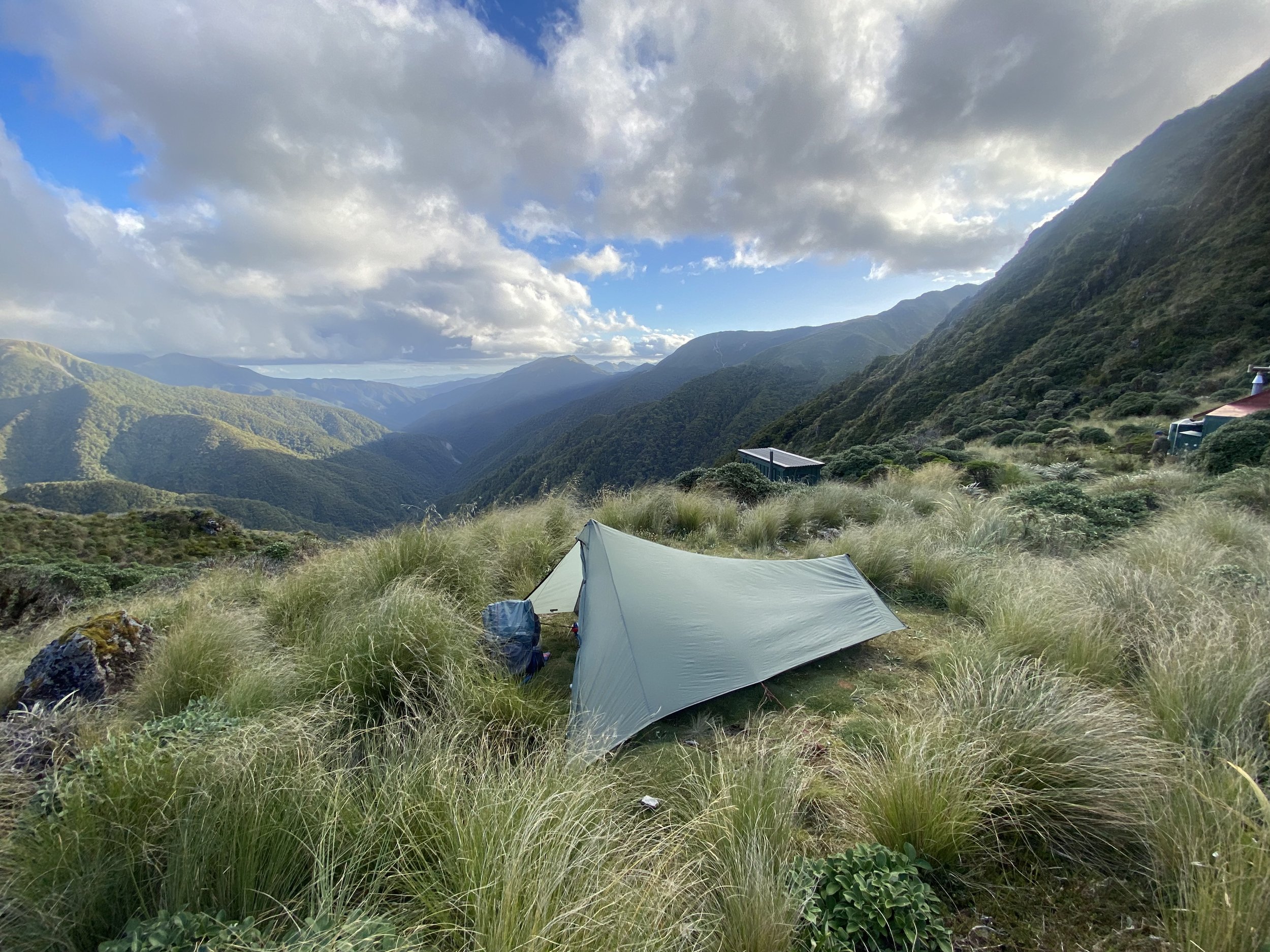
I camped outside the hut on a perfectly flat spot surrounded by tussock and spear grass and enjoyed a quiet night to myself.
I did discover in the morning, however, that I had slept on the helicopter landing pad. And, given just how many people utilize their PLBs to call for rides out of the mountains in New Zealand, I was really lucky a whirly bird didn’t try to set down on top of my tent in the twilight hours.
That was the first and last Heli pad I slept on on the TA.
Day 48 (1/26/24): 23.4mi, +7122ft // 39km, +2172m
Nichols to the Car Park on Mangaone South Rd (end of the Tararua Range)

My tent was thoroughly saturated with condensation when I awoke the next morning, even my sleeping bag was soggy.
I packed up, handling my cold wet gear gingerly, and then sat in the spot my tent had been, boiling water for oatmeal and coffee as I watched the sun softly rise. I hadn’t expected to be immersed in mountains like this on the North Island and I was really enjoying myself despite everything being wet and cold.
Ralf, Tom, Eva, Kez and I began making our way up Mt. Crawford, with Curtis not far behind. I pulled ahead quickly, putting more and more space between myself and the group. I wanted to see if I could make it to the top in under 1hr and I wanted to be alone.

Photo by Thomas WinloveThe sun lit upon the tussock, illuminating it like spun gold on the steep flanks of the ridge. My breath came out in steamy clouds and the cool air of the morning chilled the tip of my nose and points of my cheeks.
My steps felt light as I crested the final rise and made it to the summit in perfect solitude, achieving my goal by a couple of minutes.
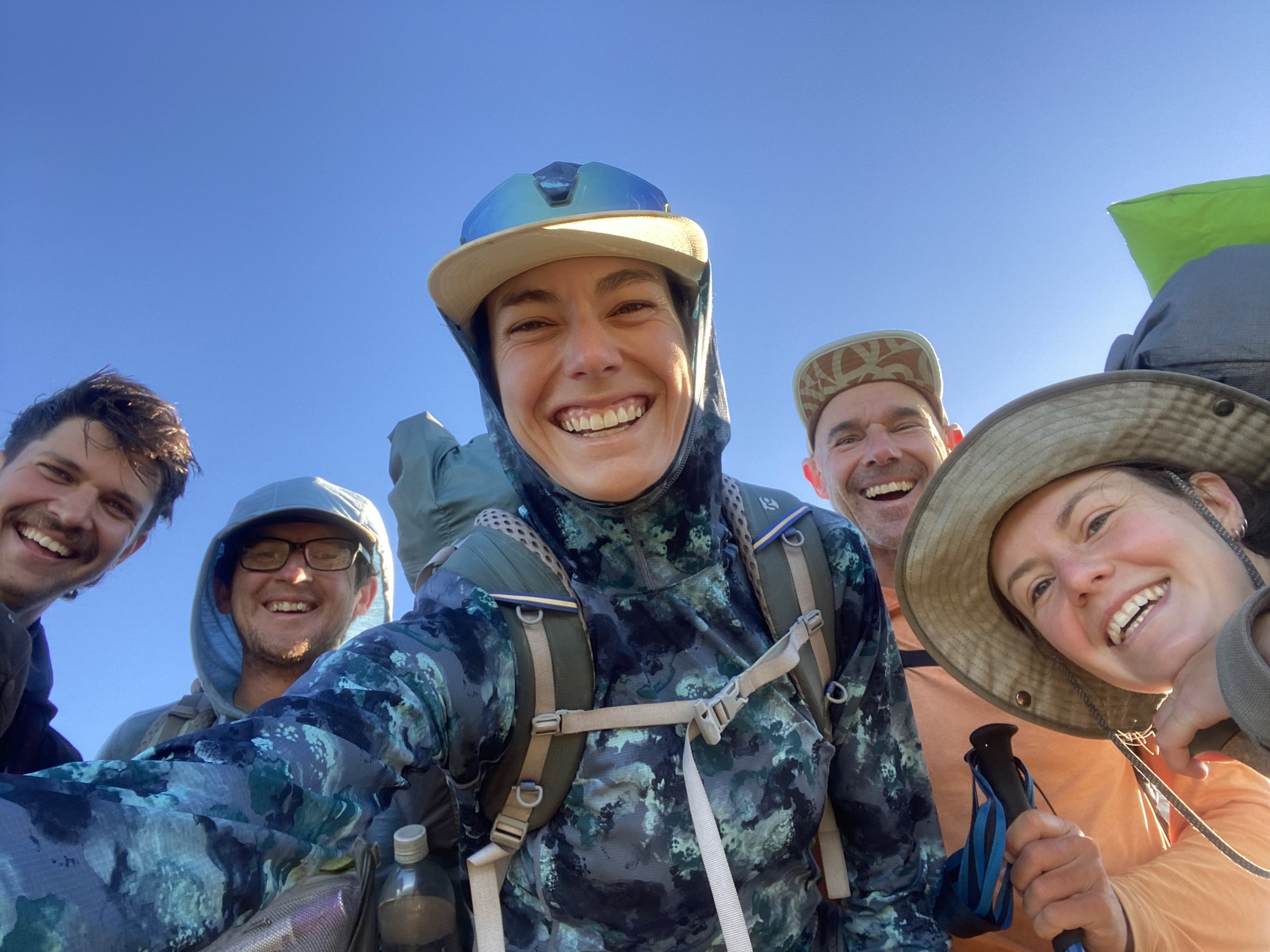
When everyone else made it to the top we took a group selfie and I was genuinely glad for the company.
For the rest of the day Ralf and I hiked together. We were sure that the rest of the group would be hitch hiking the majority of the way into Wellington after the Tararuas and, of course, we wouldn’t, we didn’t want to be left behind.
Our goal was to make it out of the mountains and to the Car Park tonight.

The rest of the day was very steep; the track wound up and down through densely wooded terrain. I stumbled over root systems like ladders, trying and failing to avoid bogs to no avail, my shoes wet and muddy for all of it.
Eventually we made it out to a river and picnic area just before the final climb of the day. I exploded my backpack, dried out my tent and sleeping bag, washed my trail runners in the bathroom sink and set them out to dry as well.
While the contents of my pack lay in the beating hot sunshine, I went for a glorious swim in the river.
After our break, Ralf looked exhausted as we made our way up Mt. Pukeatua. I felt guilty, like I had pressured him into going all the way to the car park; most of the group had decided to hang back at the river and camp there.
He insisted he wanted to push on, but he also looked like he was about to fall over. I gave him a handful of cashews and we pressed on to the summit.
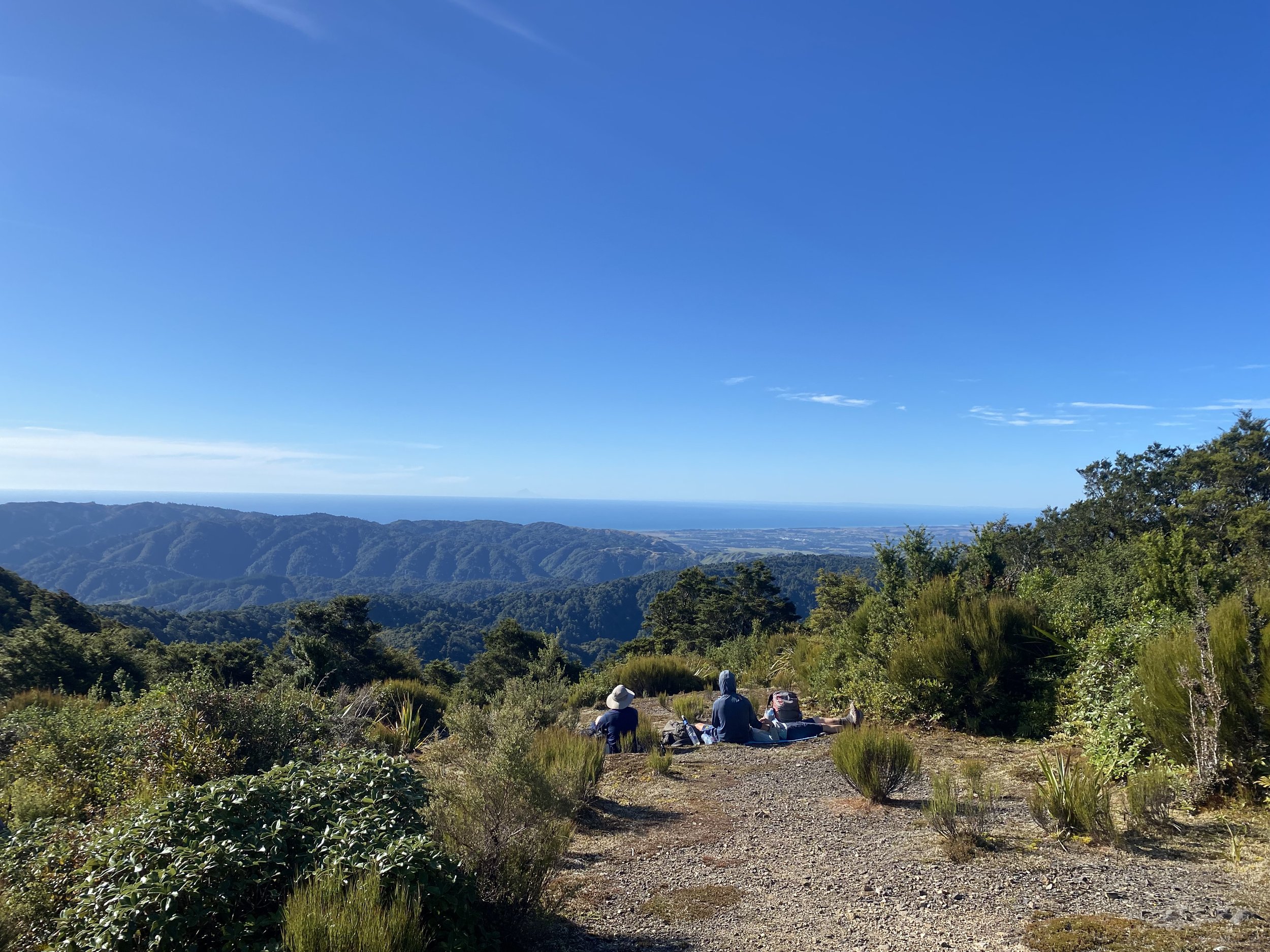
The view at the top was nice, but nothing like the views we’d already seen over the last few days, so we hurried on down the lengthy descent to camp.
As I lay in my tent that night, completely spent, I could already tell it was going to be a dewy night and morning. And tomorrow it was supposed to rain.
Day 49 (1/27/24): 21.47mi, +1175ft // 35.7km, +358m
Car Park to Paekakariki Holiday Park
And rain, it did!
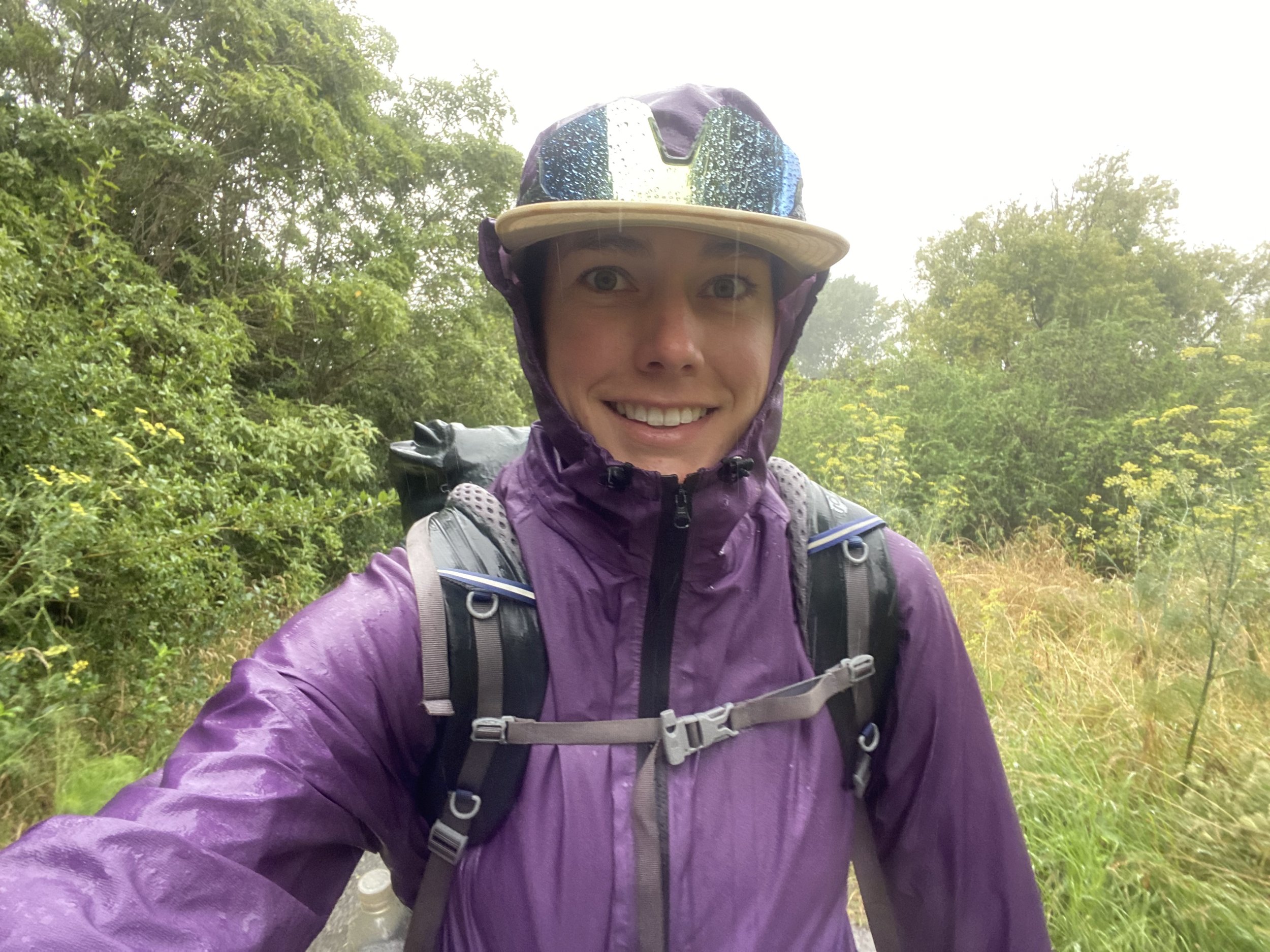
The day was one comprised mostly of road walking under gloomy skies. It poured as we made our way into Waikanae. I was desperate for a reprieve and regardless of what Ralf wanted, I was going to find a cafe to sit in.
Moments later I stumbled out of the wet and into Relish Cafe and was immediately enveloped in warmth. There was a wall full of awards for culinary prowess, a case by the register full of delectable baked goods, and the aroma of spiced hot beverages and bacon hung in the air.
Ralf seemed hesitant to sit down; I told him I didn’t care what he did, I was getting a cup of coffee and eating here.
He sat down.
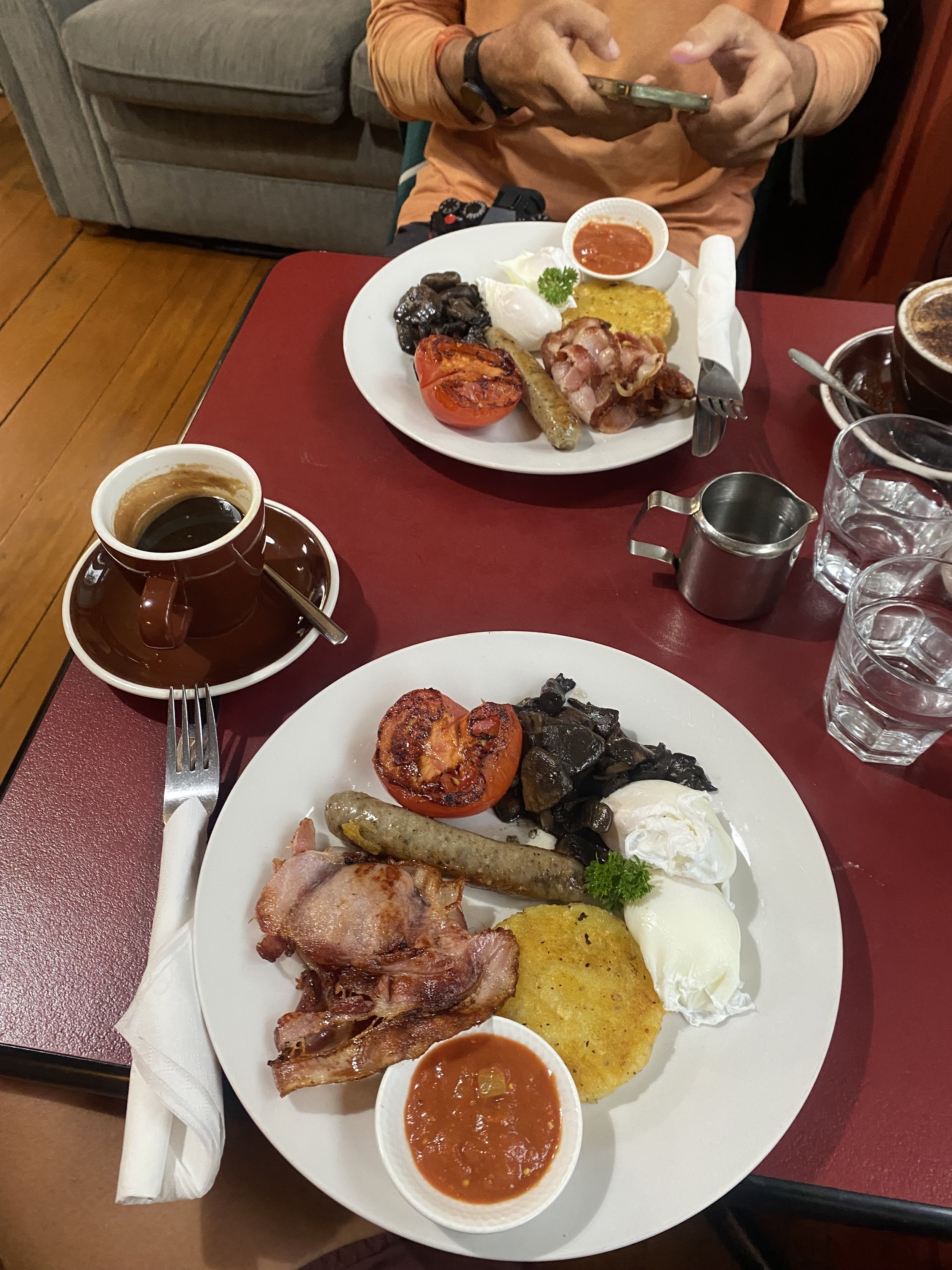
I ordered a long black coffee, a ginger gem, and the full breakfast. It tasted all the better for how chilled and sopping wet my cloths were.
I could’ve sat there all day but I knew we needed to give our table up for the next hungry round of patrons. We got ourselves together and headed back out into the rain.
The walk continued to be a soggy one for the rest of the day. Wind threw rain drops into the hood of my raincoat, and I kept my head down, trying to avoid the unpleasant splashing.

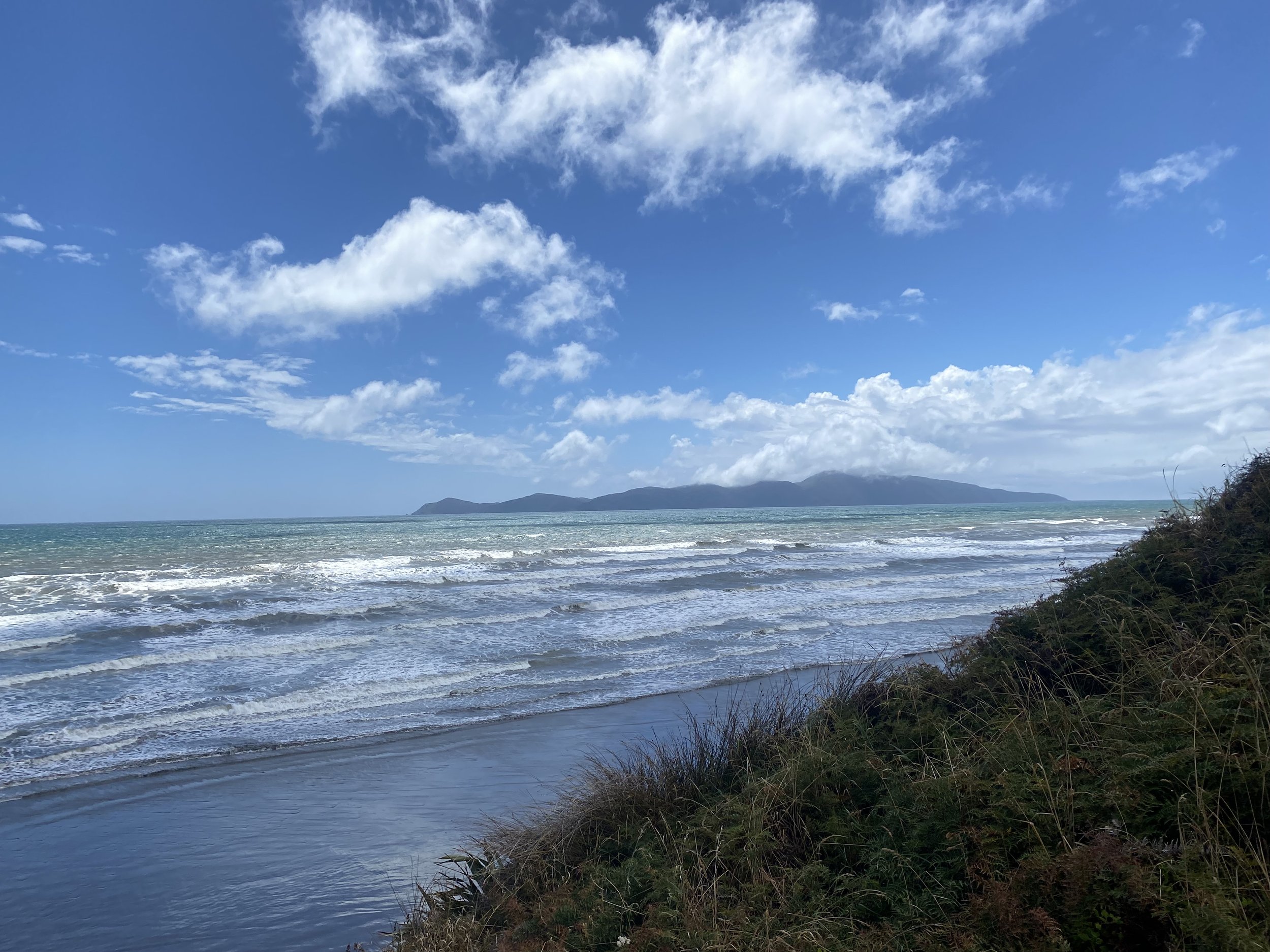
We hiked quickly all the way to Paekakariki Holiday Park, storm clouds gathering and unleashing overhead. I managed to find humor in the weather, grateful we were at least out of the mountains for the worst of it.
And the sun actually came out moments before we arrived to camp!
Once at the holiday park I was able to dry out my tent (again) and my sleeping bag (again) in preparation for another night of sleeping out.
Upon digging through my bag, I discovered my pack liner (a heavy duty contractor trash bag) had finally started to leak and some of my gear was damp. Sigh. At least I was almost to Wellington where I could most certainly source a new one.
The sun baked my quilt and made it just about the fluffiest it has been the whole trip. I was pretty excited to curl up inside of it.
And I managed to dry the rest of my gear out too, including my actual backpack, before calling it a day.
Unfortunately, due to some children who were up until 12AM screaming and jumping on the trampoline right next to my campsite (the joys of camping at Holiday Parks), I slept very little.
This would be the start of a period of poor sleep and incredible fatigue for me.
By the time I reach Wellington I am so tired I hardly feel like myself, and I ultimately decide to take 3 days off in an attempt to recoup some of my energy.
I begin to realize I may not be fully recovered from my unsupported BMT FKT in October, and I start to make a plan for managing my health and energy levels for the South Island.
To view daily maps of my progress, follow me on Strava:
https://www.strava.com/athletes/ivey_smith