The Arizona Trail: Utah to the South Rim of the Grand Canyon
98 miles; 4 days
Day 1 (11/11/21): 20 miles
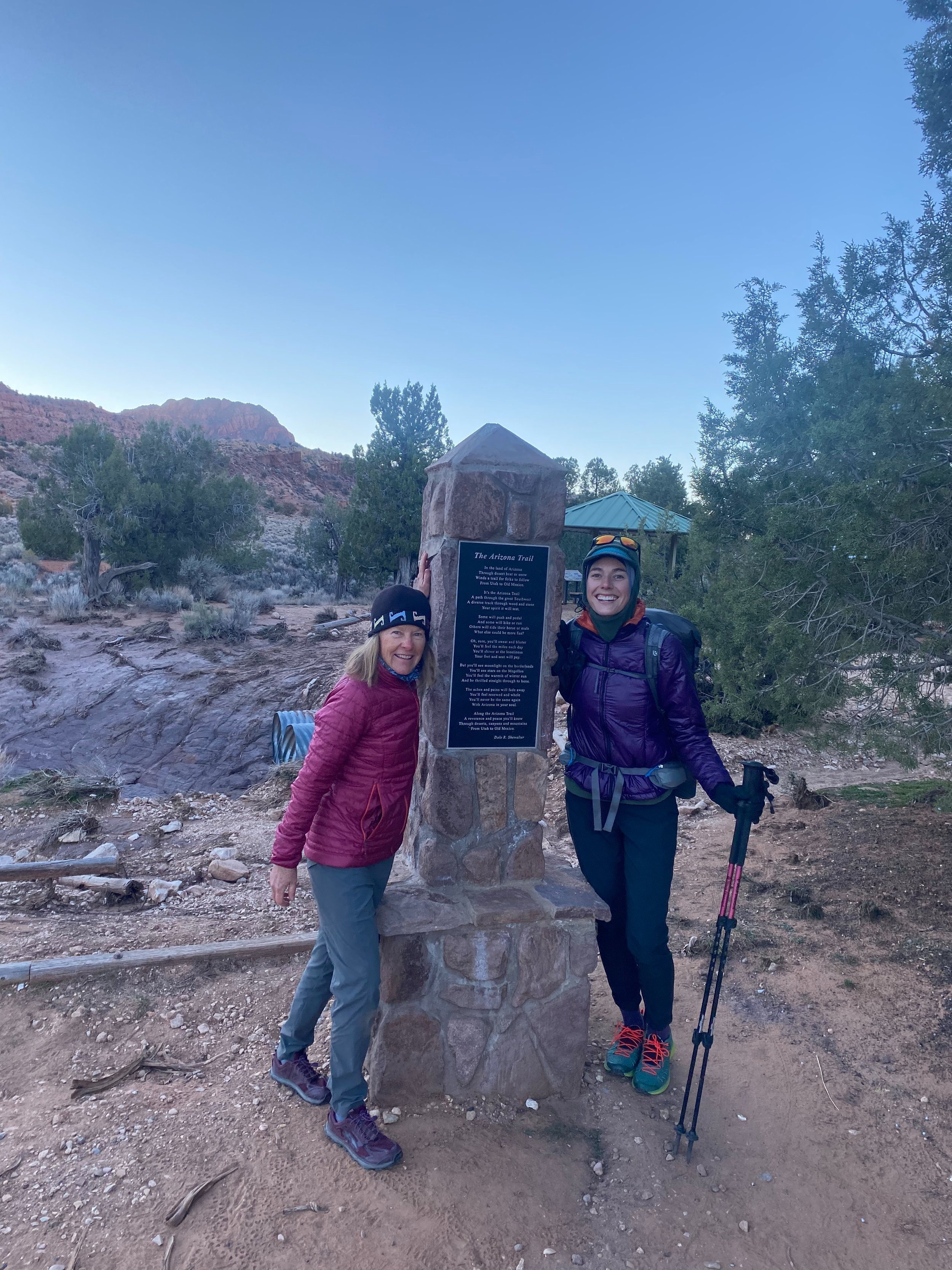
I began my hike around 7:30AM from the Stateline Campground on the border of Utah and Arizona. Sarah and Tim had driven me to the campground the night before, and we all camped together.
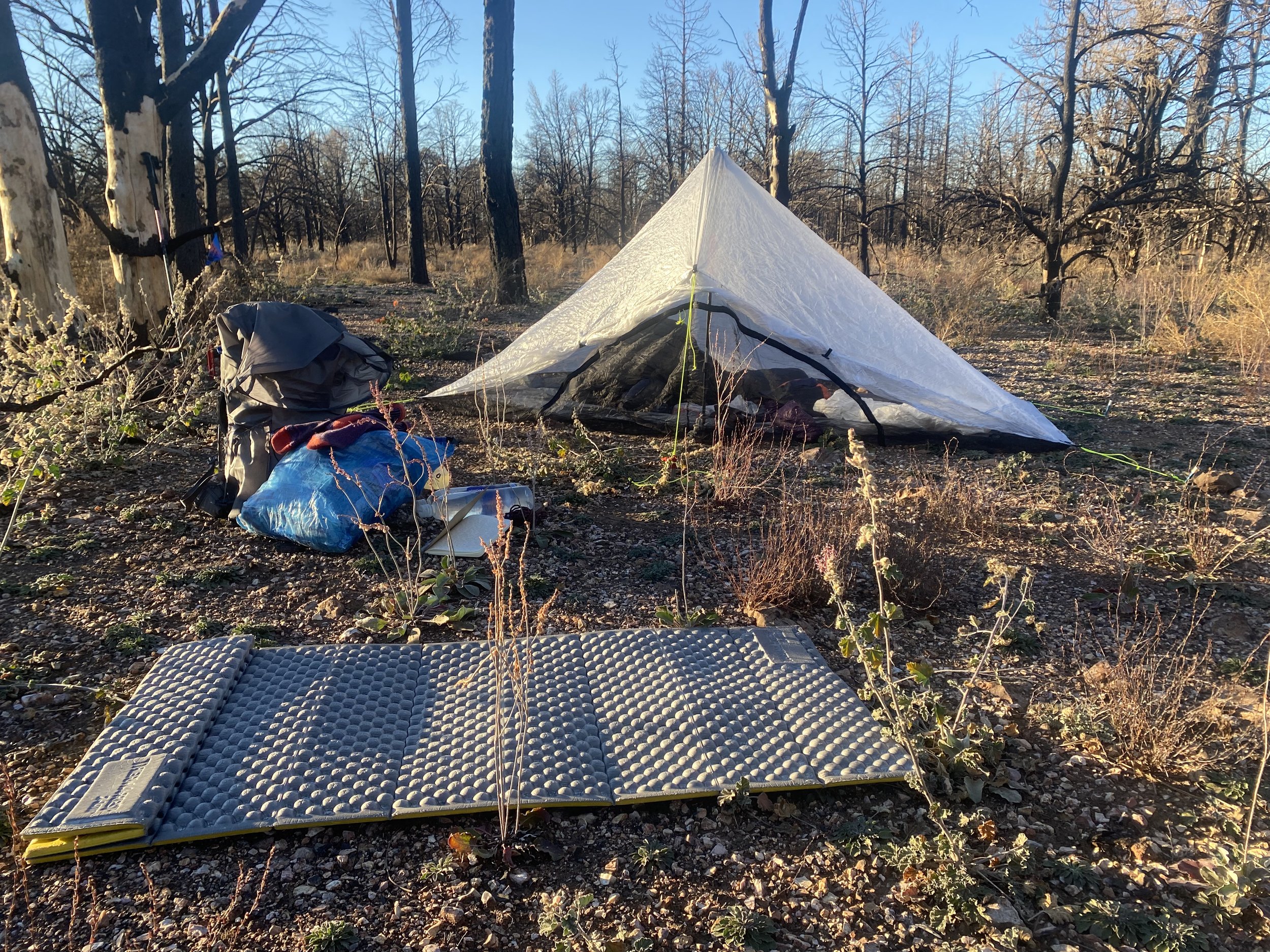
It was my first night in my new tent, and it was brutally cold. I wondered if every night would be like this?
Our conversations leading up to my departure were a welcome distraction—I was nervous about starting the journey—I knew it would be a solitary trip and, once I began walking, my trek would not conclude until I reached Mexico, 780 miles later.
I eventually said good-bye to my friends and stepped into Arizona for the first time. I really love experiencing a place this way, total immersion in the landscape at a slow pace; I’d had the same introduction to Colorado via the Colorado Trail, the year previous.
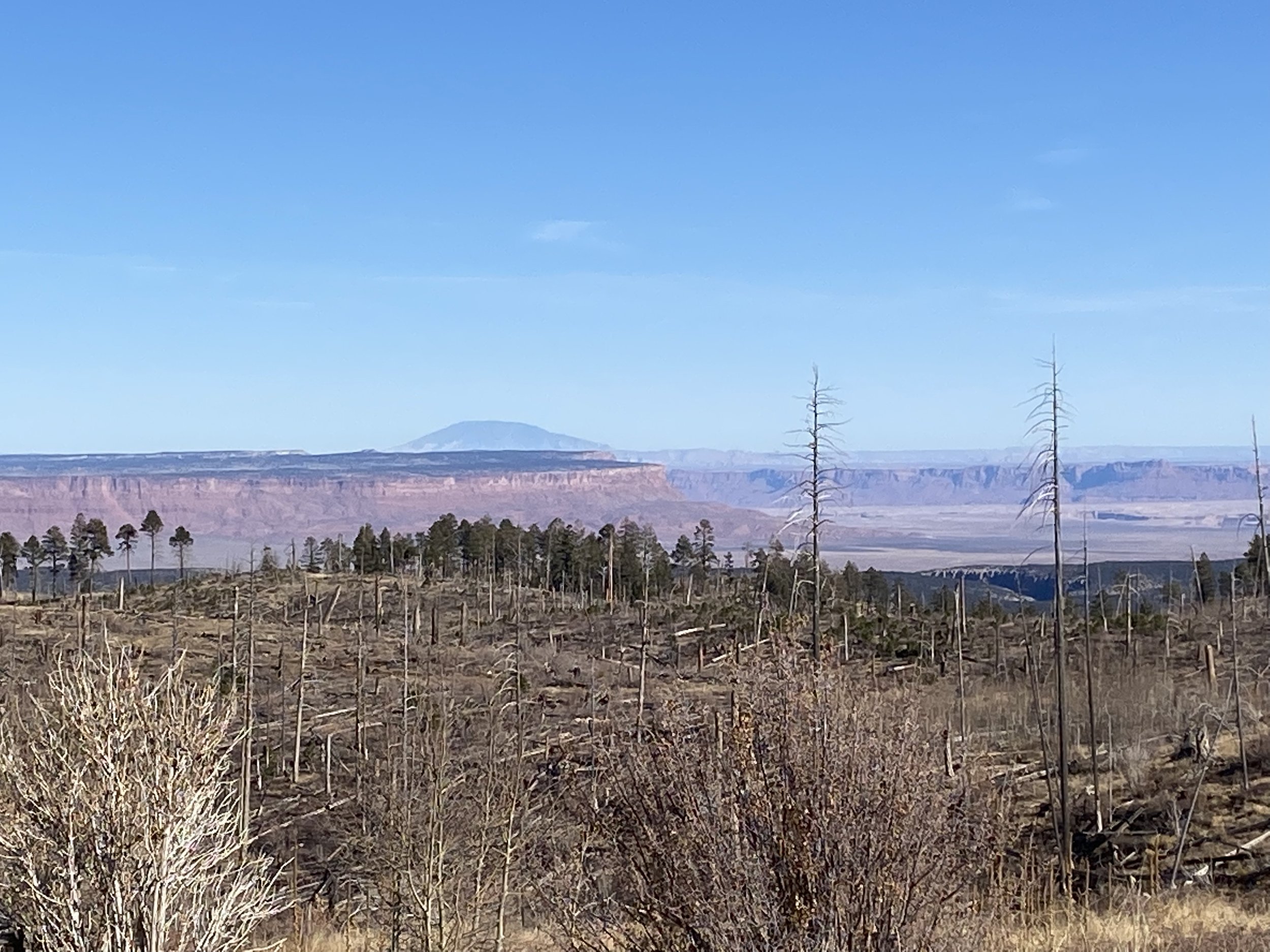
The first part of my trek crossed the Kaibab Plateau, which extends all the way to the North Rim of the Grand Canyon; I didn’t fully grasp this geologic feature until I descended into the Canyon on my third day, leaving it once and for all.
I experienced two of my most brutally cold nights on this high shelf, which is part of the larger Colorado Plateau, and reaches an elevation of 9,200ft.
The Kaibab plateau is home to aspen, juniper, pinyon pine, and spruce-fir trees, but the vegetative giant I became most familiar with was the towering ponderosa. Over the course of my journey I walked hundred of miles with only their cinnamon bark to keep me company, and a blanket of citrus-sweet needles beneath my feet.
At the end of my first day, I passed through a significant burn-zone from the Magnum fire in 2020. The area I walked through was technically closed, but their was no water on the proposed-alternate, and I had planned to camp at mile 20 on the official AZT.
The trail became hard to follow—nearly erased from lack of use—and lined with sharp, ankle-high thorns that kept getting hooked on my socks.
All around me stood the charred skeletons of juniper trees, and at their bases, rising out of the ash, were beautiful, reaching, orange flowers.
I entered a canyon and wove my way along a wash for several miles until a few cairns guided me to higher ground.
I saw a fenced in area through the trees, a low sheet-metal roof (of sorts) covering a large part of the ground within, and a cement wildlife drinker next to the roof. It was only 2:30PM but it appeared I had reached my water source and destination for the day.
There was a man drying his tent out on the railing, I tried to engage him in conversation…
“Are you thru-hiking?”
He stared at me somewhat blankly and then nodded.
“Southbound?” I prodded.
He nodded again.
I realized there was most likely a language barrier, and he seemed very tired, so I just smiled and then went into the enclosure to get water. Afterwards I pitched my tent about 200yds away from the other hiker so that we couldn’t see each other.
It was far too early; I hated to get to camp this early. I journaled, ate some food and as soon as the sun started to drop, I crawled into my tent.
Day 2 (11/12/21): 27 miles
I spent my first 5 miles bumbling around in the dark, attempting to follow a trail that really didn’t exist anymore. The cairns were sanity saving, when I could find them.
By the time the sun came out I was finished with the burn-zone and hit my first road crossing.
I wound up calling my dad to confirm that my InReach was tracking my hike.
The rest of the day unfolded with alternating forest service road walks and good single track. I hit a slump around 10AM and continued to feel depleted until I stopped to make coffee at 1:30 at mile 17. After that my brain whirred: I obsessively crunched miles, I composed a letter to my favorite author in my head—Brené Brown—and then promptly burst into tears.
I felt overwhelmed with gratitude and contemplated the fact that thru-hiking is really all about going deeper, leaning into discomfort, and loving harder.
I didn’t see anyone all day besides three bike-packers that whizzed by me going North, late afternoon.
I was constantly racing the sun. It had remained bitter cold until about 9:30AM and already, at 3:30PM I could feel a chill creeping back into the air as the sun’s angle dropped lower. I walked faster, gaining elevation, until about 6PM and then I pitched my tent in a little clearing ringed with ponderosa.
I worked hastily, my breath a white cloud of steam, hands frozen; I was wearing every layer I had and I still felt the cold seeping into my bones.
After chucking the contents of my pack into my tent I crammed food into my mouth, hung my food bag on a nearby tree and threw myself into my sleeping bag.
Day 3 (11/13/21): 36 miles
My 20 degree, down quilt was proving highly inadequate against the cold. I shivered and tossed and turned until 3AM. Realizing I hadn’t slept at all, I cursed and decided to pack-up in the pitch dark and start walking.
It had to be in the low-teens; I walked stiffly with my gloved hands stuffed in my waistband, between my pants and long underwear. My water bottles were frozen and it was too cold to stop to eat. I knew I had to power through the agonizing chill until dawn broke.
In my journal, after the fact, I described this morning as “a hell of the highest order”, and even as I write this from the comfort of my home, snow falling lightly outside the window, I know I was not exaggerating.
The temperature seemed to plunge as the sky lightened, and it dropped even lower when the trail took me through a long, open, meadow between two hills—the cold air pooling in the depression.
At mile 9 I made it to my water source, blessedly it was in the sun, but of course the wildlife drinker was still frozen. I used my trekking pole to beat a hole a in the ice, then filled up my BeFree bladder and went to sit on the sunny concrete slab nearby.
I just sat there. Stupefied by the cold. The sun bathing me but not quite warming me. And I wondered if this was how it was going to be?
Out of no where another hiker appeared at the cement trough. Her name was Acorn and she was currently doing the section north of the Grand Canyon.
I had so many questions, I didn’t even know where to begin. She told me there was water in five miles and I was shocked because there was no mention of it on the app (FarOut Guide).
I decided to believe her, and so when I packed up and hit the trail again, I was only carrying 1L of water.
There was no water in 5 miles, or 7, or even 9.
Actually, there wouldn’t be water for a whole 20 miles, and I felt sick to my stomach. How could I have been so careless and only bring one liter? Why did I listen to that hiker? I was furious.
I looked all over place, scanning the trees and the meadows for tanks, nothing.
I kept walking. The day was warm by 11 AM and I was thirsty. I saw two people up ahead of me on the trail, I sped up.
“Hi,” I announced myself. “I am thru-hiking the Arizona Trail and I misjudged how much water I needed to get me to the next source.”
Mortification washed over me. I was humiliated for having to ask complete strangers for help.
“Do you have any extra water?”
“Oh yeah,” The guy said. “We are actually getting ready to hit the road and have a few gallons in the car. We can give you as much as you need, the car is about a mile ahead.”
I was so relieved.
After filling my water bottles at the parking area near the entrance to Grand Canyon National Park, repeating my thanks to Elle and Ryan, and hitting the trail again, I tried contacting the South Rim of the Grand Canyon, to book a campsite at Cottonwood.
Even though I had already walked 20 miles and this would add an additional 16, I did not want to spend another frigid night above 9,000ft on the North Rim.
I could not reach the Park Service via phone or email; I decided to keep walking regardless.
My feet felt wrecked with blisters, and I had an unbelievably sharp and persistent cramp in my right calf. After 7 miles of power hiking through immense discomfort, in steadily dropping temps, I reached the parking lot for the North Rim TH.
It was nearly dusk, Rim to Rim (R2R) hikers were spilling out, cheering and congratulating one another for finishing their treks across the canyon. I seemed invisible to them as I crammed cold-soaked ramen into my mouth near the garbage cans and emptied my trash-bag.
Even when I passed directly by the hikers, none of them acknowledged me. It felt surreal, to have come out of the quiet woods and into a populated space, only to be overlooked by all the people around me.
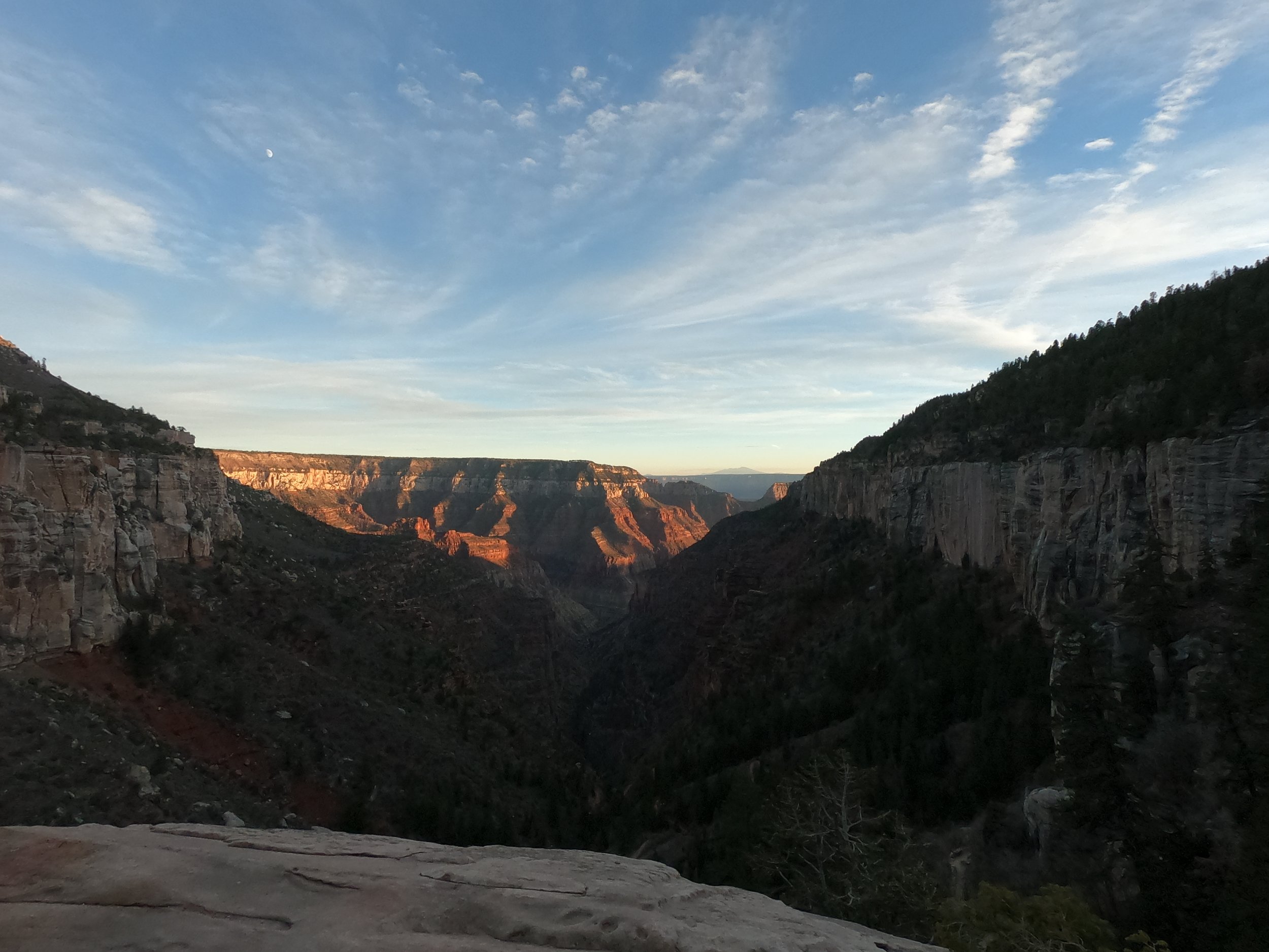
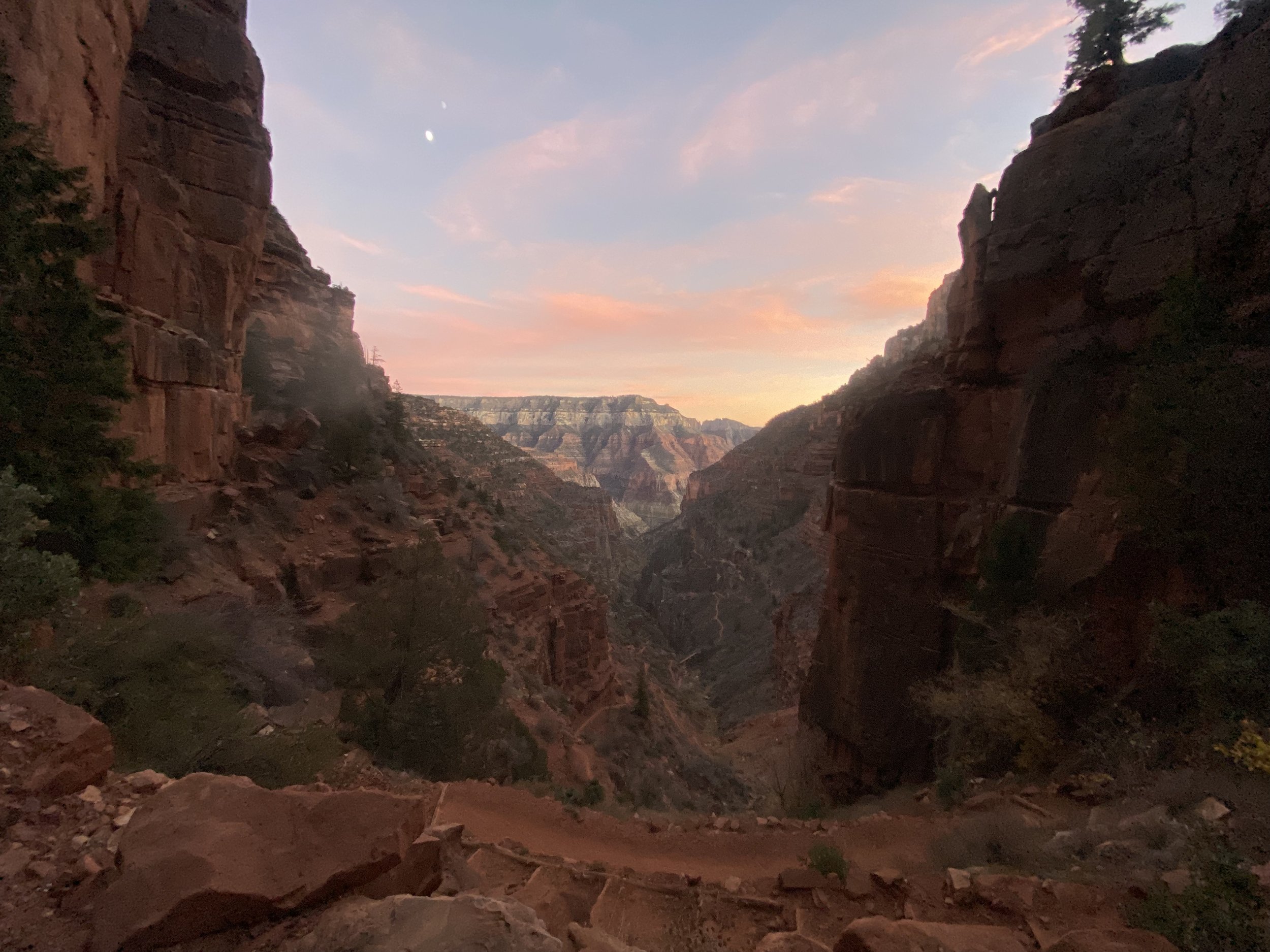
My descent into the canyon began in ponderosa, and then quite suddenly, my view opened up into a world of creamy oranges, electric pinks, rust reds and deep purples.
The sky was a powder pink fading up into baby blue, and the moon, a pale oval, hung centrally over the gash in the earth.
My mouth dropped open as I took in the dramatic edges, shear, striated walls, and ribbon like trail, which wound its way indefinitely down into the holy, inverted cathedral.
My steps echoed, the light faded, and I was dimly aware of the vegetation evolving around me—tropical palm fronds waved in a soft breeze, and verdant green bushes encroached on my path, brushing me with their welcome.
I’d only gone 2.5miles when darkness arrived completely; I decided to turn on my headlamp.
I had a long way down to go before cottonwood camp and I could feel the air warming drastically as I continued to drop in elevation. I shed layers as I walked, grateful to be out of the cold.
Suddenly the terrain on my left disappeared into blackness. I was following a wide, cliff band, which wound around the side of the canyon; the switchbacks were sharp, hairpin turns and I made sure to place my feet carefully to avoid tripping.
Hiking in the dark is a spiritual experience.
With one of my senses is entirely removed—save for that one yellow circle of light provided by the beam of my headlamp—I hear things and wonder at the sounds. I step more precisely. I get the sense that I am moving quickly, while in reality my pace has slowed marginally as my eyes strive to identify rocks in my path.
Simultaneously, I am scanning my peripherals, searching the dark for—what? I do not know.
Walking in the dark generates a primal sensation, as my body tries to remember something ancient, some old way of being, buried over ages of disuse.
I feel singularly focused, hyper-present, I loose myself in the black, and yet retain this prickling awareness of how my edges fit into time and space.
Eventually I arrive at Cottonwood; without an official permit, I am unsure of where to go. Eventually I settle for the empty group camping area. It is almost 9PM and I doubt anyone will be showing up at this hour to claim it.
I am exhausted. I have just walked my longest day carrying a backpack.
Day 4 (11/14/21): 15 miles
I woke up late, the sky light enough to see around my tent without a headlamp.
I journaled about the previous day before packing up and eating breakfast, a smattering of all the foods in my food bag. I was ahead of schedule and carrying too much food for the few miles I had left before my next resupply on the South Rim.
I stretched my tired and aching body before throwing on my pack. It was 8:30AM when I started walking and I was excited to see all the Canyon had to offer in the light of day.
The walls of the Grand were a swirl of orange sorbet run through with dark chocolate stripes; the sun would not touch me until noon, which made for a lovely, shaded, 70 degree stroll.
A creek babbled on my right, cottonwood trees and vibrant plant life leaned over the humming water. I saw little white flowers tinted blue, paddle-like prickly pear cactus, strangely geometric plants—leaves like blades—with tall stalks rising skyward from their centers; all the vegetation appeared to be straight out of a Dr. Sues book.
My heart bubbled with joy.
I paused every ten paces and spun in a full circle to view the evolution of the world around me as I walked. Never had I seen such a place, an entire world unto itself, so radically different than the landscape 4,500ft higher.
Eventually I came to Bright Angel Campground, which marked the end of the 14 mile descent I’d begun the night before, and the start of my climb out.
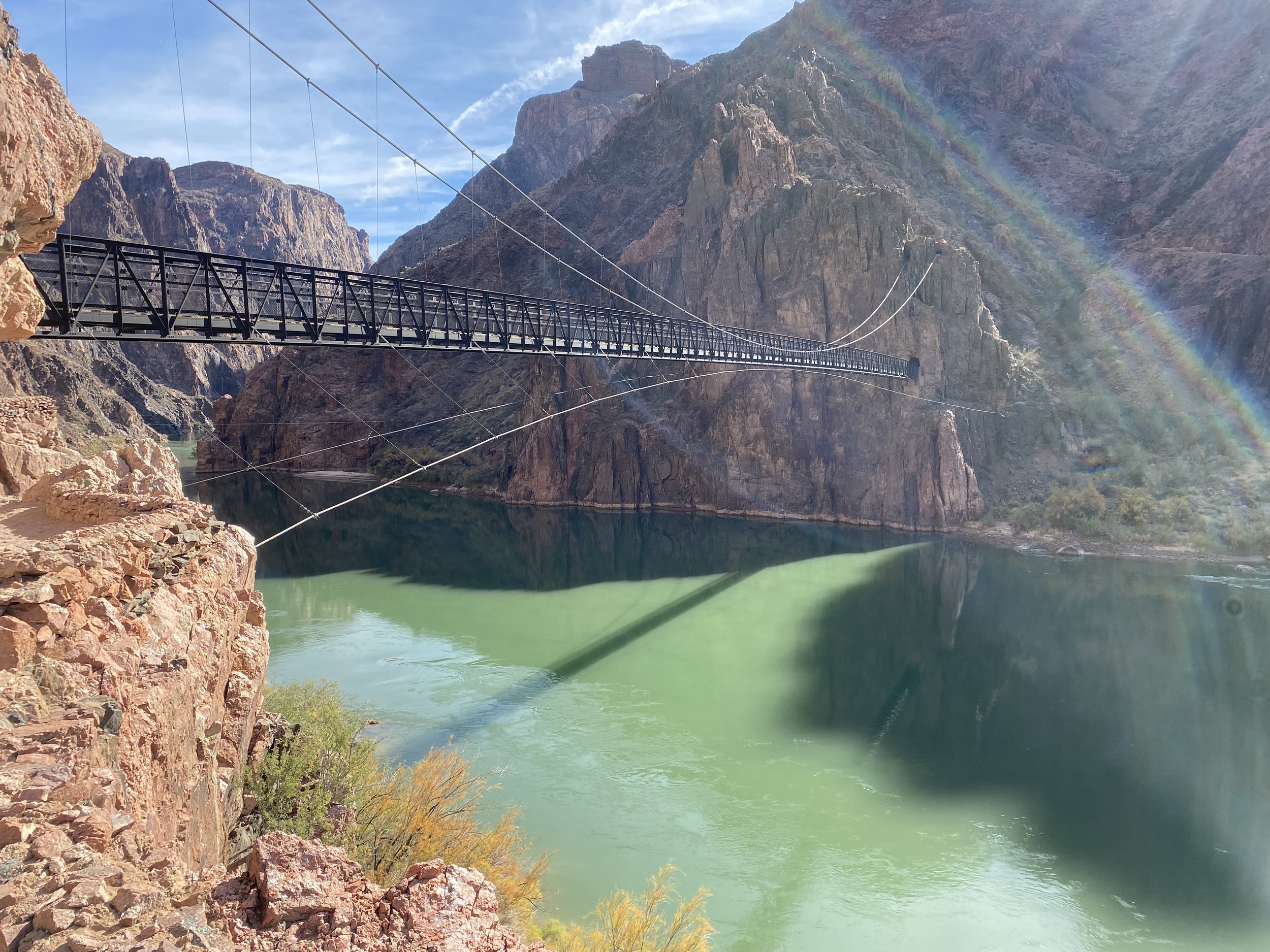
I walked across the suspension bridge over the Colorado River and began my march skyward.
I passed countless people with my quick pace, only stopping briefly to take pictures. The sun was beating on me full force once I was 1/4 of the way up, and I only found shade from its merciless glare one time, in a small keyhole, a mile from the top.
The South Kaibab trail is very exposed, with no water sources along the way—it is a 4,500ft climb over 6 miles and it took me about 3.5hr to complete.
When I reached the South Rim, I received a text message from Sarah and Tim, they had just finished their hike through the G.C. as well and invited me to camp with them at Mather.
They came and got me from the next road crossing so that I could shower before the bathrooms closed.
After cleaning up and doing my laundry in the sink, I resupplied at the village market. My next stop would be flagstaff, approximately 110 miles away.
I felt surprisingly good after covering my first 100 miles. I was nervous about the cold going forward, though.
Tim generously lent me his 15 degree REI Magnum mummy bag for the duration of my trip. The hooded nature of a mummy bag seemed to seal in way more warmth than my open-backed 20 degree quilt, and gave me the boost of confidence I needed to keep on trekking.
Up next: Mather Campground to Flagstaff, 4 days // 110 miles
Huge thank you to Tim and Sarah! You were both a major part of my success in hiking this trail.
Though solitary, this hike would not have been possible without all the amazing help I received from my friends.


