
Te Araroa: Mangawhai Heads to Mercer

A rainy stretch of trail!Day 15 (12/24/23): 18 mi, +707ft // 30km, +215m
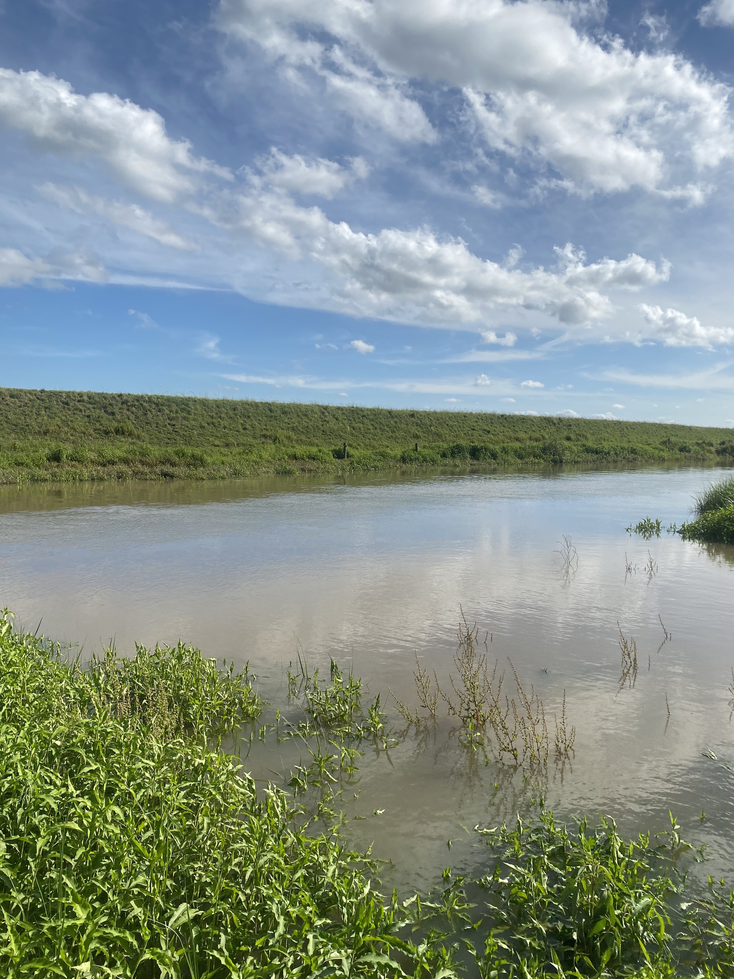
Mangawhai Heads to Pakiri Holiday Park

Jonne, Mikkel and I set our alarms for 5:30AM to catch the 3 tidal river crossings for the day at low tide. I was skeptical that the crossings would even be hard, but Jonne seemed concerned, which in turn made me concerned, so we decided to hike together that day.
It had rained just enough overnight to wet my tent and make it a bit unpleasant to pack away. Regardless, we walked out of the holiday park around 6:30 as planned, then I slowed us down because the bakery was open and I needed an espresso.

We also stopped at New World grocery to do a brief resupply but it took a longer than I thought it would; our delays caused us to hike the road miles fast and feel rushed getting to the beach.
The first two streams were barely ankle deep, and I laughed as Mikkel only took one shoe off to hop through on his barefoot, keeping his shod foot dry. Jonne did not want to get her feet wet either and tried to do the same but wound up soaking her one shoe.
The third and final stream crossing just before the Pakiri Holiday Park required us to take both shoes off and wade through; the water was knee deep and I could see how at high tide or after a big rain the crossing could be treacherous.
It was a shorter day of walking for me, not too much climbing and only 18mi, but Jonne and Mikkel were tired from yesterday and glad to stop at Pakiri. I knew I’d have to do bigger days soon if I wanted to keep my “schedule” and take a day off, but for now it was nice to not walk into camp wrecked.

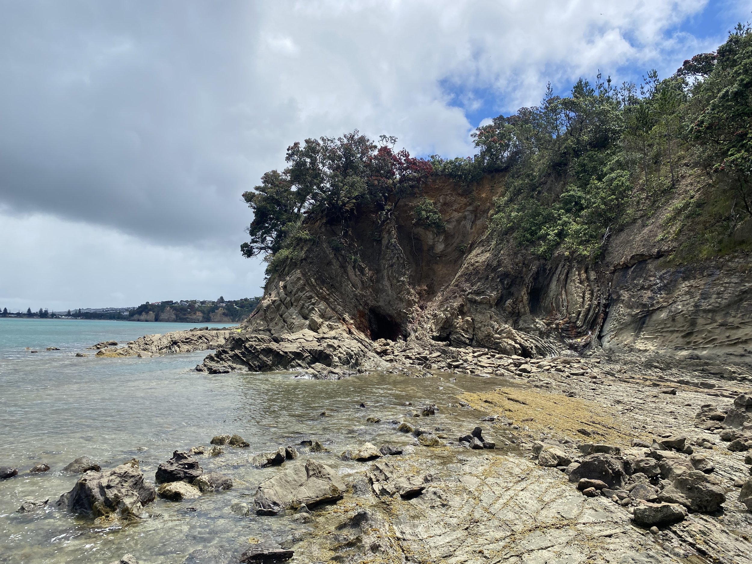
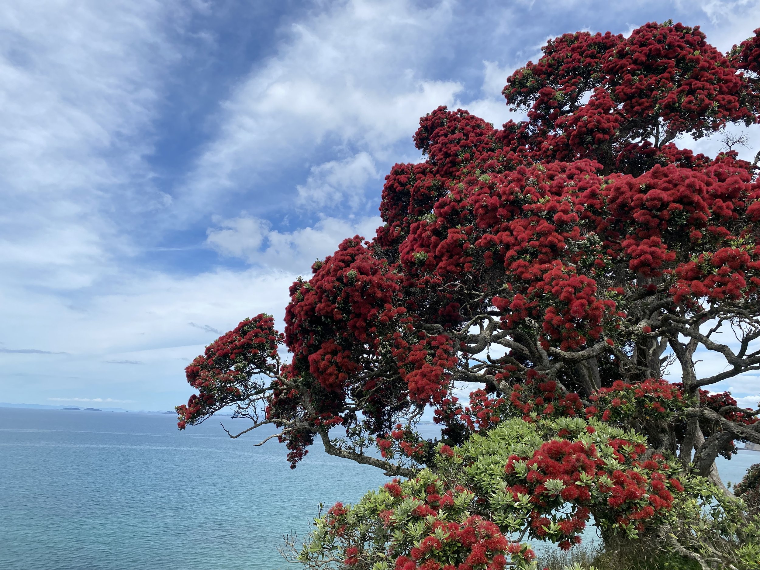
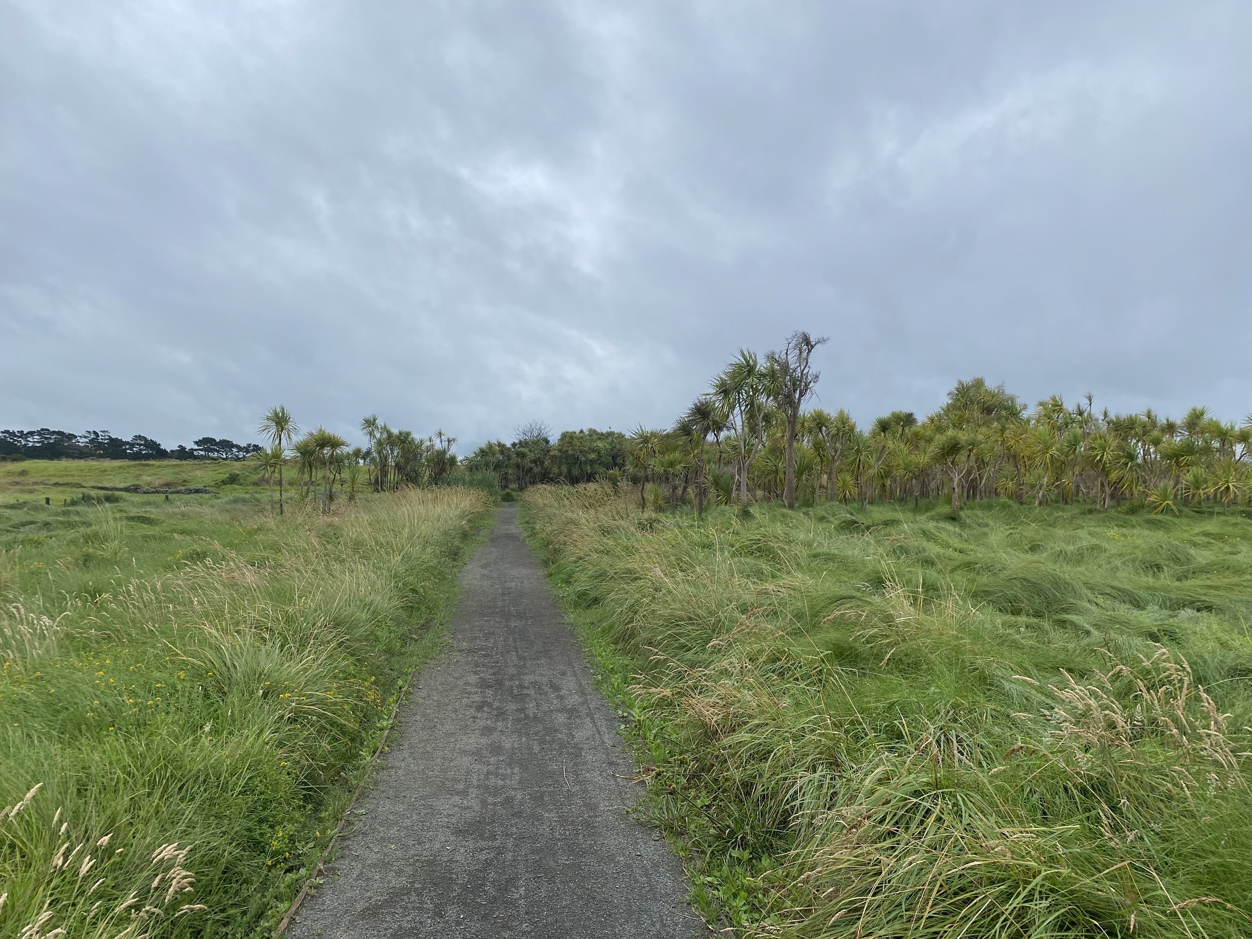
Fairy Terns!This stretch of beach and dunes is home to the last 40 fairy terns—a type of tern endemic to New Zealand—and we were lucky enough to see them!
They were truly fairy-like, with their slender, pointed wings, black capped heads, and foreheads adorned each with a tiny white star.
Day 16 (12/25/23): 18mi, +5596ft // 30km, +1706m
Pakiri to campsite at residence on Kraak Road
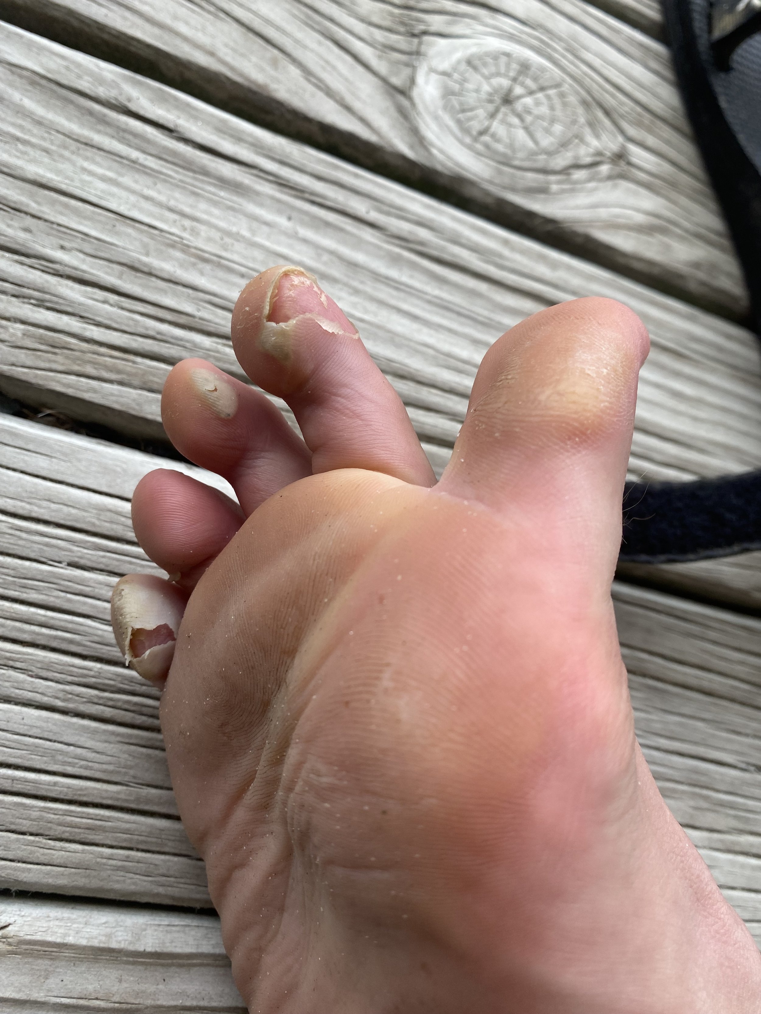
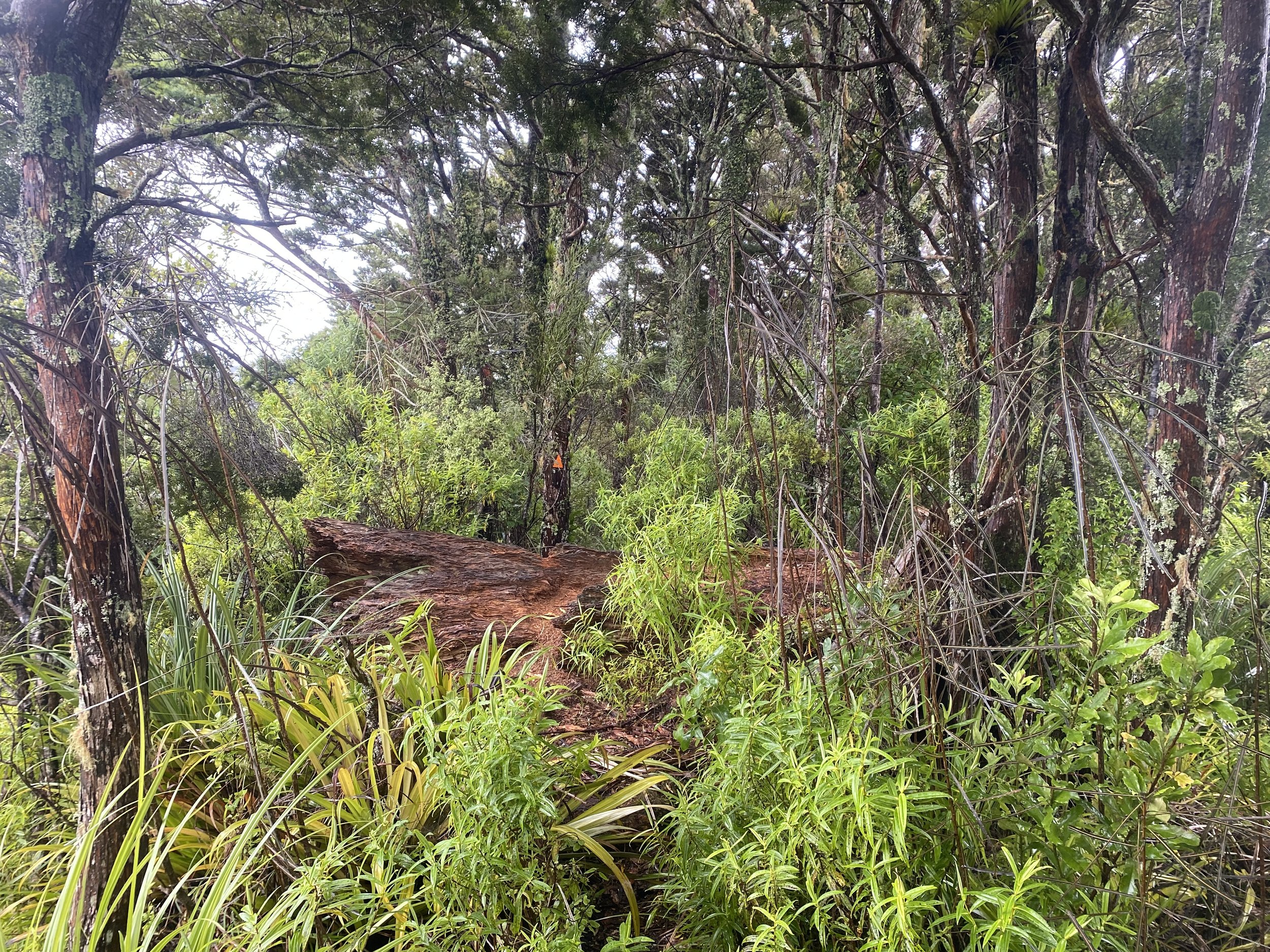
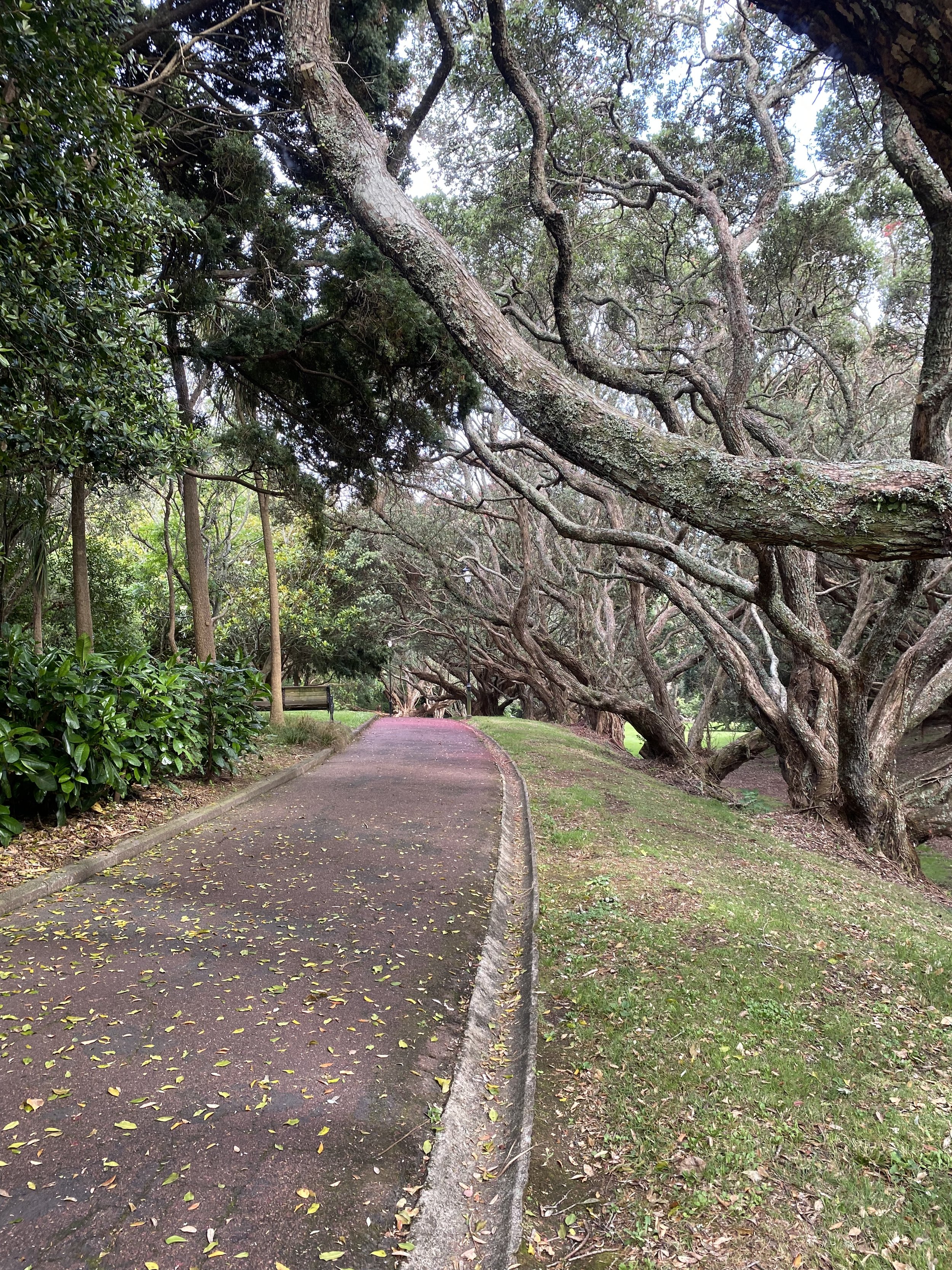
The residual carnage from 90 mile beach: old blisters, new callusesToday wound up being a different sort of day than any other on the TA thus far because it was nearly ALL single track—aka “tramping grade”. It also rained a lot.
I was the first to leave the Holiday Park and would not see Jonne or Mikkel until camp that evening, and even then, we’d barely see each other for all the rain, which kept me inside my tent for the duration of the evening.
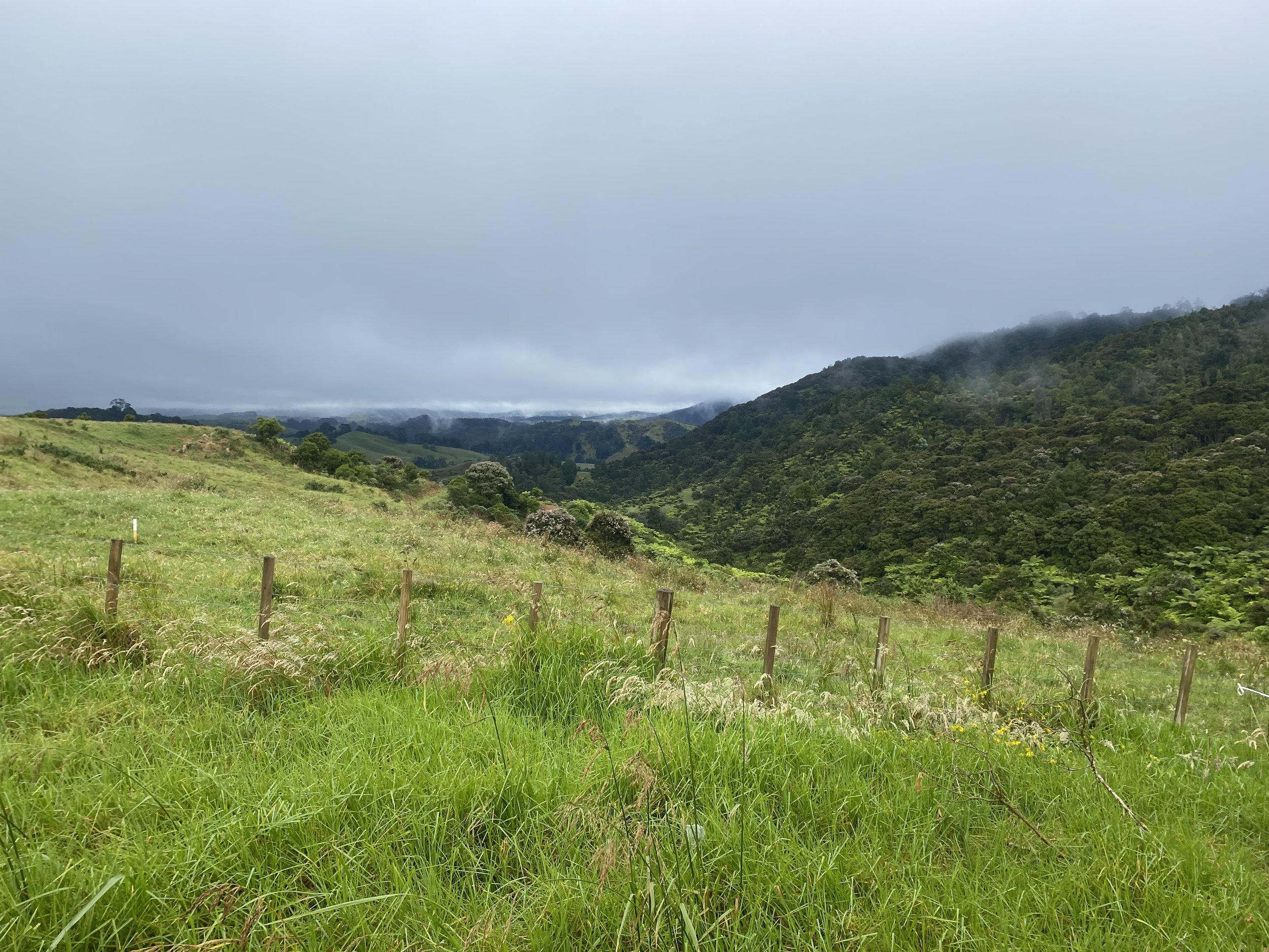
The day began with a steep climb through pasture lands, the tall grass soaking me to the bone. Sheep materialized out of the fog and ran from me; the rain began to fall.
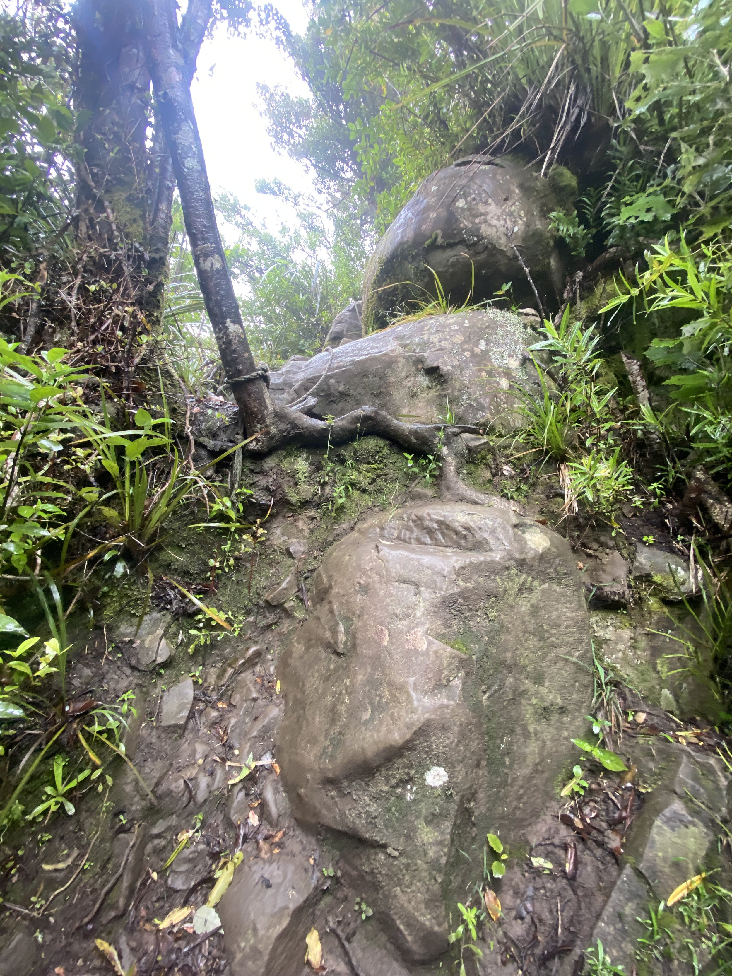
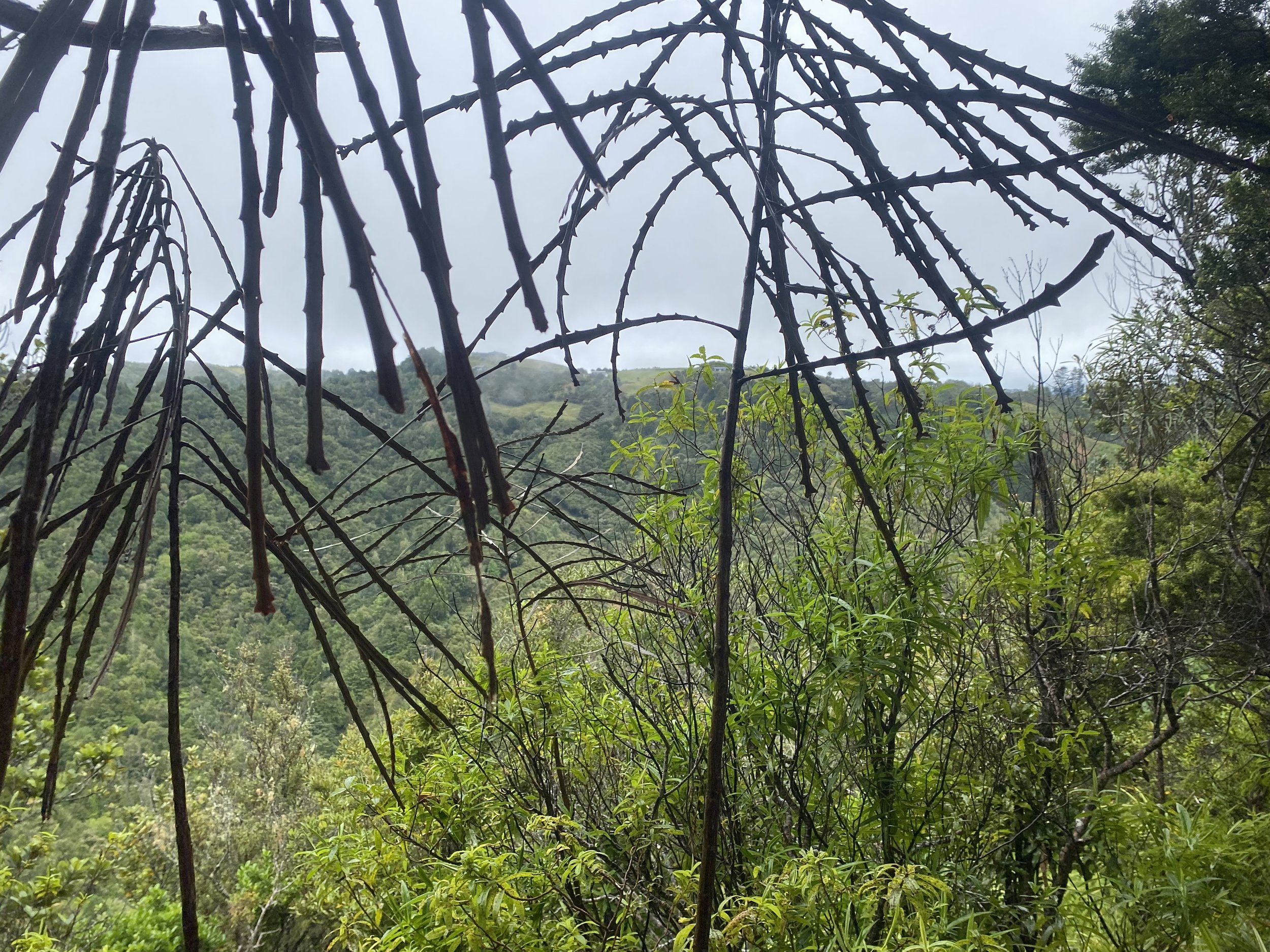
The trail entered the Omahā Forest and became steep and muddy—so steep, that parts of the track actually had ropes in place to help you climb up boulders.
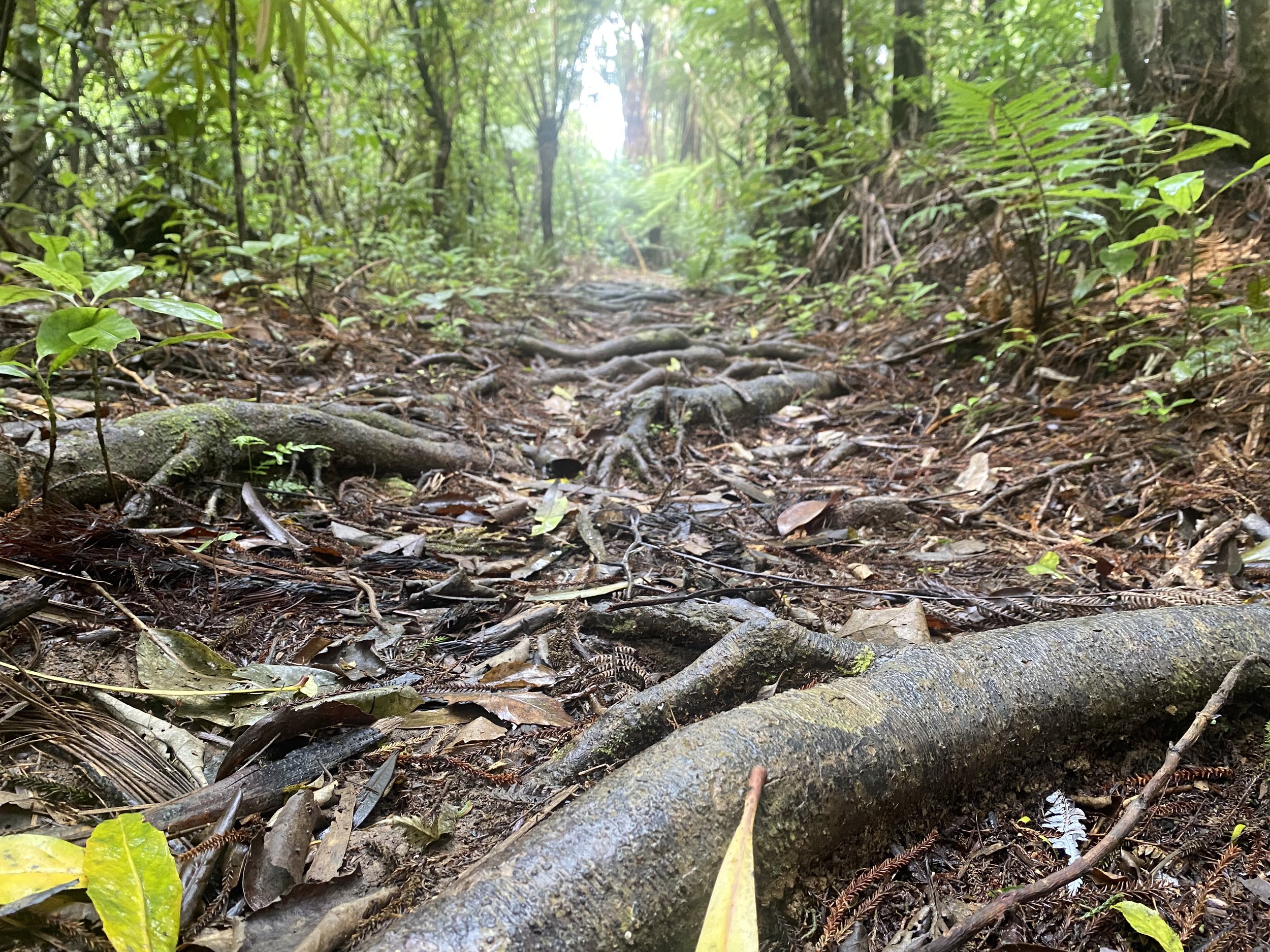
The footing, when it wasn’t mud or rock, was a bed of tangled roots, slick and gnarled.
I made it up and over Mt. Tamahunga, and down onto a gravel road where I decided to take a quick lunch break and make a wrap while it wasn’t raining. There had been a few creek crossings that I didn’t pay much attention to because I was so distracted by all the sodden spiderwebs hitting my face, one after the other.
Just as I pushed the last bite of peanut butter tortilla into my mouth, the sky opened up. It was like a massive bathtub was overflowing above me—torrents of rain ripped down the hillsides all around me, turning the road into a river.
It occurred to me that the easy creek crossings I’d made it over, probably wouldn’t be so easy anymore. Poor Jonne and Mikkel!
I popped my umbrella open and started walking, I made a bee-line for the forest and then threw my raincoat on under a tree where the rain was less intense.
I hiked climb after climb in the dense, green forest, feeling tired but not wanting to stop for a break in the deluge.
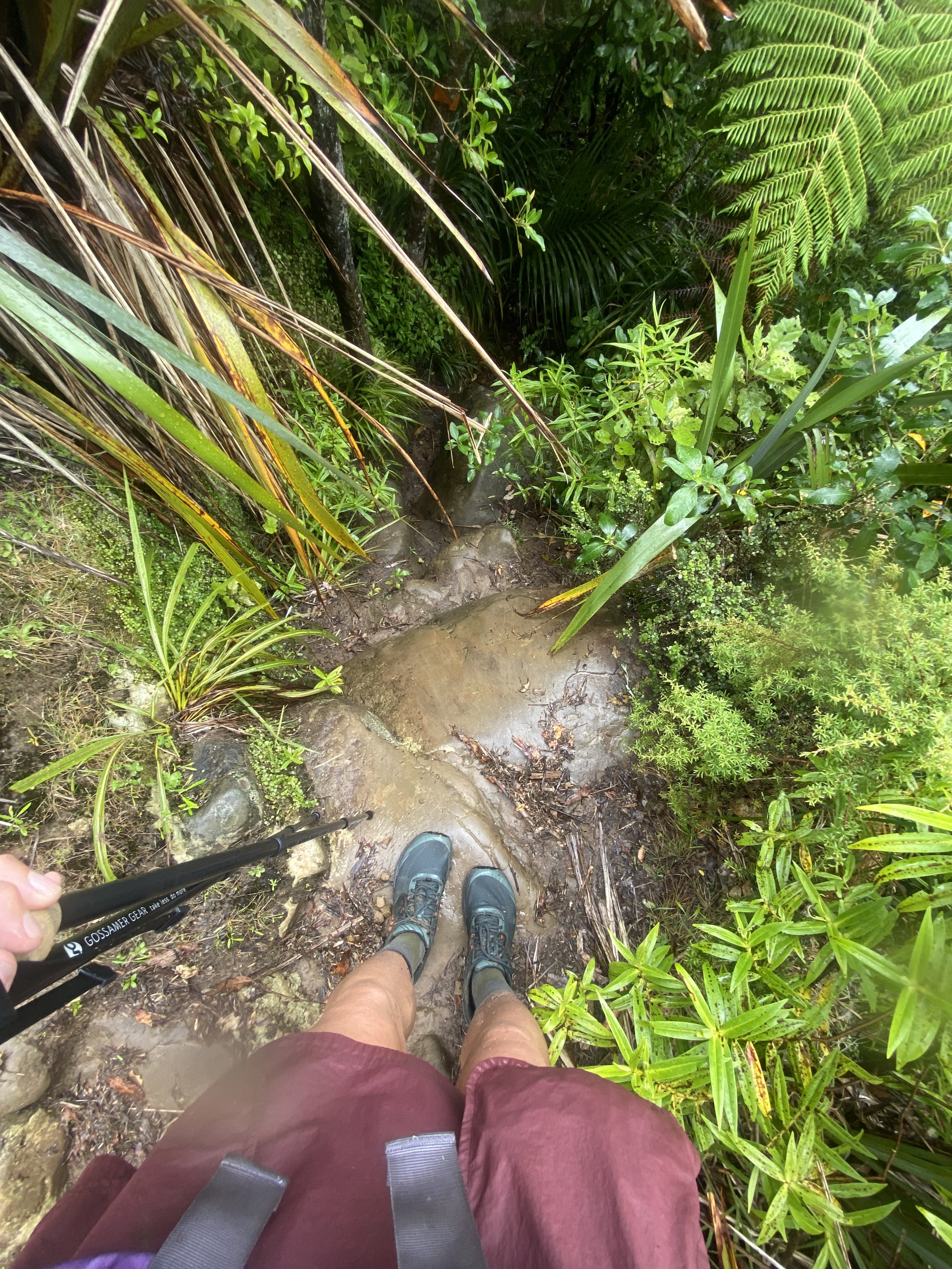
After so much walking came the near vertical down-climb off the summit of Dome Peak on the Govan Wilson Track. Every surface was slick with rain and mud, causing me to question my every step.
At one point I stood on a Boulder looking down the “trail”, which really felt more like staring straight down a hole into the jungle.
I powered through one obstacle after another and made it to the Dome Cafe, which had been closed for years, and without even pausing, headed up Kraak Road to find this mystery campsite mentioned in the comments of FarOut.
I knew what I was looking for when I saw it, a grassy yard with a sign that could have been depicting a tent? I tried knocking on the home owner’s doors to no avail. Heavy metal music was playing in the garage but none of the lights were on.
I collected water from the rain gushing down the gutter on the side of the house and then threw up my tent.
All I wanted was to be dry, but I wound up spending the night feeling sticky and damp.
When Jonne and Mikkel showed up later they told me how absolutely terrifying the stream crossings were, that they had to wait and hour before fording the last one because it was chest deep and raging!
Day 17 (12/26/23): 25.5mi, +3399ft // 42.5km, +1036m
Kraak Rd to Pillows Lodge, Orewa
The next morning I was feeling a little testy—irritable—and wanted to just get going. We all packed up in the shed, out of the rain (it was still raining) and I could tell I wasn’t the only person who was tired.
Jonne and I discussed campsites, I wanted to go all the way to Orewa but she wasn’t sure she and Mikkel would make it that far. We parted ways and I was still unsure of what my plan was exactly.
I tried to remember how I handled continuous rain on the Appalachian Trail, that was the rainiest hike ever, but all I could remember was that it always kind of sucked and never exactly got easier to be wet all the time.
I powered through the morning road walks at a good pace, averaging just under 5km/hr. By 10AM I’d done 10mi and hoped to make it to Puhoi by 12PM, that is, until I stepped into a wormhole in the jungle.
I was walking a casual pasture-forest track, saw an orange triangle marker nailed to a stile to my left and made a beeline for it, I’d been expecting a gate or a stile or something so it didn’t seem out of place. I should’ve checked my GPS.
Suddenly I was pelting down a steep hill on unformed track, through palm fronds and ferns and spikey plants, weaving in and out and up and down—it was 1.5mi of slow, painfully tiring hiking, chasing orange blazes.
And when I did finally check FarOut, my location symbol was floating in a whole lot of nothing on the map. Uhg.
When I emerged from the forest an hour later, I was pretty much back where I started, on a highway not far from the farm track. What the heck?
I road walked to the trail and rejoined it further south along my route, shaking my head at whatever that was, that I just hiked.
The adventure didn’t put me too far behind schedule, though. I passed through Puhoi around 1PM, walking a stretch on the highway that could only be kayaked on an outgoing tide, and made it to Waiwera around 2:30.
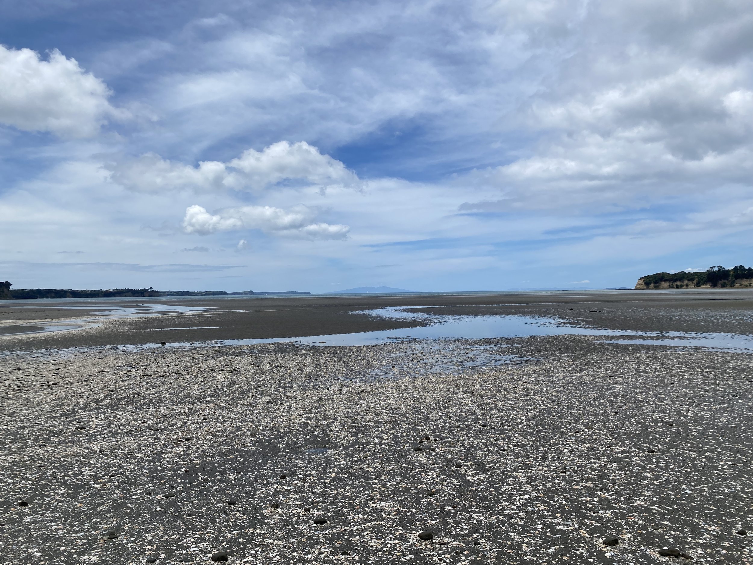
I’d caught low tide! This was huge, as making it to Orewa via the Hibiscus Coast required low tide to navigate around the rocky shoals at the bases of the beautiful sandstone cliffs.
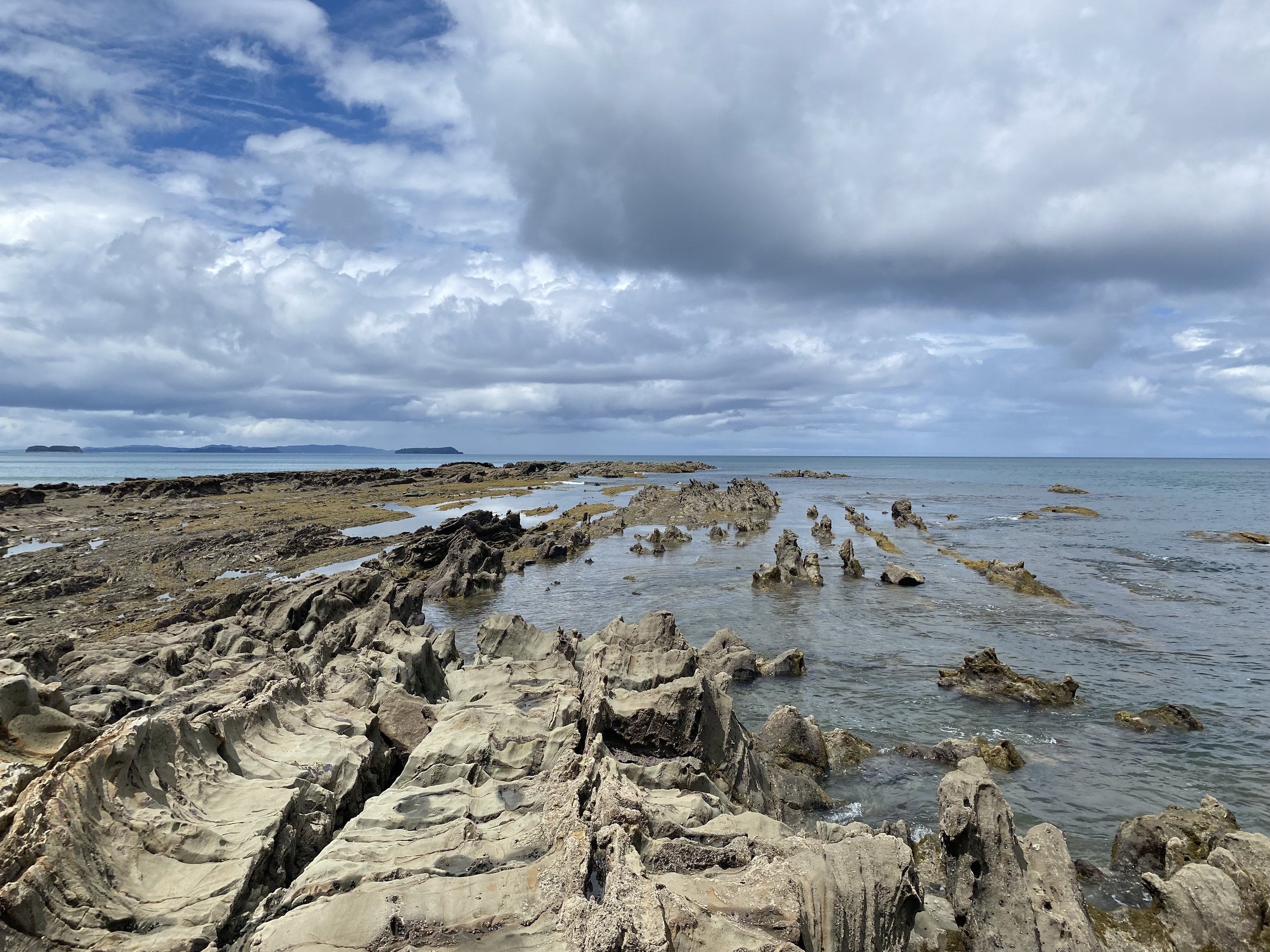
The sun was shining through light layers of clouds as I picked my way along the rocks, trying to avoid barnacles and slippery bits of seaweed. The views were stunning, everything I’d hoped for!
The Hibiscus Coast was a section of trail I’d really looked forward to. Once I reached the beach in Orewa, I took off all my clothes save for my sports bra and underwear and went for a swim in the ocean.
The day had felt long but very rewarding. I’d called Logan after my bonus loop in the jungle and he’d cheered me up. And then I’d managed to book a single room at the hostel in town, there wasn’t a good camping option as the holiday park was supposed to be expensive even for TA hikers.
If I was going to spend the money either way, I wanted a bed and space to dry out all my gear.
Day 18 (12/27/23): 32.5mi, +2749ft // 54km, +838m
Orewa to LyLo Hostel in Auckland
I slept in! And took my time getting ready in the morning. I’d exploded my pack and dried out all my gear the night before and wanted to be sure I left nothing behind.
Pillows Lodge was a unique stay—comfortable & clean room, complete with my own electric kettle and little packets of coffee and hot cocoa—it was also very clearly a halfway house for people newly in recovery.
Everyone was really nice and left me to myself, but the shared bathroom was a bit, uhm, foul? There were only two toilets and one shower for everyone at the lodge to share, and as it goes with withdrawal, people were sick. The guests all had curfews, though, so no one returned late at night or was loud. It was a quiet place and I slept well.
When I left Pillows, I planned to walk to Takapuna Holiday Park; despite hikers saying it was expensive, it was the only reasonable option on this side of the bay before the ferry to Auckland.
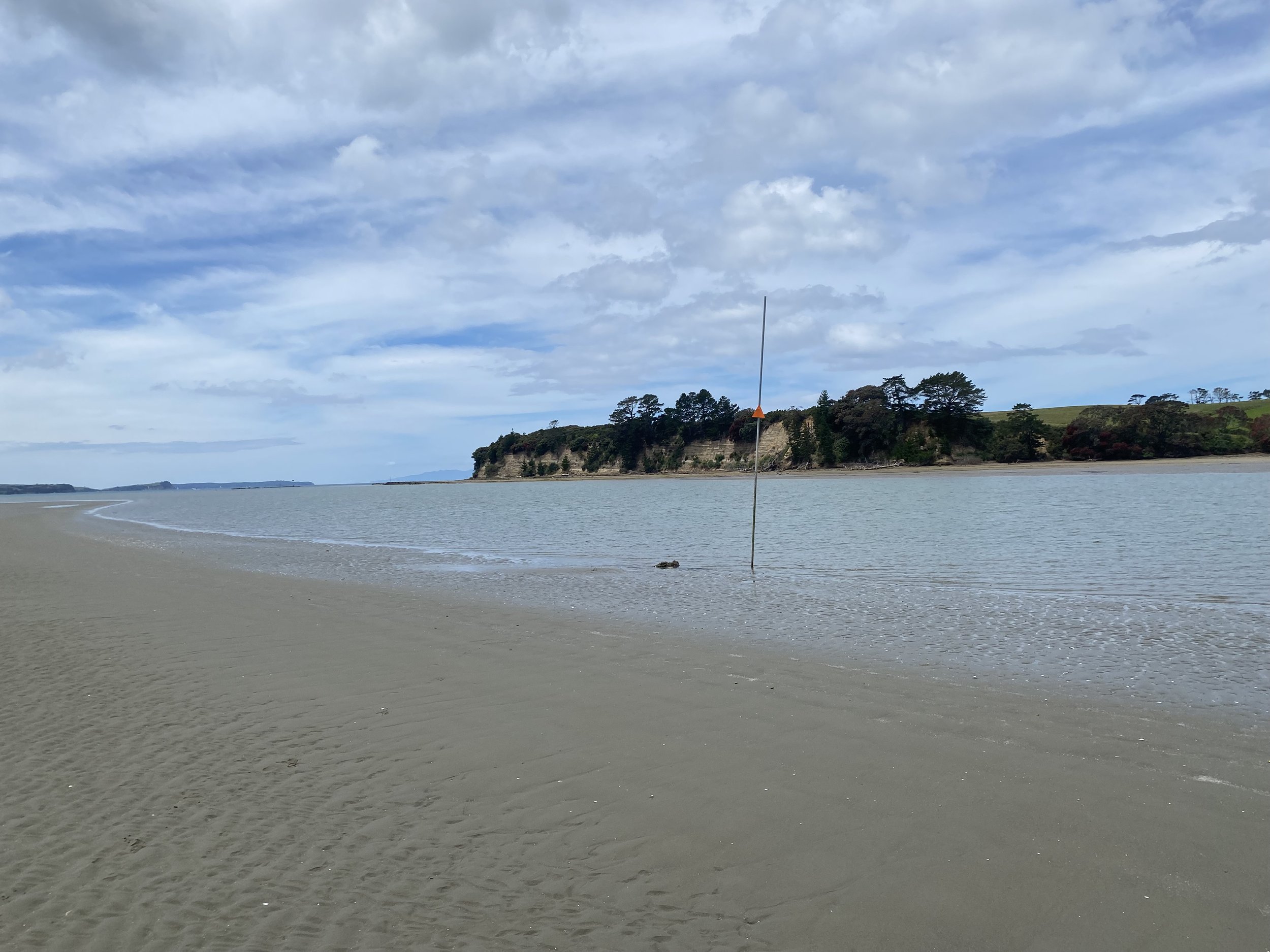
The obstacle of the day was a tidal crossing of the Okura River. I was actually pretty excited to cross this river as it sounded wide and deep but lacked a strong current. I figured it would be a good opportunity to face my lingering fears surrounding river crossings.
I walked out into the estuary on squelchy sand, looking around for a post with a TA marker denoting the crossing point. Once I found it, I realized just how wide the crossing was!
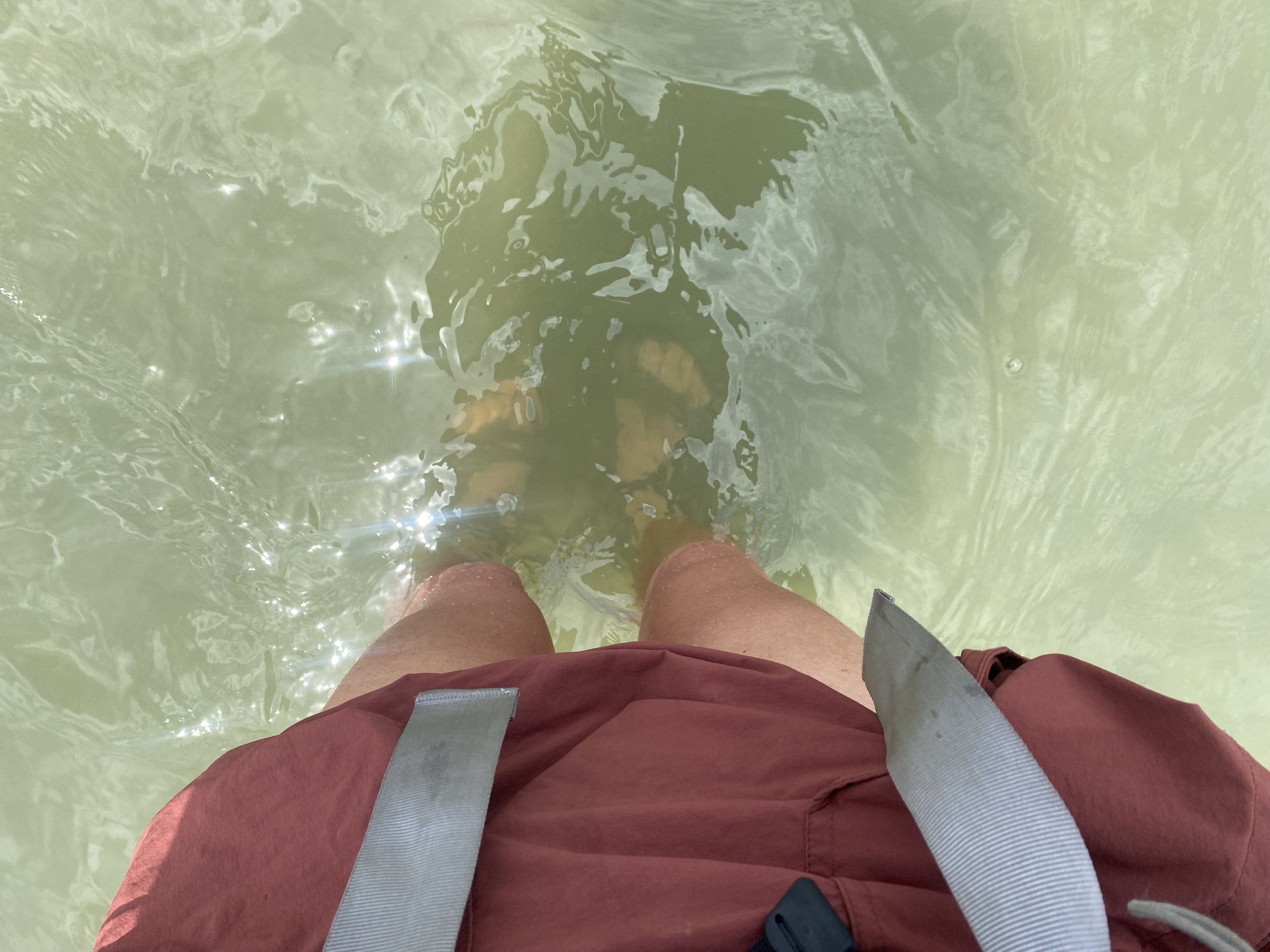
I stashed my technology up high in my pack, then waded out into the pale green water. A stingray shot away from me and I smiled. What a cool experience. At its deepest, the water only came to mid thigh, I must’ve caught the tide just right.
The afternoon was hot and sunny and unfolded slowly. I felt like I should be covering more ground than I was, but I had waited an hour at the river for the lowest tide possible, so that set me back.
I ran into an Australian named George, he was 19 and made me feel incredibly old when I told him I was 30 and he looked something akin to horrified.
He was a kind person, though, if not a bit hapless; he was having foot and ankle problems and his tent weighed several kilos. Additionally, his father was furious with him for quitting his job to hike the TA and had kicked him out of the house a week before he was set to leave, which devastated me to hear.
If anything, I was really impressed by George. I couldn’t have done this trail at 19.
We passed the last 10 miles to Takapuna chatting and swapping stories, and when we got there sometime after 7PM, exhausted, hot, thirsty, the office was closed and the late-comer tent sites that were supposed to be available, weren’t.
I was in a bad mood, no sugar coating it. A woman in the tenting area had spoken to us like we were idiots, vagrants, rule breakers—she was totally condescending and awful—and I decided to just keep walking, to the ferry if I had to! I’d figure it out.
I told George he might have better luck yogi’ing a spot alone, without me and my mood fouling things up, and we parted ways there.
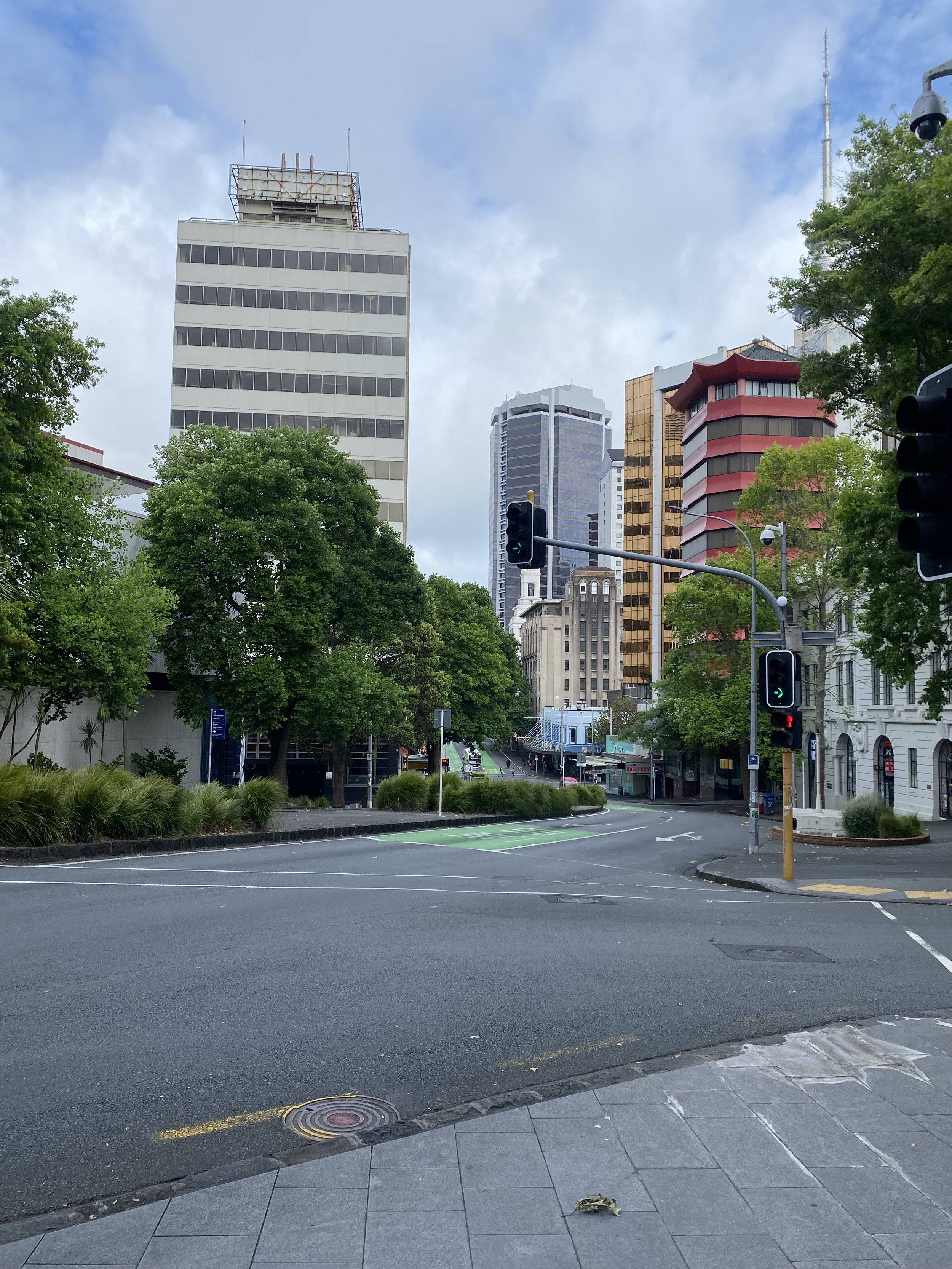
I wound up walking another 10 miles, all the way to the ferry and into Auckland.
At 10PM while sitting aboard, I managed to find a hostel which had a 24hr check-in desk and booked it immediately. I was so exhausted that I didn’t even notice the ferry had docked and everyone had gotten off.
I arrived to LyLo around 11PM, showered, clambered into my “pod” and attempted to sleep. It was kind of claustrophobic in that little box, though, I must admit, but overall I was relieved to be horizontal.

Day 19 (12/28/23): 14.8mi, +1411ft // 24km, +430m
Auckland to Ambury Regional Park Campground

I didn’t sleep terribly well in the hostel, but I was very grateful to have slept at all, to have had a bed and not spent the night on the street, which is what I feared would happen when I got on the ferry without any real plan in place.
I got two bagel sandwiches and a long black coffee at a cool breakfast spot, then began an ambling walk through Auckland, sort of following the “trail” but also walking wherever I felt drawn to.
Auckland is a beautiful city at its core, I think, because of all the trees!
I’d planned a short day and pre-booked a campsite at this working farm a little south of all the congestion. And as I walked, I ruminated on something that had been nagging at me.
On other trails I’d felt really proud walking into towns after long stretches in the mountains. I didn’t feel out of place or worry about how I appeared, how I smelled. But the TA is different, maybe because it is more urban and I am interacting with a lot of people from the “civilized world” throughout each day.
I feel… self conscious? Insecure? And the interaction I had with the woman at Takapuna really exacerbated that feeling. 99.9% of my interactions with people have been so wonderful, but all it takes is one.
Like most people I walk by here, she had no idea what George and I were doing. We were just an annoying inconvenience—or worse, a threat—to her carefully curated family vacation. She made sure to point out she’d planned ahead and booked the tentsite “for her family”, before telling us to go away.
She wasn’t even curious about where we came from or why we were walking.
I wrestled with the feelings of disdain I held for her, knowing she was probably in my path to reveal some area within me that needed growing.
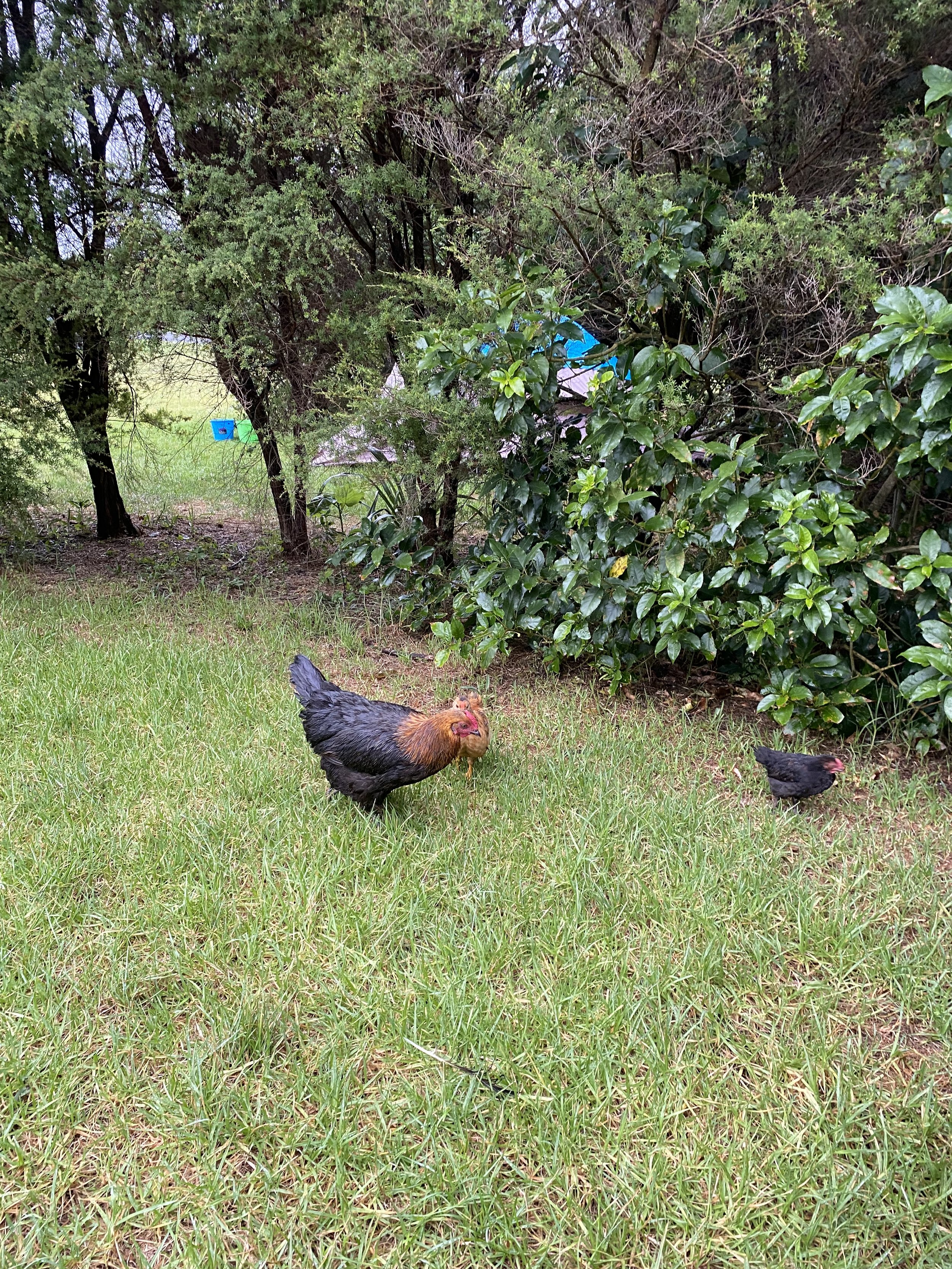
I made it to Ambury Regional Park and meandered to the campground past the ducks, the horses, and the cows.
I chose a tentsite guarded on either side by trees and sat at its picnic table, eating the chips and guacamole I’d picked up on the way. I watched the chickens peck at tiny bugs in the grass around me, their gentle clucks and coos calming my whirring mind.
Farm animals make for the best sort of company, don’t you think?
Day 20 (12/29/23): 21.5mi, +917ft // 35km, +279m
Ambury Park to Ranfurly Road in Alfriston
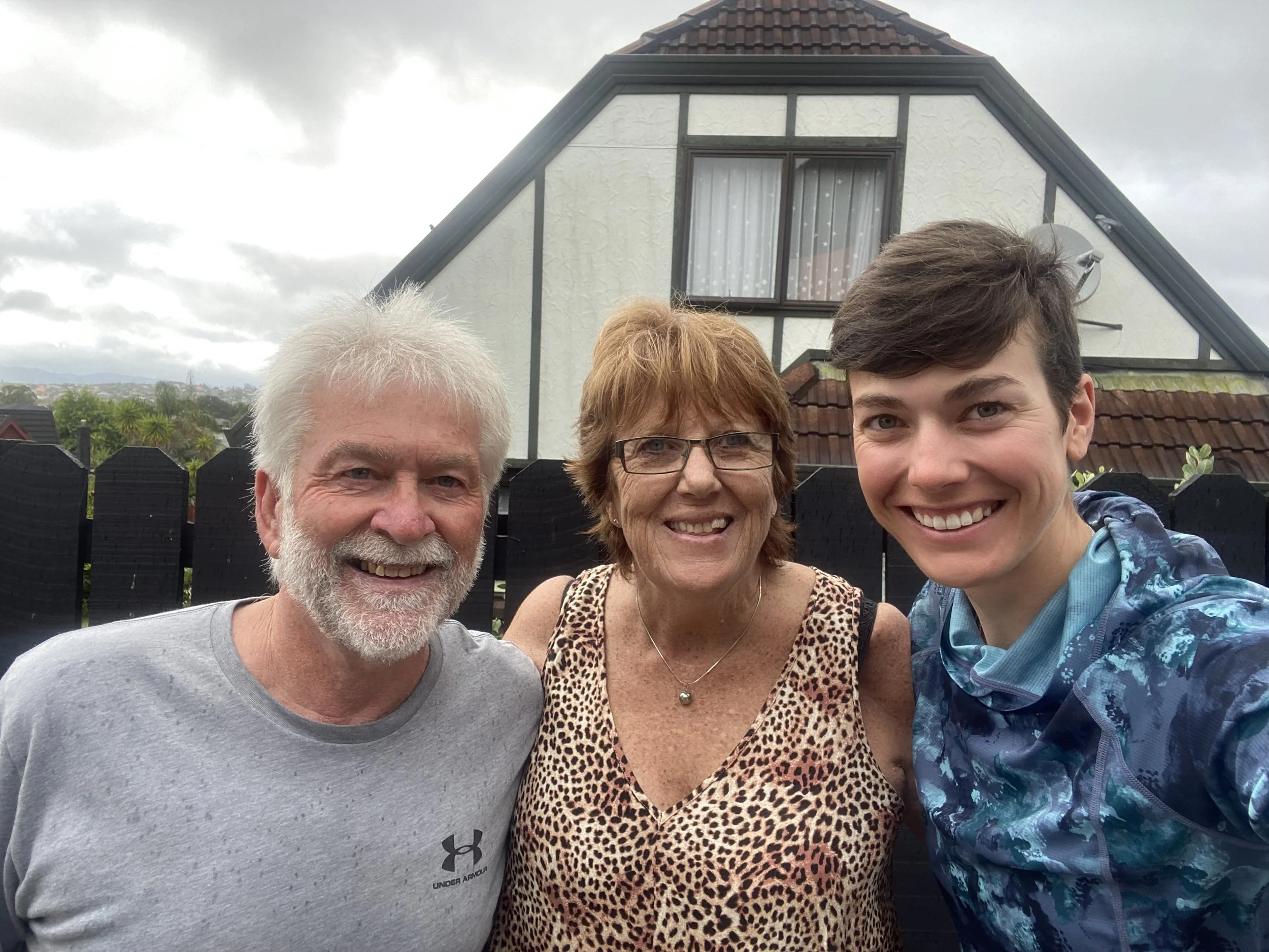
I walked with a bit more purpose today than the day previous, as I’d arranged a pickup with a woman named Julie, who my new friend Leigh from CB, had put me in touch with. She was her mom, Waverly’s, best friend.
She and Gary had offered to host me for a night when they heard I was having trouble finding places to stay in and around Auckland.
I’d attempted to book an Airbnb twice, and neither request had been approved. Id heard of some hikers hitching back into the city every night but I didn’t want to do that; there just really weren’t many options.
I hiked past the airport, where I’d initially flown in, and that felt like a major milestone! I then proceeded to sit in the shelter of a bus stop and make a bagel cheese and salami sandwich, avoiding a little rain. Epic.
By the time it was 11:30, I was more than halfway through my day and found myself sitting under the awning of a toilet, avoiding a deluge of rain. I wasn’t in a rush; thankfully I was ahead of schedule. Why get wet sooner than I had to?
Peter, a 26yr old hiker from Germany I’d met yesterday, caught up with me shortly after I’d abandoned the toilet and walked out into the rain. Of course I’d walked the wrong direction and he’d been following me.
We laughed at my mistake, consulted our GPS apps and backtracked to regain the route across some farm fields, taking a break once we were past the botanical gardens. He was wonderful to talk to, a very thoughtful person.
Mostly we discussed why we were hiking, what we hoped to gain from the experience and how we were living our lives slightly off the beaten path in general, not just on trail.
When I arrived at the junction of Ranfurly Rd and Mill Rd, Peter went on and I found a stump to sit on with my umbrella where I waited for Julie. I was so grateful to her for wanting to pick me up! She didn’t want me to hitch.
When she pulled up, she gave me a wave so I knew it was her, and I beamed from under the hood of my rain coat. She and Gary fed me the most delicious cheese plate & dinner, gave me bubbly water, a shower, and a super cozy bed to sleep in, even did my laundry!
I was floored by their generosity and so completely happy to have gotten the chance to get to know them, just in time too! As they are hoping to move to Mangawhai Heads, that gorgeous area I’d walked through not even a week ago.
Day 21 (12/30/23): 30mi, +2736ft // 50km, 834m
Alfriston to the motel in Mercer
Gary took me back to the trail in the morning after making me a breakfast of bacon and eggs—the plate was heaped with bacon—delicious. I said my thank yous and goodbyes, slung my pack over my shoulders and began walking.
He and Julie had both lead such interesting lives; having both grown up in New Zealand they were really passionate about all the amazing things there are to see and do here. I left with a mental list of places I desperately wanted to see.
My walk kept me on sidewalks for the whole morning, you gotta love a good sidewalk! I called Mary, my sister, and we caught up. Then I called Logan and chatted with him for long time.
In truth, I miss him badly. We got engaged the end of October, and then he winged off to Tignes for a month to train for a season of Ski Mountaineering. He returned just a few days before I left for New Zealand. No amount of time together would have been enough, really anyways.
He is really supportive of me being here, doing this, just like I am 100% behind his travel for skiing and competing.

The trail eventually took me away from the roads and into steep pasture, climbing over Mt. William.
Then back to roads.
Then back to pasture.
And then… a river?

I wasn’t in river mode, not really. The whole day had been so straightforward and I wasn’t expecting any challenges, to be honest. So when I looked out over the bloated, brown Mangatāwhiri River, I was stumped.
I waded down into the tall grasses and murky brown water, holding my shoes in my hand, sandals on my feet. I then climbed ever so carefully over the electric fence between me and the river, while standing thigh deep in water.
When I reached the river “edge”, if we can call it that, now underwear-deep in water, I tested the depths further out with my trekking poles.
Something huge splashed beside me and I shrieked, probably scaring the baby cows behind me on the stop bank.
Oh hell no! I thought, spinning around.
I flew out of there, climbing delicately back over the electric fence, and running up onto the stop bank. I consulted the TA app for options but it only offered a long detour, back up to the highway, over a bridge, then back down to the opposite side of the river. It didn’t feel amenable after having already walked 25miles that day.
Then I heard another splash and my gaze shot back to the river. Fish? Giant gold fish?
Oh for crying out loud, I thought. Fish can’t kill me, I’m crossing that damn river.
So I marched back into the murk, climbing back over the electric fence a third time, after tucking all my electronics high up in my pack and stowing my shoes.
I took one bold step, then another—up to my waist now in water—then, quite suddenly, I was swimming.
My pack rose up behind me, threatening the push my head below the surface. I quickly clawed at my hip belt, unbuckling it as I should have prior to entering the river. Then I kicked my feet and paddled my hands, swinging my trekking poles through the water until I reached the opposite shore.
My mind eerily quiet, supremely focused on the task at hand—survival.
Once I’d drug myself up onto the bank, I heaved gasping breaths, shaking from the adrenaline and terror. My worst nightmare had come to pass and I’d survived. I wanted to cry, but I also felt completely relieved and unburdened of the worry I’d been carrying.
A different me, a less experienced me, would have detoured. But the woman I am today faced her fears and now is stronger for it.
I felt proud.
I marched the remaining 5 miles in a mess of sogginess, heading for the roadside motel in mercer.
When I arrived I bought McDonalds and sat in the grass eating French fries. My milkshake was totally melted but I didn’t even care, I was alive.
I was alive.
To view daily maps of my progress, follow me on Strava:
https://www.strava.com/athletes/ivey_smith