
Te Araroa: Mercer to Te Kuiti

As an introduction to this week’s entry, I would like to begin by saying this section of trail was really hard. The 120 miles (200km) from Mercer to Te Kuiti are very challenging, full of dense, scratchy bush, steep climbs that will have you on the tips of your toes and sometimes hands, too, slick clay, deep mud, awkward, pocked farm tracks, and many, many stiles.
My resolve was tested, to be sure. And my biggest reflection from the past week is this: I will hike Aotearoa’s north island once and hike it well; it is a privilege to see the country this way, to experience it so completely and so meticulously, but I’m not sure I would hike the north island in-full a second time.
Certain sections I would absolutely hike again, but the thorns-in-your-face, falling down in mud holes, steep clay slip n slides, chunky, uneven farm walking, scary, high speed verge-less roads—maybe once is enough?
Day 22 (12/31/23): 29.7mi, +1348ft // 49.5km, +411m
Mercer to Huntly Campground
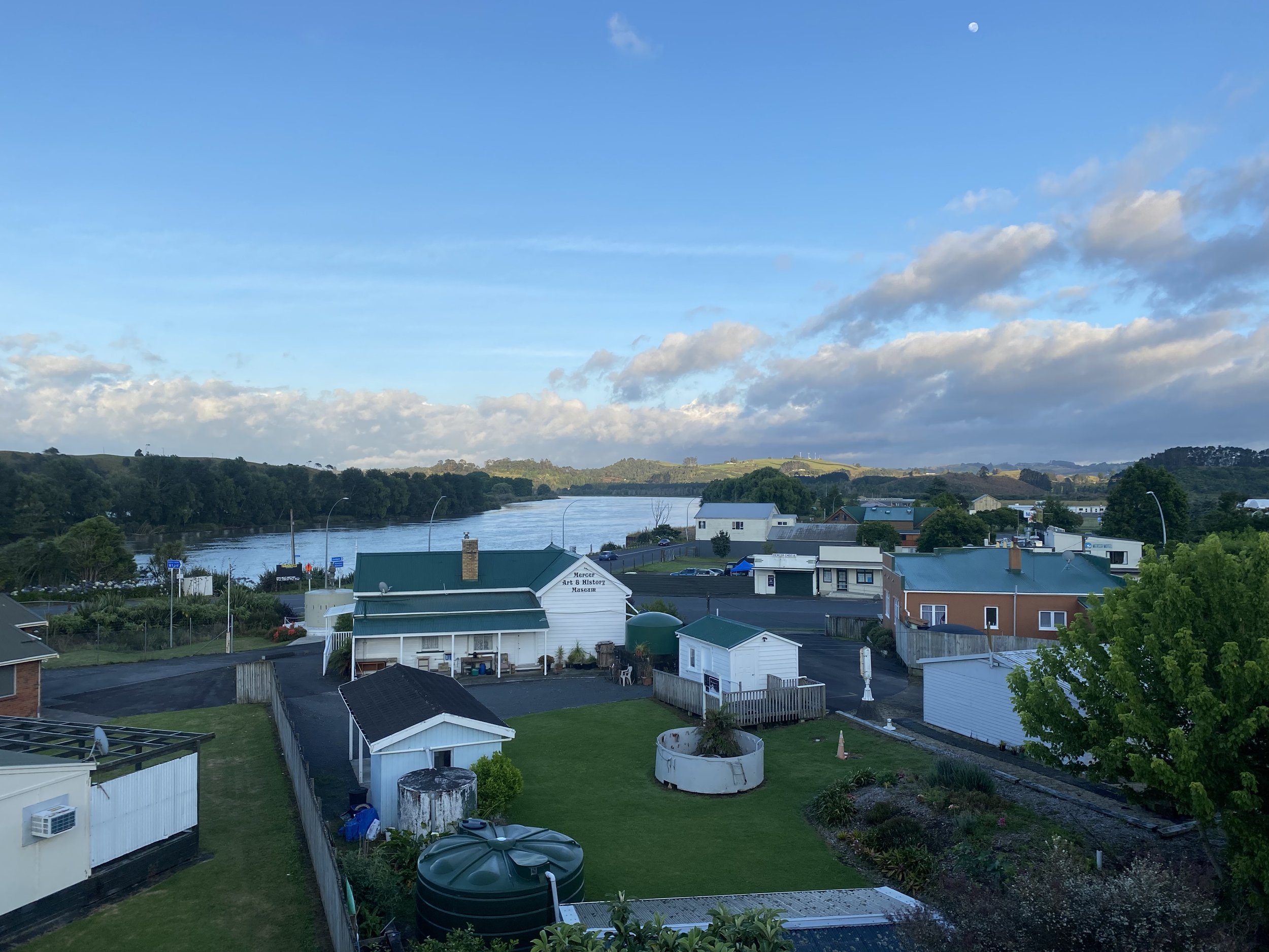
I woke up to a bunch of condensation in my tent. I hadn’t slept particularly well; there was a guy at a picnic table outside the motel’s backyard making fight noises until late, for hours, like he was getting himself amped to/-I don’t know—fight someone?
I’d met Chris and Rihanna the night before, and another hiker I’d tried to chat with but he quickly told me he didn’t speak English. Everyone was still in the process of waking up when I hit the road walking.
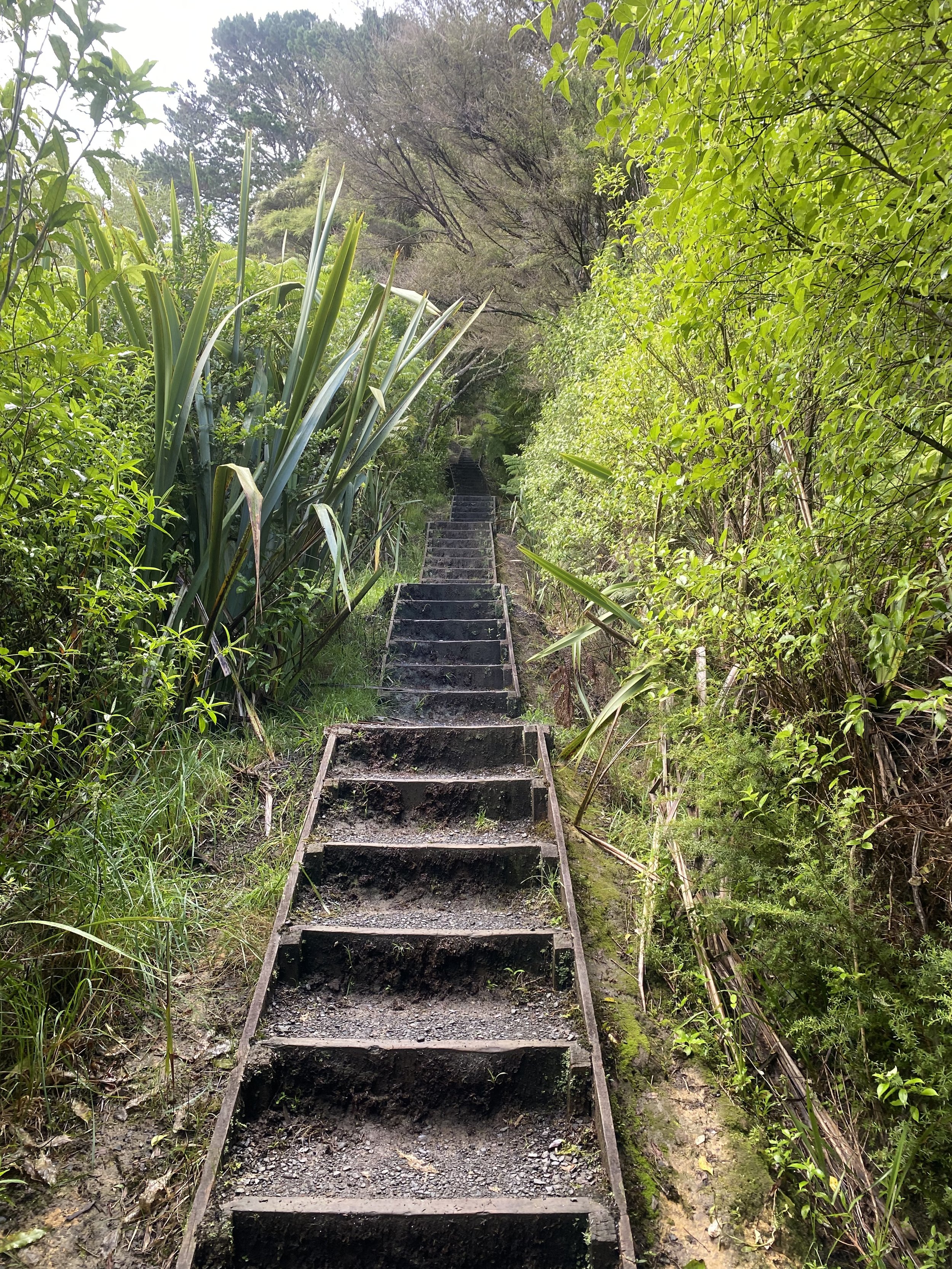
My first challenge of the day was the Wharigarino Track; it is only 3km but holy heck, it was the hardest most action packed 1.8mi so far. The trail careened up and down steep hills, it was off camber, barely put in, bushy, sharp, and—wouldn’t you know it—boggy.
I was tangled up to my ears in razor grass, falling this way and that, and then—schloop!
My left leg is sucked into the ground, underwear deep, into clear water. My right foot is poised on the barest edge of land (in this case mud) and I’m in the deepest single leg squat of my life. I grunted like a world class weightlifter as I hoisted mine and my pack’s weight into an upright position.
And so it went.
The first 3km gave way to many, many more kilometers of hard. There was, of course, a brief stretch of easy along the highway, but afterwards the track along the Waikato River proved to be exceedingly slow going, nearly all the way to Rangiriri.
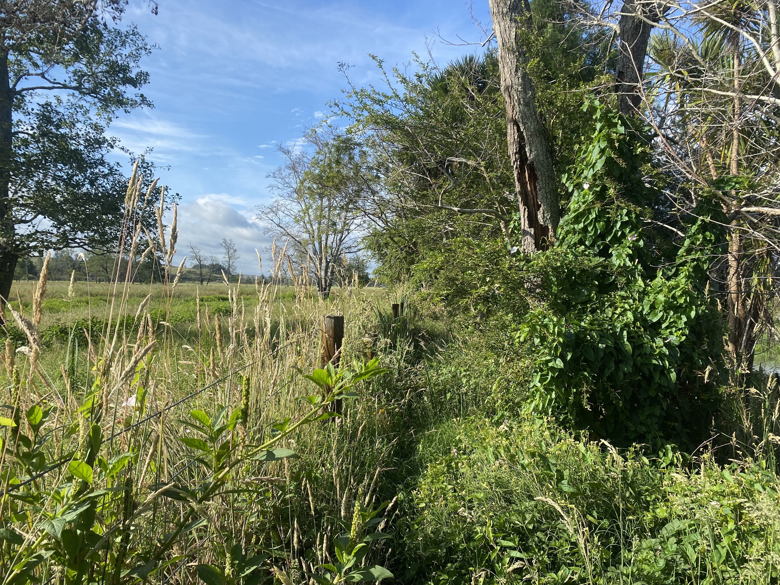
As I scraped, clawed and fought my way through nature, I decided razor grass and thistles were my least favorite plants, and then also a third unknown plant which caused my legs to break out in hives was also added to my list.
I felt… disheartened. I wasn’t sure when the hiking would get easier. I knew the track was sure to change eventually, it was nothing if not variable, but the not knowing scared me just a little.
I dodged barbed wire, hidden logs and debris, narrowly avoided falling in the Waikato several times, and then made it to the road walk into and past Rangiriri.
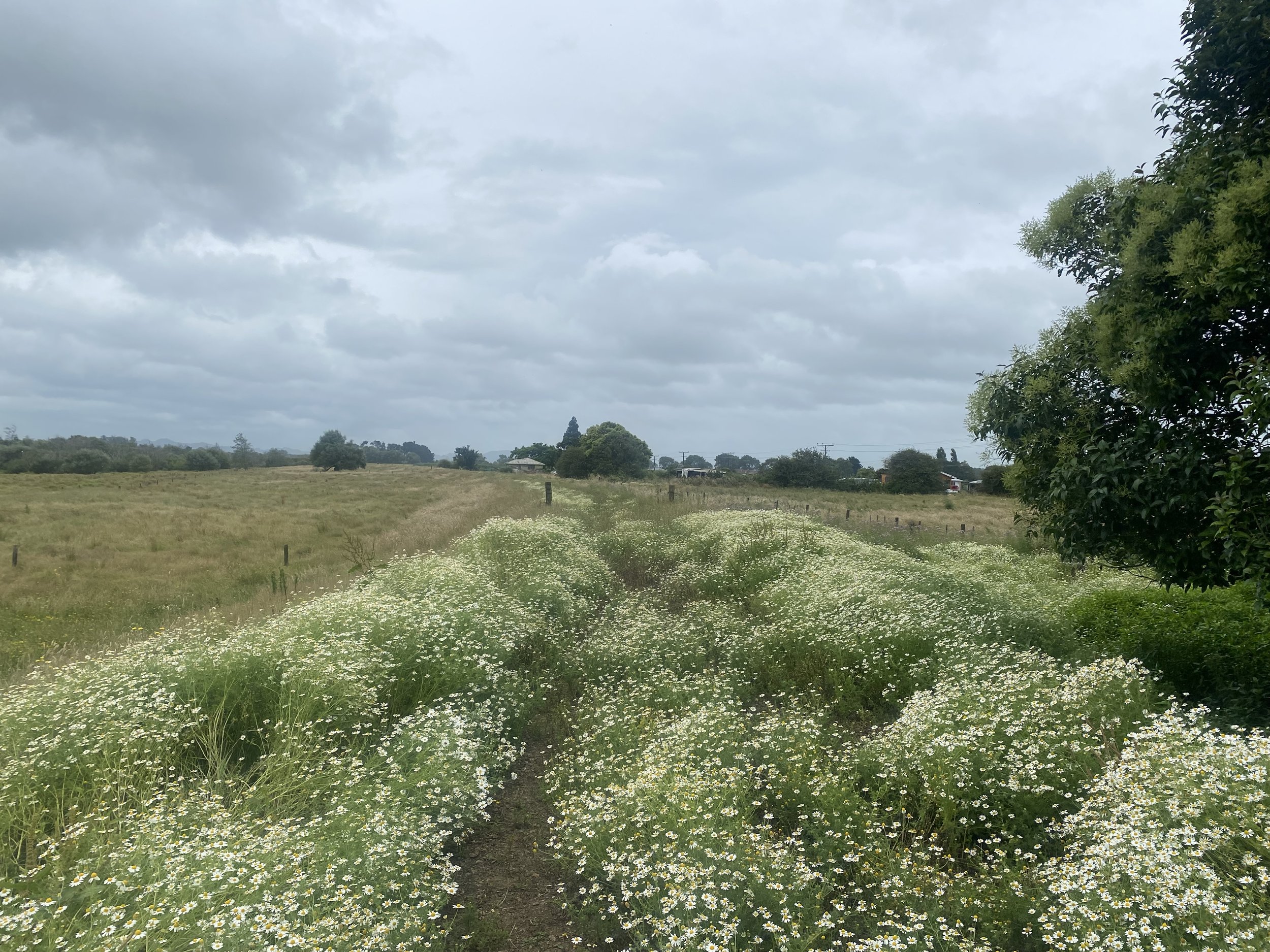
I detoured into town to use the bathroom and get water, then called my parents on my way out. Thankfully the track between Rangiriri and Huntly was all stop bank walking, and quite easy compared to the morning struggle.
I paused to put on my raincoat after my phone call when the clouds started to spit a little more venomously.

It was pouring rain when I veered off trail and over the bridge into Huntly; I registered a slightly “off” feeling in my gut as I passed by shuttered storefronts and dairy’s which were open, but had suspiciously empty shelves. Something wasn’t quite right about this town.
I was quick in Countdown Supermarket, getting the few things I needed for tonight and tomorrow, then power-walked the 1.5miles to the campground run by Dave and Carol at the other end of town.
Dave hooked me up with a cabin at a hiker-friendly rate. It was so nice to be somewhere dry. Exhaustion settled over me quickly once my chores were done, and I was out like a light.
Day 23 (1/1/24): 28mi, +4042ft // 46km, +1233m
Huntly to Hamilton YWCA Hostel
I left Huntly early in the morning, hoping to walk the strangely desolate, boarded up streets while all the “baddies” were still sleeping. I decided it probably wasn’t a safe town for me to be parading around in with my pack, all alone.
I had about 4 miles of road walking to do prior to entering a forest section; I’d heard from an Australian hiker I’d met at the campground, Bryan, it would be a potentially hard stretch of trail.
It was steep and challenging, as I would find out, but also totally in my wheel-house of “hard things I’m good at”.
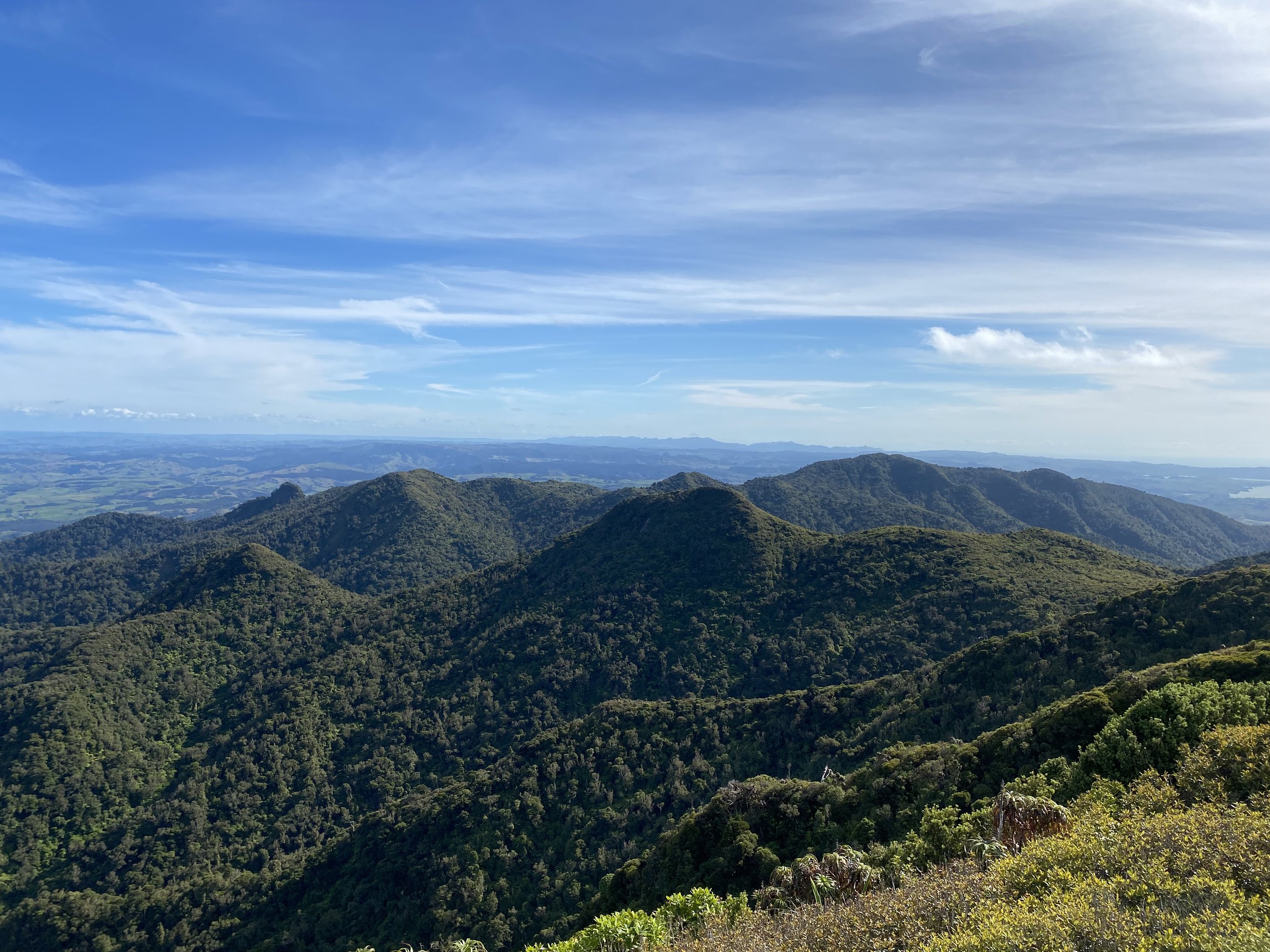
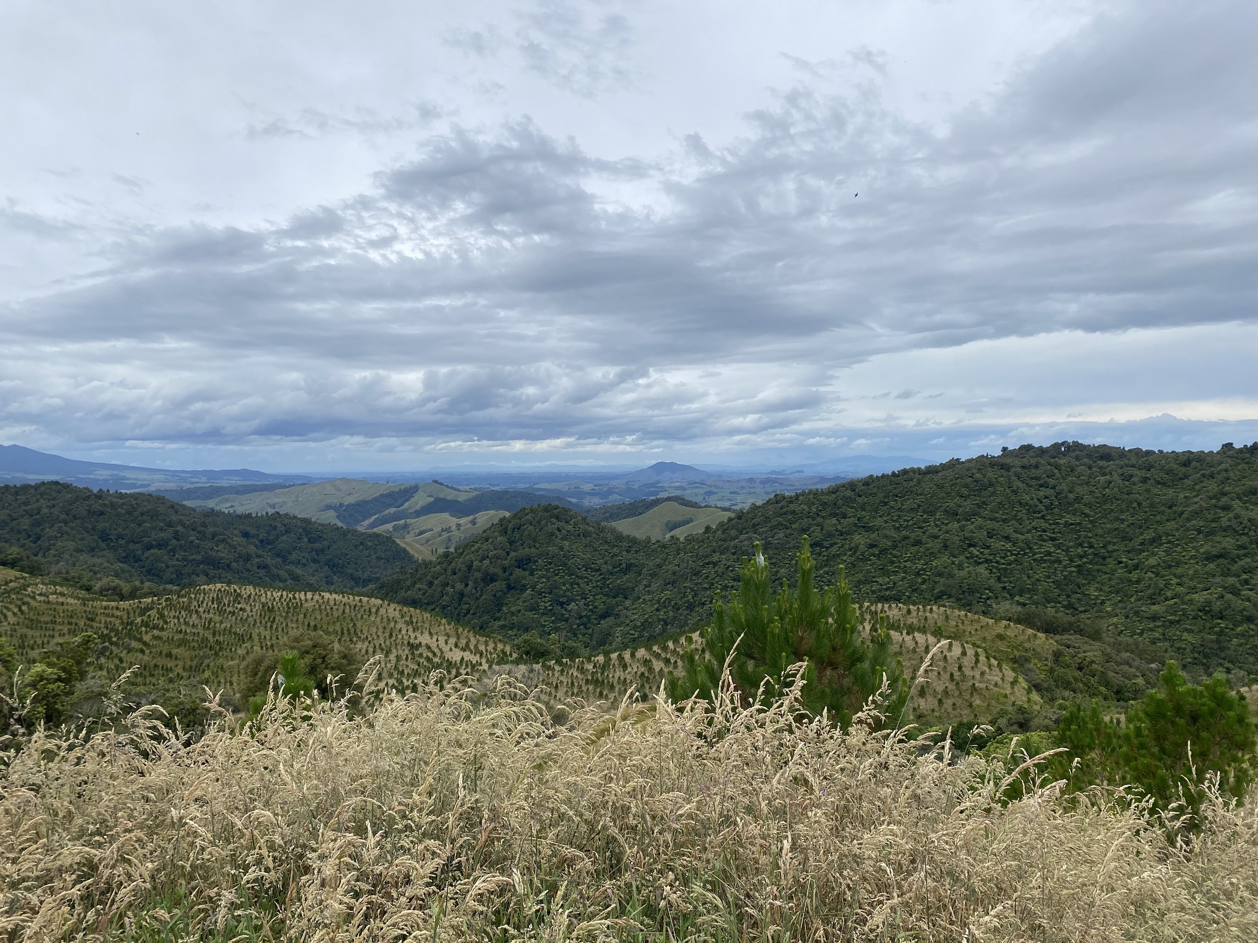
The Harakimata Track is one of those incredible sections of trail on the North Island that I would hike again, in a heartbeat! All the signs at the trail head said it was 9km and would take about 6-7hr to walk (very slow going) but it was longer, but took me just 3.5hr to get to Brownlee Ave on the other side.

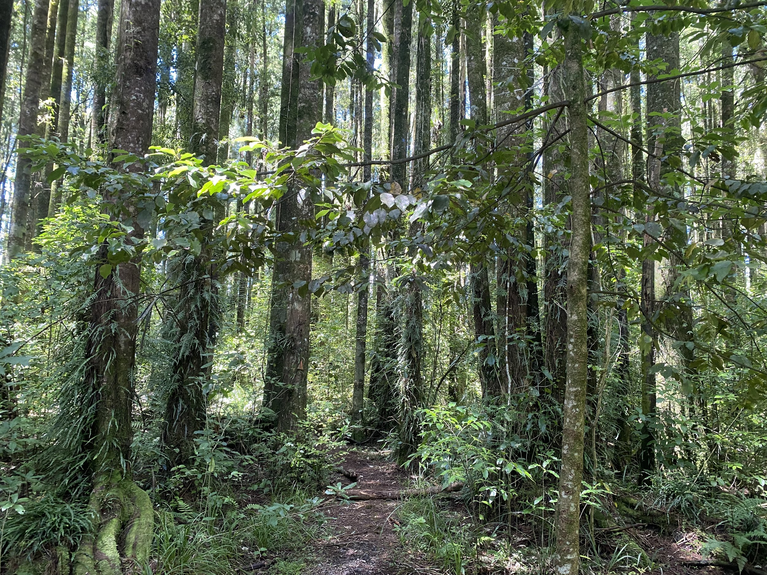
I walked past a giant Kauri tree and admired its mottled white, grey, and tan bark, thick trunk, and tall, green canopy. Then I paused at a beautiful young grove of Kauri trees, all ramrod straight and growing close together.
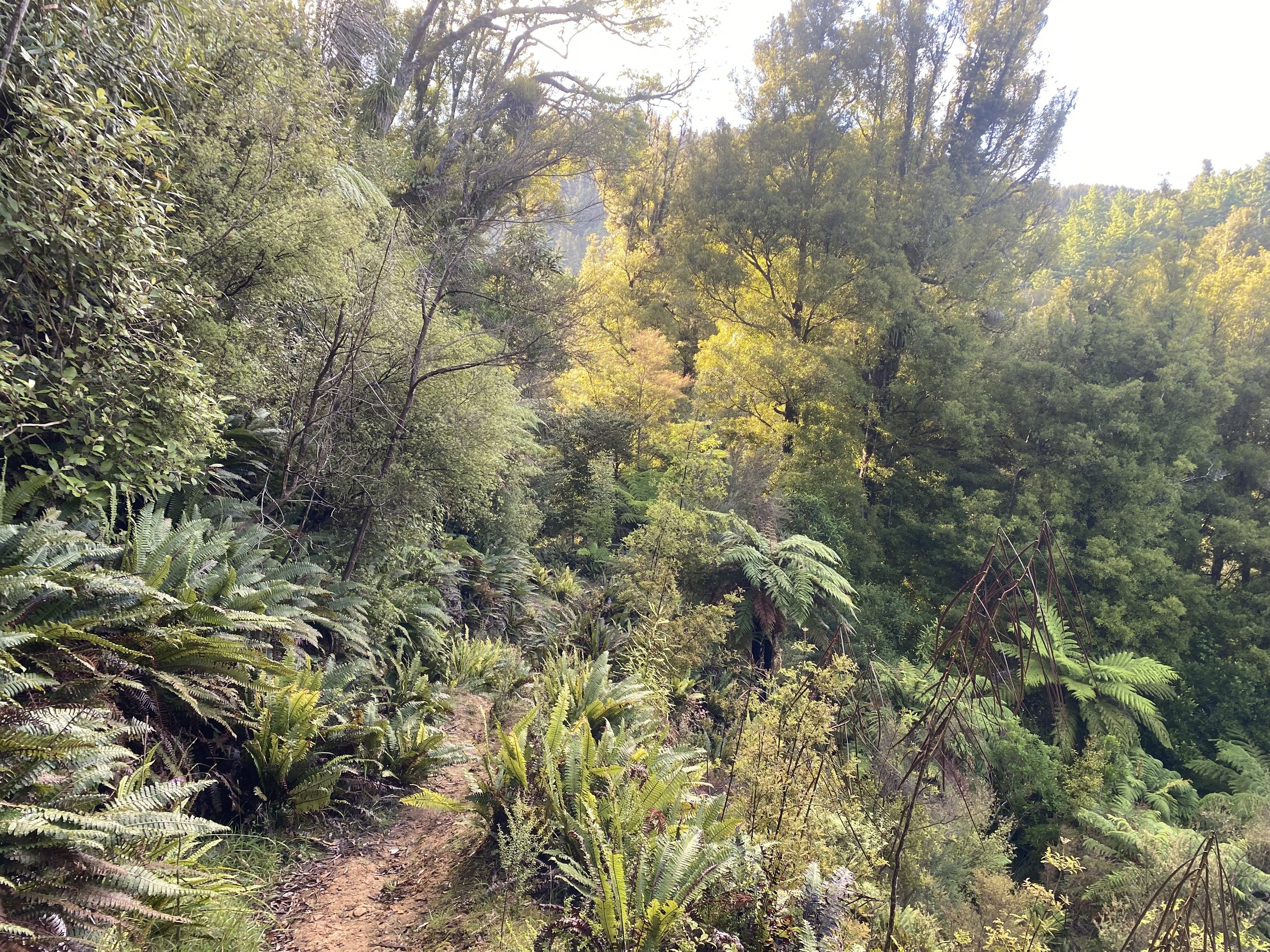
After the scenic, manicured portion of the track ended at an upper viewpoint, it became a standard tramping track—aka: mud.
But it was fun mud, if there is such a thing. And the climbs kept my brain engaged, as I placed my feet carefully over, under, around and on-top of complicated root systems.
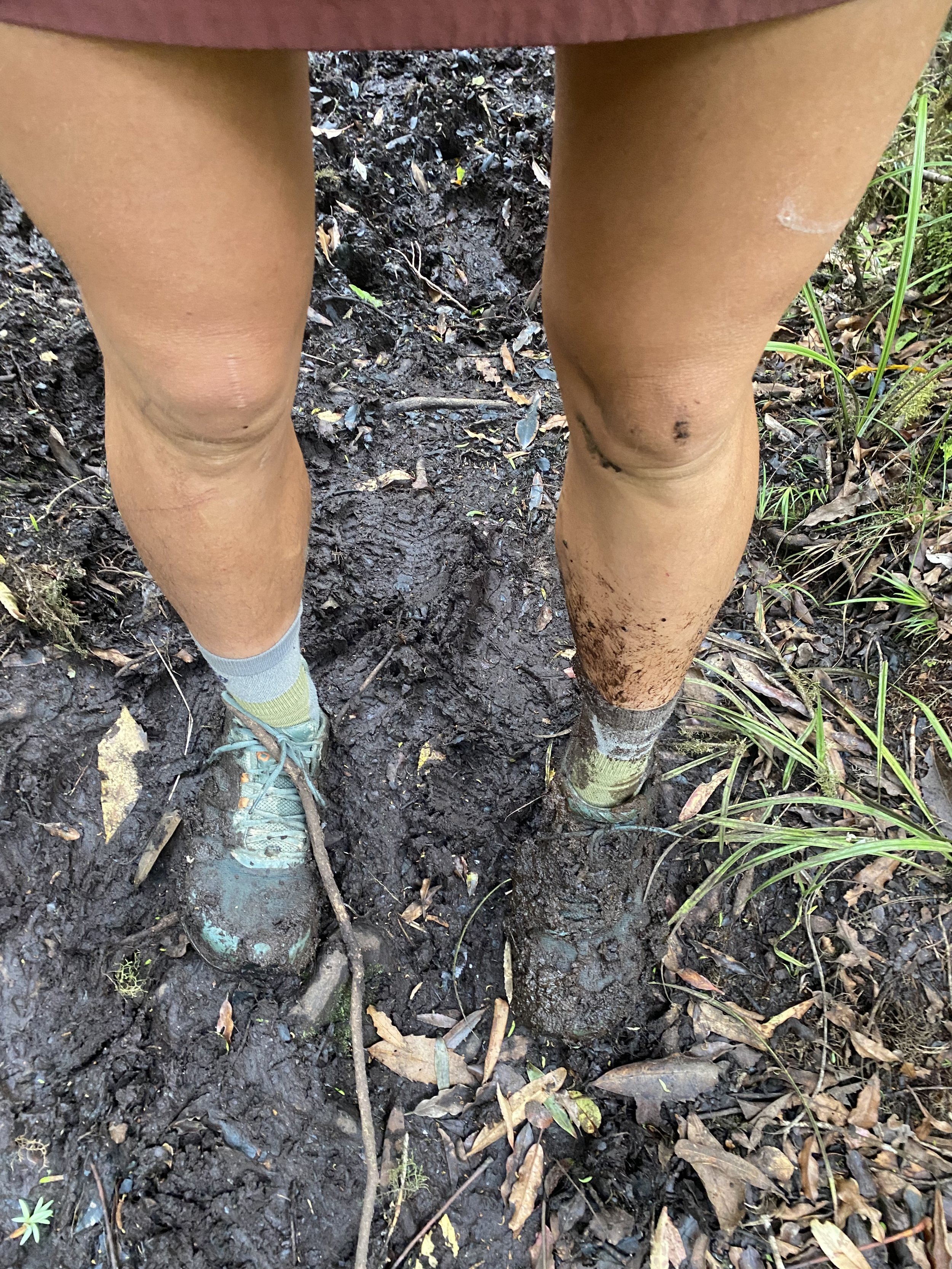
I fell down 3 times, my feet rocketing out from under me on portions of exposed, slick clay. A bit annoyed, but unharmed, I rose each time wiping chunks of mud off my hand on the only fabric I could, my skirt.

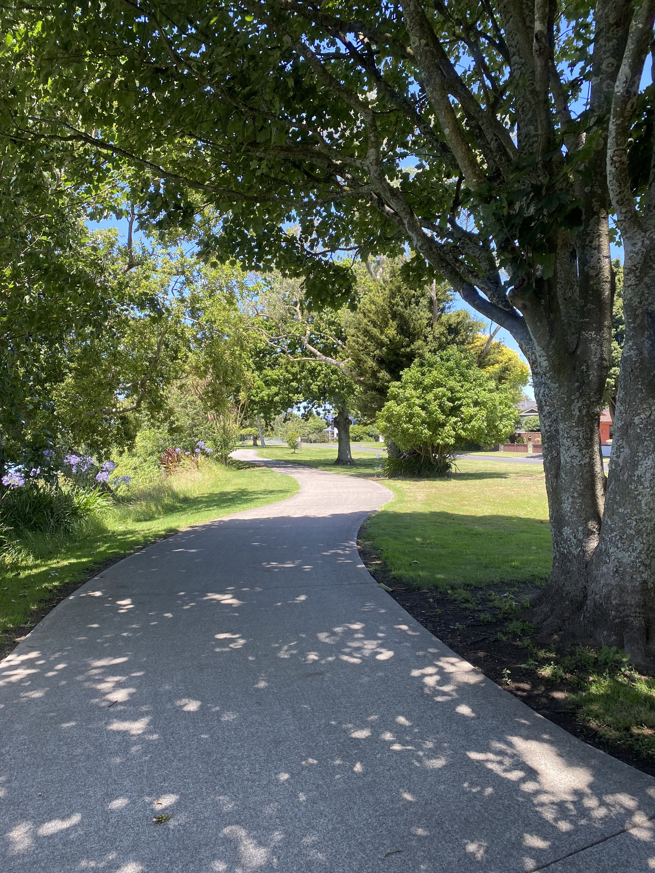
When I emerged onto Brownlee, in Ngāruawāhia, still covered in mud and grime, I found a beautiful park to sit in. This would be the start of a very long sidewalk trek into Hamilton and I wanted to eat lunch before tackling the pavement.
I also used the break to email the YWCA hostel and book a place to stay for the night. I didn’t want a repeat of Auckland; Hamilton is a much smaller city and there would not be any hostels with late checkin times.
The afternoon walk unfolded seamlessly. I was exhausted and moving slowly. The last few days had been big ones, mileage wise, and tiredness had taken up roost in my bones. Logan called—it was NYE in the states—and wished me a happy new year.
He sounded just as tired from all the holiday festivities as I did from walking, but hearing his voice perked me up and got me moving the last couple miles to the hostel.
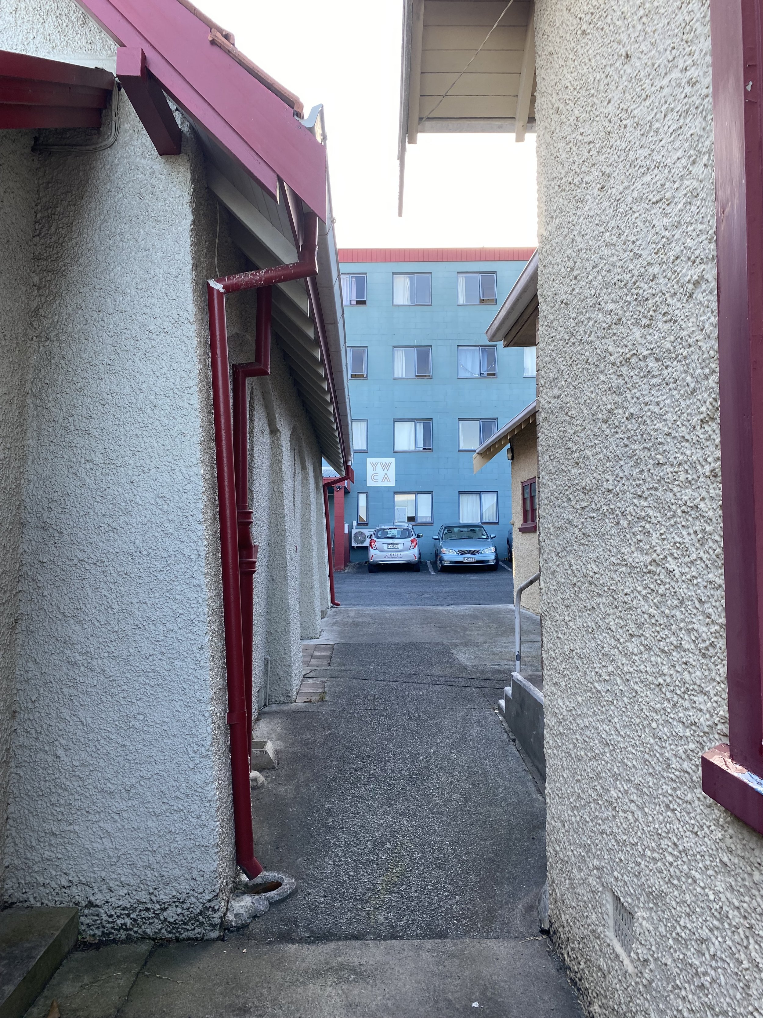
The YWCA was clean and well organized, with only one creepy old dude, who cornered me in the tiny kitchen and talked at me for 10 minutes, occasionally working in inappropriate comments, while I tried to make noodles (I say “one”, because the vibe was such that there might have been more).
Between him and the steady stream of ants pouring into my window overnight, I was quite ready to be on my way in the morning.
Despite it all, though, I slept like the dead.
Day 24 (1/2/24) near-o: 10mi, +696ft // 16.6km, +212m
Hamilton to Whatawhata Village Cafe (then on to Cambridge)
I left the Y around 8AM and kept my pace slow, I only had about 10 miles to walk to get to Whatawhata, and they looked to be mostly on roads, where Leigh would pick me up and take me to her house in Cambridge for a zero day.
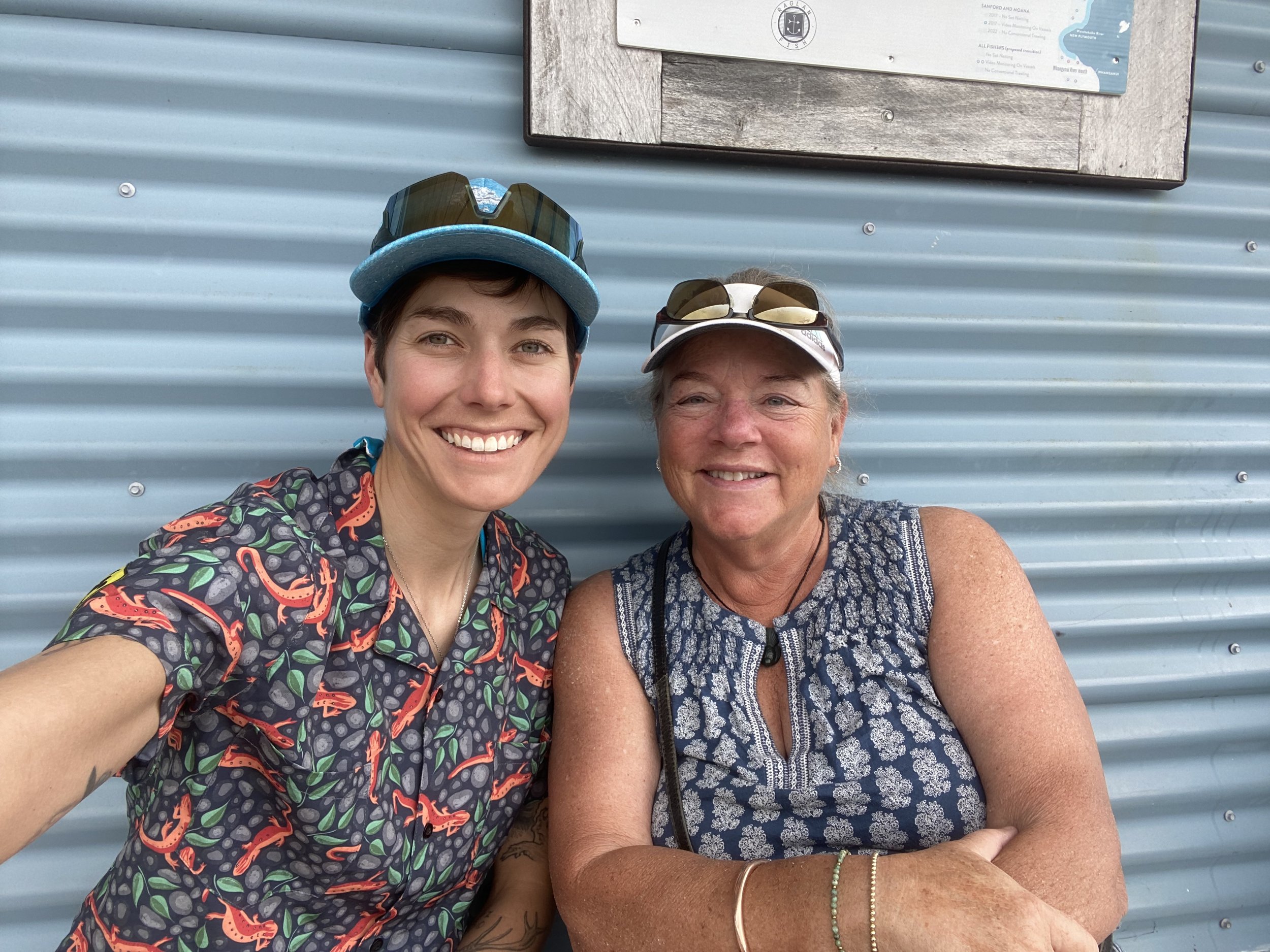
Molly, a good friend and my cousin Tyler’s wife, knew Leigh from the horse world, and had put me in touch with her when she realized I’d be walking fairly close to her house on the TA.
The connection was invaluable to me, as I really needed a day off from walking and Leigh was not only willing to take me in, but also really excited to!
The walk was mostly easy, with only one chunk of farm track where the grass was so tall it reached my ears. I even got a coffee from a gas station at one point, and sat in a park for a while, just killing time and taking it all in.
When I reached the Village Cafe it was closed for the holiday. It seemed like most places were still closed the day after New Years, and in someways I thought that was really nice, especially for the employees.
I sat curled up on a bench outside the empty shopping center and felt the totality of my exhaustion settle over me. I was so tired I wanted to cry. My emotions were all over the place; suddenly my homesickness was so acute I thought I might scream.
I took deep breaths, reminding myself this wasn’t supposed to be easy, that it was normal to miss Logan, to miss home, to long for familiarity.
All I needed was sleep, a shower, and probably some water, too.
Day 25 (1/3/24) zero day: 0 TA miles walked
Cambridge & Raglan
I don’t normally write about zero days, as they are full of rest and chores and are predictably the same, but I will share the highlights of this one!
Leigh is an incredible person; not only has she bounced back stronger from whatever life has thrown at her, she is also compassionate, thoughtful, generous, brave, highly driven, and gifted with the art of making a friend out of everyone she meets.
I think about the day and a half I spent with her and I am overwhelmed with gratitude. I feel like I really got to know her, and got to see a slice of this beautiful country I otherwise might have missed.
If you know me, you know I was (am) horse-y. Horses were my everything until I was bullied (as Leigh pointed out) to the point of doubting my self and my passion for riding, by a particular high ranking coach for whom I was a working student. His “teaching style”, while probably intended to motivate me, made me feel small, incapable, and scared me right out of something I loved.
And while the way he treated me was a shame, the thing I’ve never been able to get over is the feeling that I didn’t try hard enough, that I wasn’t persistent enough, or dedicated enough, to bounce back and keep riding despite the hurt I felt.
It haunts me to this day, and I can’t help but feel like I did it all wrong.
I love my life today, of course, but the anxiety-voice in the back of my head is always whispering, “You gave up too early, you should’ve stuck with it, you failed.”
Spending the day with Leigh reminded me that I didn’t fail.
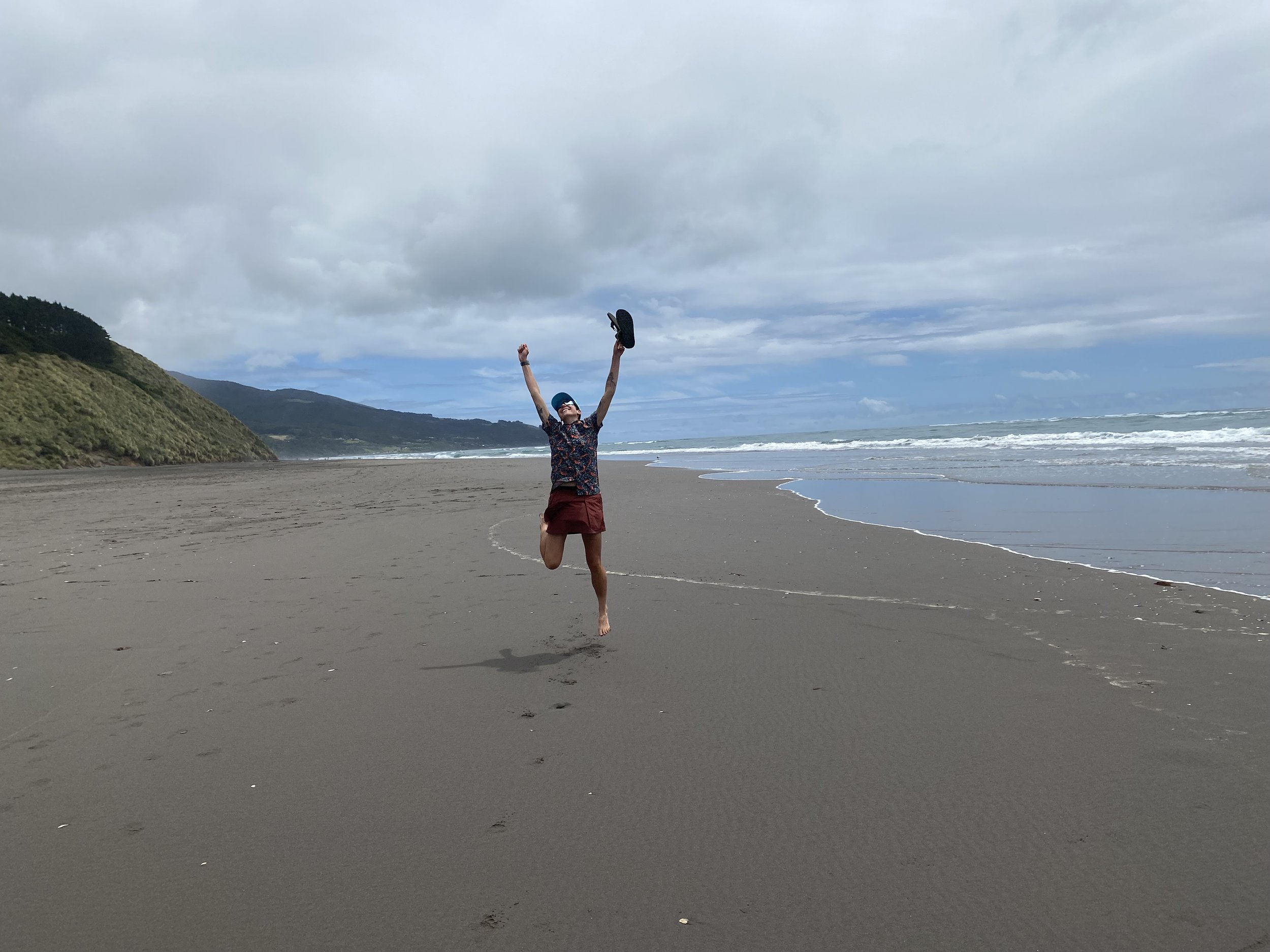
It was in the little things, like listening to her stories, eating the best fish and chips ever, walking on a black sand beach, smelling the salt air of the ocean, her precious little dog, Thistle, that made me feel whole again, like I was right where I was supposed to be.
I thought horses were supposed to be my life, instead they shaped my life, in ways I could not have imagined.
It isn’t unreasonable to think horses brought me here, to this wild experience in the southern hemisphere, to new friends, and to this life I couldn’t have invented, not in my wildest dreams.
Day 26 (1/4/24): 20.6mi, +5190ft // 34km, +1583m
Whatawhata to Pahautea Hut

Leigh got me back to Whatawhata by 9AM, and both of us were sad over my leaving. I’d had the most wonderful rest, and such a nice time with her.
The trail was mostly roads and my pack felt like a million pounds. I was carrying too much food and a brand new pair of trail runners—I wasn’t sure I’d be able to get a pair when my current ones wore out, so I wanted to be prepared.
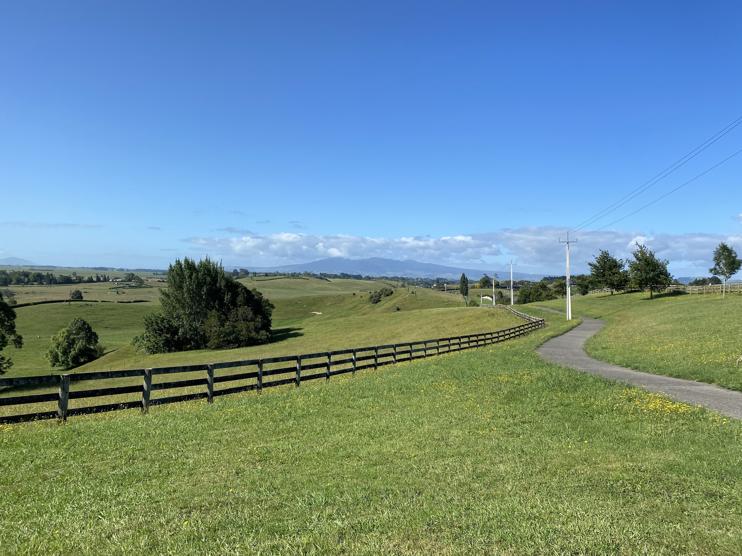
When I parted from the road, I began a rolling farm track (the Karamu Walkway) with excellent views. It was truly lovely, like something out of Lord of the Rings. Around mile 13.5, I took a break at the Kaniwhaniwha Stream Picnic Area, took my shoes off and ate a tuna wrap.
It was a nice, shady spot after so much sun.
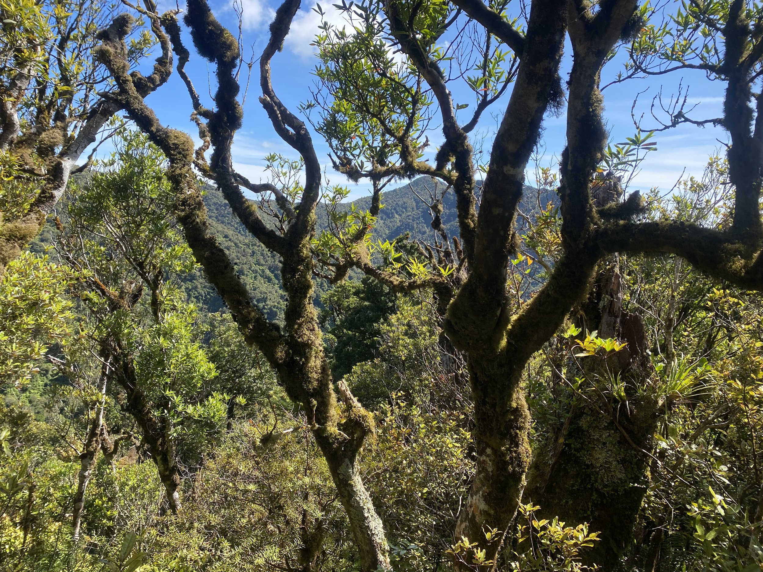
The next part of my day would have me climb Mt. Pirongia, which I was nervous about based on what I had read on FarOut. Hikers were definitely dramatizing the difficulty level, though, as I actually found the climb to be quite lovely.
The trail was relatively smooth and easy to begin with, though it increased in steepness, but only at the very top did the mud begin in earnest.

The roots and rocks made the final mile to the summit quite slow, but the view from the top was oh so rewarding. All in all I had a great time. I made it to the viewing tower by 5PM, about 3hr after leaving the picnic area.
A family I’d encountered earlier told me it would take more than 5hr, that there was no way I’d make it today, so I felt rather vindicated by my accomplishment.
So often we sell ourselves short, only to find out our strength vastly exceeds our expectations.
My backcountry hut pass covered my stay at Pahautea, which was a nice change from paying for campsites each night; I cooked dinner on the porch of the hut and then returned to my tent for some much needed sleep.
Day 27 (1/5/24): 23.8mi, +3477ft // 39.7km, +1060m
Pahautea Hut to mile 529.8 (freedom campsite)
My morning unfolded beautifully and slowly. I’d slept for 10hr!
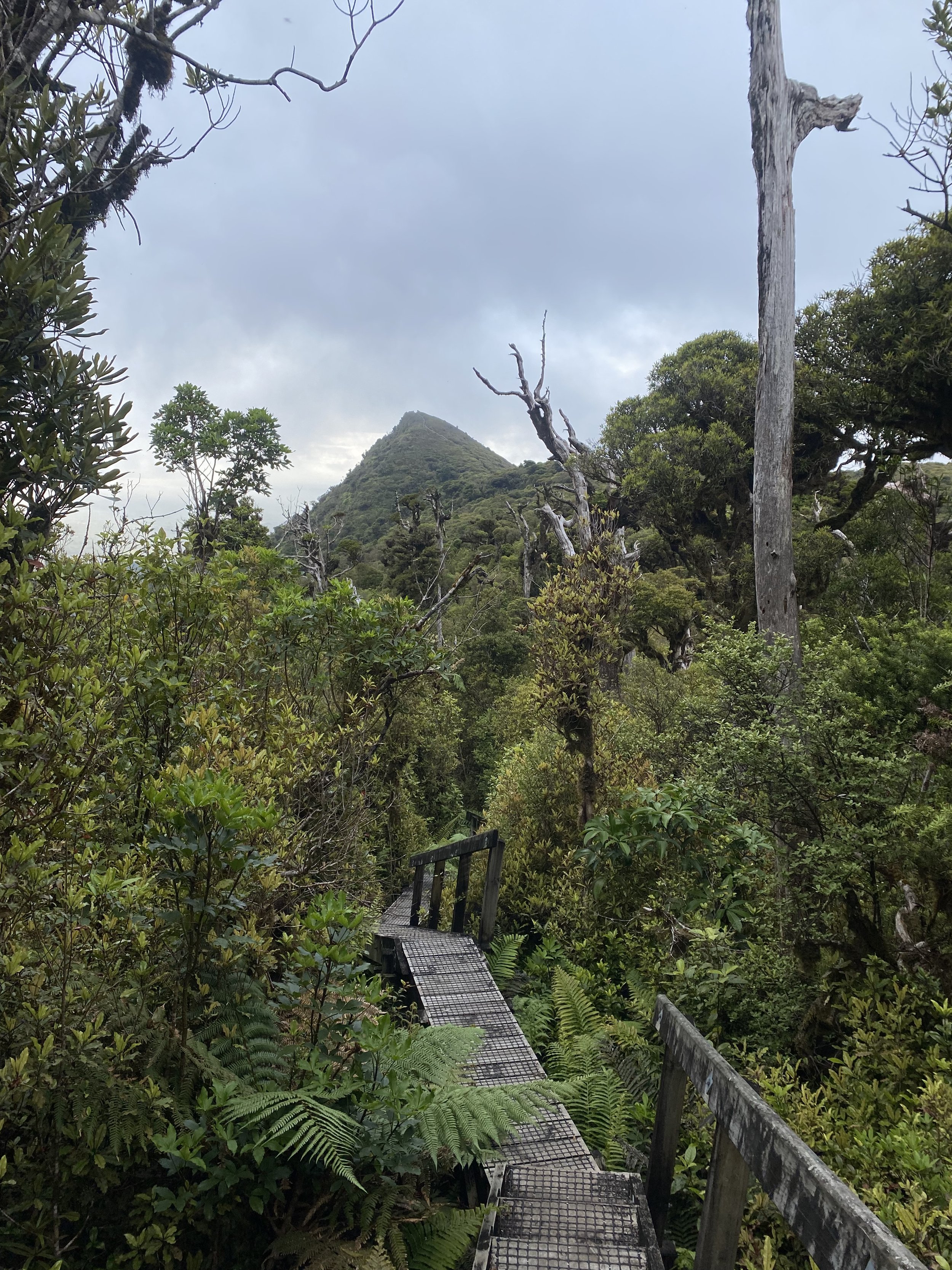
There were boardwalks up here! All the way to the top of the second peak, practically! Hihikiwi looked like the swoop of an ice cream cone, peaking up over the dense foliage.
The nice boardwalk ended abruptly on the summit and I was left with…. Mud. And overgrown vegetation of course. But I took it all in stride and made my slow way down the other side.

My back was screaming from the weight of my pack by the time I made it down to the road. The descent had taken forever, as I carefully stepped down slick drops in terrain, avoided going for a swim in the mud, and tried not to get my pack tangled in vines.
On a sign telling drivers to watch for TA hikers, there was a dead possum slung over the side of it, and someone had written in sharpie: “Don’t shit on our land”.
I am not sure if the possum was a threat, or maybe roadkill-art just added to the sign after the fact, but I immediately felt worried about the coming road walk and farm track.
I’d seen so many dead possums at this point, but this particular corpse seemed full of foreboding.
I trudged to mile 14.5, the beginning of the farm track, and dropped my pack.
I sprawled on the gravel pull off and took a break to eat and hydrate. I could’ve slept right then and there. I was relieved though, that nothing bad happened while on the roads. I had been terrified to squat and pee anywhere for fear someone would think I was pooping. Truly.
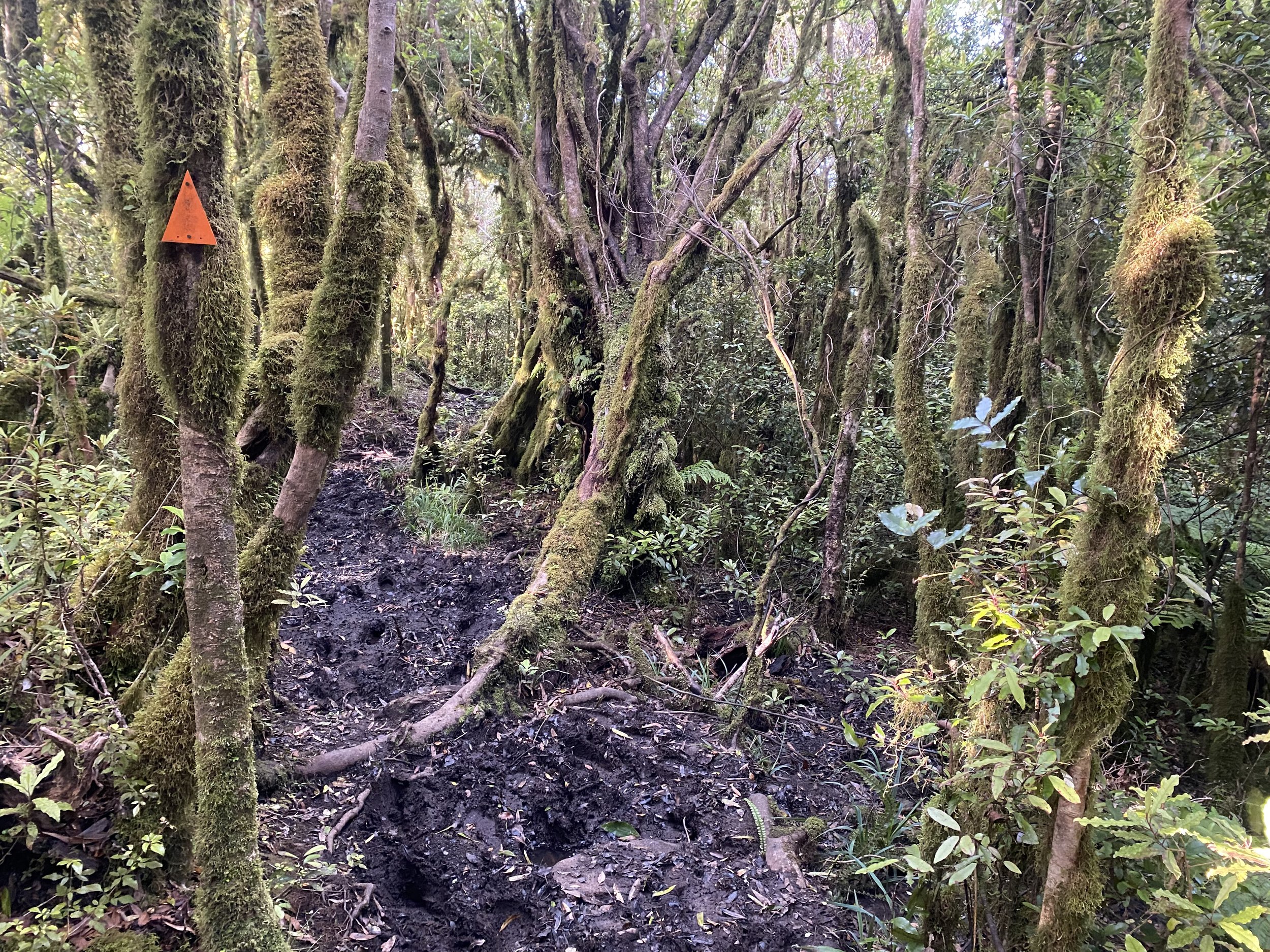
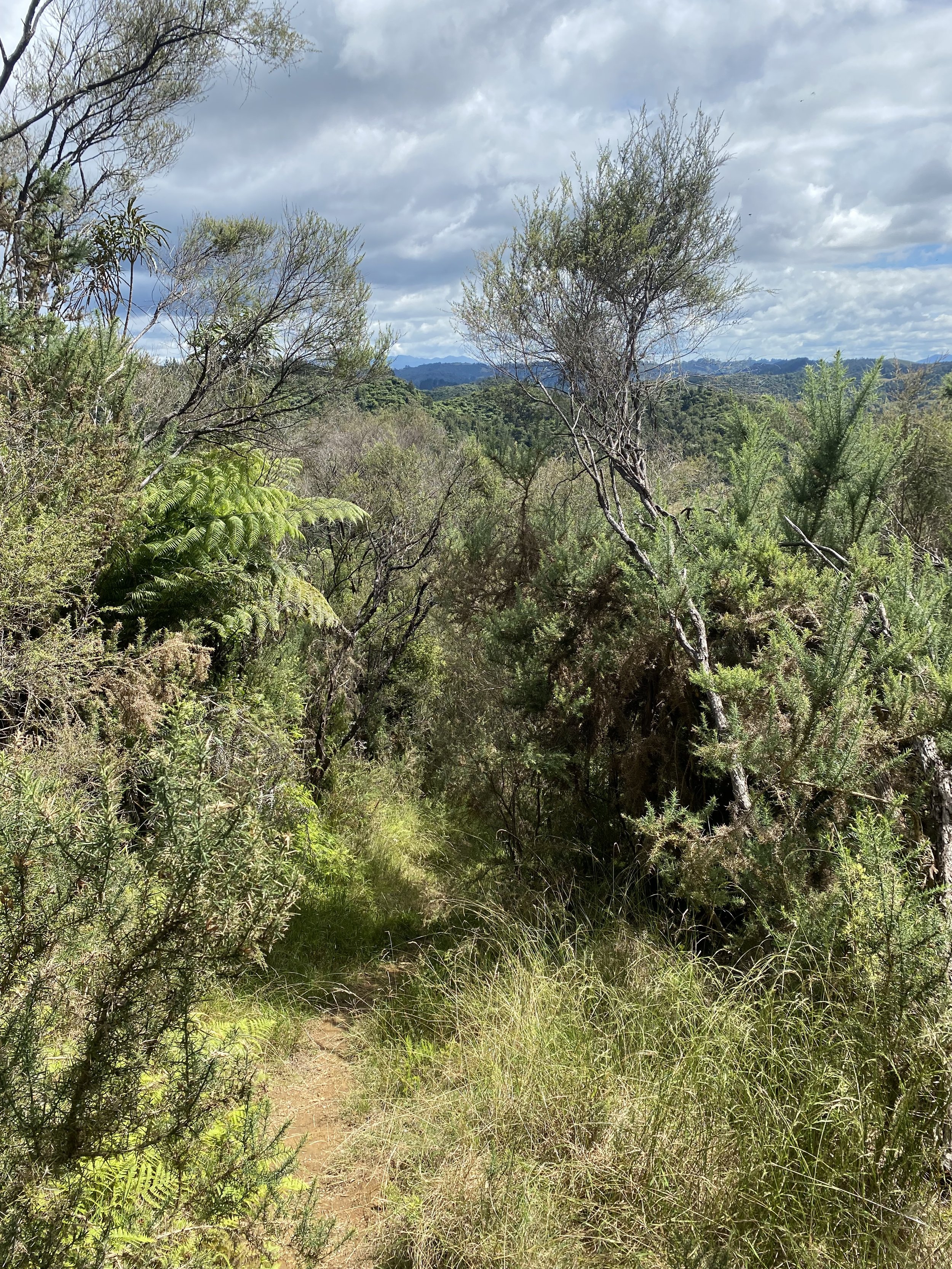
Finally and with much ardor, I slung on my heavy pack again and walked into the tall grass. The walk was nice to begin with, but when it gave way to forest, it was no longer so.
The bogs were stagnant, the bush, dense, the foliage, scratchy. I felt exhausted and the miles came slower than I thought they should.
The day ended with several steep pasture rollers—PUDs aka, pointless ups and downs—which pushed me about over the edge, and by the time I made it back into the thorny, dense forest, I was so ready to find a place to camp.
I wound up camping somewhere random in a forest, it was a good flat spot in the trees, just before a private property boundary.
I hoped there wouldn’t be possums, and my paranoia wound up keeping me from sleeping deeply.
Day 28 (1/6/24): 18mi, +2835ft // 30km, 865m
Freedom campsite to Motel Te Kuiti
When I woke up, I realized my possum fears had been unfounded, I’d gone unbothered by nighttime pests. And the first part of my walk was mercifully easy, all the way to Waitomo.
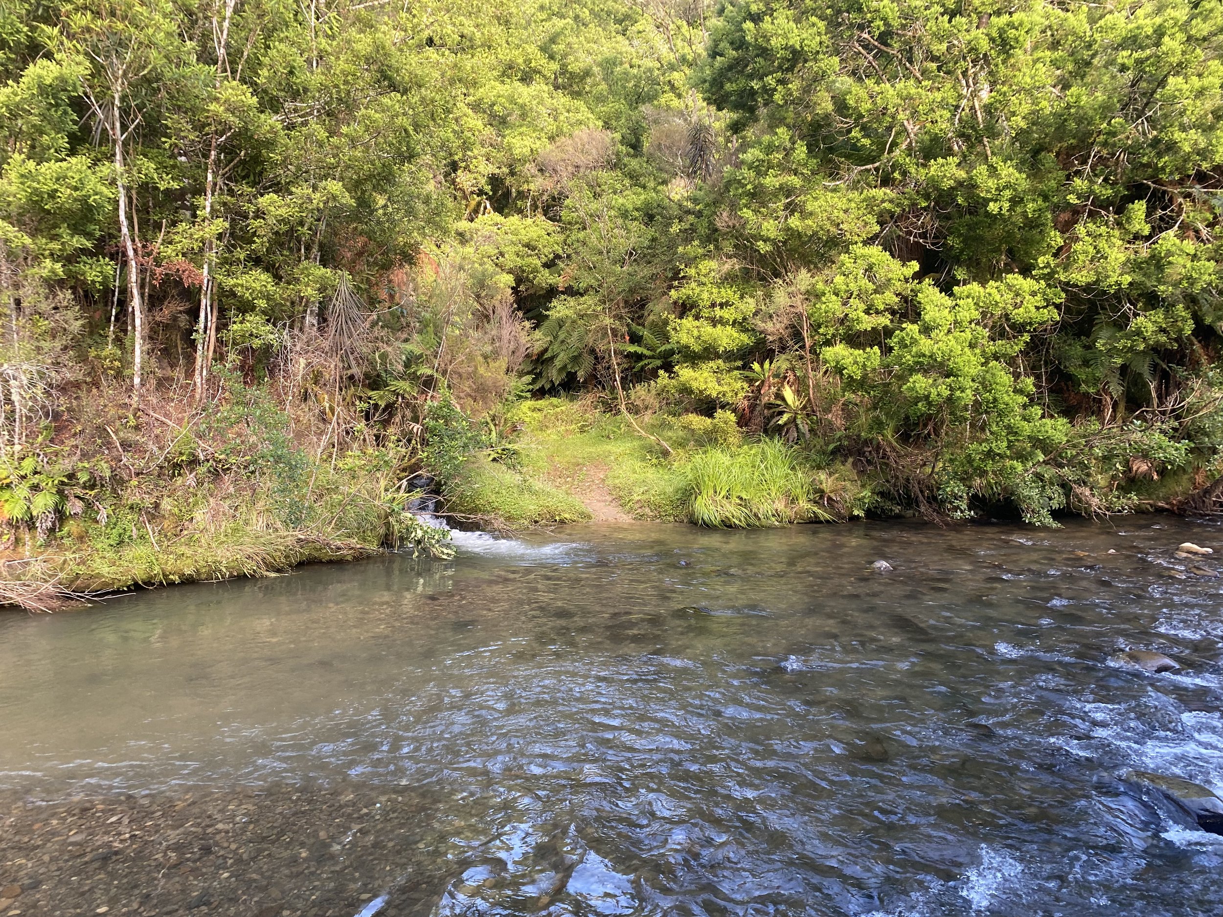
The track in the forest was good, and there was a sweet little creek crossing that could have been problematic had it been raining a lot, but was only shin deep for me.

Logan and I had plans to FaceTime for the first time since I’d left, that evening, and I wanted to get to Te Kuiti early, so that I could shower, do sink-laundry and get settled before then.
I had booked a sort of expensive motel for lack of camping options, and I wanted to make the most of my room.
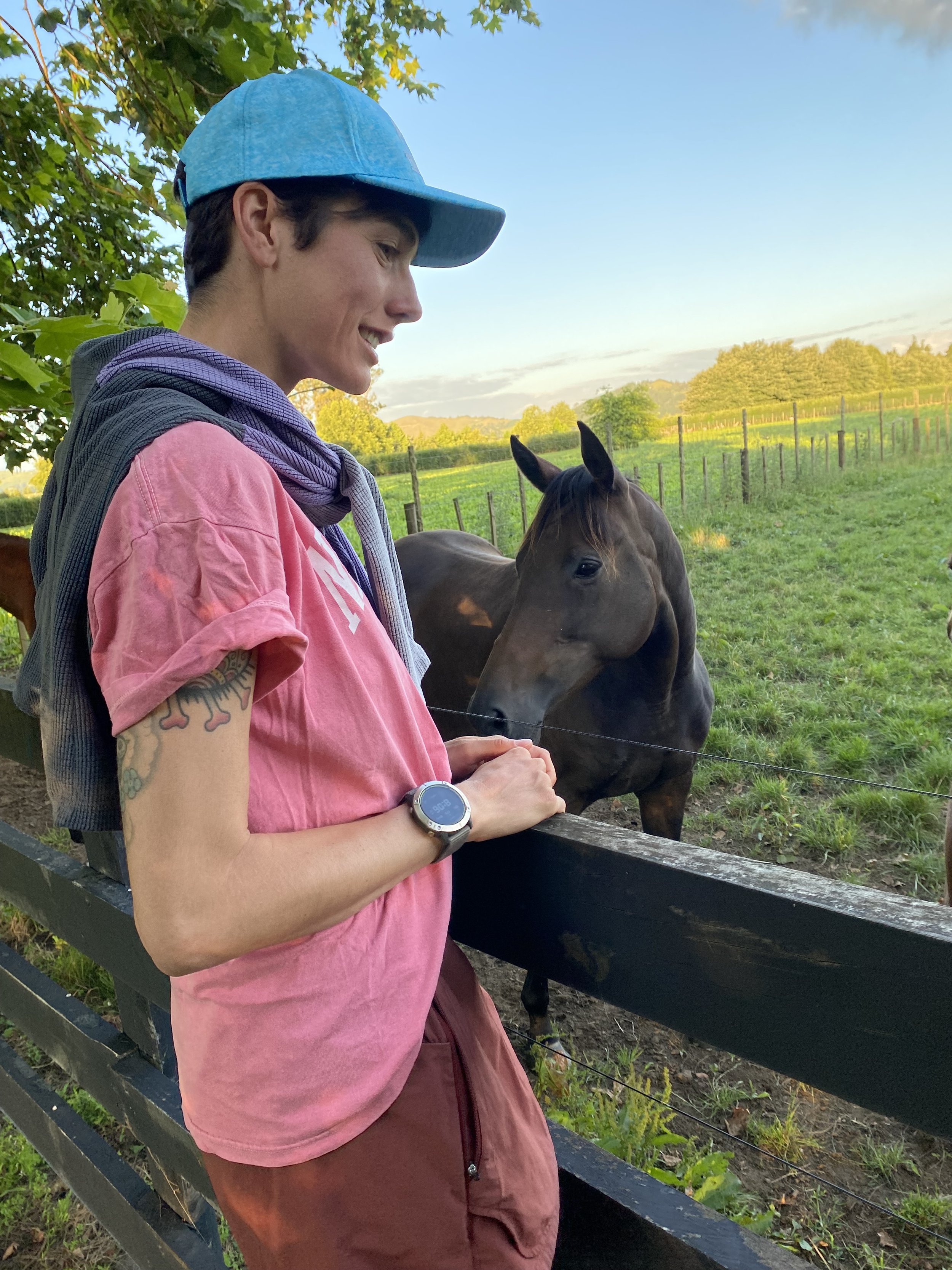
After passing through Waitomo, the trail turned into a farm track, which was beautiful at first, full of horses, then it turned harrowing.
I went the wrong way in a field first, though, and the landowner chastised me. I had followed the directions in a comment on FarOut and unfortunately, they were bad directions.
I corrected my course and then found myself entering a steep forest. The track was barely put in and I had to fight my way uphill through spiny plants and spiderwebs. The sun baked me anytime the upper canopy disappeared.
Sweat poured down my face, forming gritty salt crystals on my cheeks. I stopped short before a steep traverse along a clay hillside with a precipitous drop to my right. I eyed the slanty, damp looking “trail” across the slick red earth with suspicion.
I was so grateful for dry weather as this looked borderline impossible to do in the wet.
Slow careful steps brought me safely to the other side of the traverse.

When I emerged into pasture land again, I felt utterly spent. I hobbled over knobby grass lumps, through thistle patches, onto a gravel road and off again, into a forest and then back into a pasture.
Each mile felt slow. I stopped for a break under a big old tree in a field, and fended off ants as I ate a salami and cheese wrap, then some chips.
After some deliberation, I made the decision to abandon the last 4 miles of farm track and walk a road instead.
I didn’t feel guilty for this, not in the slightest. I had been so true to the TA route thus far, walking the long road detours around closed forest tracks, walking to my campsites, to resupply, etc. If I wanted to buy myself a few easy miles so that I could make my FaceTime date with Logan, I had earned it.
I arrived in Te Kuiti at 2:30, checked in, showered, washed everything I owned that was pungent in the sink, and then collapsed onto the Queen bed. Exhaustion weighed on me, but I felt a great sense of accomplishment for making it this far on my own two feet.
The miles had not been easy ones.
When Logan called, we talked for 2 hours, and it almost felt like being home 🩵
To view daily maps of my progress, follow me on Strava:
https://www.strava.com/athletes/ivey_smith