
The Grand Enchantment Trail: Monticello to Abo Arroyo
The San Mateo Mountains, Apache Kid Wilderness Area
“This failure of attention will make orphans of us all.”
—Ellen Meloy, The Anthropology of Turquoise: Reflections on Desert, Sea, Stone, and Sky
Day 29: April 21, 2025 // 21.22mi, 5,696ft+
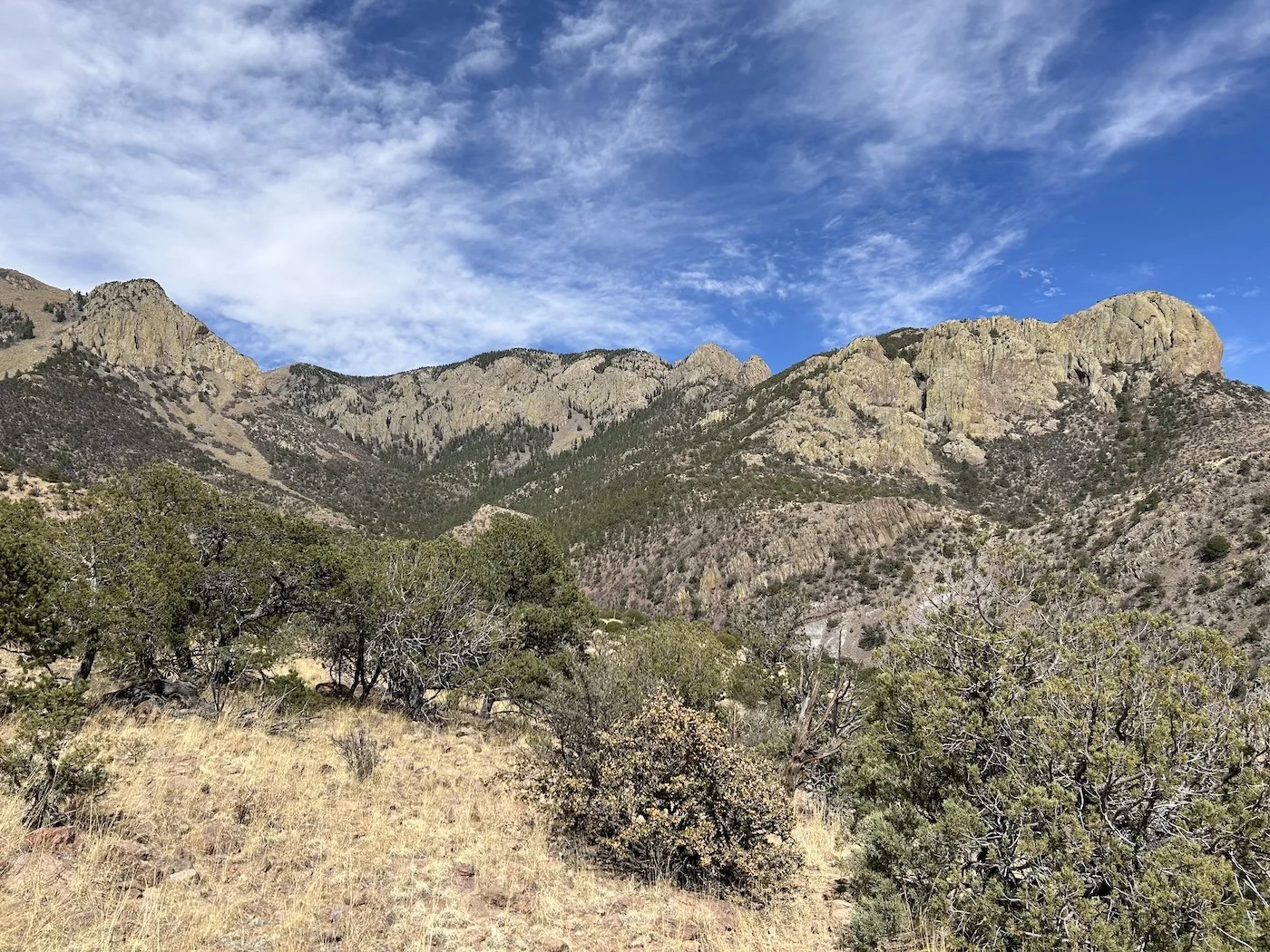
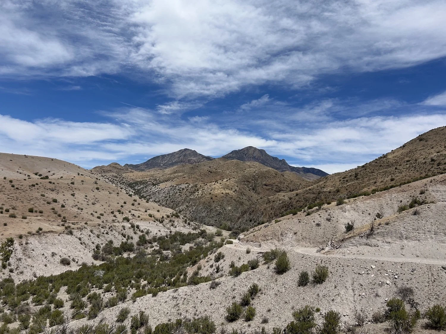
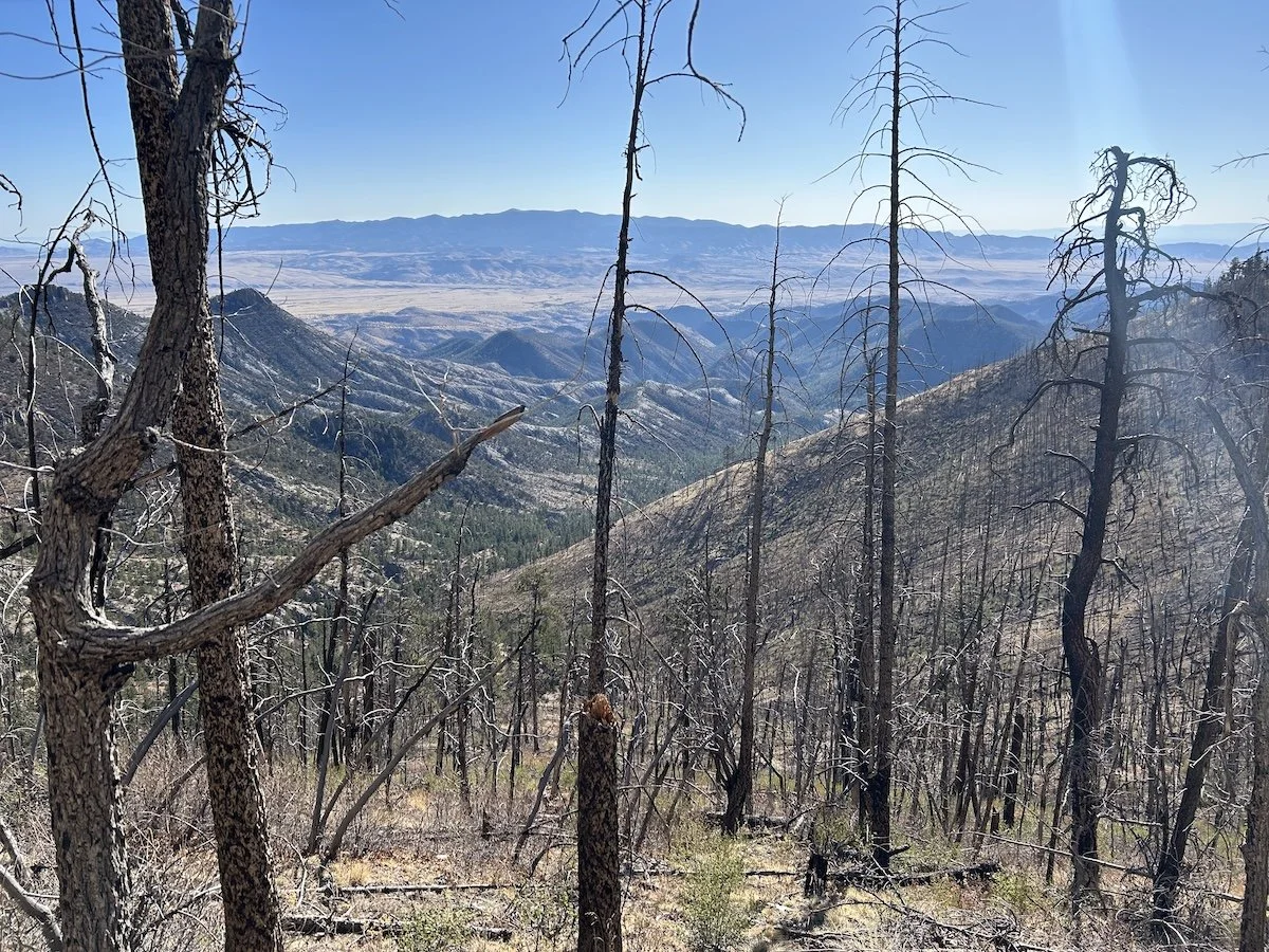
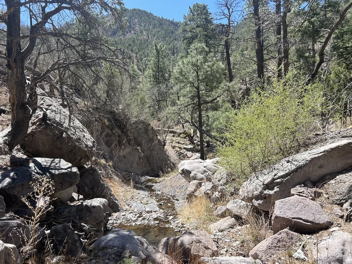
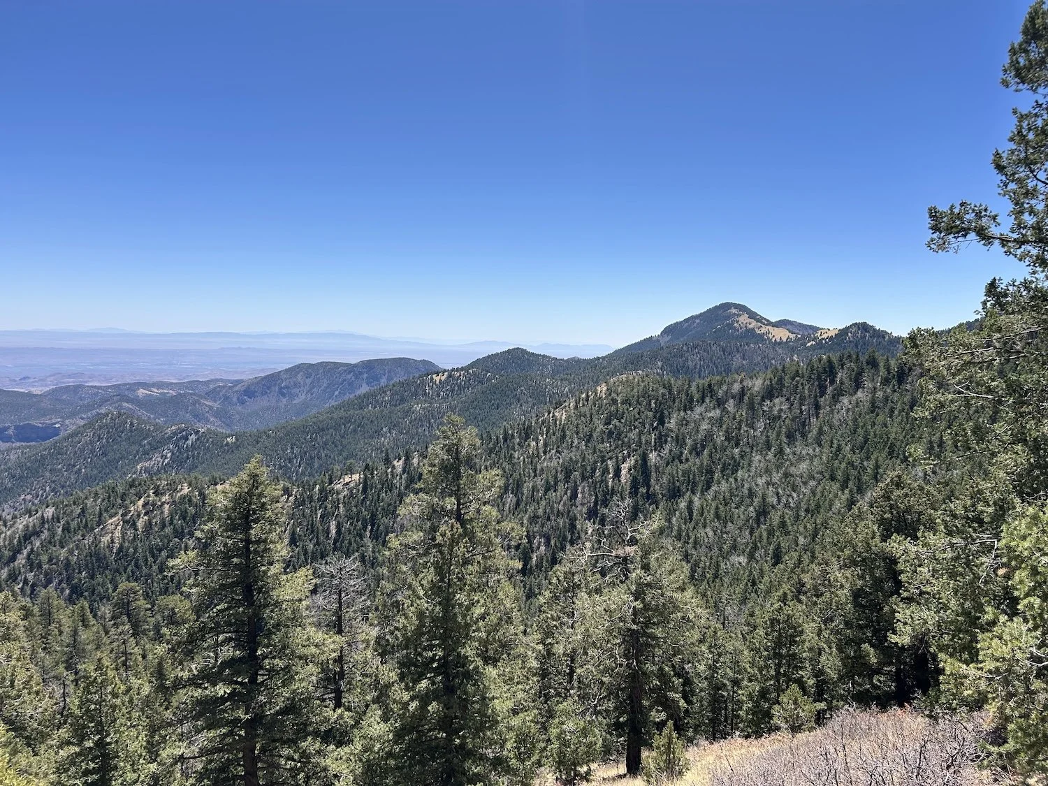
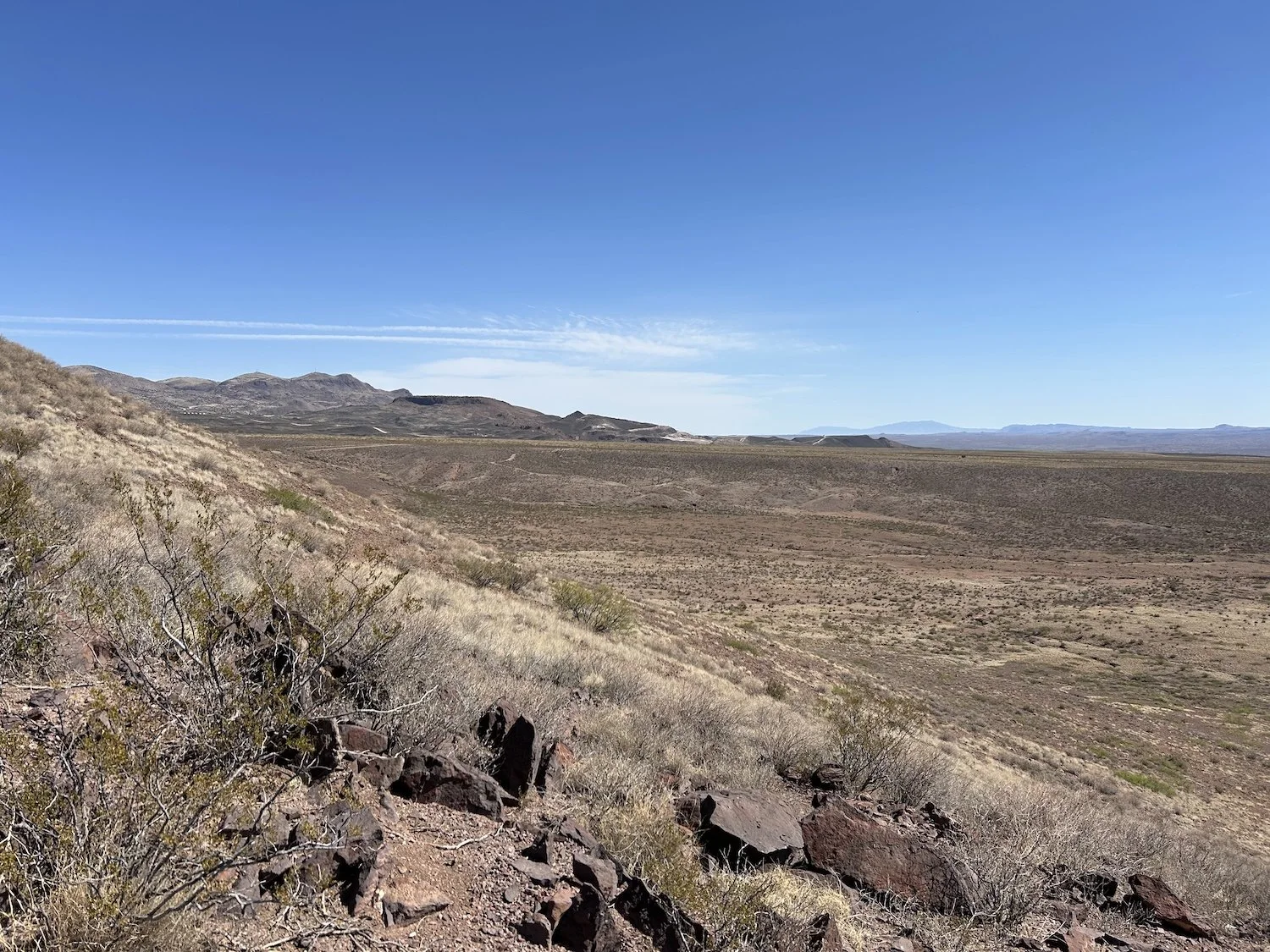
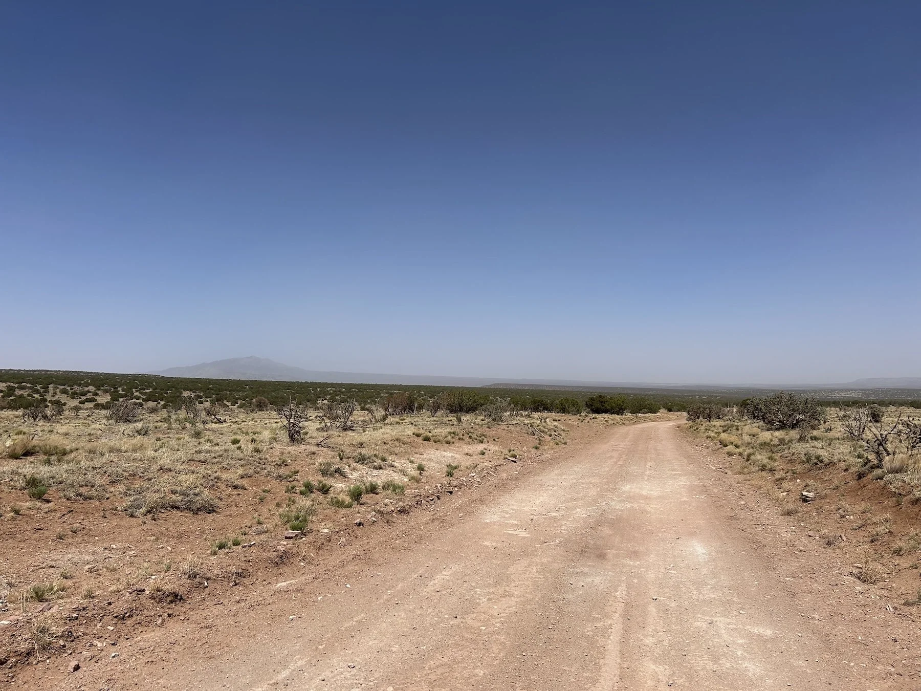
The climb into the San Mateo Mountains
I was nervous about hiking through the San Mateo Mountains. I’d seen them as I walked into Monticello, looming, rocky, forested, and worried about the state of the trails. Would they be well used or used at all? Had there been fires and subsequent erosion? Would the going be agonizingly slow?
Much of the next seven days would be incredibly arduous and slow, but today was not one of those days.
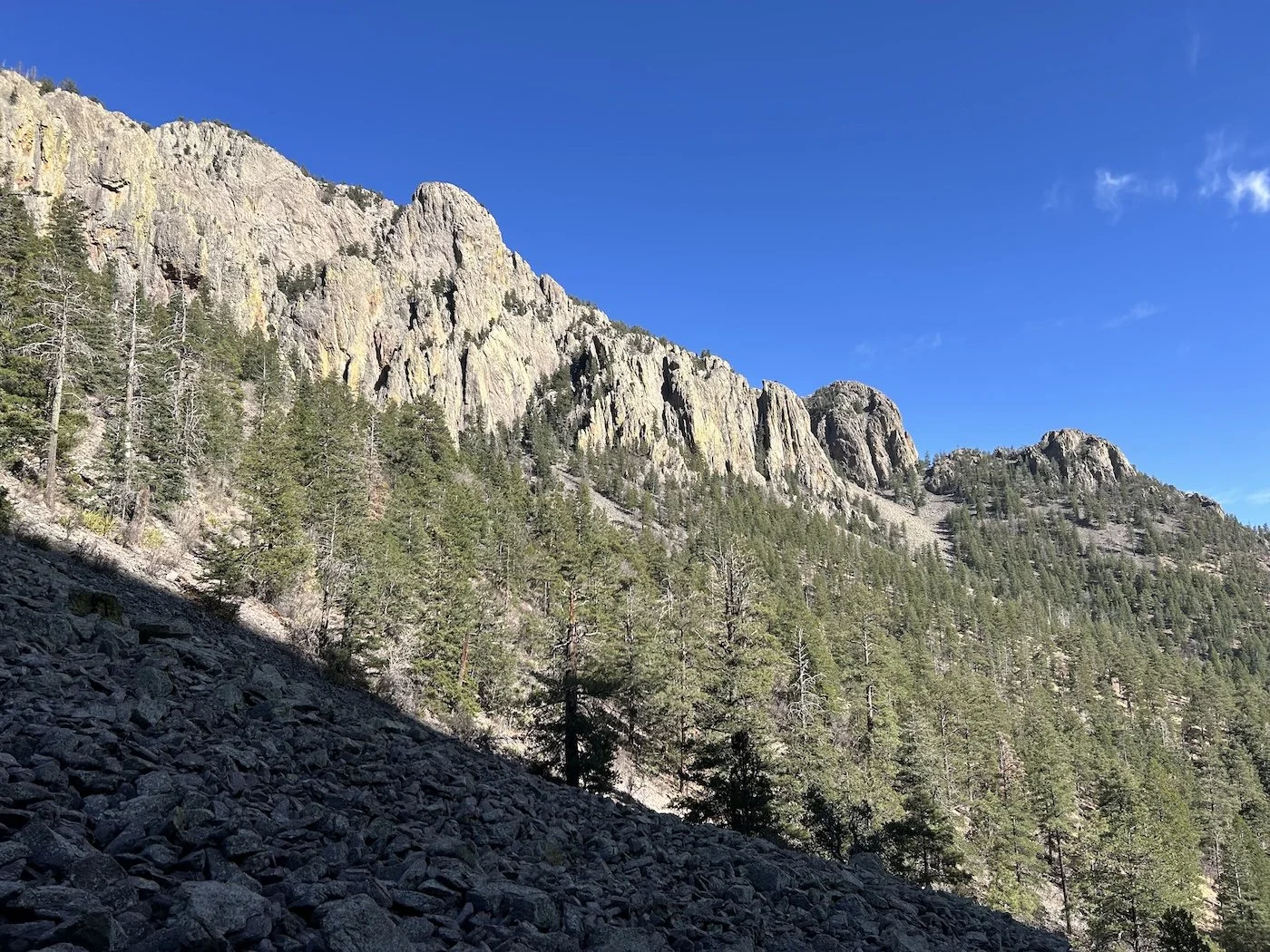
Scree field in the Apache Kid Wilderness Area
I retraced my steps along the 15 mile forest service road out of Monticello, taking few breaks and making good time. I collected water at the trough just before my departure from the road, enough to camp with, if need be; the water chart was no longer being updated ahead of me, so I didn't know what lay ahead.
Since Gila Cliff Dwellings (when the Great Western Loop hiker departed the GET for the CDT) I was the hiker out front for the season, the only one reporting back on trail conditions and water sources.
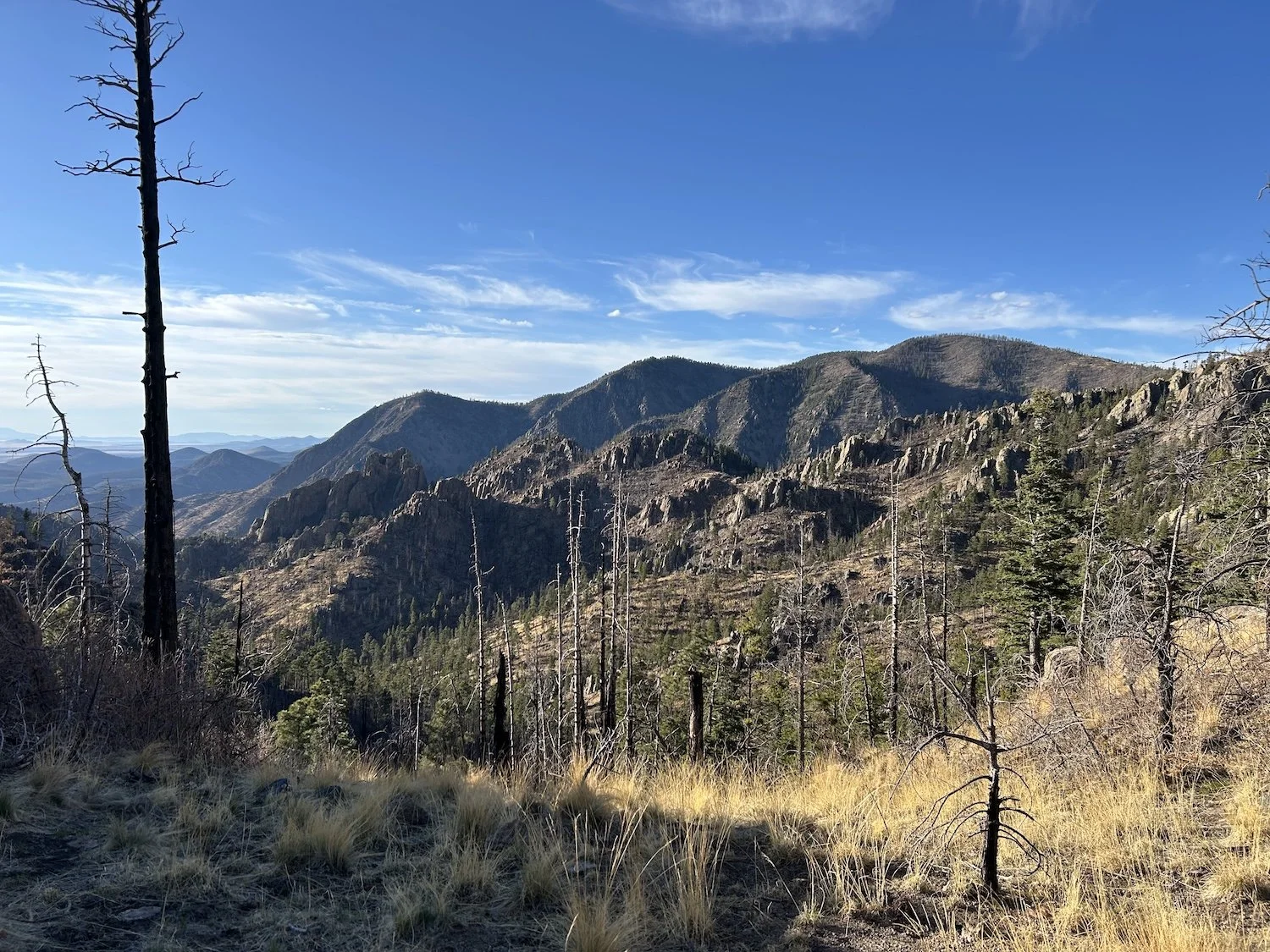
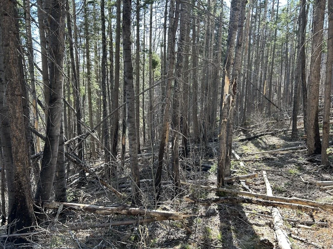
Burnt trees along the Shipman Trail, Apache Kid Wilderness Area
The first three miles into the mountains were logged and brushed, and the two or so after weren’t bad. There were plenty of blow downs and scorched sections of forest, but where a trail was lacking, I spotted red flagging tape fluttering in the breeze on charred limbs. There was the occasional cairn as well, a welcome sight amid the destruction.
I struggled to find a safe place to camp that night; I did not want to camp beneath a dead tree in the event the wind picked up, but nearly all of them seemed to be. Eventually I found a small patch of living trees and pitched my tent. These ponderosa towered over the rest of what remained of the burnt forest; they felt like a sanctuary and the elk seemed to think so too, as several bands of them trotted through my campsite over the course of the evening.
Day 30: April 22, 2025 // 25.2mi, 6,109ft+
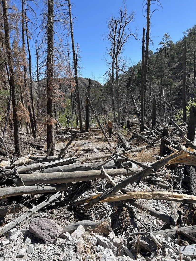
Destruction on the Apache Kid Trail
Brutal. Slow. Arduous. Existentially dreadful. PMS. Irritable. Headache.
—excerpt from my journal
Today was a hard day.
Apache Kid “Trail”
It didn’t start out hard, though; the trail was good for about a mile. And then it absolutely was not. To put it in perspective, the first 10.9 miles of my hike took 6 hours, a sub 2mph pace which is less than half as fast as I am capable of walking on any sort of trail that actually exists. I was so shocked when I looked at my watch and saw my pitiable mileage, that the wind went completely out of my tattered sails.
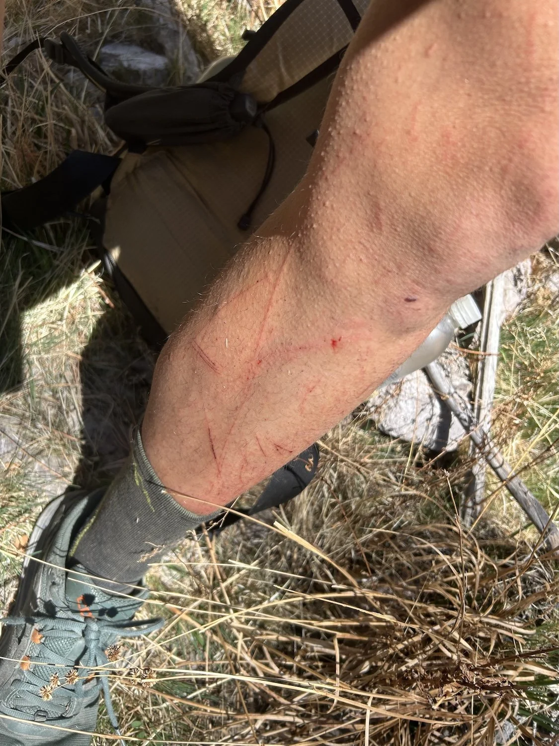
Why was this day so slow? Blowdowns and snags galore. So extensive was the destruction that at times, I could not even guess at where the trail might have once gone. I chose the path of least resistance in those instances, but don’t worry, there was still plenty of resistance and my already bruised and bleeding legs bore a new network of injuries by the time I took a break for lunch at a small stream.
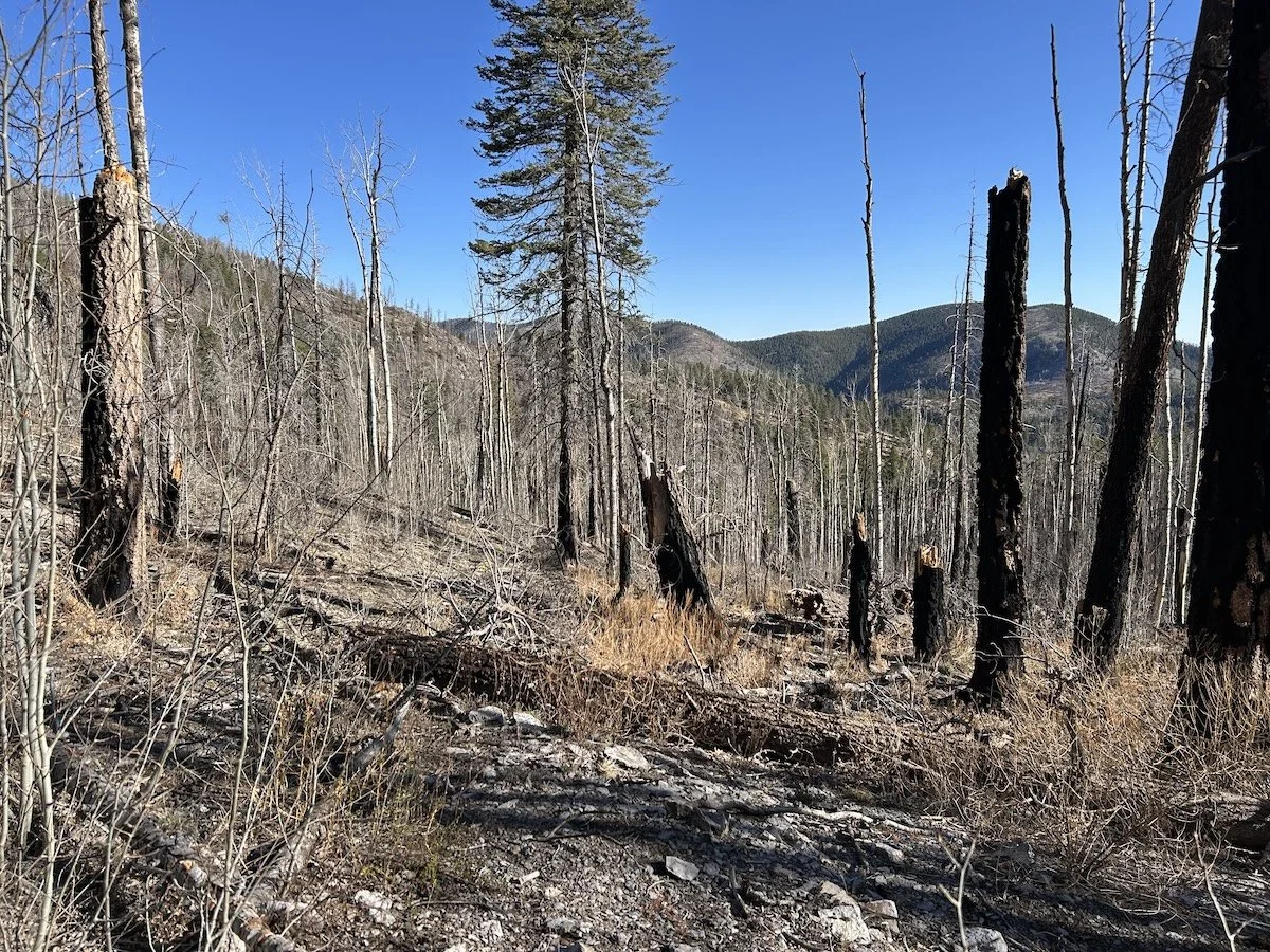
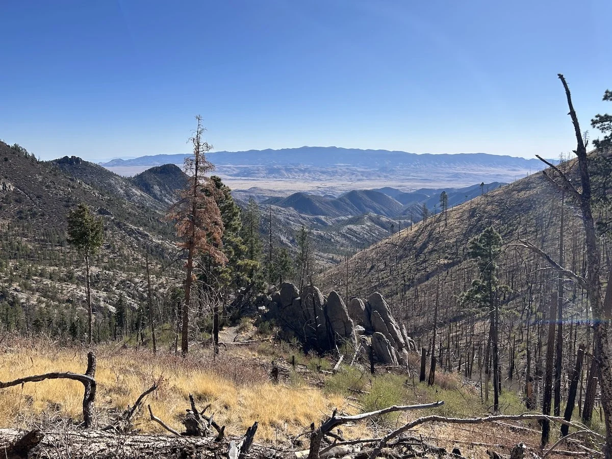
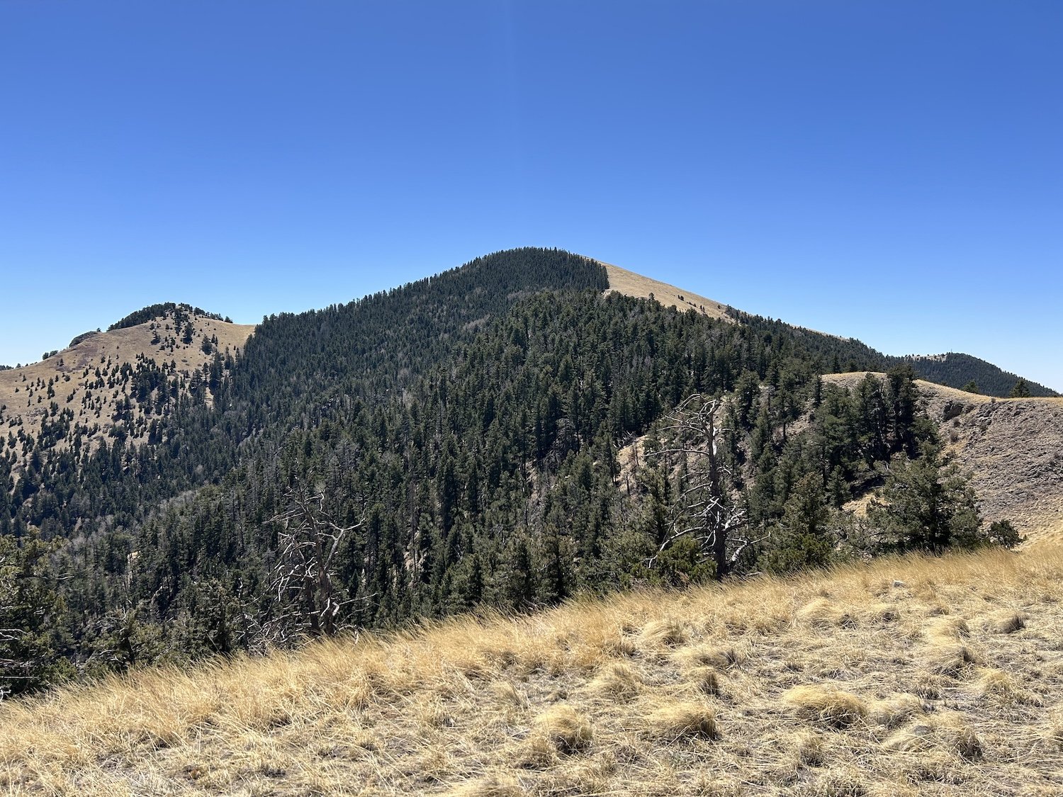
Grassy Lookout, San Mateo Mountains
The second half of my day was equally as slow but for different reasons—I was tired, for one, and about to start my period. While I’d made it through the worst of the burn scar, I still had to hike cross country up a wash, across some nebulous, juniper studded hills, and then up to Grassy Lookout. Gaia showed a trail to the summit of the Lookout, but alas, there was none, so I hiked directly uphill and goshdarnitall it was steep.
Some highlights from the day, though, because it wasn’t all bad, were that I saw heaps of turkey, deer, elk and even a horny toad (which I now know is a lizard, not a toad! But I do enjoy saying “horny toad”").
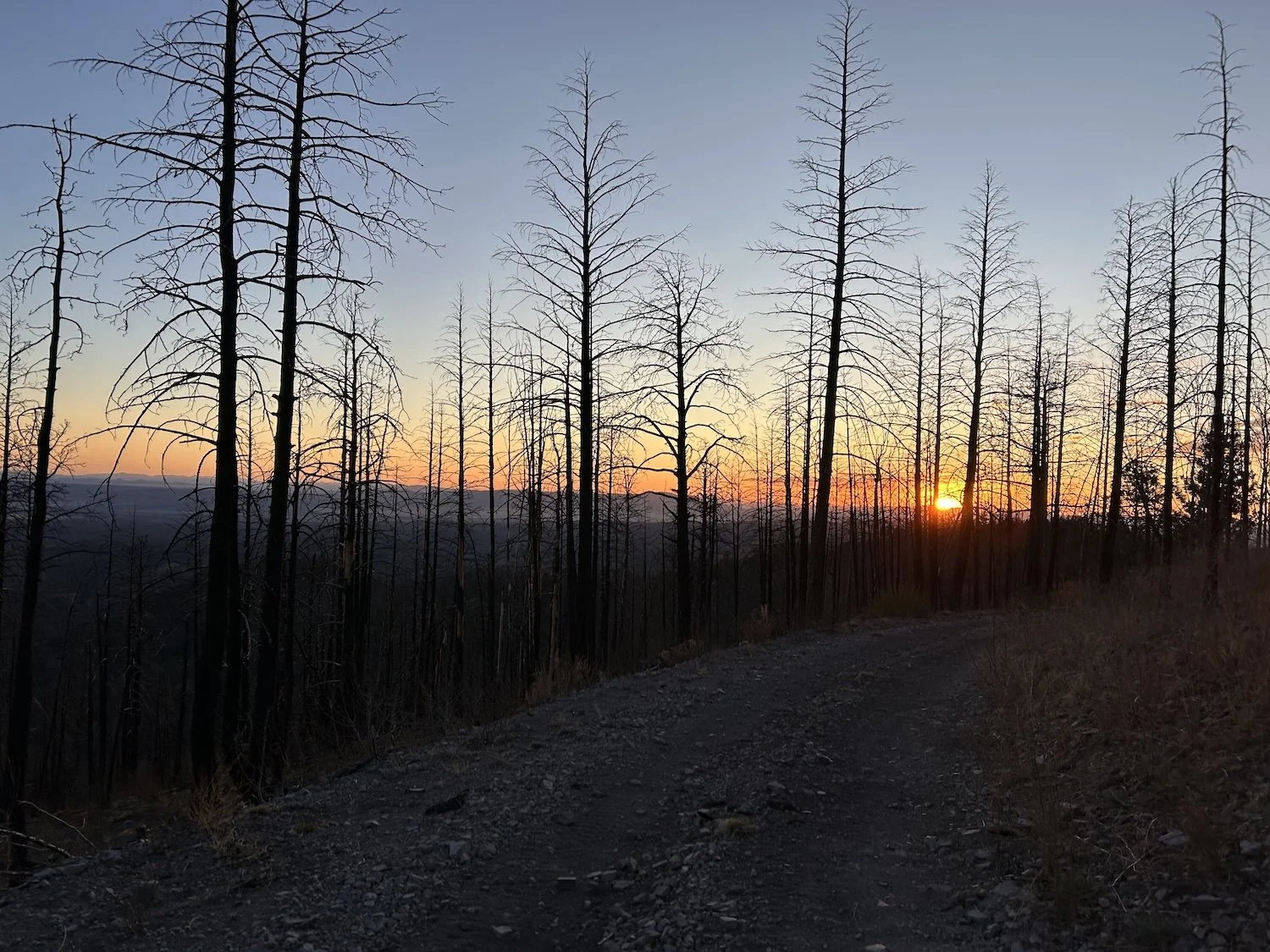
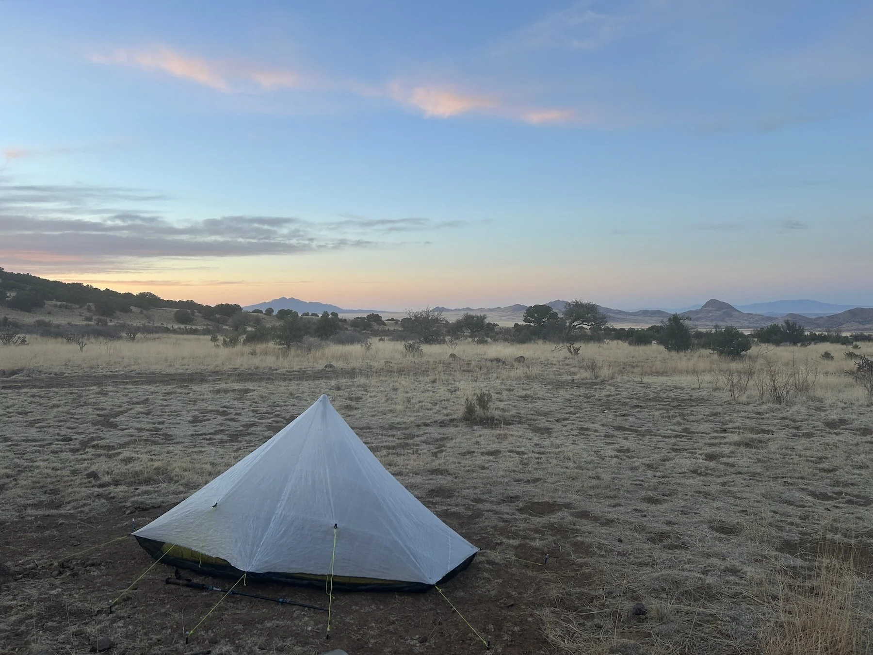
Sunset from Forest 330 Road
I set up camp at 8:30PM, after the sun had already dropped below the horizon, and felt a little demoralized doing so. The descent out of the San Mateos tomorrow was supposed to be extra hard; there was a waypoint on Gaia that said “trail obliterated” in reference to the Potato Trail, and I seriously could not imagine a trail being more obliterated than the one I’d hiked earlier today.
I made a quick dinner of ramen, instant potatoes and very melted cheddar cheese, and passed out pretty much right next to a forest service road; I hadn’t had the energy to find anything secluded.
Day 31: April 23, 2025 // 28.78mi, 3,655ft+
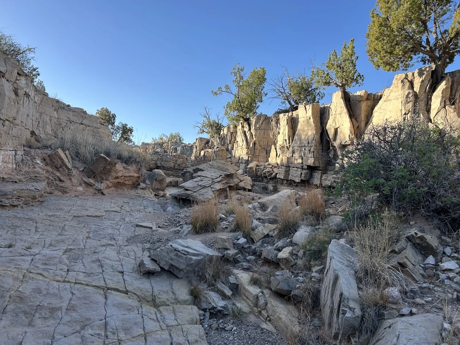
Potato “Trail”, Withington Wilderness Area
I woke without a pounding headache and breathed a sigh of relief. My body felt stiff and battered from the previous day, but at least I’d managed a descent night of sleep. I packed up quickly and power hiked the remaining 4 miles of forest service road before abandoning the road for the woods.
The Potato Trail was signed as having been destroyed by fired and no longer safe, but it was my best option for getting down and out of the San Mateos. There was approximately one established switchback and then conditions deteriorated into bracken and deadfall with a side of thorns. I continued to switchback, as it seemed easier than walking directly downhill, and occasionally I was able to find a thorn-free stretch of hillside to tread along.
It wasn’t until I descended several hundred feet lower that I was able to appreciate the sheer magnitude of the erosion mentioned in the guidebook. Gullies of unimaginable depth had been carved into the mountainsides, clogged with logs and boulders and debris. The power of water pounding through what had once been drainages and creek beds of moderate depth, had dredged their bottoms of stone and soil, dragging all of it, along with half the burnt forest, down slope, toward Potato Canyon.
View into Potato Canyon, Withington Wilderness
I knew I needed to cross over the trench to my right, at least that is what hikers from a previous year recommended in the notes section of the water chart, so I started looking for a place to drop down.
Approaching one section of the blown out gully, I peered over the edge at the roughly 20 foot drop below—nope, this was not a good spot to climb down. I kept walking through thorns and bracken until I found a spot where the side was more sloped than vertical and plunge stepped down the sandy embankment. Now to find a way out. I considered the log jam up ahead and decided that, while probably unstable, it was my only option.
I climbed the log pile, pressing my hands to the smooth, sun bleached wood, climbing higher and higher out of the eroded pit. Nerves bubbled in my gut as a log shifted under my weight; I half expected the entire pile to come down on top of me, but it held.
I didn’t take any pictures of the erosion, and I wish I had. I tend to not pull my phone out when I am scared, and it’s safe to say I was really scared. There is something so unsettling about walking through swaths of mass destruction in the middle of nowhere. The carnage above Potato Canyon was a display of the effects of climate change, the devastation of forest fires and subsequent flooding; it was a haunting experience to contend with.
Debris at the bottom of Potato Canyon
The aftermath of descending into Potato Canyon
In order to drop into Potato Canyon, I had to negotiate a series of pour-overs, which wound up being pretty fun, and then my feet touched the strange, flaky sand of the wash, like instant potato flakes—I’m not even joking. I let out a big sigh of relief.
My toils weren’t entirely over yet, as I still had to climb several hundred feet back out of (and then back down into) the canyon to avoid an impassible pour-over, but the going was notably easier. In the narrows of the canyon I found clear, cold water and a series of pools big enough to soak my tired body in, which I did not hesitate to do. The biting cold was refreshing despite making the cuts on my shins burn.
Lovely water source in Potato Canyon
I saw a red tailed hawk in the canyon just before I emerged into the zinging heat and electric sun of lower elevation climes. Every time I left the sanctuary of the mountains (no matter how abusive the burn-scar walking was) and into the aridity of the lowlands, it felt like a slap in the face.
I stopped at what I believed would be the last stock trough for about 13 miles and tanked up with 3L of water, assuming I’d find water somewhere before camp that night. But as the miles stretched long and one stock trough after another turned up empty and dust-filled (one was even skunk-filled—dead ones, of course) I began to worry.
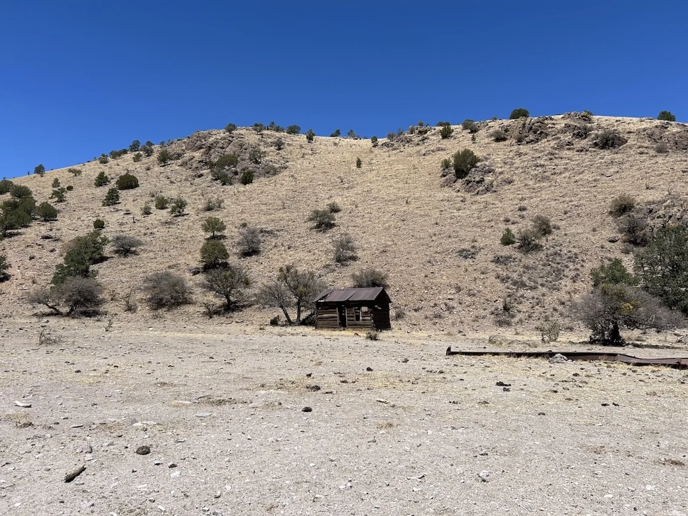
Derelict cabin on Forest Road 56
In one particularly dry wash, probably sometime just after noon, I zoned out. Stumping along, obsessively worrying over the relative impossibility of finding water out here, I became aware of a noise I couldn’t place, a sort of buzzing, almost like a cicada. Cicadas made sense in my heat addled mind so I kept walking towards a choke point in the wash, jam packed with tumble-weeds.
Were there cicadas in the desert? All of a sudden I didn’t think so. I stopped with one foot hovering over the wall of tumble weeds and gasped, leaping backwards. There weren’t cicadas in the desert, but there were rattle snakes. I gave the tumble weeds a wide berth.
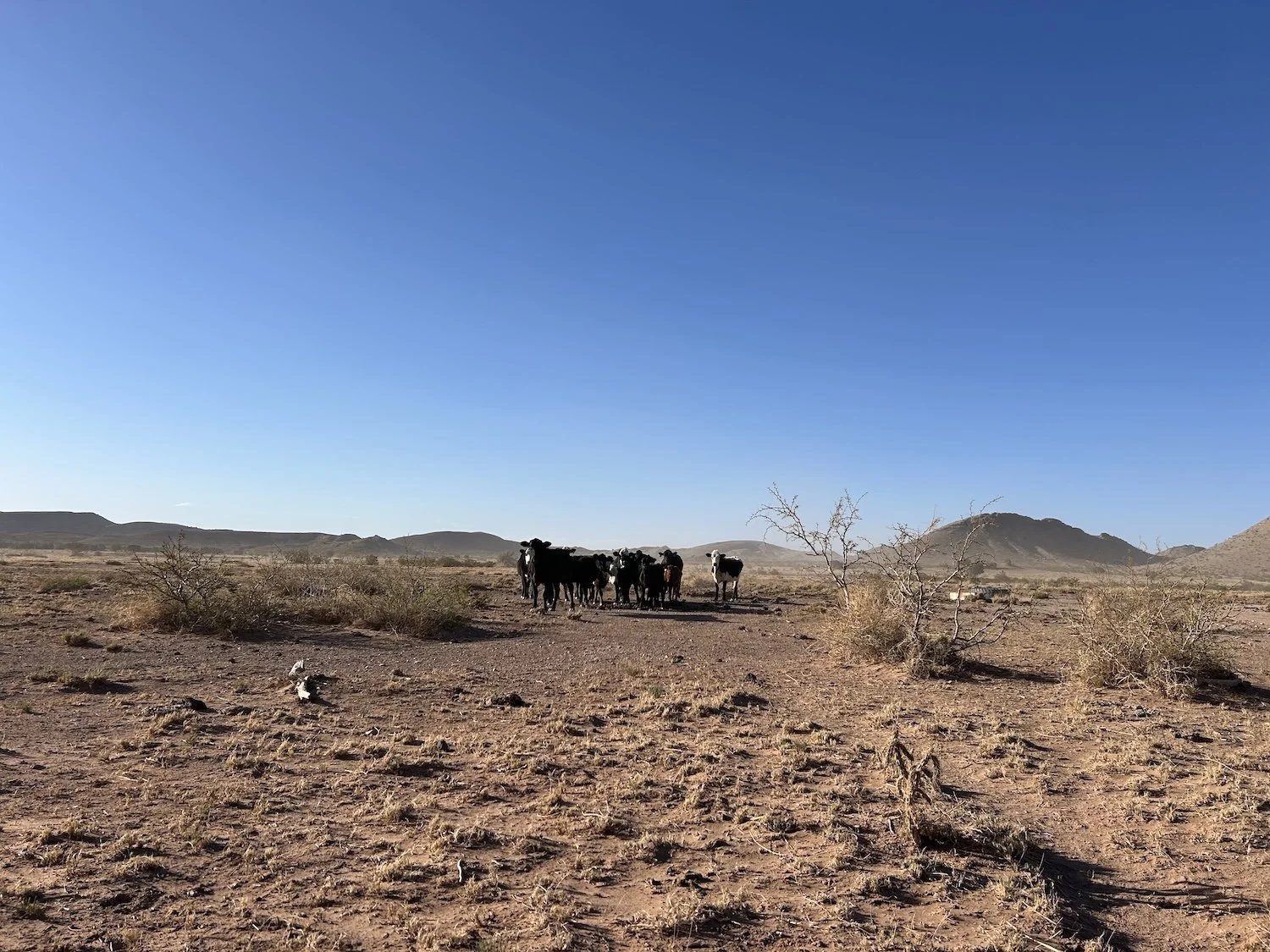
Late in the afternoon I began to scan the water chart more closely. I needed a Hail Mary water source. I’d been chugging water to combat the heat. Apparently there *might be water in a trough 1.5 miles off trail, someone reported seeing cows in the area a year ago, and where there were cows, there was water. I decided it was worth the extra 3 miles to find out.
Mercifully there was water. I knew it before I saw the shine because I heard birds singing and stepped in a semi-fresh cow pie. I borrowed some time at the tire trough from the cows and then walked a distance away to make a bean and rice burrito. It wasn’t until after I’d eaten the whole thing that I realized I’d set my stove up not 10 feet from a very dead, very rotten cow. I didn’t even care.
This day had gone on forever already, but I decided to walk until I was truly at the base of the Magdalena Mountains, the last range standing between me and Socorro. I wound up pitching my tent at a confluence of little used dirt roads, not expecting a lick of traffic and there wasn’t. The night was silent, devoid of wind, and I fell asleep quickly.
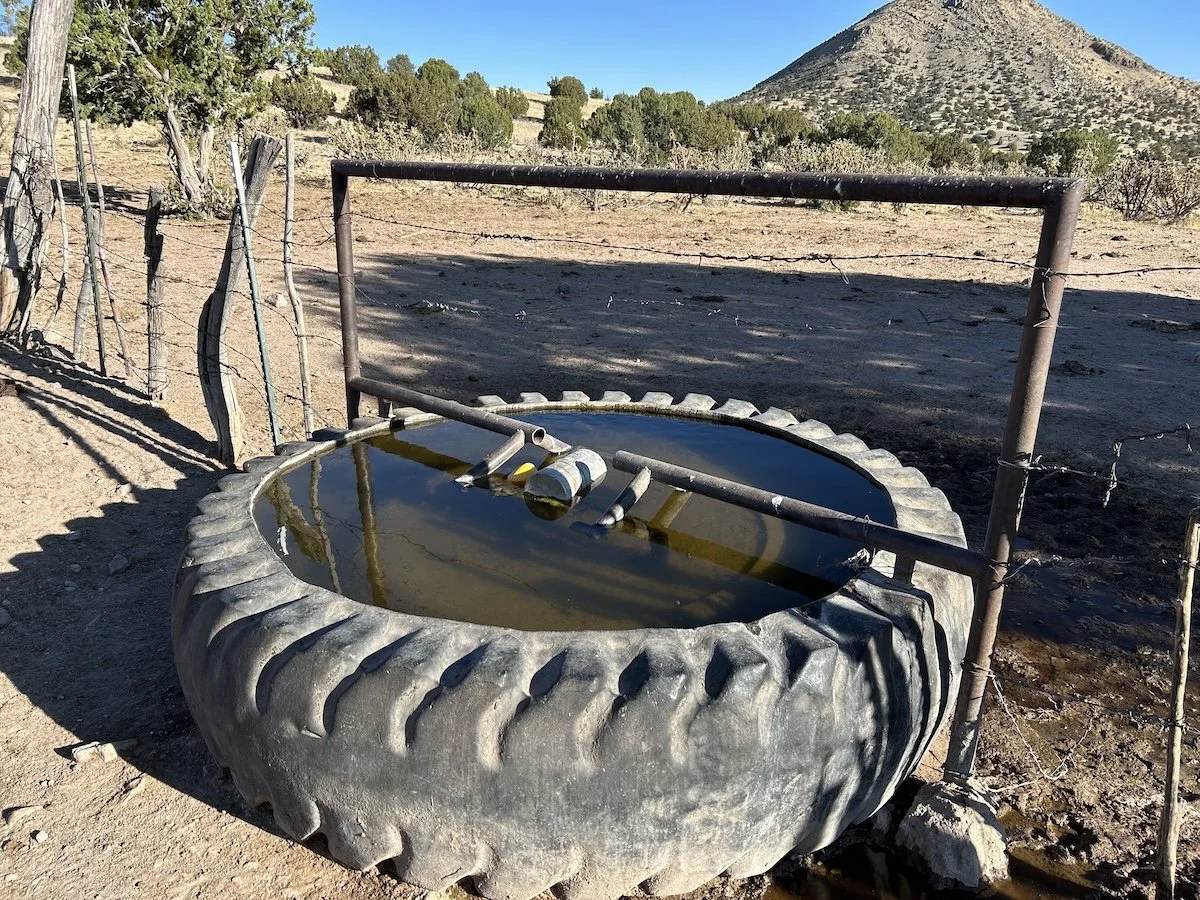
A lucky find! Trough 1.5 miles off-route, took a risk and it paid off
Day 32: April 24, 2025 // 21.23mi, 5,256ft+
Hiking toward the Magdalena Mountains
The Magdalena Mountains were dreamy. The walking was blissfully smooth and the trails were well put-in. I took an alternate route once I attained the ridge; instead of heading toward Magdalena on the main route, I decided to head east to Socorro. I hadn’t mailed a package to Magdalena and wasn’t sure if I’d be able to do a full resupply there, so Socorro seemed like a better bet.
View from North Baldy Trail
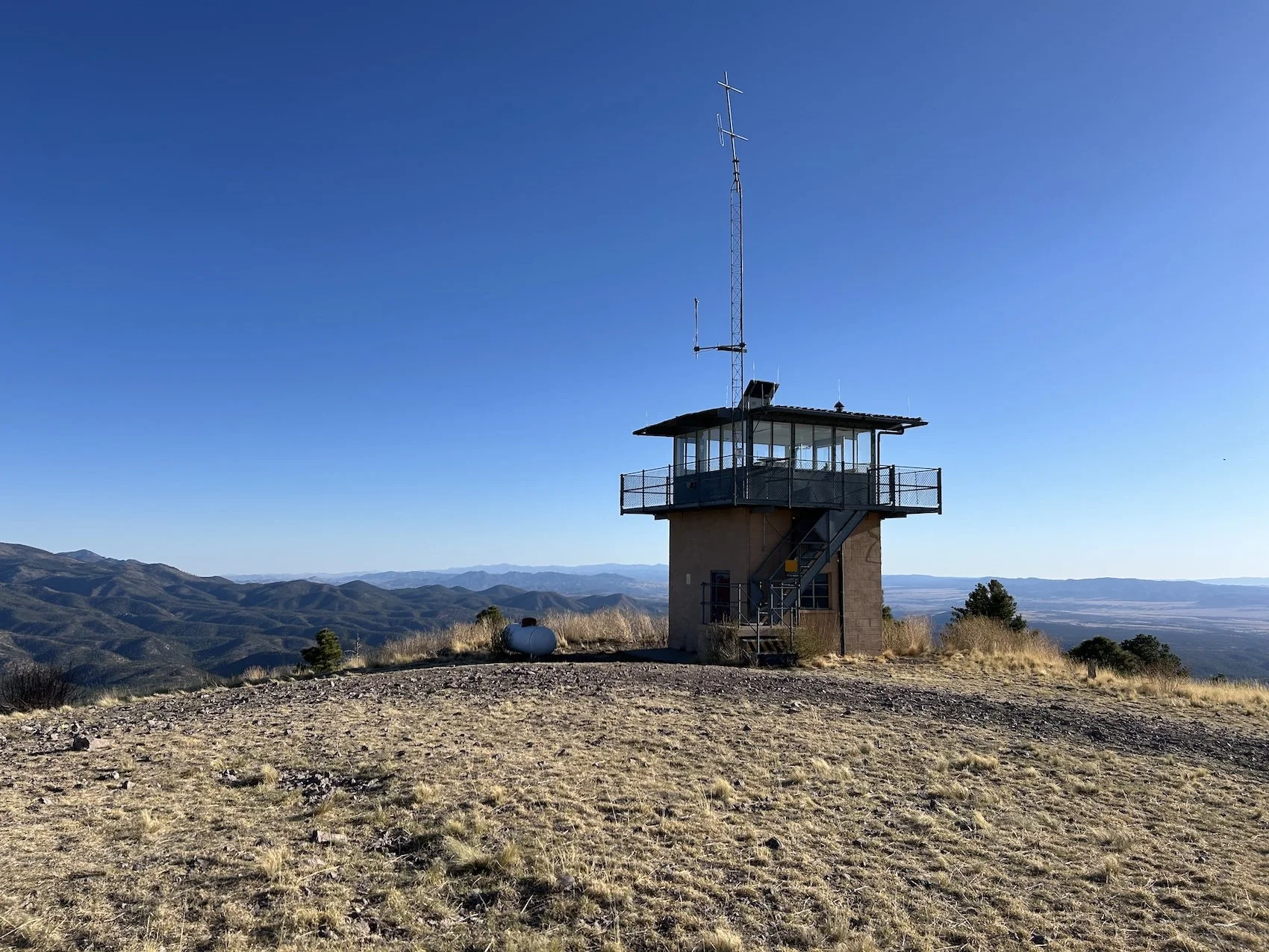
Because I took the alternate, I had the opportunity to climb South Baldy, which was 5 meters taller than Mogollon Baldy and my new highpoint on this trip. There was a weather station on the summit and research buildings just below it where I was able to collect water.
I wished I could have spent days hiking in the Magdalenas rather than just one. I couldn’t believe how nice it was to hike on an actual trail.
Looking toward South Baldy
The descent from South Baldy was smooth, partially on a forest service road and then on more lovely single track. I couldn’t believe my luck. Along the descent I stopped a picnic table near some pit toilets and chatted with a woman on a horse; she asked me where I was going.
“To Albuquerque.” I smiled at her and took another bite of my tuna and potato chip burrito.
“What in the heck?” Her horse tossed its head and stomped a shoed hoof against the gravel. “Why?”
“I like walking, it makes me feel right-sized, like I actually belong somewhere in the world.”
“Right-sized, huh? Are you sober?”
“I am,” I said. “For about 6 years.”
“I thought so! I’ve got 8.” Her horse shifted from foot to foot anxiously. “Hey, I’ve got a ranch not far from here if you need a place to stay.”
I added her phone number to my notes app and thanked her profusely. I didn’t wind up staying with her, though the offer was kind. I already had a reservation at the Best Western in Socorro, which was very close to a grocery store, restaurants, and had its own laundry. Who knew how far out of town her farm would end up being and the idea of getting stranded there made me anxious.
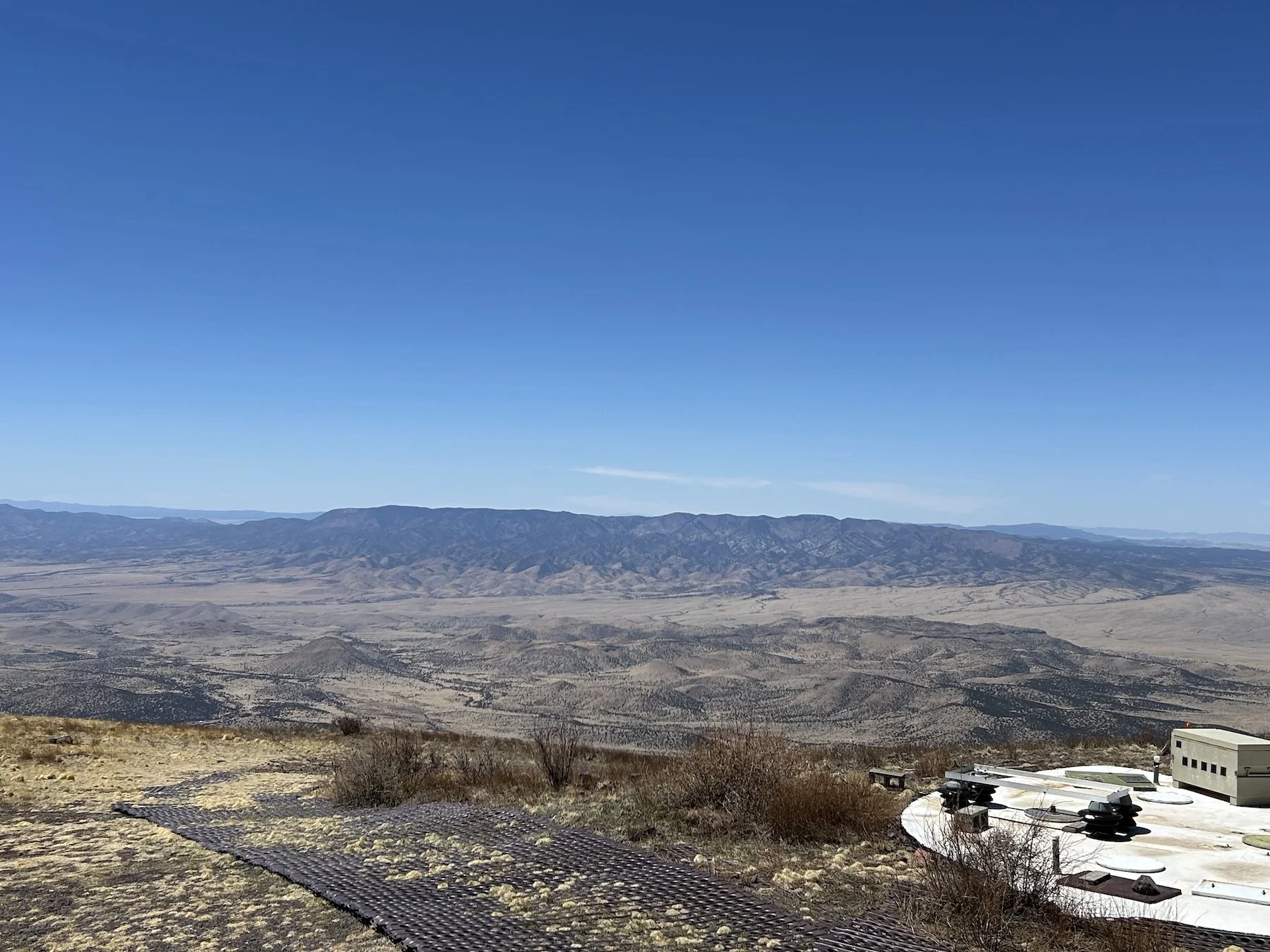
View of the San Mateo Mountains from the South Baldy Summit and weather station
I had one more short climb to negotiate—on more excellent single track—and then a long, buttery descent into South Canyon. Sure, the trail was a little overgrown, but still so so nice. I flew through the narrow wash, enjoying the bird song and pretty canyon walls.
Contentedness settled in my chest. I was grateful for this gift of a day on really good trail. I hadn’t expected it, which made it all the more special.
I made camp where the canyon opened up into a wide valley with spectacular views, and enjoyed a breathtaking sunset while I cooked dinner. I had fewer than 20 miles into town the next day and regardless of the challenges they might pose, I knew I’d make it.
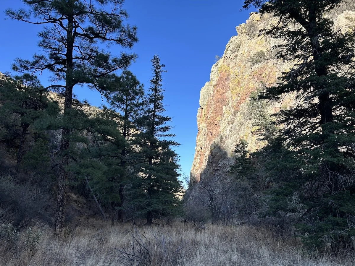
South Canyon
Day 33: April 25, 2025 // 18.92mi, 866ft+
The hardest part of my day turned out to be eating Sonic, but let’s back up.
Campsite at the mouth of South Canyon
It had been a hot, exposed walk into town and I booked it, flying over chunky forest service roads, through a heinous wash that was full of deep sand, shifting river stones, and sharp vegetation, off-trail, of course, and I definitely forgot to drink water.
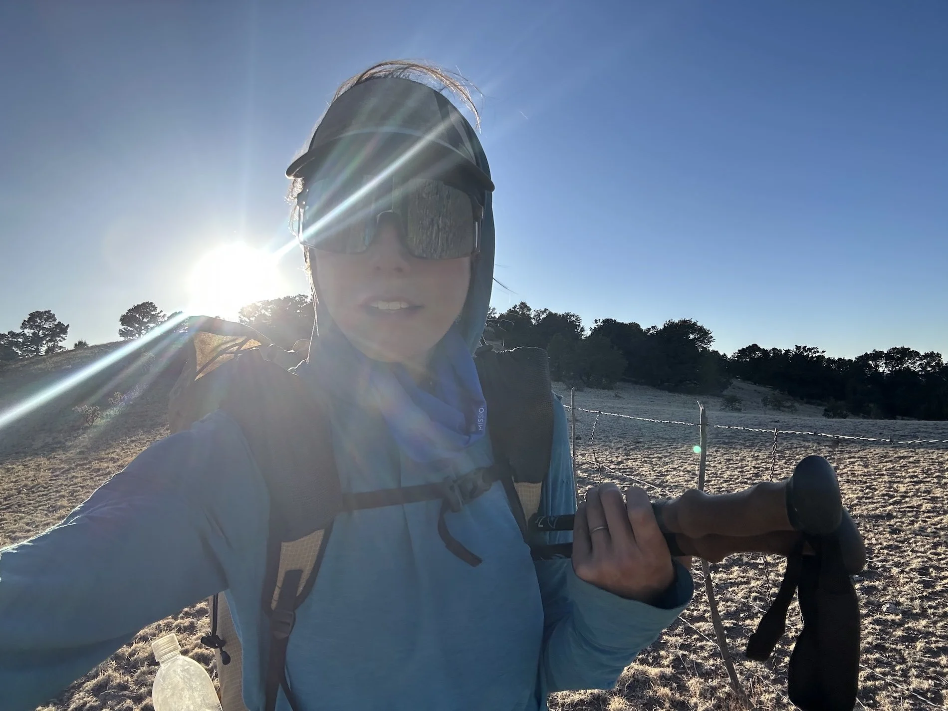
Wind had battered my tent all night and I hadn’t slept well, so when morning came, all I wanted was to get to town, hide from the elements, take a shower, and lay on a soft mattress.
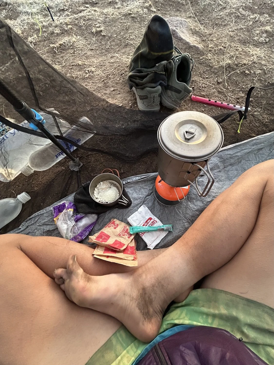
Haphazard cooking arrangement
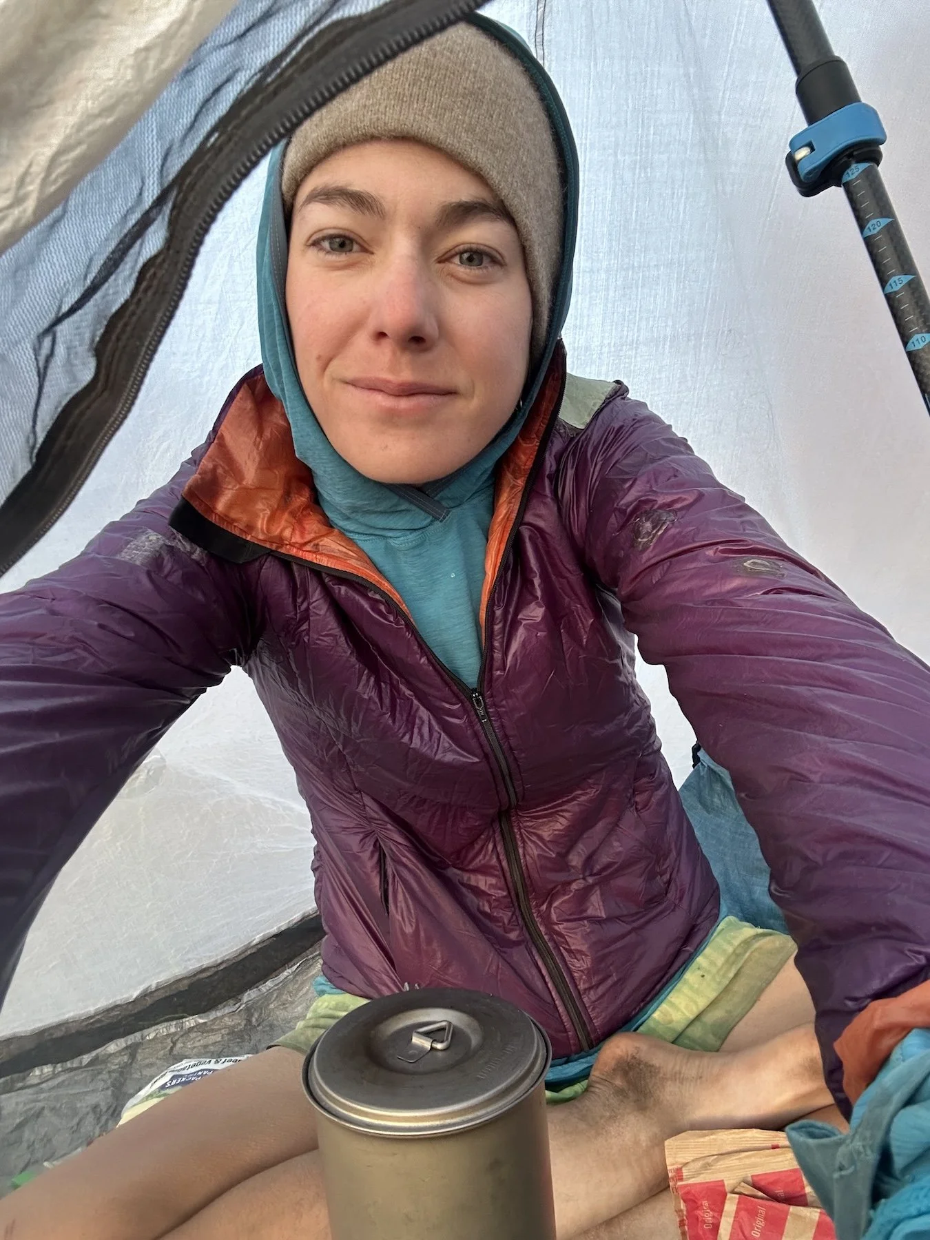
Windbeaten, filthy, and in need of caffeine after a night of exceptionally poor sleep
I listened to music for the first time on the entire trip when I hit some mountain biking trails and the experience was blissfully euphoric. I belted out the lyrics I knew, danced while I walked, and somehow achieved a 5mph pace walking.
When my shoes touched pavement, I called my mom. I still had quite a bit of walking to do through town to get to my accommodations and chatting with her really helped pass the time. I still hadn’t consumed a full liter of water since breaking camp.
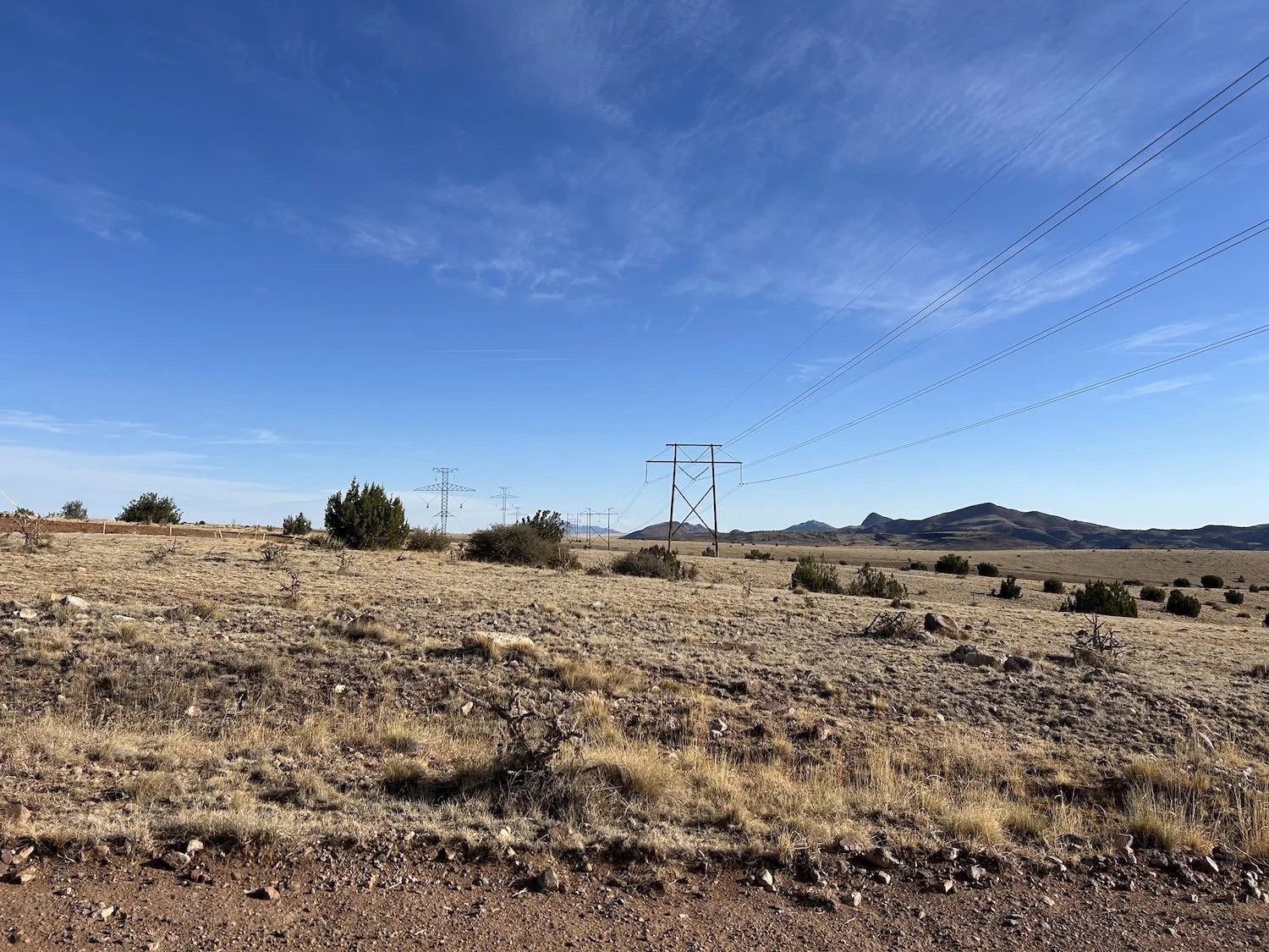
Powerline Rd outside of Socorro
By the time I saw the Best Western and the Sonic right across the street, my energy had started to flag and I felt almost nauseous.
I said good-bye to my mom and dropped my pack at a picnic table before ordering a burger and a chocolate shake. I figured food would help me feel better since I hadn’t taken a snack break or eaten lunch.
Dusty hike into Socorro
When my food came out, I wolfed it down while uploading my days to Strava, adding pictures and detailed captions to each activity. I chugged the milkshake like it was water, attention glued to my phone, but still hadn’t consumed any actual water in hours.
And then a wave of nausea hit me. I was suddenly lightheaded; my ears were ringing and my vision narrowed to points. I felt like I was gasping for air. I hated feeling like this in public; it felt acutely vulnerable to be this helpless. I wanted to lay down on the ground but thought that was a little dramatic, so instead I stuck my head between my knees and waited it out, hoping I wouldn’t puke or shit my pants or black out. It was a truly mortifying experience that seemed to go on forever.
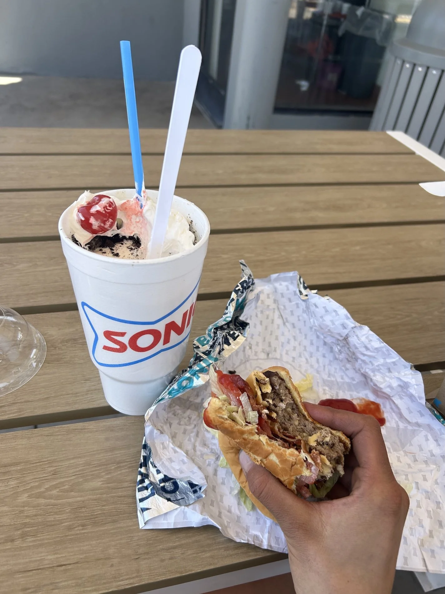
Sonic in Socorro, NM—where I almost died
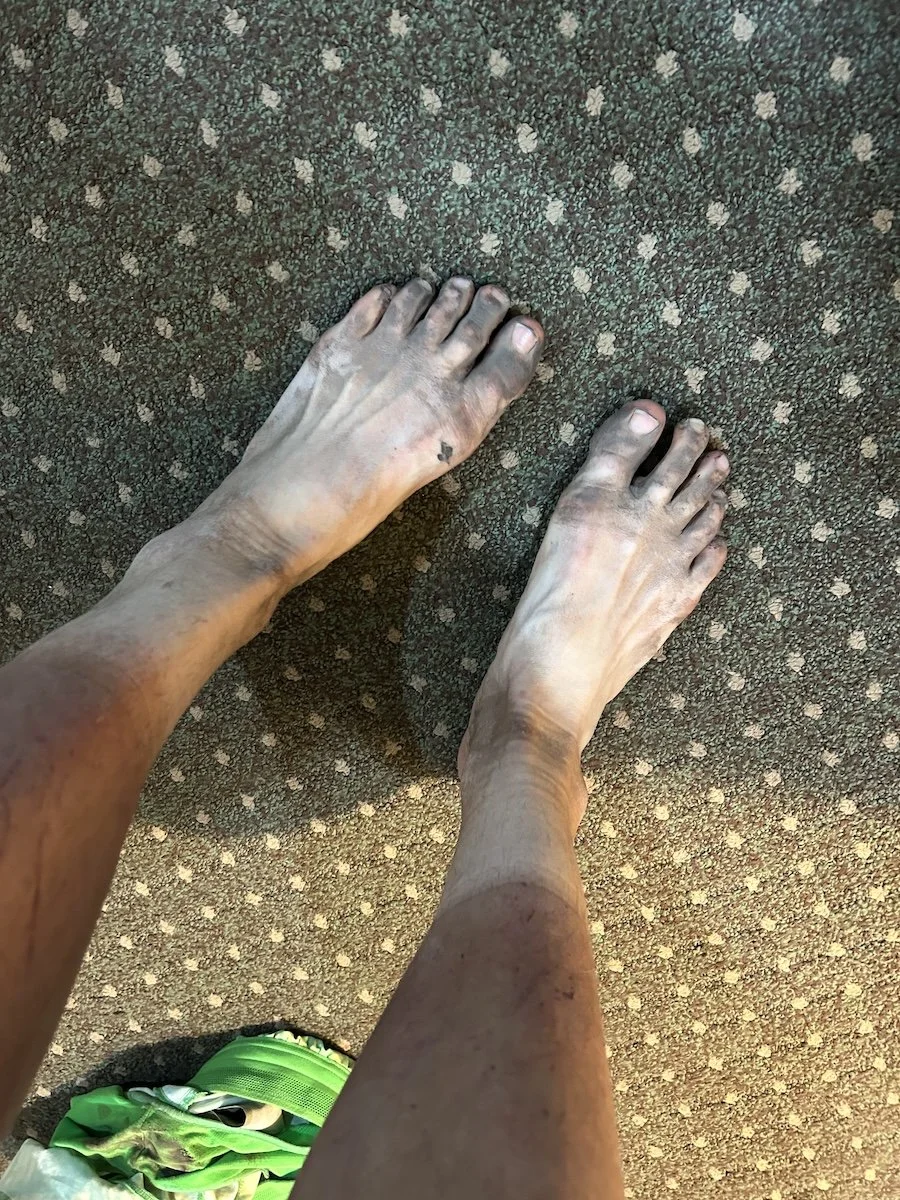
A whole lotta ash on these feet
As soon as the dizzy spell passed, I made my way over to the Best Western, feeling weak and drowsy as I crossed the busy highway. I did not leave my room to do any chores until the sun started to drop, and I made sure to drink plenty of water. Exhaustion weighed on me, and I felt some relief knowing this adventure was nearly over.
Socorro would be my last major resupply before the end.
Day 34: April 26, 2025 // 21.35mi, 1,575ft+
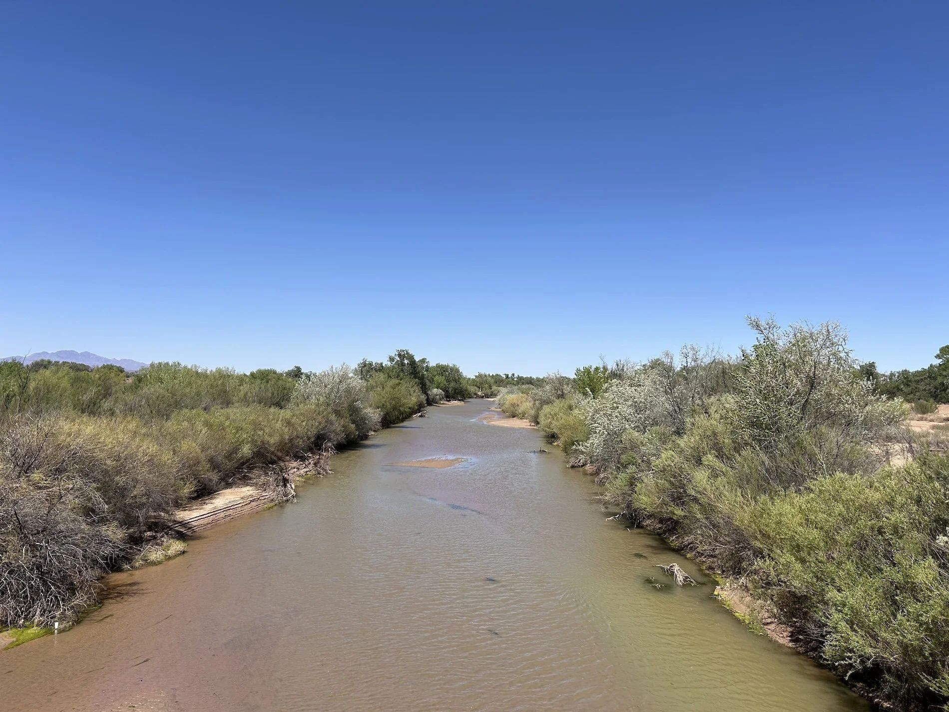
The Rio Grande
I didn't leave Socorro until noon the next day because I wanted more time to rest and hydrate. I went back to the hotel breakfast buffet twice, returning repeatedly to the waffle-making-station before deciding 4 was probably enough even though I was pretty sure I could’ve eaten a fifth.
Talking to Logan on the phone made me miss him tremendously and suddenly the week + I had left out here felt like a damn eternity. At least now I was walking toward him in earnest as the remaining miles were rather direct.
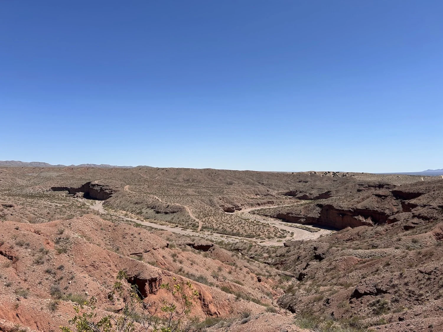
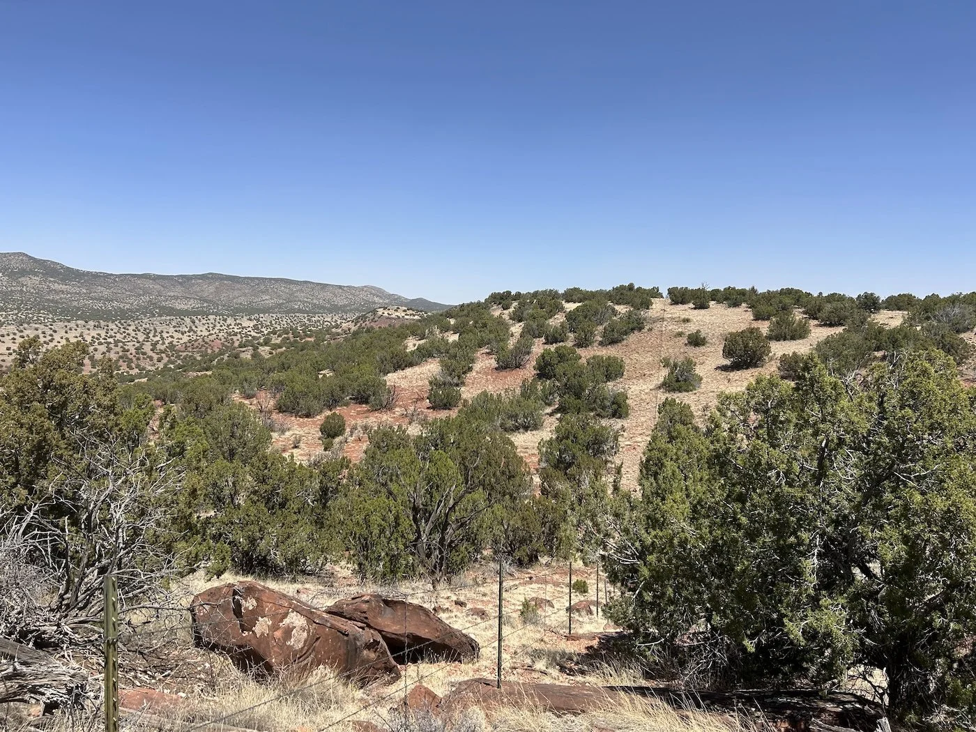
View from Johnson Hill on the hike out of Socorro, NM
The extreme heat and exposure, a leaking water bladder, and the sheer nothingness of the terrain directly out of town didn’t exactly help my morale, nor did passing a questionable looking muck bucket full of something that smelled an awful lot like a corpse down by the Rio Grande. The views and smells improved, though, when I reached the top of Johnson Hill and took in the landscape. I had dipped into the Chihuahua Desert, which over all maintains a higher elevation than the Sonoran Desert, has colder winters and is quite a bit drier.
East of the Sevilleta National Wildlife Refuge Boundary
This section of the GET traverses private land with the landowner’s permission. I made sure to follow the route carefully, which was, at times, quite hard. Though I was following a primitive road for most of the way, sometimes the road intersected other vague two track or faded into non-existence. I passed cattle and filled up with water at a trough.
The first sip tasted like sulphur, so much so that I really did not want to drink it. But I couldn’t afford to get dehydrated out here; there wasn’t a lick of shade. I tried adding Skratch to the water and it really didn’t help so I started holding my nose every time I took a drink.
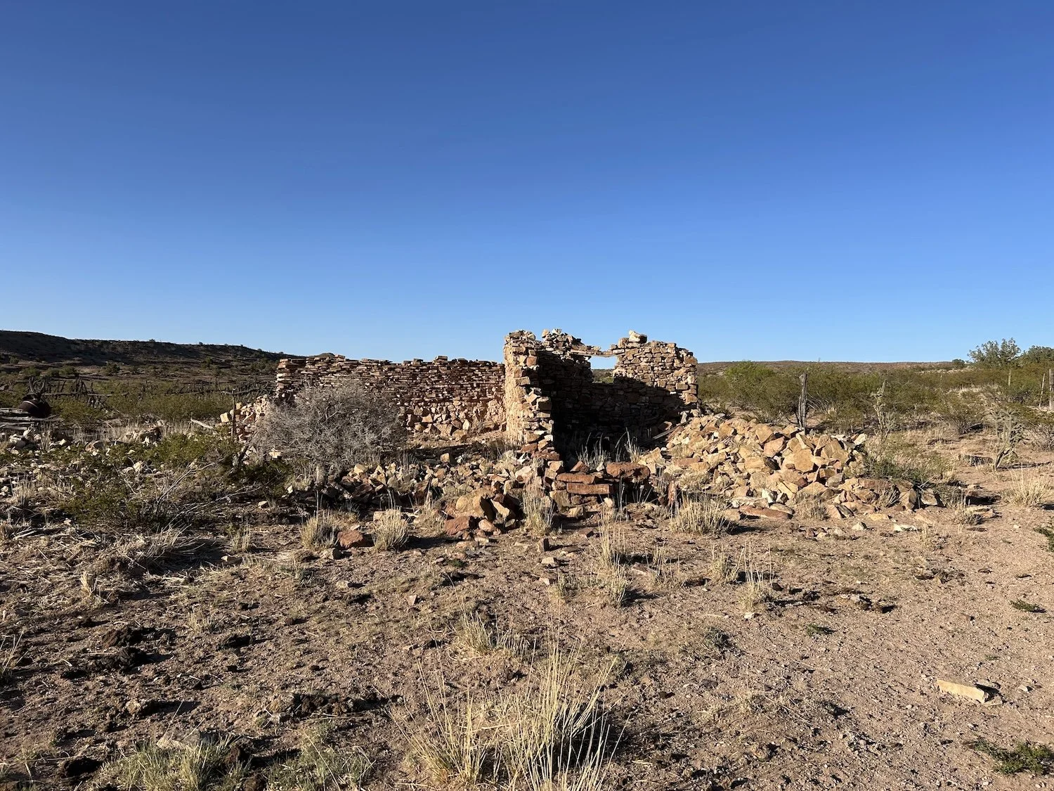
A ruin
I passed a ruin near another trough, the water there tasted just as bad, but I was consoled by the mere presence of water, disgusting or not.
My burps began to taste sulfurous around 4PM, which put me in a bad mood.
Pretty painted wash in the middle of nowhere
When I reached a sheltered arroyo, I pitched my tent directly in its center. Wind and dust and sand had pummeled me all day and I was eager for a reprieve. I used the smelly water to cook dinner and was pleased to find the ramen flavor packet overpowered the eggyness almost entirely.
In my journal that night I note that while the wheels haven’t fallen off yet, they are definitely getting loose. I was ready to be done in many ways, eager for the end, but I knew I would miss this, not sulfurous water, cow shit, flying sand or arduous wash walking, but the rhythm of walking. Once I stopped, I knew I would mourn the ritual of it.
Day 35:April 27, 2025 // 31.43mi, 3,504ft+
Sunrise in a wash
I wound up walking about 31 miles on this day, purely because I wanted better tasting water. You can imagine my disappointment when I arrived at the water source that was supposed to be a clear, bubbling stream and it was instead stagnant sludge, completely ruined by cattle. The whole canyon smelled putrid, in fact.
Winding back to the morning, though, I woke to more pummeling wind. The air was thick with dust and I had a cough. My asthma symptoms hadn’t abated on this hike, I had just learned to live with them. I now knew that when my lungs felt tight and stiff and utterly useless, I wouldn’t die, I would just be miserable. And somehow that gave me peace of mind I needed to keep going.
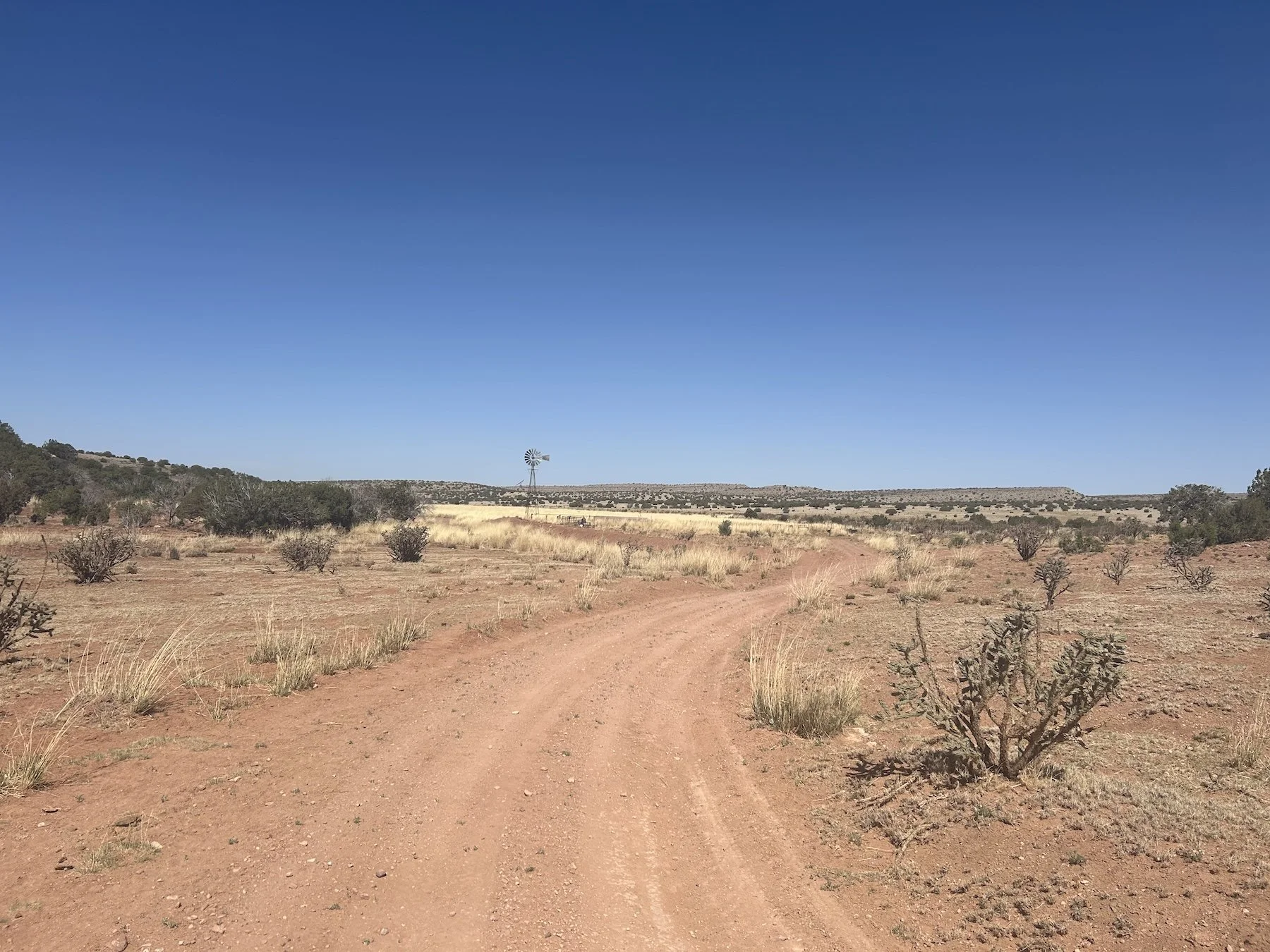
Windmill water pump on a windy morning
I passed a windmill trough and dared to hope the water might taste better—it definitely did not—but that did not stop me from hiding from the wind behind the cement trough and gathering a bit more water. The landscape was woefully uninspiring to me, but I wasn’t sure if that was just because I was tired of everything smelling like rotten eggs, or because I was exhausted from being pelted with sand, or if it was because the view was, in fact, dull.
Beyond the dirt road, I entered into an 11 mile cross-country adventure entirely off trail. It was navigationally demanding and the way was studded with sleeper prickly pear, no taller than ankle height; I tripped over every single one of them. My toes were bloody and swollen by the end of the day and I screamed plenty for f*ck-all to hear.
I didn’t see a single living thing.
Walking along a barbed wire fence just outside of the Sevilleta National Wildlife Refuge
Some of the hardest walking involved following barbed wire fences and occasionally crossing over or under them when the guidebook directed me to. At one point, I stopped in a wash and sat in the shade of a stunted Juniper and watched a tumble weed get blown back and forth in front of me for at least twenty minutes, sipping my stinky water and contemplating all the life choices that lead me here, to this place in the middle of nowhere.
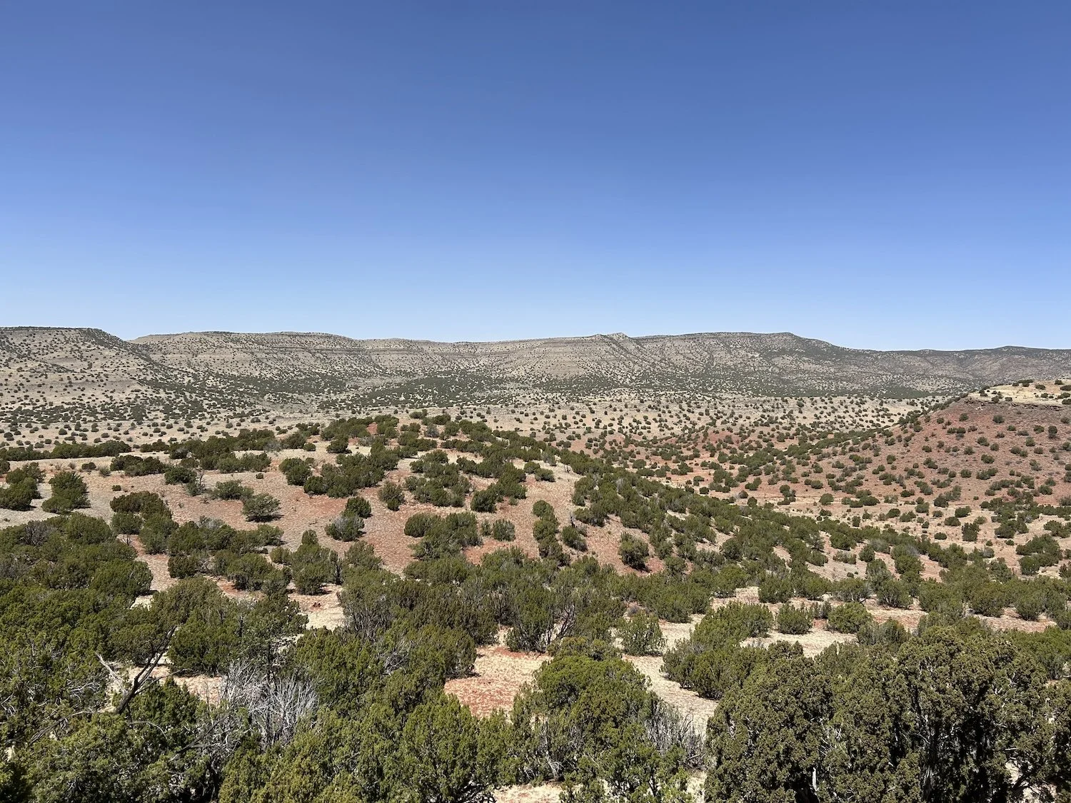
Looking into the Sevilleta National Wildlife Refuge
I crossed hwy 60 in the late afternoon and looked wistfully in the direction of Mountainair. There was no traffic, though, and it was too late in the day to arrive to town without any lodging booked. I sighed and forged ahead. I wanted to make it to Abo Arroyo where the water was supposed to taste better.
Murderously windy and dusty as f*ck
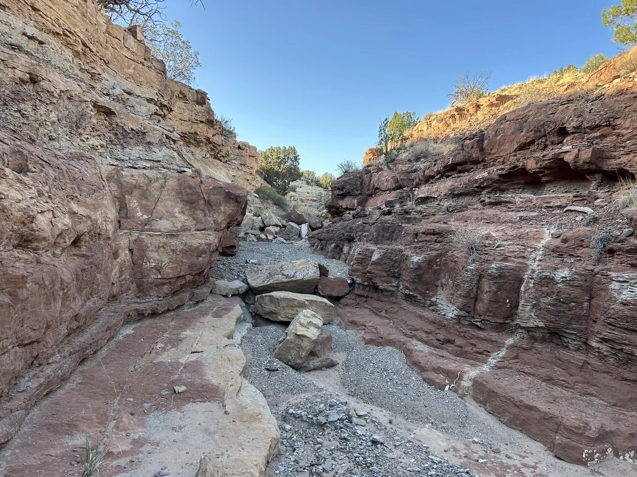
The walk down the wash that would eventually join Abo Arroyo was slow going at first, but eventually opened up into a gravel bottomed canyon that was quite beautiful. My mood improved with every step.
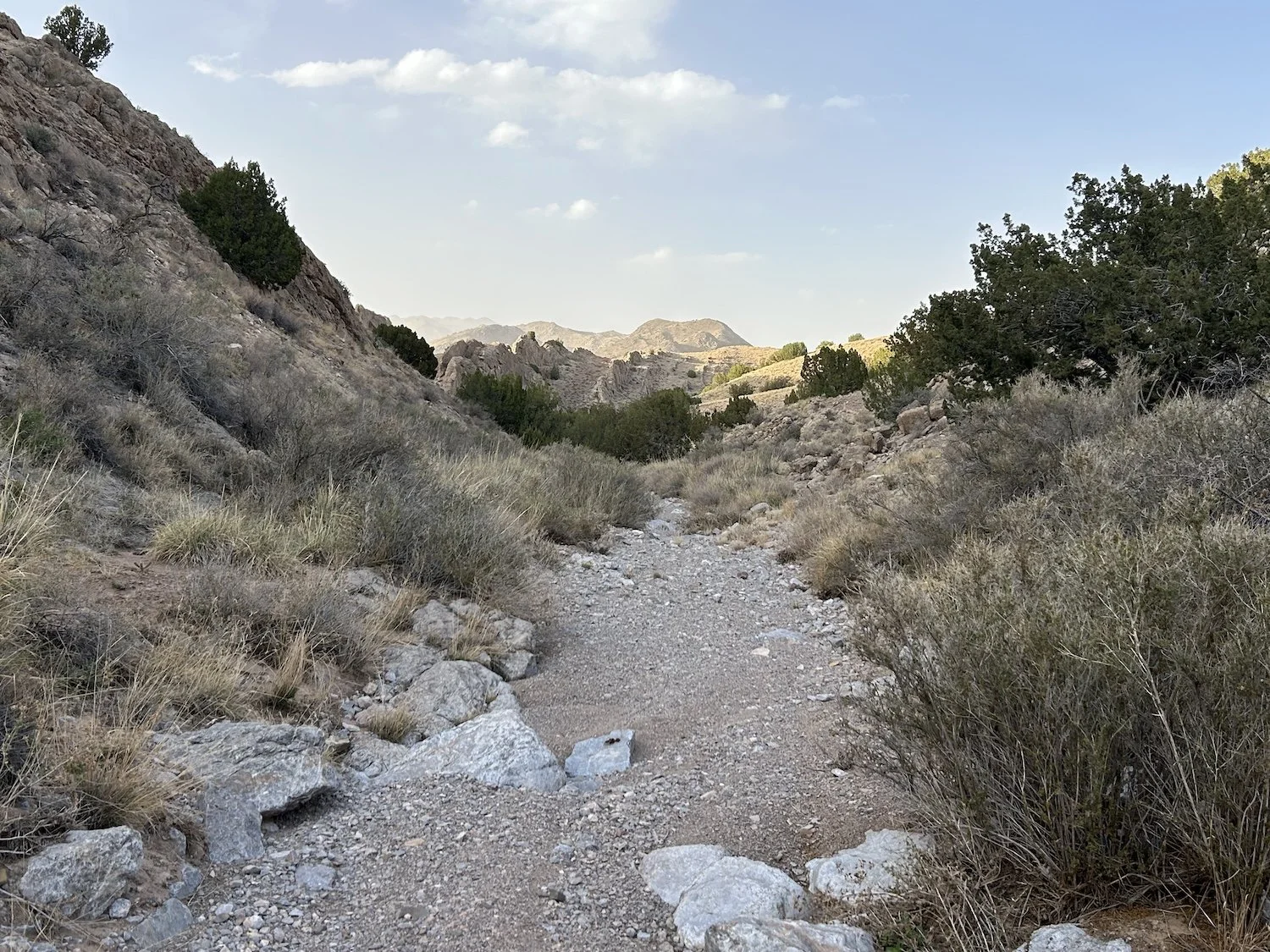
Approaching Abo Arroyo
And then I saw the awful mat of algae coating the stream in Abo Arroyo and gagged. Disappointment and resignation settled heavily over me. I walked a bit further in the canyon to see if conditions improved, but they did not and it was getting dark. I knew I needed to call it day, but what a demoralizing note to end on.
I set my tent up on the bank of the creek, noting that even the air in the canyon smelled sulfurous, cooked dinner with putrid water, and fell asleep to the sound of trains roaring by, not fifty feet above me.
Like I said, this was a hard day, but conditions improved markedly in the days to come.
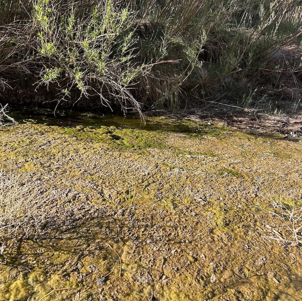
Scum, not water, in Abo Canyon