
The Teton Crest Trail
The descent into Alaska Basin on the Teton Crest Trail41 miles // 9,800ft+ // 2 days & 1 night
Northbound: Phillips Canyon TH to String Lake TH
Logan on Phillips PassLogan and I woke in the dark the morning of September 19; I crawled my way out of the truck-bed, sliding awkwardly off our 4” foam mattress supported only by the hard wooden platform of drawers below. I unfolded myself gingerly, and waited until I was fully upright, facing away from the truck, before clicking on the red light of my headlamp.
After taking care of some personal chores, I boiled water for coffee and oatmeal and waited for Logan to rise.

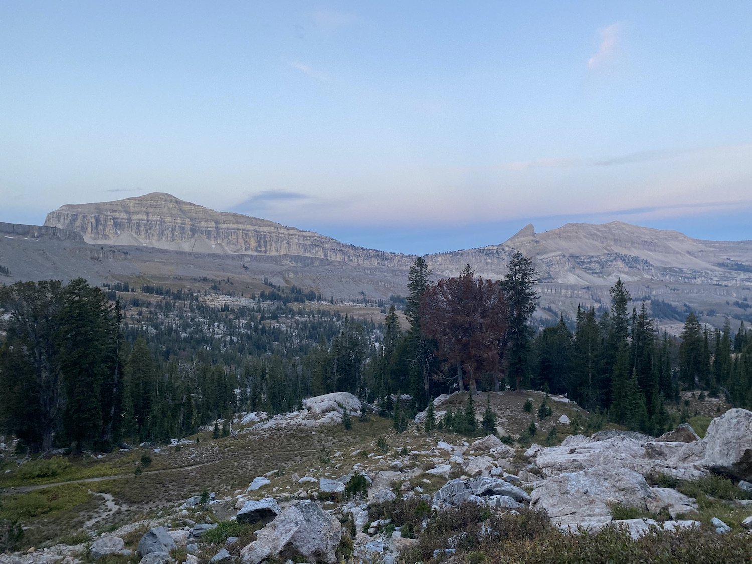
Beyond Phillips Pass, there is another climb, surpriseThe morning air was chilly, the stars still shone, and I was sore from a weekend of running.
Logan and I competed in Big Sky, MT, at Run the Rut, both of us participating in the VK and the 28K trail races for a combined vertical gain of 9,400ft in fewer than 20 miles. I had also run a trail in the Tetons yesterday to see Amphitheater and Surprise Lakes, while Logan had scrambled straight up Teewinot, the 6th highest peak in the Tetons.
We were feeling it, so to speak.
But there was the undeniable allure of hiking the length of the Tetons, to observe them from all angles, to stand in their shadows and gaze up at them with awe—we couldn’t resist.
The morning we were set to begin our hike of the Teton Crest Trail, we dressed, packed our packs, cleared out our site at Gros Ventre Campground, and then drove over to String Lake and Leigh Lake Trailhead to park my truck. At 7AM on the dot our shuttle from Teton Mountain Taxi pulled up behind my Tacoma. We threw our packs and trekking poles into the back and piled inside.
Our driver lived in Sumatra most of the time with his wife and kid, he was a surfer, and he only came to Jackson to drive because the pay was good. He was nice and didn’t ask any questions when Logan handed him a wad of $1 bills as a tip (from his 2nd place, thousand $1 winnings at the Rut).
Day 1: 19.62mi // +5436ft // Phillips Ridge TH to Alaska Basin
https://www.strava.com/activities/9889252933
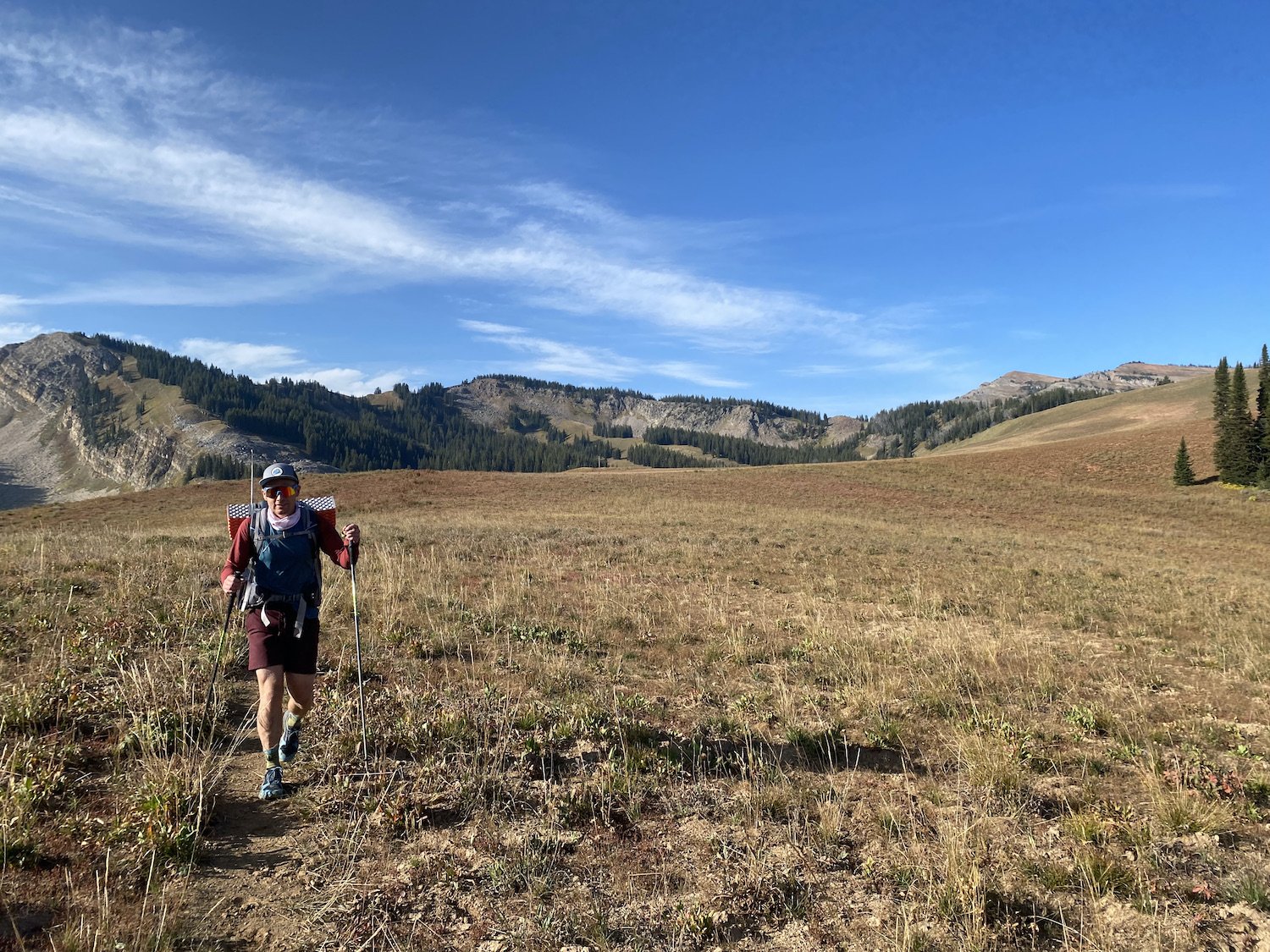
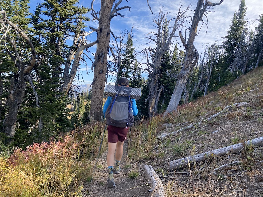
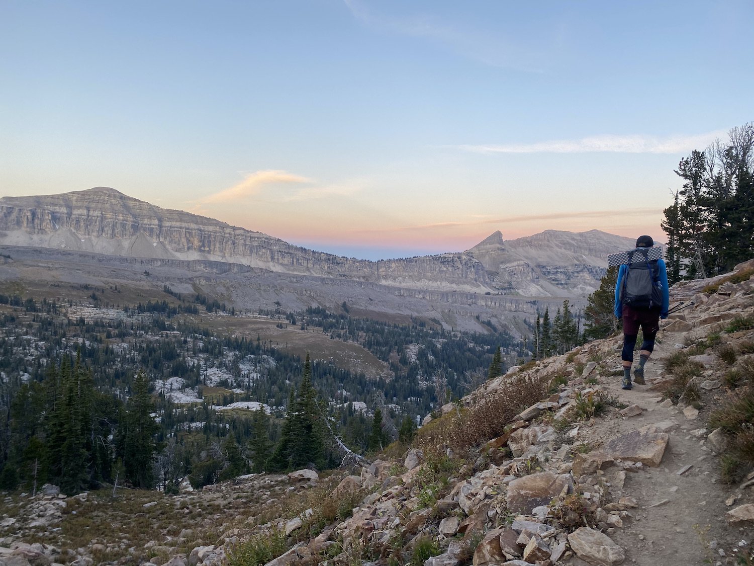
Logan on the climb to an unnamed Pass before Marion LakeWhen we first began walking, I worried silently over how tired I felt; backpacking was my thing, it’s what I loved most, and yet, my body was telling a different story. As we hiked up Phillips Ridge on a trail as wide as a highway, I fantasized about stretching out on a warm sandy beach with a good book and nothing to do but read and sleep.
I was grateful though, that Logan had retained enthusiasm for this particular adventure, that he found and booked the shuttle, and made it clear he really did want to go, leaving me with the simple job of organizing our gear and making sure we had everything we needed for 2 days of walking.
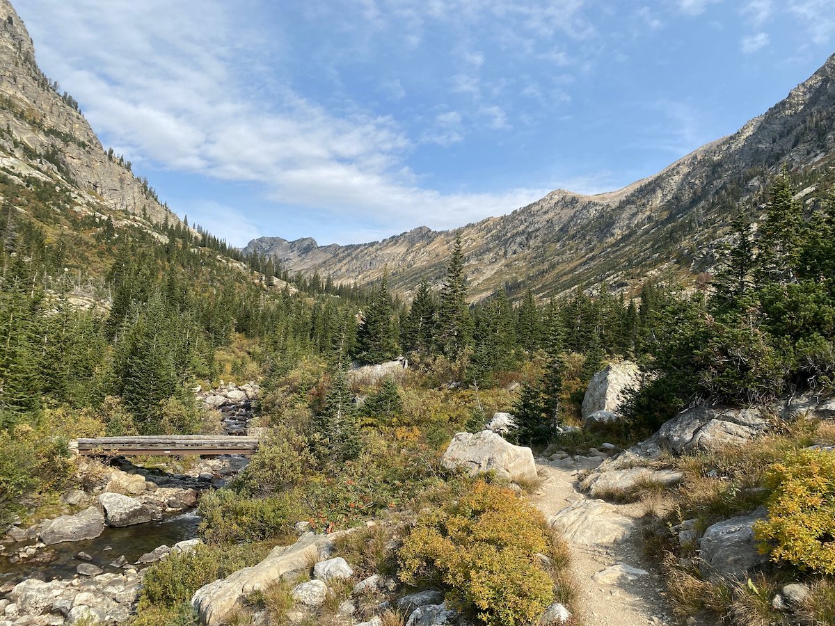
The longer we walked the narrower the trail became, and upon reaching Phillips Pass, the views began in earnest. At one point we looked uphill, to our right, and saw a medium-sized black bear running not far above us. I called, “hey-yo”, for absolutely no reason at all, considering it definitely was aware of us.
Logan laughed, “Did you see his face? I swear he looked at you like, ‘Seriously?’”
I cackled nervously in response. I wasn’t sure what it was, but I felt anxious about bears—I didn’t usually—something in the air just had me a bit on edge.
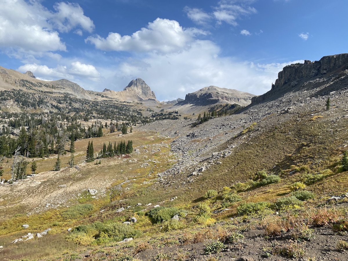
We arrived at Marion Lake, 6.4 miles beyond Phillips Pass and about 11 miles into our day in total, and decided to break for lunch. As we rolled up tortillas of salami and cheese, we watched a community of Pika dash to and fro across the scree-field next door. They eep-ed at us boldly from atop the rocks and then dashed out of sight, back into the safety of their talus kingdom.
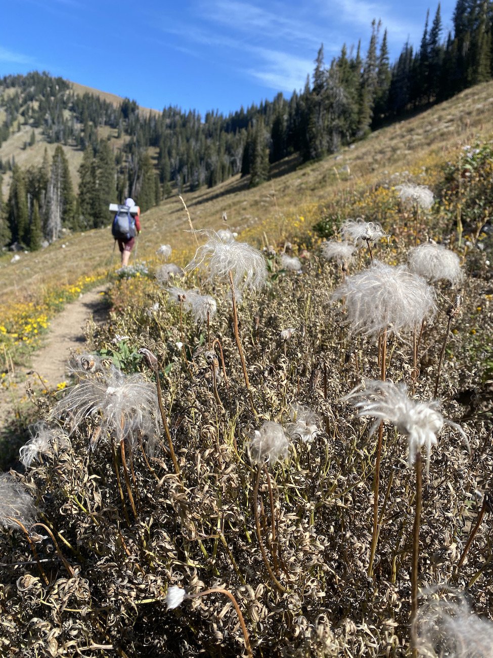
After Marion Lake, we began to encounter other hikers—the trail had been devoid of humans thus far—and we passed several groups (all men, I counted 12 guys in total) as we walked along the Death Canyon Shelf.

Looking back at Marion Lake from the climb up Fox Creek Pass
Almost to the top of the PassWe marveled at the expansive vista stretching out before us; fat marmots lumped their way across the tundra and whistled alarm calls from atop massive boulders, their copper and black coats shining in the sun.

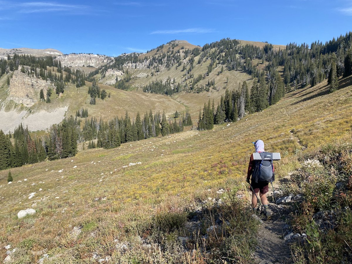
Logan on the approach to Death Canyon ShelfWhile we rested in the pooling shade of a tree-well, Logan asked me what my favorite part of the trail was so far. I sat in the dirt, leaning against the expansive root system and considered that even though we had only covered about 15 miles, Death Canyon Shelf might be hard to beat.
The views were incredible. Stark granite cliffs towered to our left, forming an impressive wall of stone pillars splattered with neon lichen and striped with black; to our right yawned a vast chasm careening steeply down and out of sight.
When I closed my eyes, I saw a color palette of pastels—lilac, pale yellow, shades of dusty gold and powder pink—all of which were edged in steel.

View into Death Canyon from the shelfThe feel of the place was exposed and unforgiving, and yet, the Whistle Pigs seemed happy enough to call it home, so I decided it was probably just fine (pending weather).
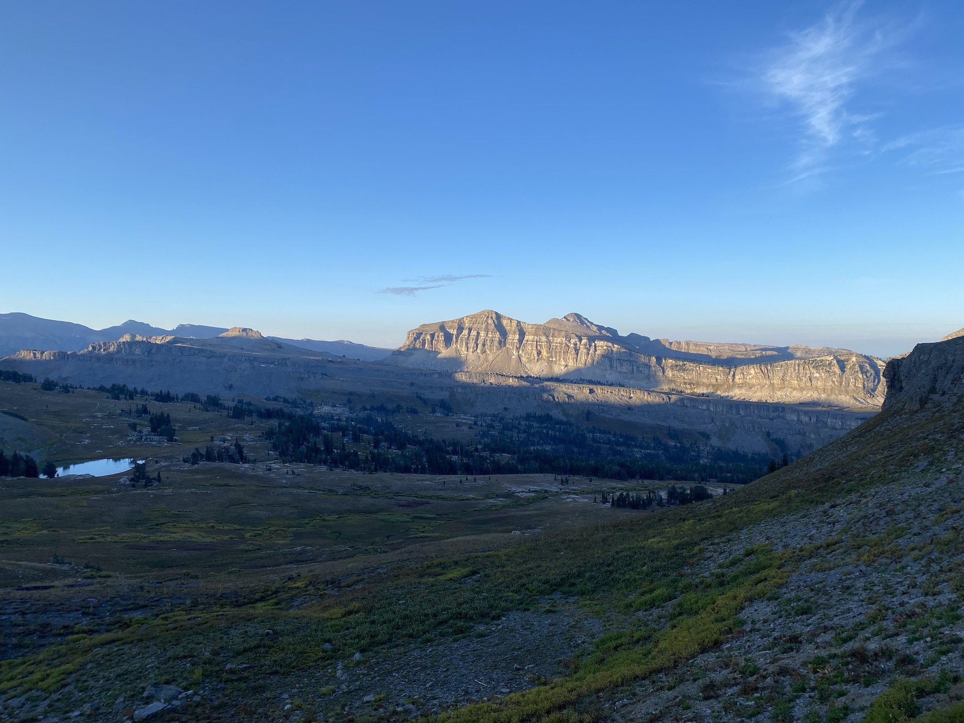
We kept walking. After clearing our final pass of the day over Mount Meek’s shoulder, we began our descent into Alaska Basin. Alaska Basin was outside the National Park, in Targhee National Forest’s Jedediah Smith Wilderness Area, therefore we did not need permits to camp for the night. Considering we had already walked 19.5 miles and climbed over 5,000ft, that was exactly our plan.

Looking back along the Death Canyon Shelf
Final stretch along the shelf, you can see the Grand Teton in the distance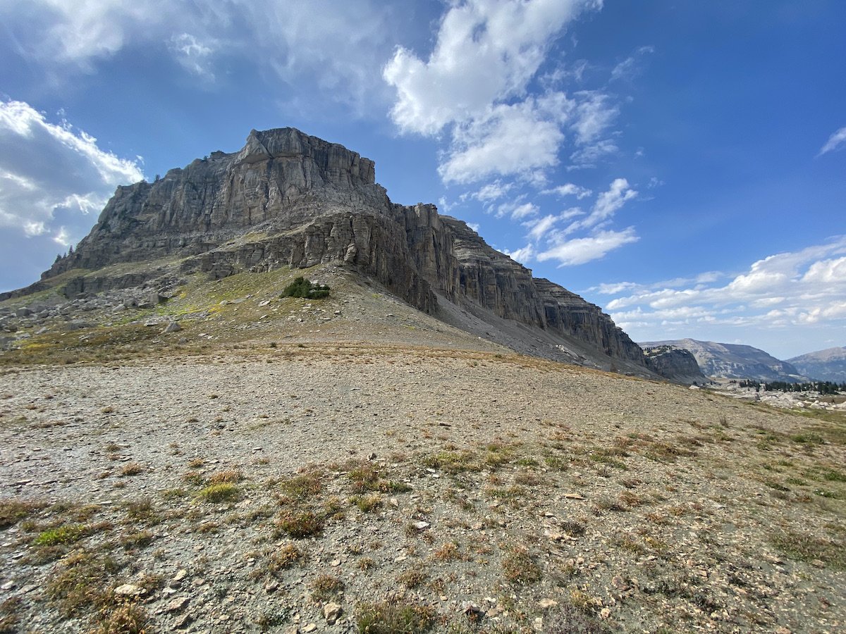
View of Mt. Meek from the Pass, prior to our descent into Alaska BasinWe took care in selecting the perfect site, going a ways off trail to find something flat and wind protected. In the end it was the perfect spot—until I became gripped with a distinct paranoia that we were going to be attacked by a bear.
The descent into Alaska Basin (1)
Descent into Alaska Basin (2)Logan fell asleep quickly, but I drifted in and out fitfully, bolting up right every half hour, gasping, my eyes searching for a pair of unfriendly eyes and sharp teeth in the dark.
I woke Logan each time with my raucous but I, of course, had earplugs in, so when he asked if I was okay, I never heard him and I would just lay back down as if nothing had happened—I’m insane, I know, why where earplugs if I am so afraid of a bear sneaking up on me?

Our humble abode, cozy but not exactly bear-proof; The Two, by G.G.I couldn’t stop picturing scenes from The Night of the Grizzlies, in Glacier National Park. I had listened to two podcast retellings of the nightmarish events—two women, eaten by two different bears on one night in the Park—and I pictured myself being ripped from the tent, over and over again. The slightest breeze had me jumping to attention.
I cannot fathom why I was so gripped; I had Logan with me, after all, and I’d spent many a night alone in bear country without any issues.
Eventually, I slept.
Re-hydrating Peak camp meals for dinner (which according to me, "taste like a restaurant"; Logan thought they were good, but not quite restaurant quality)Day 2: 21.45mi // +4439ft // Alaska Basin to String Lake TH
https://www.strava.com/activities/9889282288
Dawn breaking as we hiked up and way from camp in Alaska BasinI looked at my watch around 6AM and decided it was time for us to get moving. I gently shook Logan’s shoulder and whisper-shouted, “It’s 6AM! We’ve been in the tent for almost 12hrs!”
This was absolutely true. We’d crawled into our sleeping bags around 6:30PM and listened to a This American Life podcast for an hour, before I fell prey to bear-paranoia and Logan passed out. We needed the horizontal time, though, after so many adventures, we were wiped-out.
I threw on my headlamp and exited the tent to retrieve our food-bag. It was still dark but not overly cold, some thin cloud cover was providing a bit of insulation. I proceeded to boil water for oatmeal and instant coffee from the comfort of my sleeping bag.
Once we’d eaten and I caffeinated, we made quick work of packing up and hitting the trail.
The morning was beautiful, the sky was painted in delicate pinks, purples, and peaches; as alpenglow lit on the surrounding peaks one after another, it was easy to feel like we were getting a special show, one that most people missed sleeping-in.
View looking back at Sunset Lake from the climb up Hurricane PassAs we approached Sunset Lake the temperature dropped drastically and the wind picked up. We were freezing as we marched by other hikers still in the early stages of waking.
I paused to watch some ducks paddle around the lake and to take a photo, shivering against the chill, then I jogged to catch up with Logan.
Battleship Mountain cast in the perfect shade of one of the Tetons
The meandering climb up Hurricane Pass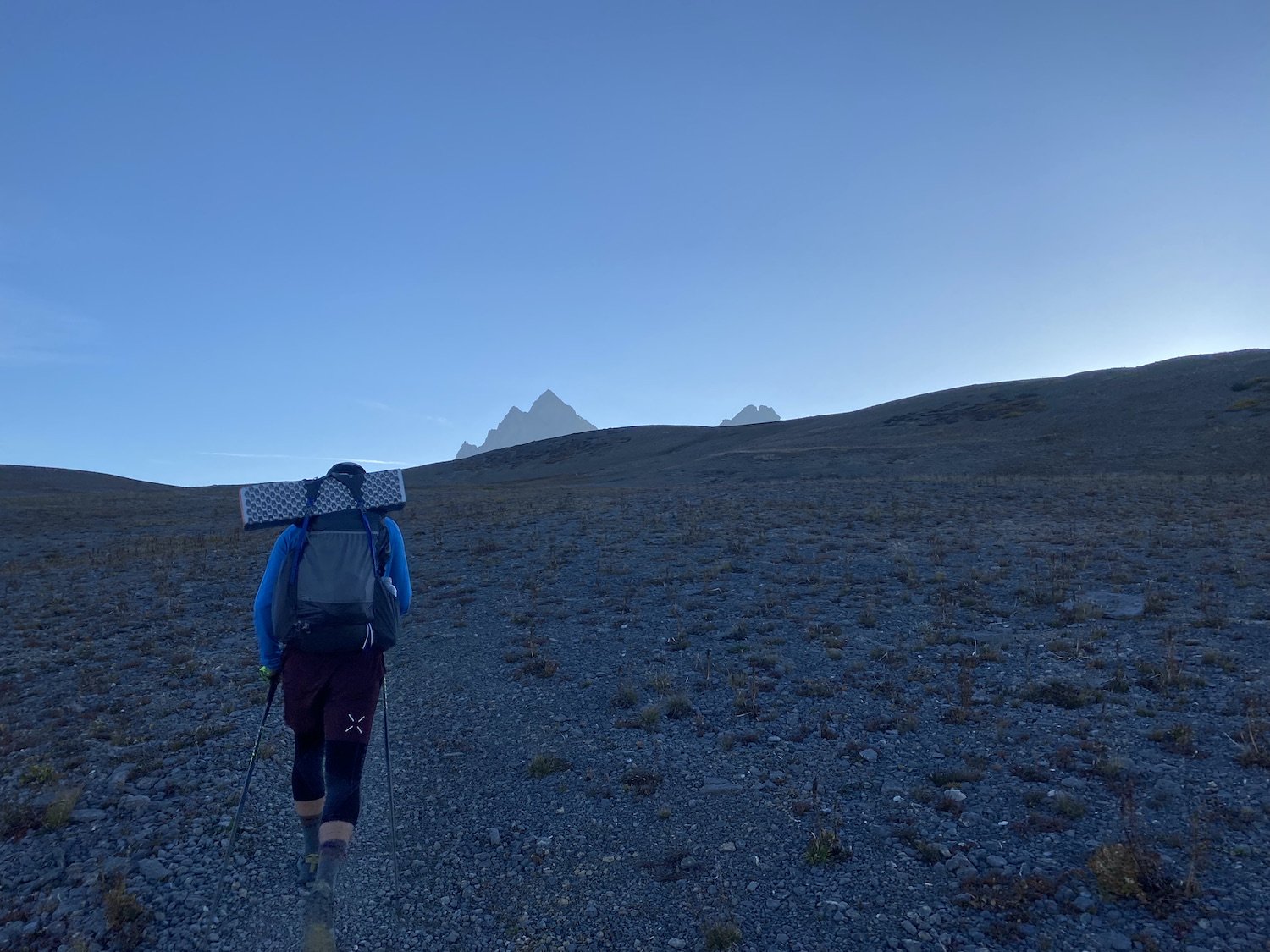
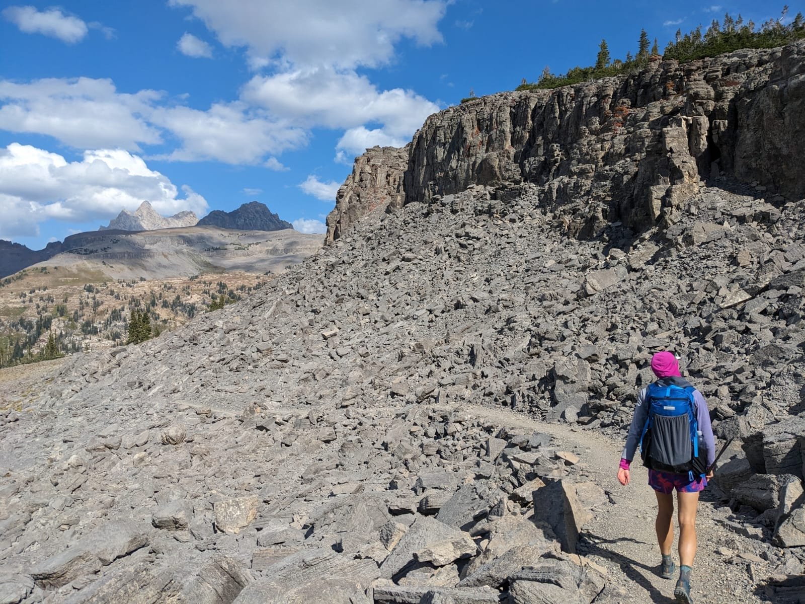
Approaching the top of the climbThe climb up Hurricane Pass took us all around and not at all in the direction I thought we were going to go. And we fought against the wind as we ascended, eager to reach sunnier slopes.
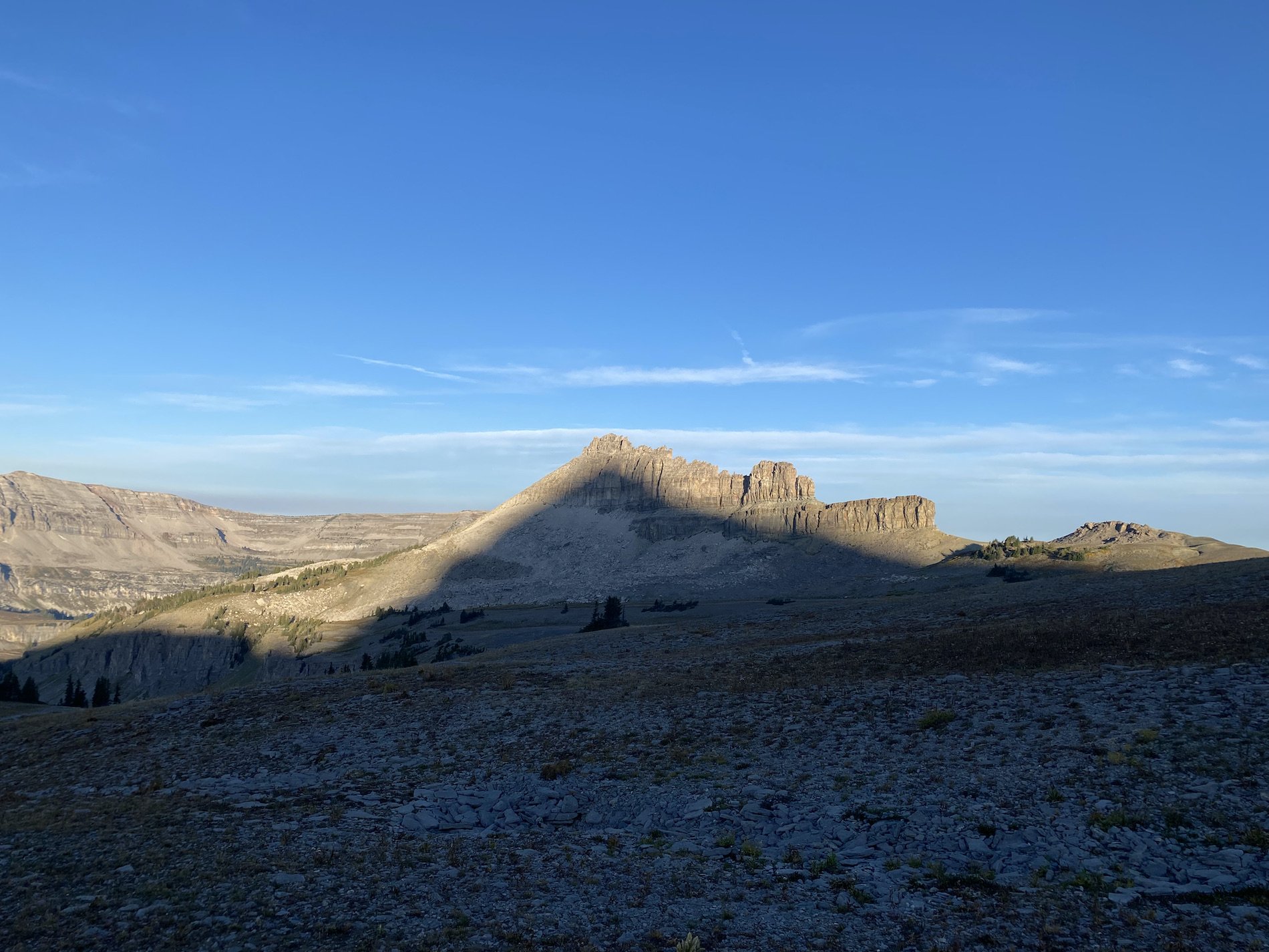
We passed by Battleship Mountain as the sun threw the shadow of another peak onto its hide—it really did look like a battleship, I noted.
When we finally reached the pass, the wind howled against our clothing, stealing every shred of warmth from our bodies, but we were standing on the sunnier side of the mountains now.


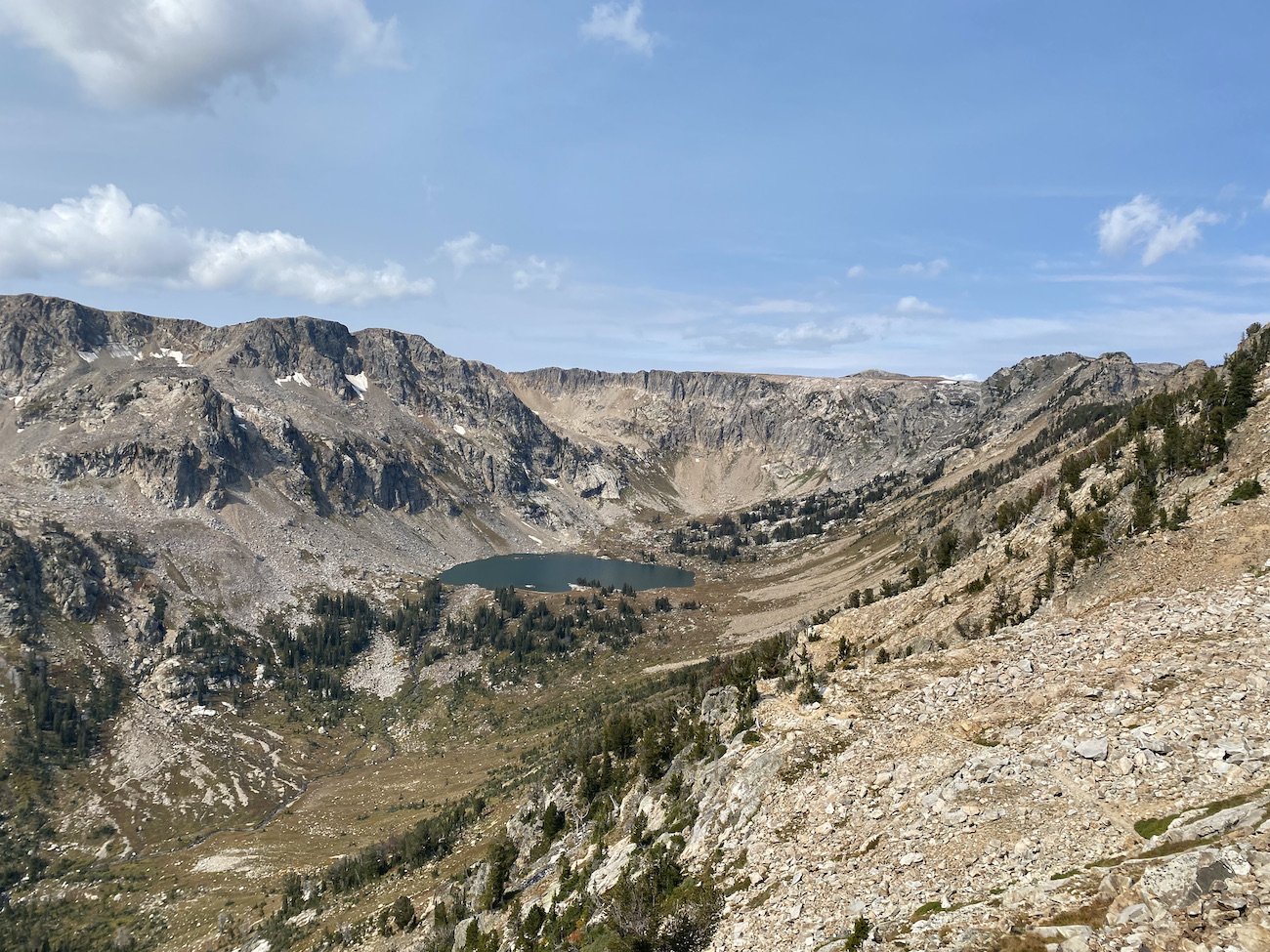
We descended to Schoolroom Glacier and admired how it was perched so delicately, so snuggly, on the side of Avalanche Divide, full of icy rifts and wrinkles; overall it was very small, which made us both a little sad.
Logan wondered aloud how long ago it was that the glacier reached all the way down to the impressive wall of moraine a hundreds of feet below. In place of ice, now a lake sat at its toe, filling the rocky bowl like a silvery pane of glass.
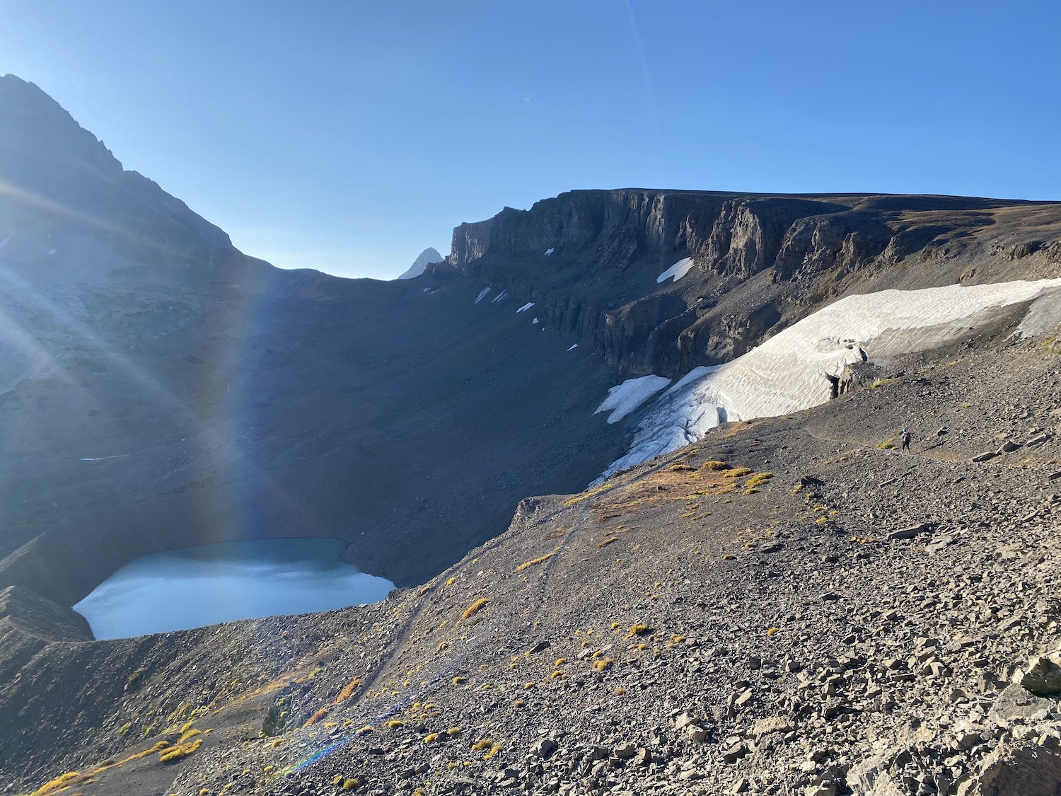
Schoolroom Glacier with a view of Avalanche DivideAs we continued our long descent, we spotted two baby bears as they fussed and cried on their decent down a steep rock wall; mom was surely waiting below, keenly aware of our presence.

Logan managed to get a picture of the bears!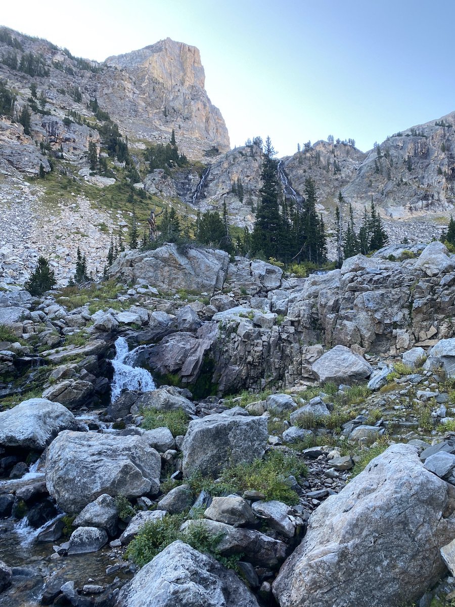
Descending along South Fork Cascade Creek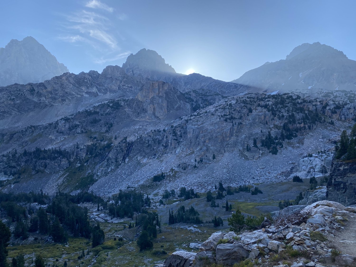
View of all 3 Tetons: The Grand, Middle, and South, respectivelyAnd just when the day began to warm, we started our long ascent up North Fork Cascade Creek, to Lake Solitude and Paintbrush Divide.
The hike up valley was stunning; the vegetation climbing the mountainsides had turned bright shades of red and orange. Autumn had arrived in the Tetons, in all its burnt toned glory.
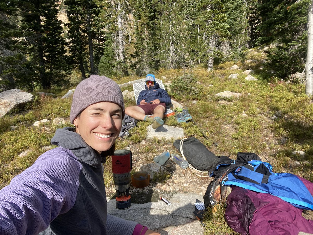
I could feel tiredness creep over me though the climb was gentle to start, I asked Logan about taking a break once we reached Solitude Lake and he agreed to the idea happily.
The National Park Service builds the best bridges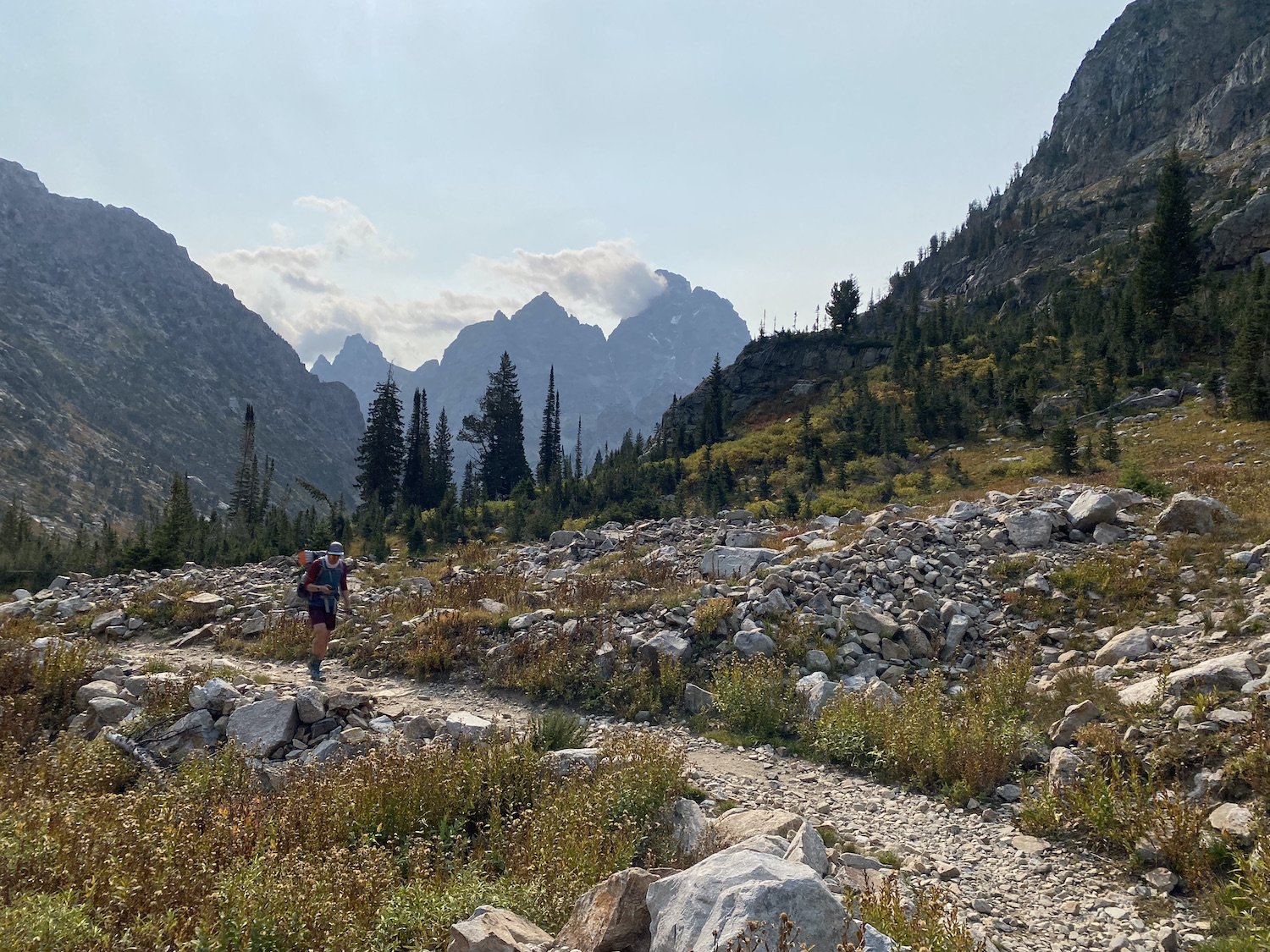
View of the Grand along the North Fork Cascade When we reached the lake, we slipped out of our packs and set about doing various personal chores. The water in the lake was a cold-looking, steely blue, surrounded by a cirque of sharp, grey and white, peaks.
I ate some goldfish and gummy bears—the perfect snack—and closed my eyes, leaning against a giant boulder. We had about 11 miles left and just one more pass before the conclusion of this adventure.
I felt grateful that my feet were holding up, that Logan and I were able to do something like this together, and for all the wildlife sightings we’d been granted.
View of Solitude Lake from the climb up Paintbrush DivideThe climb up Paintbrush was a doozy. When we started climbing, I swear we walked a mile on a single switch-back, when it finally did switch back, as any switch back should, Logan called out to me over his shoulder.
“I think we are almost there!”
I pulled out my phone and consulted Gaia. I wanted him to be right, but something didn’t add up. I had a feeling we had several more switchbacks and a ridge walk yet to go.
“I think it’s a false summit!” I shouted over the wind.
“No way,” Logan said with a laugh. “We’ve been climbing forever!”
“I don’t want to be right, but I just have a feeling.” I said, picking up the pace to catch him.

View of Mount Moran over Paintbrush DivideUnfortunately, I was right.
Upon gaining the ridge we had thought was a saddle, we saw a tiny figure far up and away, and knew that’s where we were headed too. At least the views were now utterly fantastic.
We kept climbing.
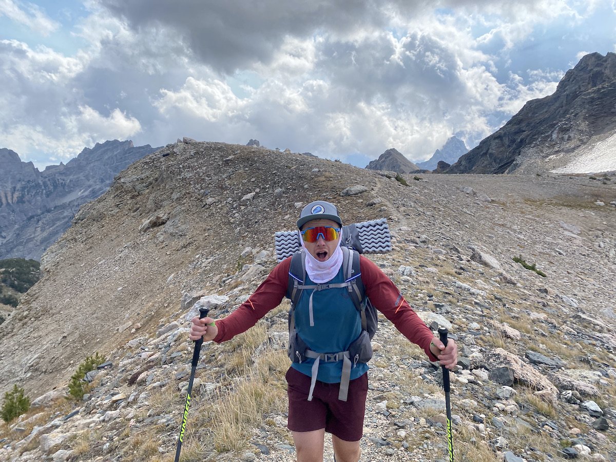
We frickin' made it! The excitement was palpable.The divide—when we finally reached it—was stunning; we could see Mt. Moran, The Grand, and many of the other Tetons as the clouds shifted about in the sky behind the austere, shattered-looking summits.
Based on the clouds, rain was coming, but all we had left to do was descend—for a long while—and then we were home free, so neither of us was too concerned. We took a lunch break out of the wind before hiking down.

Looking back along Paintbrush DivideWe encountered a group of 7 horseback riders on their way up trail; it was amazing to see the horses climb over the rocky footing without missing a step, and quickly too. The man leading the group jokingly asked, “Are we getting close?”
“Depends where you are going,” I smiled.
Logan and I continued on, chatting and making plans for the rest of our day. It was about 1PM at that point and it had finally started to rain. We paused in our power-hike to throw on raincoats and grab a quick snack.

The clouds parted momentarily, gifting us a golden view back up valleyThe rest of the hike out was beautiful and smooth. The trail mercifully turned from rock to dirt, and as we reached String Lake—a body of water narrow as a river, very string-like, I decided—I appreciated it’s brilliant turquoise hue.
I was tired, to be certain, but I made sure to bask in the glow of all we had seen and experienced on our walk through these truly mind-bending mountains.
Only then did I let my mind drift to pizza.

The descent to String Lake Trailhead with a view of Jackson LakeReaching the truck just as the rain and wind doubled down was a relief.
We chucked our packs in the bed and contemplated our next move. We were both dying for a shower at this point; it had been 7 days without for both of us—since before The Rut—and we definitely needed to make bathing a priority.
We grabbed pizza in town first, and then made a bee-line for Astoria Hot Springs just outside of Jackson, it was the perfect spot—clean showers, excellent pools for soaking, friendly staff—what more could two tired adventurers want?

Exhaustion.