
The Collegiate Loop
164 miles // 36,709ft // 3d 23h 21m
https://www.strava.com/activities/9785373410
Sweeping Takes on the Collegiate Loop
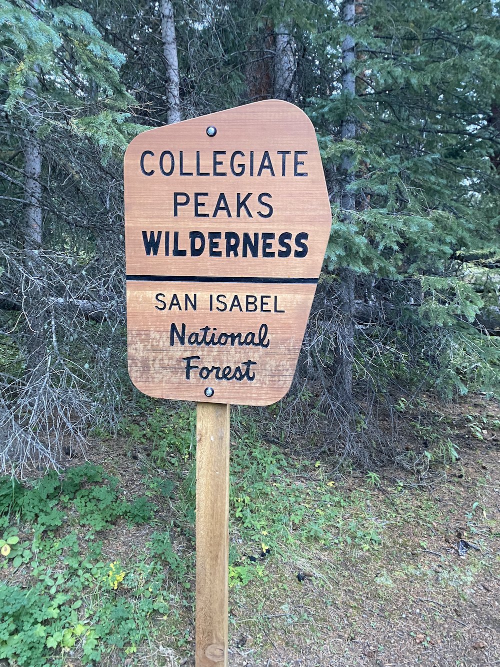
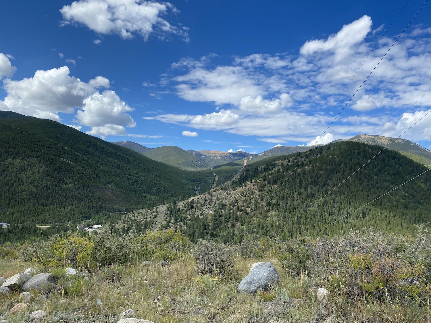
The Collegiate Loop is an epic, 164 mile route with nearly 37,000ft of elevation gain (and loss) that runs all around and through out the Collegiate Peaks area, in the Sawatch Mountain Range, located in Central Colorado. The Loop combines the Collegiate East route (part of the Colorado Trail) and the Collegiate West route (part of the Continental Divide Trail).
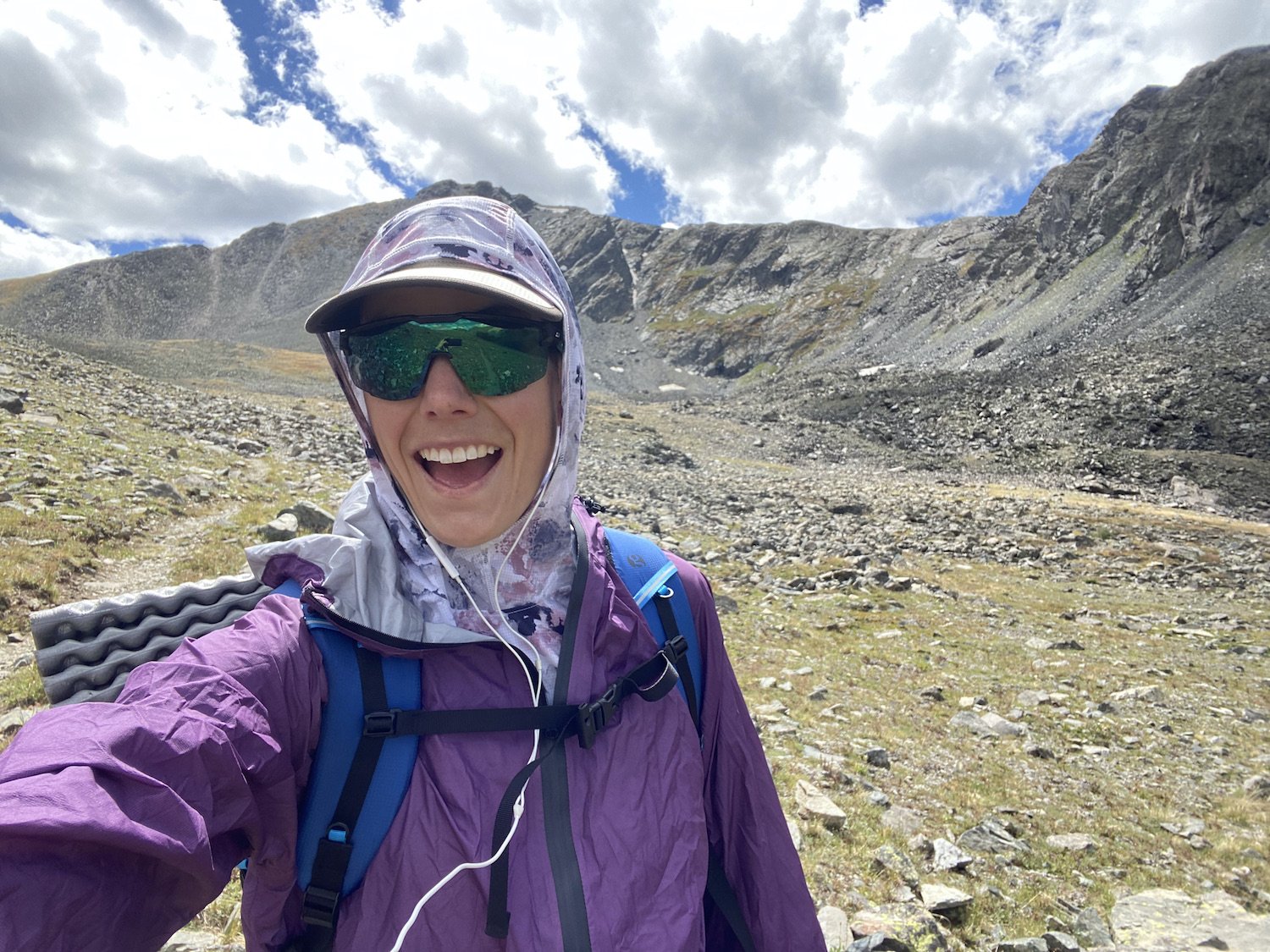
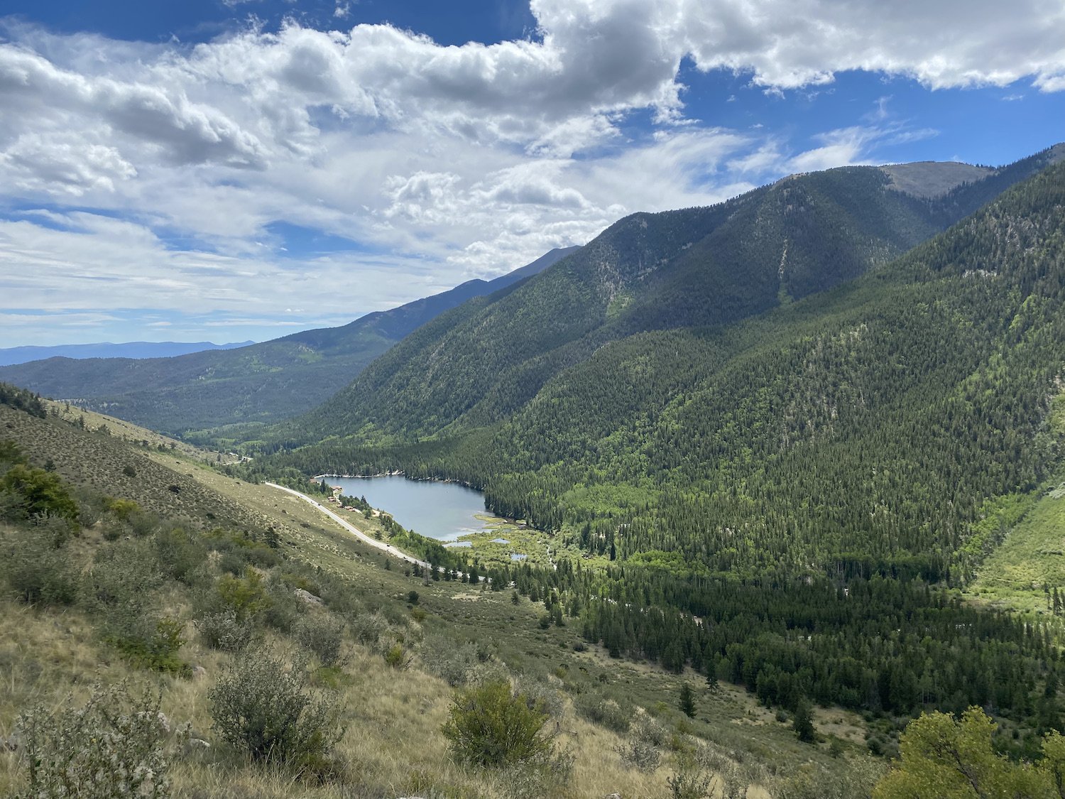
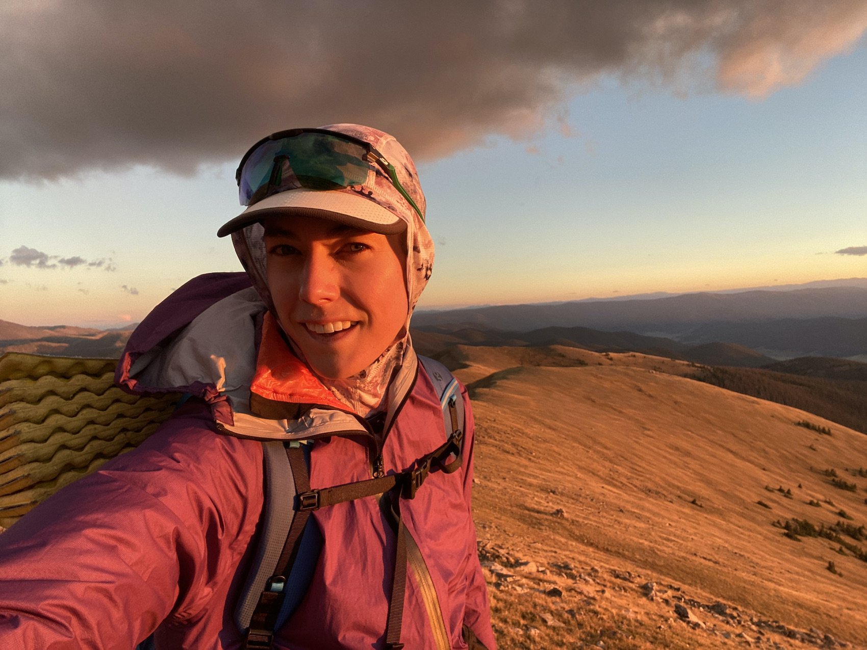
Many hikers begin and end their journeys at Twin Lakes, the northernmost point of the route, but I chose to start and end on Cottonwood Pass, as that is closer to where I live in Crested Butte and my partner, Logan, was able to shuttle me to and from.
I hiked clockwise from Cottonwood, beginning with the northern portion of the Collegiate West track, hitting Twin Lakes, then hiking south along the Collegiate East track until it met back up with the West at it’s southernmost point on the Monarch Crest Trail, from there I hiked north, finishing out the West track back to Cottonwood.
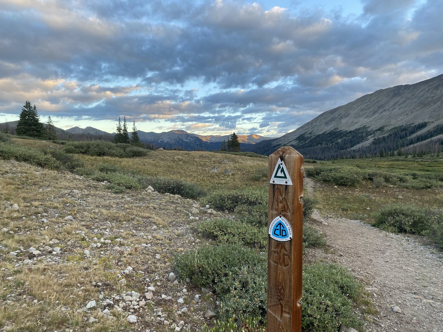
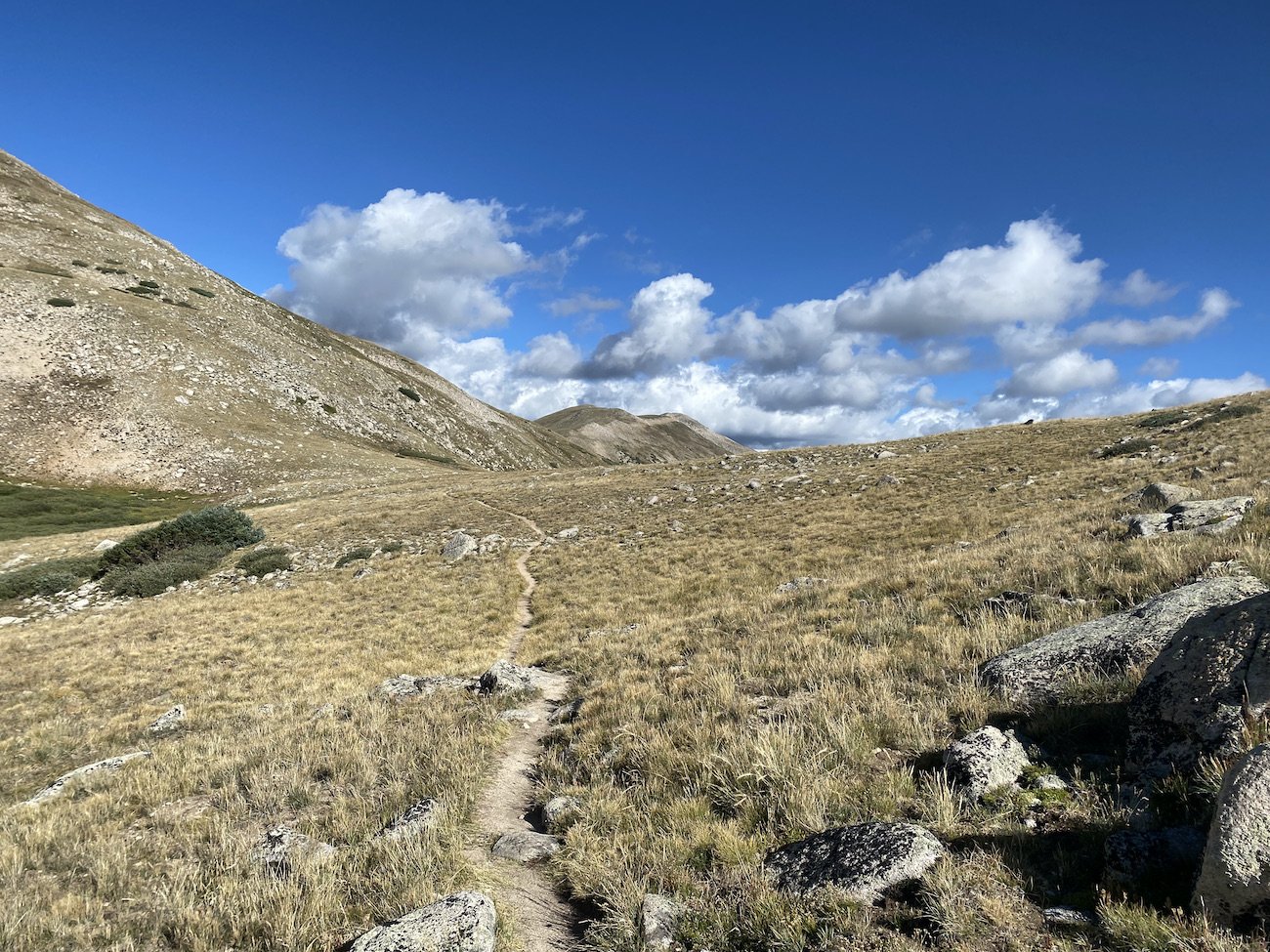
My favorite parts of the loop are also some of the most physically demanding, and all of them can be found on the Collegiate West track: Lake Ann Pass, Chalk Creek Pass, the area around Mt. Helmers, and of course, the 16 mile high alpine walk along the Continental Divide just south of Cottonwood Pass.
I found the Collegiate East track to be mentally tough; there is plenty of climbing and descending to be had, minus the incredible alpine walks & magnificent views on the Western track. I had never hiked it before and found myself working hard to stay mentally positive. I had my lowest lows on this portion of the loop, and the mileage still before me felt a bit soul-crushing.
I only listened to about 2-3hrs of audio per day, but only on 3 of the days I was hiking; it was a mixture of music and podcasts. Otherwise I listened to myself breathing, coughing, and a strange soundtrack entirely invented by my tired brain of children playing and screaming at the beach, above the crashing waves. I heard them clear as day and I just accepted they were real, until I really thought about it, that is.
Beginning on the afternoon of my second full day, I started seeing things out of the corner of my eye which caused me to jump; a stick snapped at my ankle and my heart dropped because I didn’t see a stick, I saw a snake. A Flicker in a tree burst into flapping directly above me as I hiked one night and I thought something was scrabbling on the top of my pack trying to reach my head.
Boulders looked like ultralight tents in the dark, and I shielded my headlamp from beaming at them, until I walked by and realized they weren’t shelters pitched inappropriately right on the trail, they were just rocks.
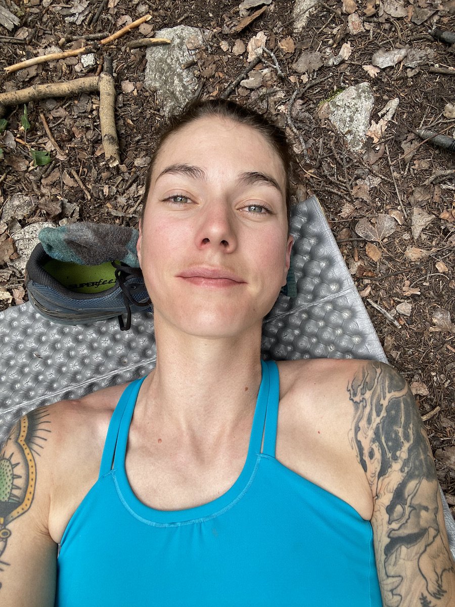
I was exhausted, and my feet hurt so badly from day 2 all the way until the end, I thought I might puke when I stumbled on rocks. I ate even when my lips were so chapped I couldn’t open my mouth wider than the circumference of a quarter, breaking that awful callus over and over again with each bite.
Most people take around 10-14 days to hike to loop and average about 11-16miles a day. I chose to test my mettle and hike just over 40 miles a day, completing the route in 4 days. I needed to know what I was capable of and now I think I know—it’s more than I thought.
On that note, though, I strongly encourage you to check out the Fastest Known Time for some really incredible times on this route. Courtney Dauwalter completed the route Supported in a time of 1d 16h 14m 20s in 2022, and just this year, Maggie Guterl hiked it Unsupported in 3d 5h 10m 50s. Inconceivable. Amazing. Inspiring. Wow.
This was the first time I ever tried to hike something this fast or this continuously, and I can see where there is massive room for improvement in the way I take breaks, the way I fuel, the way I “camp”, and move over different types of terrain. I am excited to be learning and to be on this journey.

Day 1: 50.72mi +11,397ft (5:54PM on 8/31/23 through 8:15PM on 9/1/23)

My first day on trail lasted about 27hrs, over which time I covered 50 miles and slept for about 4.5hrs. Logan dropped me off on Cottonwood pass the evening of August 31st and I began walking north at 5:54PM. My trip started off with a long descent to Texas Creek and a terrifying moose encounter.
I crossed Texas Creek and turned left to stay on the trail, paralleling the river. There was a steep hill to my right and suddenly there was also a pair of horse-sized haunches hauling away from me through the lodgepole pine forest. That was just the baby; Mama Moose was not happy, nor did she appear frightened, and she herself was much larger than your average horse.
I swear I have never been so terrified of a wild animal in my life. My heart thudded in my chest so hard I thought it was going to explode. I was staring death in the face from 15 feet away, waiting for her to decide if today was my day. I didn’t yell, I couldn’t. I didn’t flap my arms or try to seem scary. I wasn’t, I knew it, she knew it, and she was pissed.
I backed slowly down the trail the way I had come until I couldn’t see her or her calf. And then I just stood there and weakly called, “Hey-yo, hey mamma, hey-yo.” Trying to encourage them to move on so that I could too. There wasn’t away from me to circumnavigate them without seeming like a threat. I gave it a couple of minutes and then slowly walked along the trail, back towards them.
Her baby had moved further up the hill, who I studiously avoided looking at, but the Mama had barely given way. She loomed above me, her head as big as me was angled in my direction, watching. I couldn’t breath. I turned my face away from her instinctually and tiptoed across her line of vision, talking calmly, hand on my heart.

Her eyes never left me. And I have never been so acutely aware of my mortality save for those seconds I spent walking not 20 feet in front of an angry mother moose, out-weighing me by somewhere around 2,000lbs.
Night fell and I kept walking, adrenaline coursing through my veins. I covered 15 miles before making camp, chugging a chocolate recovery shake by NeverSecond (highly recommend, it tastes like ice cream, especially when mixed with the coconut milk creamer by Laird).
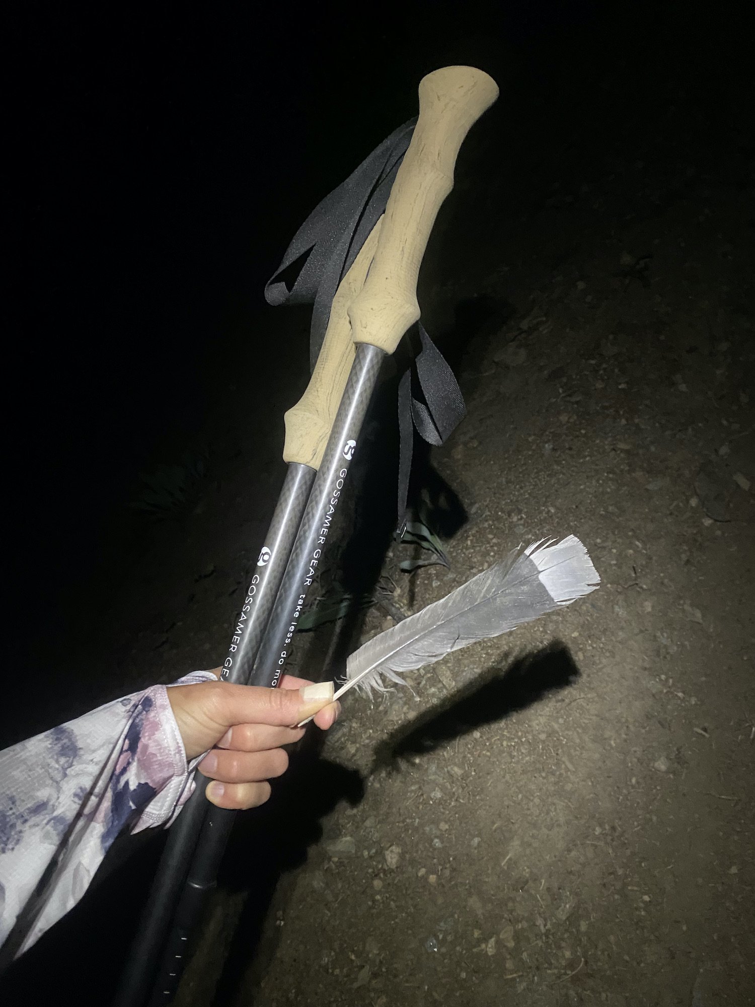
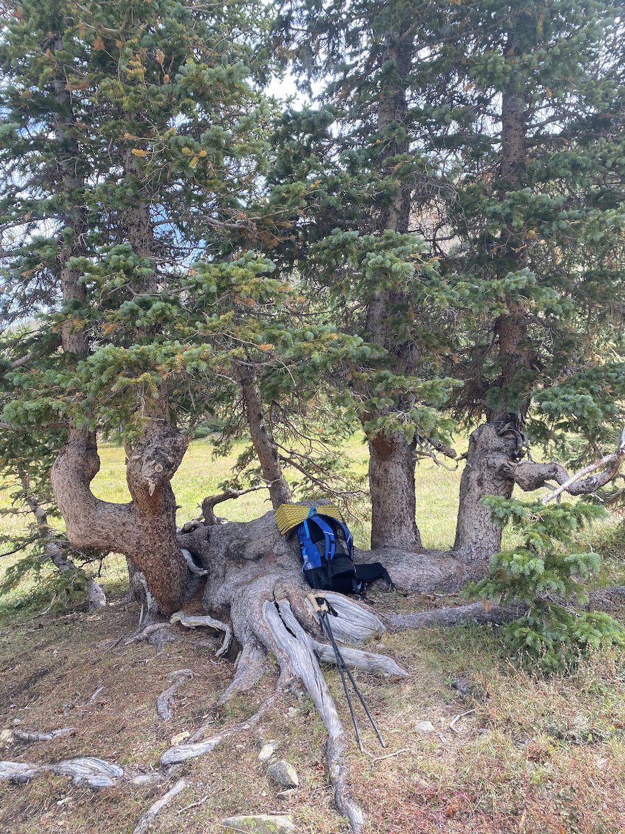
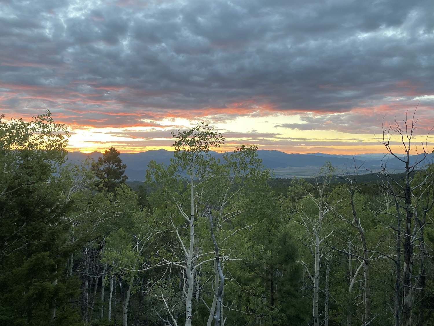
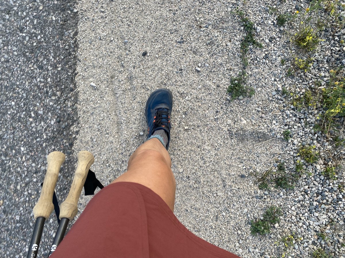
The moon rising over a ridge, one night after it was a full blue moon.My camp set up did include a tent: the Hexamid Solo by Zpacks, which only weighs about 10.8oz (without the bathtub) and sets up with one trekking pole; I hiked with the LT5 trekking poles by Gossamer Gear. I slept in the Enigma Quilt by Enlightened Equipment, carried a tiny camp pillow (old habits die hard, I just need that pillow), and slept on a Thermarest Z Lite SOL foam pad. The pack I carried was by Gossamer Gear, the G4-20, a 42L frameless pack. These were my big ticket items weight-wise, so I wanted to detail them, but I won’t bore you to death with gear talk any further.
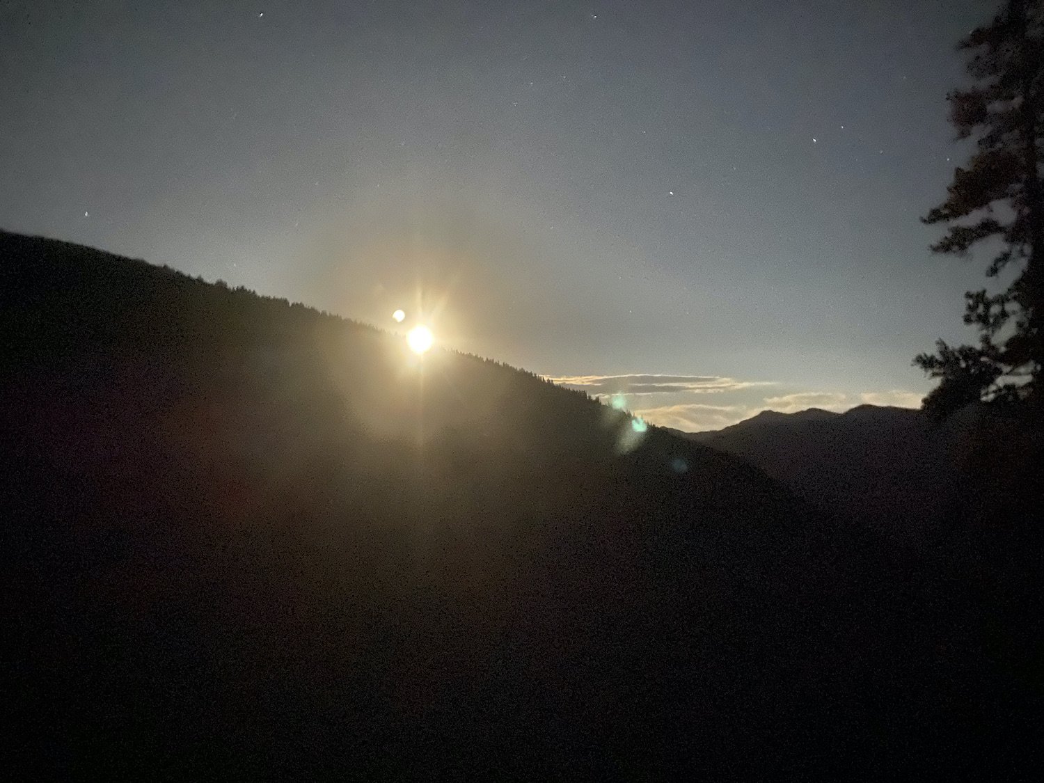
I slept from about 11:30PM until 4AM, at which point I packed up my simple camp and was walking again by 4:30. The moon was nearly full—it had been a blue moon the night before—it shone brightly above me, casting everything in ghostly shades of silver and grey.
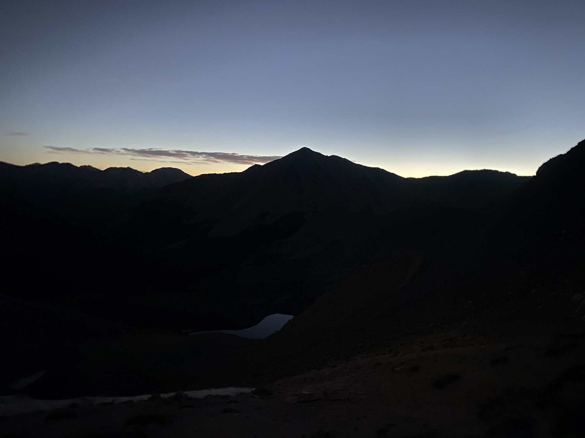
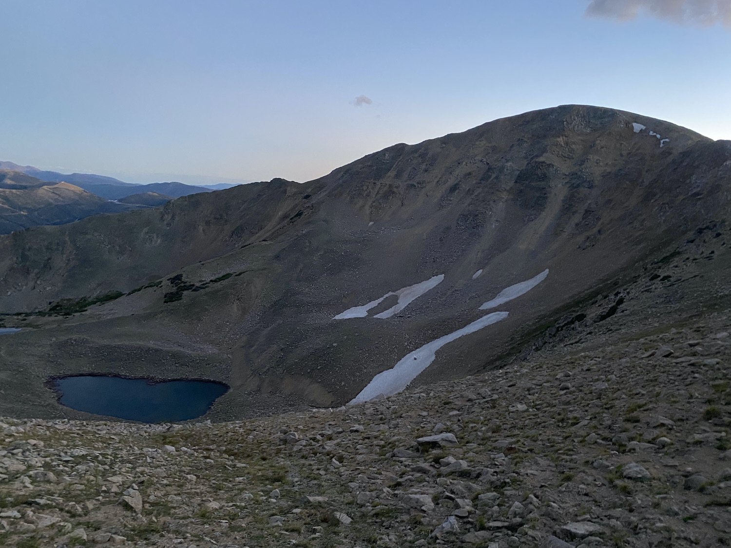
Pre-dawn on Lake Ann Pass.A fleeting shadow moved swiftly across the ground and surprised me; I jumped. It was a Raven, or the shape of one, as it winged through the night above the alpine slopes of Lake Ann Pass, where I stood, clutching my heart. I continued my ascent up the rocky moon scape until I reached the top of the pass. Bats flew against a sky shifting from indigo to pale yellow to peach, catching moths and tiny insects and tears pricked the corners of my eyes. This is why I am here—why I am alive! I thought to myself and smiled.
The lake was a shining mirror a thousand feet below me in the pre-dawn light. And as I descended I couldn’t help feeling I was right where I was supposed to be—crazy or not and perpetually walking a winding path—I’d landed in the right place.

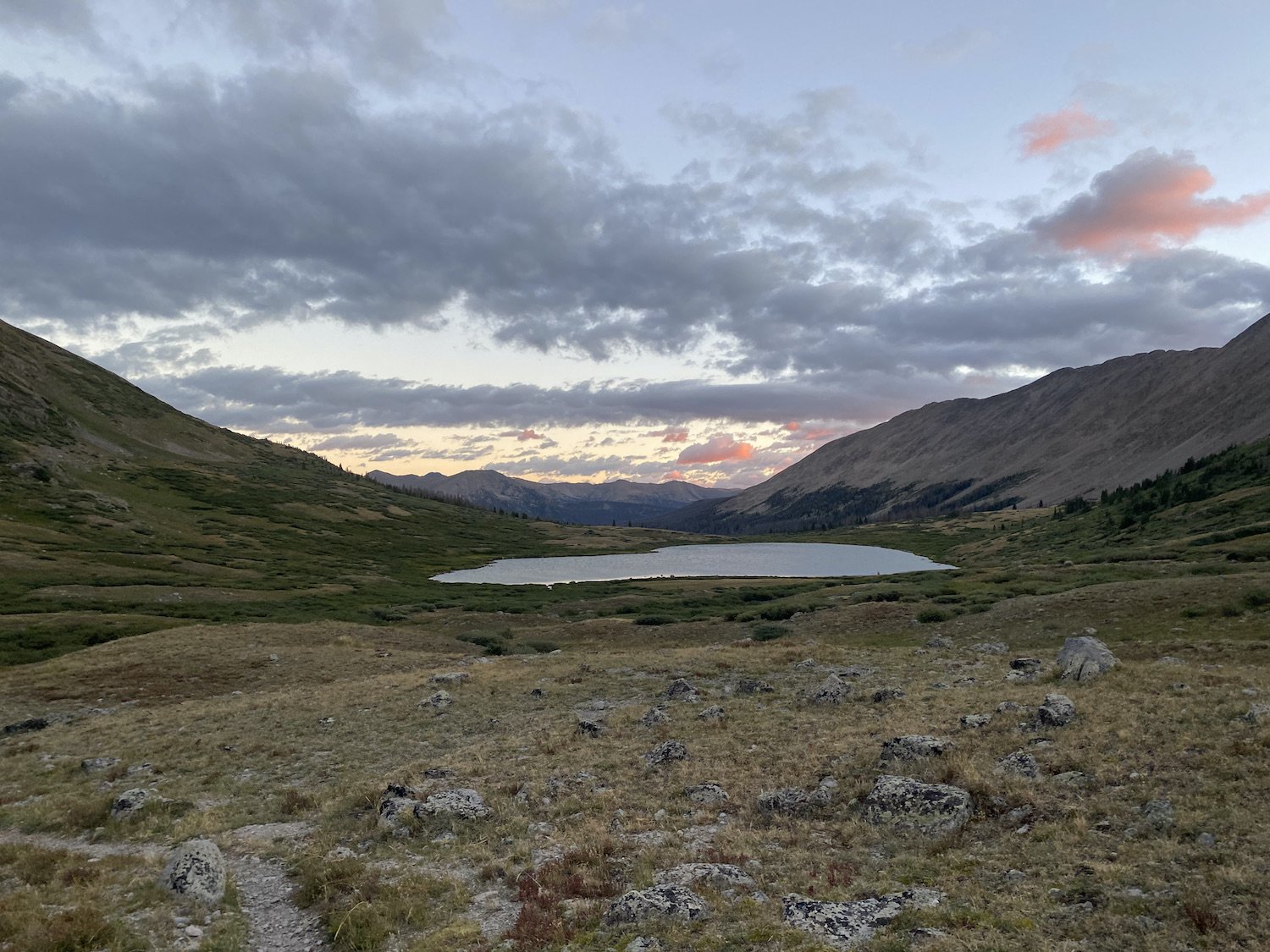
The rest of the morning unfolded like an Aster flower might, after a night with petals tightly bound against the cold. And then I began the climb to Hope Pass. I suffered. That climb is a big one, a seemingly endless one, and it was hot. I shoved snacks in my mouth, breathed like a train, chugged water and electrolytes, until I finally topped out under a big grey cloud.

I wouldn’t have even minded if it rained. My body temp dropped as I descended to Twin Lakes, though; I paused once to take a break on a chair-shaped cluster of trees (epic) and then later to dig a cat-hole and filter water.

I should mention, each “day” I drank anywhere from 4-6L depending on the distance and heat.
The walk around Twin Lakes was dull and hot. And the climb away from the lakes on the Collegiate East track was unexpectedly brutal and steep. The trail continued to pitch up and down until it descended to Clear Creek Campground, around mile 30 for the “day”—not including the 15 miles I’d hiked the night before.

I walked quickly through the campground until I reached the bridge over the creek. My brain had spiraled darkly in the last 3 miles—Was this effort going to make me hate hiking? Would I even want to go to New Zealand this winter after all this relentless walking? Would I still want to do the BMT really fast this fall? Was I being stupid? Why did I feel the need to be out here? What is even the point of me?—I am not even joking. I collapsed, hopeless, onto the grass next to the gurgling stream.
And then as I lay there in utter despair, I watched some of the cutest kids I’d ever seen exclaim over some cowgirls riding their horses in the creek. I actually smiled. One of the kids walked up to me and asked, “How are you?”
“I am good,” I smiled again.
“Look at my crystal! I found it in the river.”
“Wow, that is a huge crystal!” I studied the white quartz in her hand and realized this was about the highest level of conversation I could handle right now. I laughed.
I can do this, I thought to myself. I can climb this hill.
I set about doing my chores, filtering water, drinking a protein shake, cold-soaking ramen and instant potatoes for later, organizing my trash, prepping some snacks for my climb.
When I was ready, I threw on my pack, put in my earbuds and listened to my the playlist I created and downloaded for this hike specifically as I climbed 2,500ft up and over a ridge to camp. I had not listened to any music, audio books, or podcasts on any hike since the Appalachian Trail, until now. I had been rigid in abstaining from audio while hiking because I thought it made me more present, I still think it does in some respects, but on this day I decided to ditch rigidity and embrace flexibility. I was glad I did, too, because I practically danced up the trail.
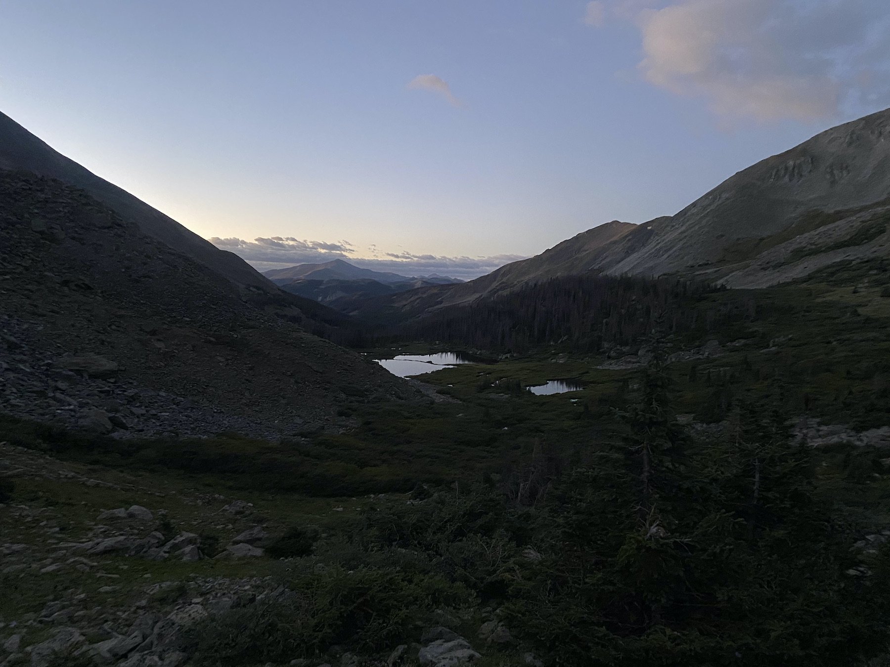
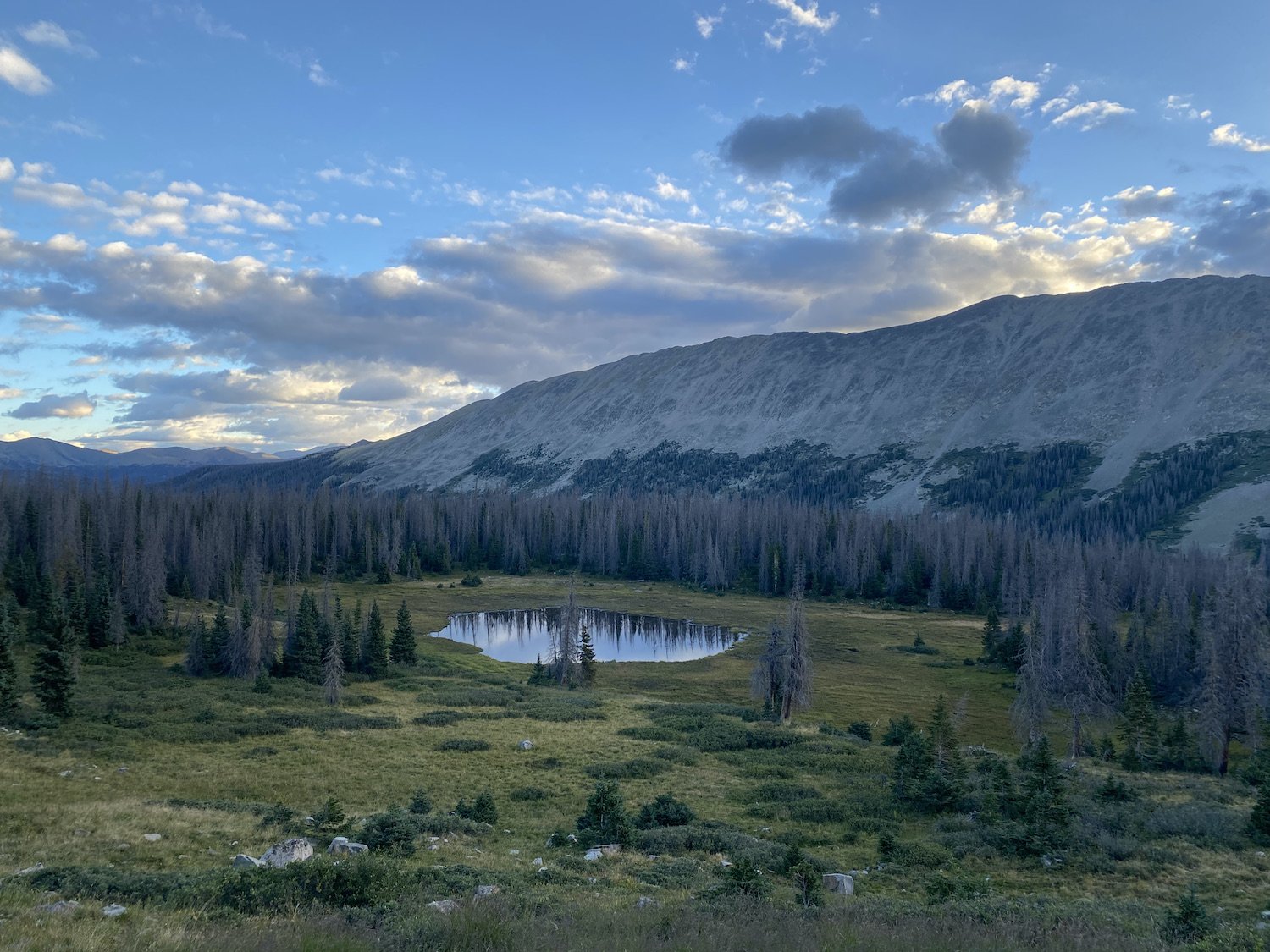
My day ended in the dark in a high valley that was beautiful, I imagine, but I never saw it in the light of day. The next morning I was walking again by 4AM.
Day 2: 41.57mi +8,531ft (4AM on 9/2/23 through 10:15PM on 9/2/23)
I had pitched my tent on the edge of a cliff, kind of, over looking a creek, and I had built myself a little fence so that if I stepped out to pee in the dark, I wouldn’t fall over the edge. I was very concerned, but once I laid down, I didn't get up again until I was ready to hike, so there was really no need to take such precautions.
While I was walking in the dark, climbing up and down nebulous and hilly terrain, I tried to imagine what things might look like in the daylight. But I honestly couldn’t build a clear picture in my mind. And then I became very convinced I was being stalked by a bear, for no legitimate reason whatsoever.
I called out into the night, “HEY-YO!” with as much aggression as I could muster, I clacked my carbon fiber trekking poles together every so often, and I panned my headlamp into the trees looking for eyes. Nothing.
The sun eventually rose, as it tends to, and I was still in one piece, walking. I hiked past several 14er access trail junctions, and then began the long climb up to Yale’s eastern ridge. Once upon a time I thought I might climb Yale’s peak, “if I had the energy”. I did not have the energy. Or the time.
I was quickly realizing in order to cover 40+ miles in a day, I needed to walk for between 16-18hrs. I tried to manage my breaks, to eat on the go, to filter water without taking my pack off, and to only take my shoes off once instead of three times over the course of a day. I was feeling really overwhelmed by the miles still ahead and the fatigue I was already feeling.

But as I marched up the switchbacks on Yale’s eastern flank, it also occurred to me that my overwhelm was a variable that I could control, I could choose how much energy I dedicated to worrying about the what-ifs. I could just focus on the mile I was walking, the problem in front of me, I didn't have to spiral. What a revelation.
I therapized myself into a state of calm. Anytime panic crept in, I told it “no, not right now, I have other things to do” like it was a person. I felt in my bones the truth of each step bringing me closer to my goal, and I believed I could keep walking no matter how much it hurt, and no matter how tired I got.
It was a roller coaster of establishing calm and losing it, over and over again. Of feeling on top of the world and strong, and taking a nosedive into the pits of despair. Of realizing it didn’t matter how many times I counted, divided, added or subtracted, the mileage was the mileage. I would make peace with the distance and climbs, then lose it.
In my lowest moments one of those beautiful hummingbird moths, a white-lined sphinx (Hyles lineata), flew into my lips and I was immediately awash with joy, like I’d been kissed by magic. Everything was light and airy and hopeful for a while.
And so it went, over Yale ridge and down the other side. I crossed Cottonwood highway east of the divide at noon that day, and met two other hikers near the trailhead. One of them chastised me for “rushing” and not “enjoying the journey”, which I found annoying if not mildly amusing, considering he was in the process of quitting the Colorado Trail to go to a resort. For all his talk of languishing in camp, “enjoying the experience”, it seemed to me he must not be enjoying his hike very much at all.
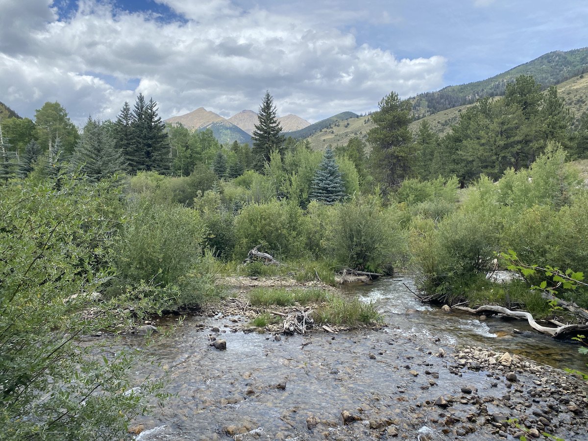
I power-hiked the next 7 miles to a beautiful creek with a white sandy bottom and kicked off my shoes. Stepping onto the sand in the cold water and rolling my feet around in it was borderline orgasmic, there is no appropriate way to describe the sensation. I lost control of my face and was glad no one was around besides some massive black ants to witness me.

I took a longer break at the creek than planned, but it was needed. The 6 or so mile road walk down to Mt. Princeton Hot Springs was particularly hard on my feet. Music saved me and kept my head in a good place.
As I marched through the small town, I saw a higher concentration of “No Tresspassing”, “ Private Property”, “You Are On Camera” & “Under Surveillance” signs than I’ve ever before seen. It was honestly quite stressful considering I was chugging water and needed to pee about every half hour, and wasn’t thrilled about someone filming me yank my underwear down to squat in the grass.

I made it to the Chalk Creek Trailhead at dusk and promptly laid down on the gravel next to the river. Some people who were paying to camp in actual sites gave me anxious looks, like, “Is this girl going to just sleep there with the river spiders? Is she, like, sane?”
So I got moving on my chores; I drank a protein shake out of my Talenti jar, cleaned it out, then cold soaked ramen in it for later, arranged snacks for the next 6 miles or so in my hip belt pockets, filtered water, and with a sigh, kept walking.
The trail seemed never to get me to my destination, every time I thought I had finished the last climb, I’d check my GPS and see I was only halfway up my third to last one. The agony. I put a murder podcast in my ear and tried to distract myself from the growing pain in my feet. They ached to the bone and the flesh on my soles felt like I’d taken a cheese grater, then a baseball bat to it.
I heard things in the dark, an underlying murmur swelled from nothing, like a crowd of people was congregating over the next rise. Noises in the woods made me jump. And then I saw them, a dozen pairs of white eyes watching me from the dark and I was headed right for them.
I gasped. The white orbs were steady, each pair floating above a red blinking light. What horror was this? I didn’t know what to do but my feet just kept carrying me closer to them, while my sluggish brain spun its wheels in the mud trying to make sense of it all.
Cows. I was close enough now for my headlamp to illuminate one of their forms as it struggled to its feet. They were pitch black, the color of the night. I laughed and apologized to them for disturbing their sleep.
When I finally made it to the creek I planned to stop at for the night, I threw up my tent as fast as I could and crawled inside. My hips ached, my feet throbbed, I wasn't hungry but I still ate. I changed into camp socks and my long underwear bottoms, ripped off my sun hoodie and sweaty sports bra and replaced them with my warm fleece. I laid down. I set my alarm for 4:30AM; I tried not to think about tomorrow.
Day 3: 39.11mi +7,951ft (5:30AM through 9:30PM on 9/3/23)


At 4:30AM my body still felt like trash so I gave myself another 30 minutes of horizontal time. Precious time well spent, as it turned out. When my alarm chimed for the second time, I was ready.
I was moving along the trail by 5:30; it was a pleasant track, and the sun was out soon enough bathing the mixed aspen and pine forest in a sweet, orangey glow. As the day progressed, I kept moving at a steady pace and took as few breaks as possible.
The sky turned grey and moody as I passed the trail junction for Shavano and Tabeguache peaks, two more 14ers, and I saw several day trippers in running vests and colorful attire, all of whom smelled like fresh laundry. I nodded at them as I power-walked by.
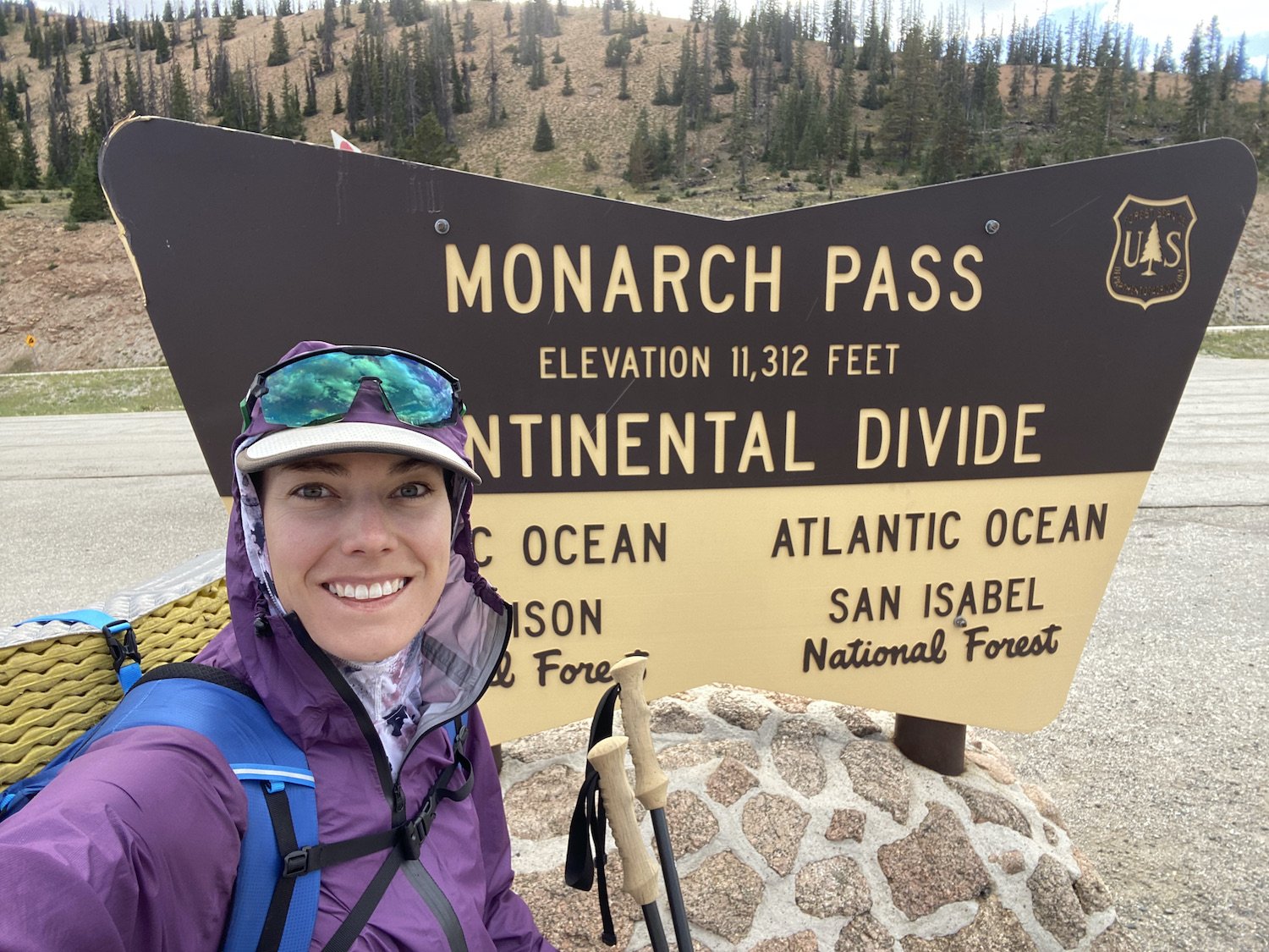
The sky spit rain and then the sun came out. I had several milestones to look forward to that day: reaching mile 100, crossing Hwy 50 the first time, joining the Collegiate West track again, making the final turn north, and then crossing Hwy 50 for a final time at Monarch Pass. I held onto those goals even as my feet began to ache.
After crossing Hwy 50 the first time, I realized the next 5 or so miles would be on a gravel road. I both appreciated and detested this. I could walk faster on a road, sure, but my feet would surely be sorer than ever at its end from the constant pounding on a hard-packed surface. I promised my feet a good break when I got to Fooses Creek Trailhead, so I popped in some music and got moving at a 4 mph pace.
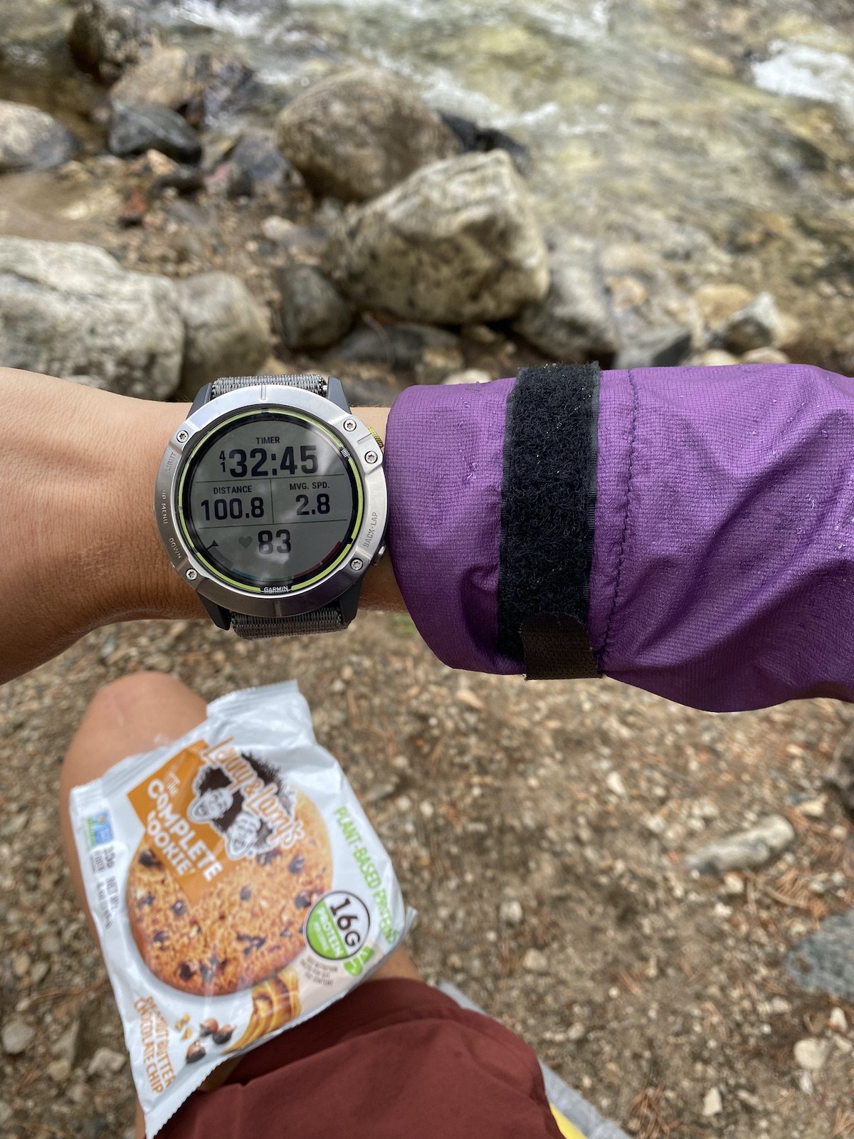
Mile 100!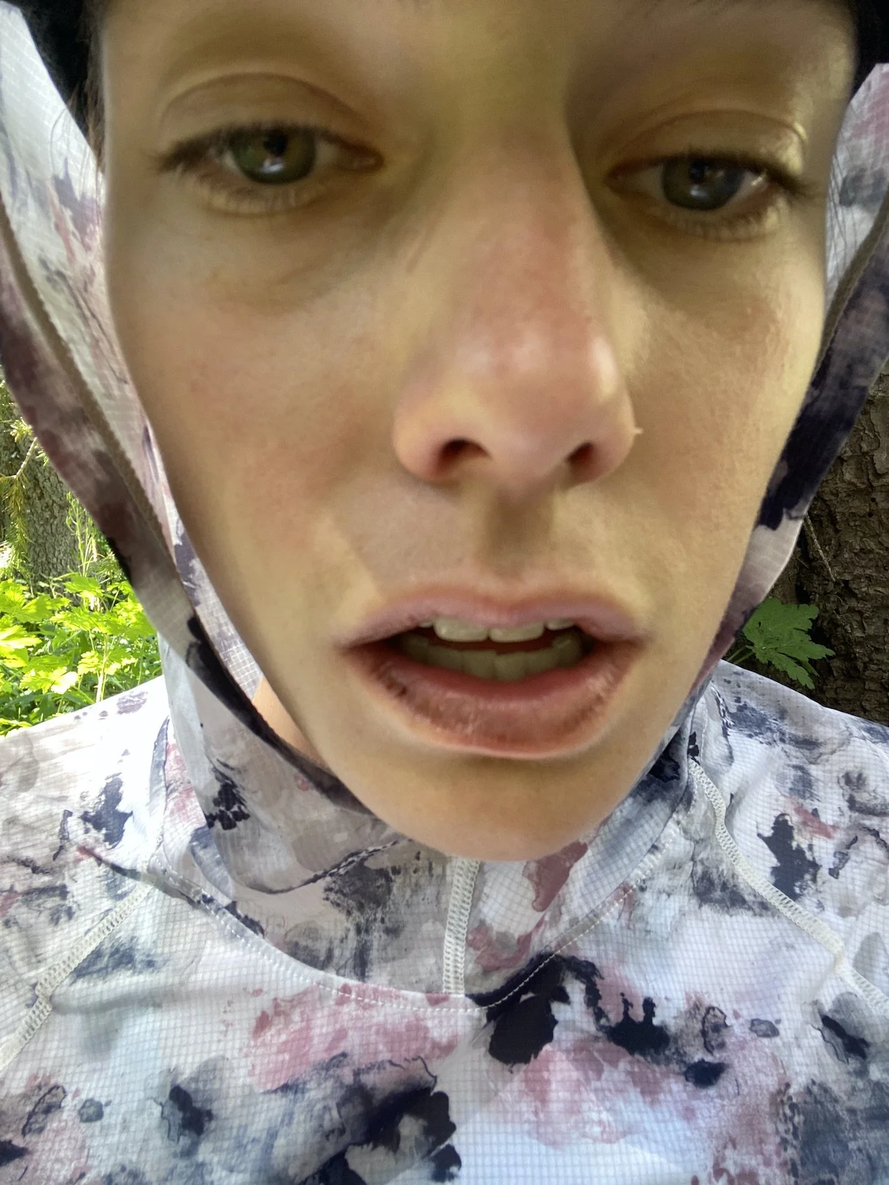
My poor chapped lips.The road initially took me by giant, mod-looking mansions, spaced well away from each other and obscured by trees; all of the properties sported a variety of no trespassing signs which threatened more surveillance cameras even than the properties around Mt. Princeton.
I trucked along and pondered the concept of private property, and how there was probably a more direct route to Fooses through the woods than this road, but I’d never know because none of these landowners would ever allow a trail to be built.
When I reached the Creek, I found a nice tree, laid down before it and kicked my feet up above my head, resting my heels on its trunk. They stung and throbbed as the blood left my toes. I did some chores laying down, like making a salami, cheese and chip burrito and stuffing it into my mouth between chapped lips.

Eventually it was time to move on, and the trail up Fooses Creek was beautiful, truly, save for all the mountain bikers pelting downhill from the Monarch Crest. It’s tricky, as a hiker I technically have the right of way, but feel guilty making mountain bikers get out of the way for me because I know the downhill is the fun part for them. I always step aside when I see them coming.
Stepping aside became tiresome, though; the trail had to be around 11 miles long up to the Crest, and it was steep in parts. Plus it was hard to get a rhythm going on tired legs. I found myself staring at the ground more than looking up ahead, so I was almost always startled by the bikers. Finally one biker stepped aside for me, and I thanked him profusely.


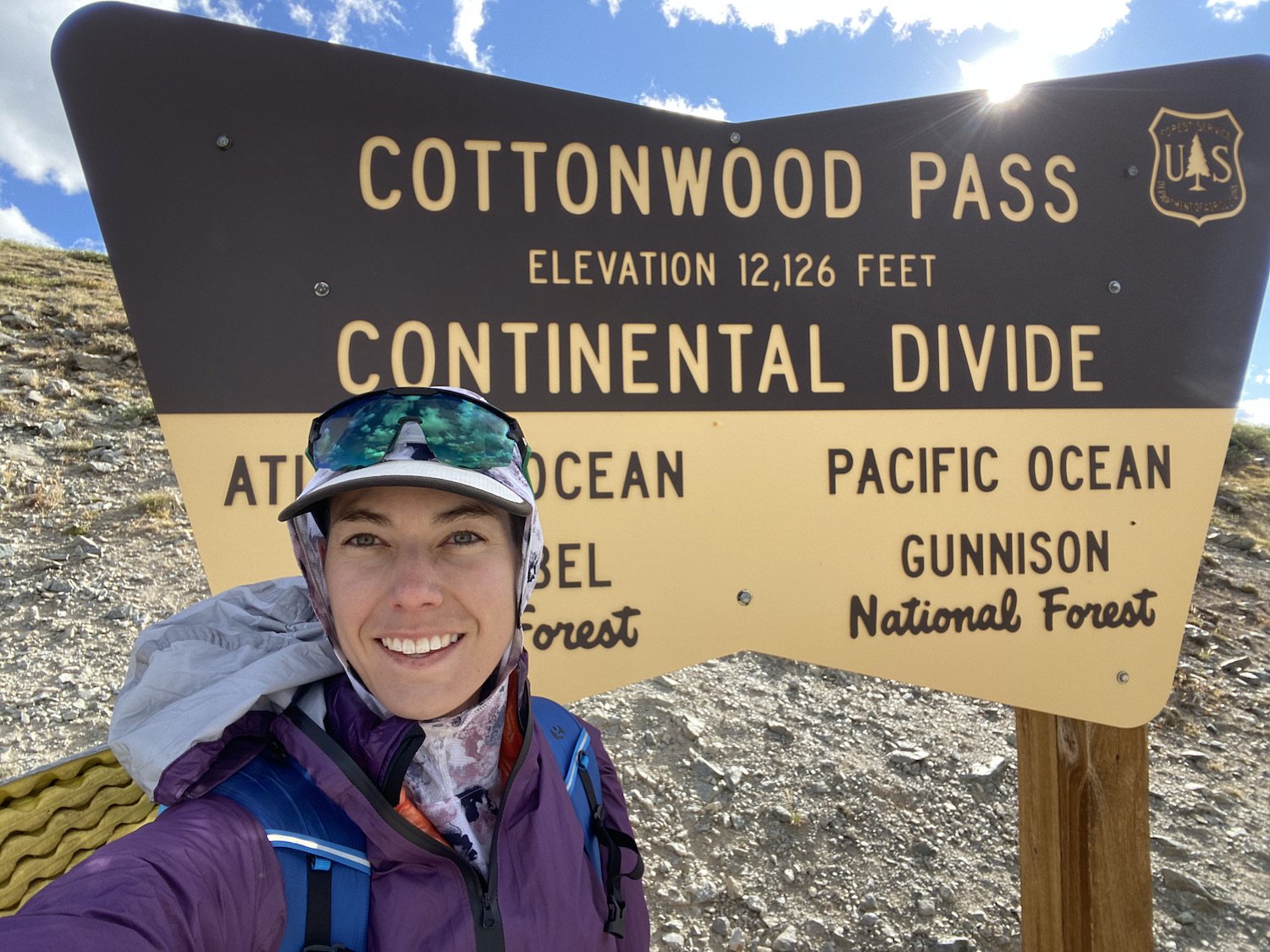
The final pitch up to the Continental Divide was so steep I was practically on my toes walking up it, and the sandy, washed out grit was virtually without traction. Finally I reached the top, and leaned against the sign marking the junction for the CDT and the Collegiate West route.
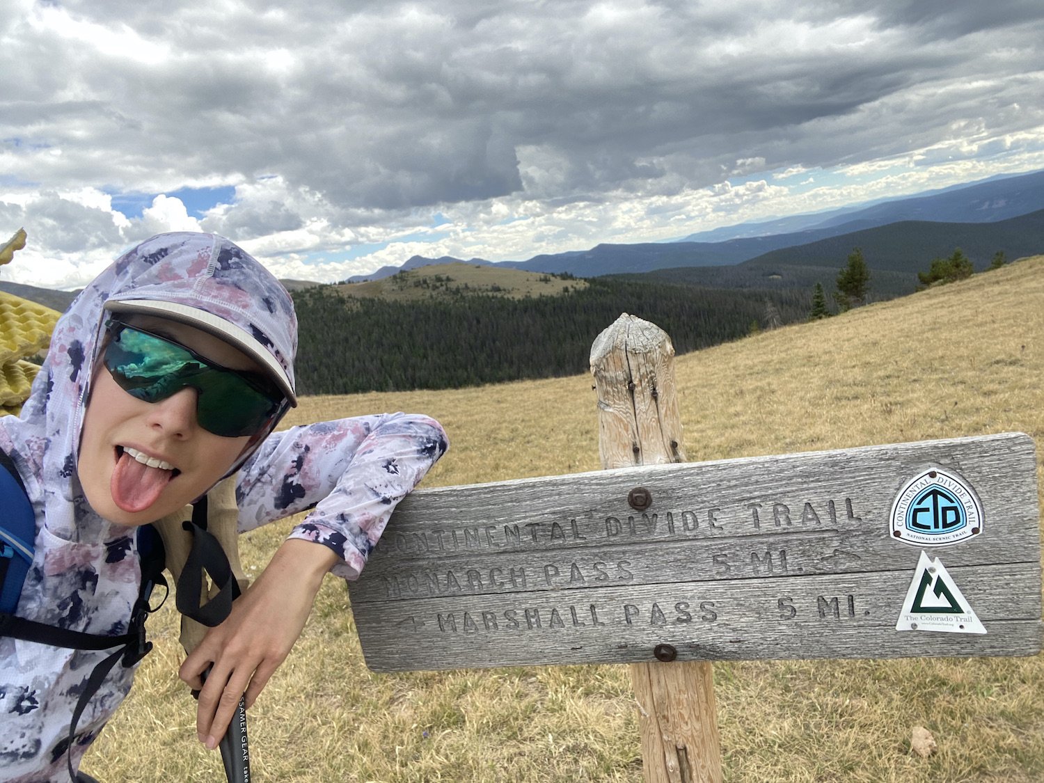
I’d turned the final corner, now all I had to do was walk north to Cottonwood (I say that like it was easy, it was actually quite hard).
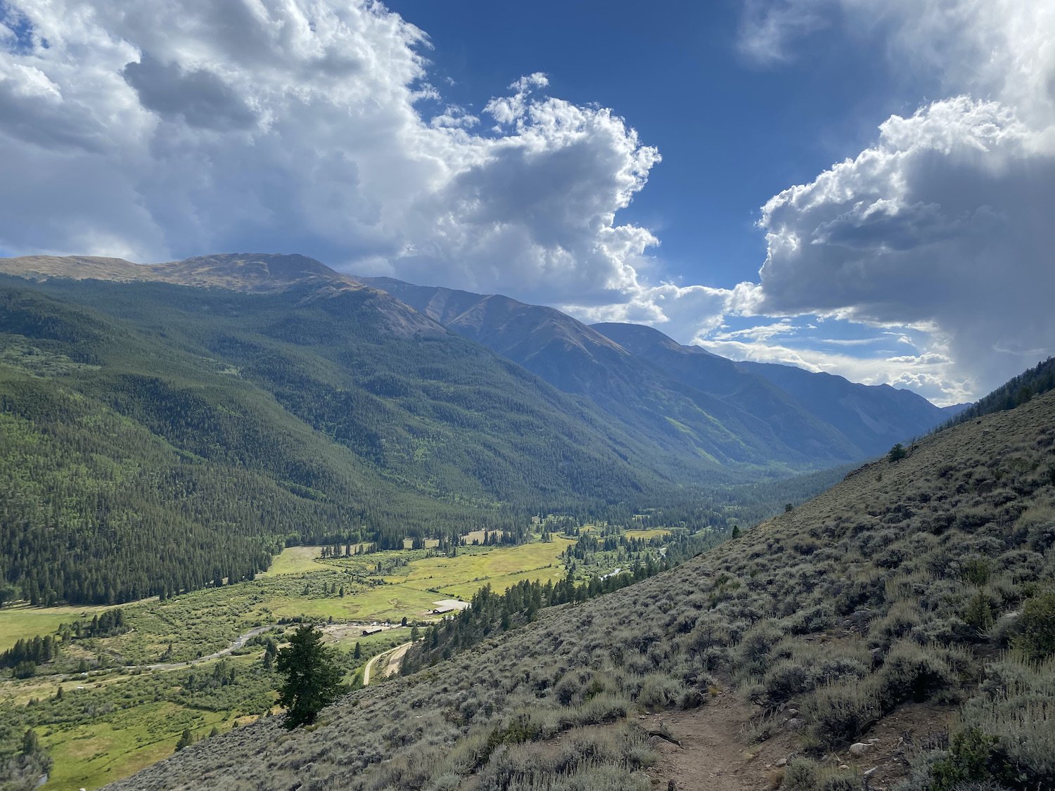
The descent to Monarch Pass was full of stunning views, moody skies, and biting wind. I hobbled on wrecked feet down the trail, fantasizing about taking my shoes off when I got down to the parking lot. After what felt like ages, I reached the pavement and was immediately sucked in by the gravitational pull of some colorful Adirondack chairs on a sheltered porch.
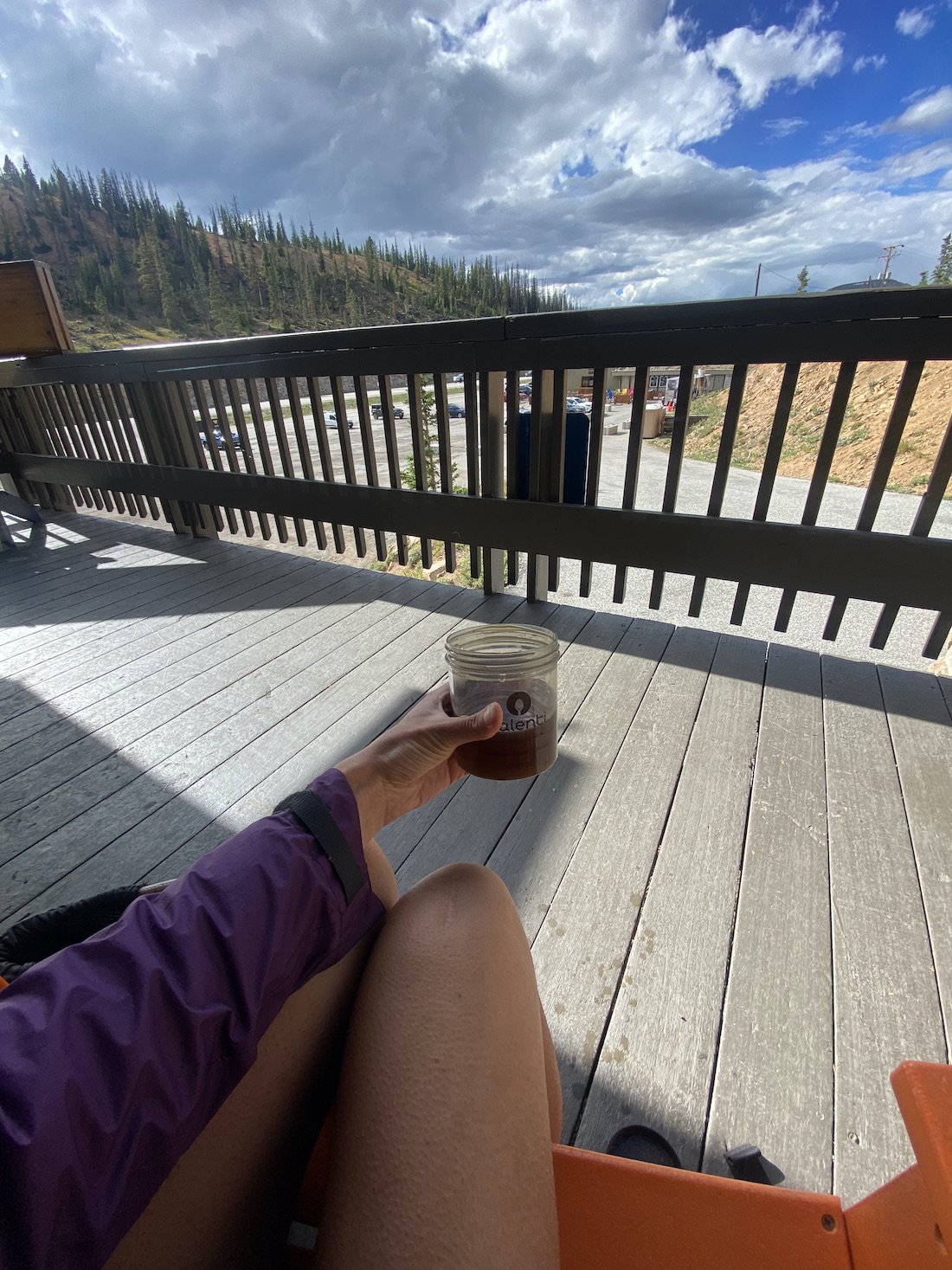
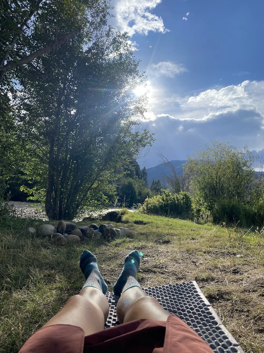
Mandatory coffee break.I layered up against the wind and spitting rain, yanked my shoes off and delicately peeled my socks away from my swollen feet. Shockingly, I only had one blister on one toe. The pain was internal, in the soft tissue of the soles of my feet. I dug my fingers in, rubbing out a series of knots and pressing into the puffy areas, I shuddered. The feeling was complex, it was both hell and bliss, similar to all parts of this adventure.
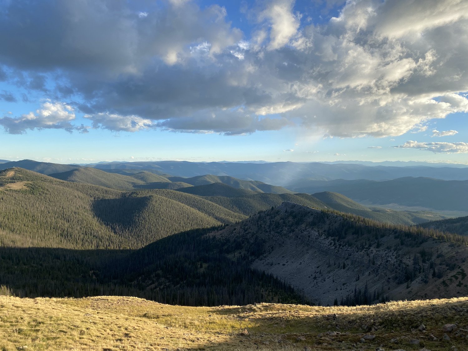
After eating, drinking water, sending Logan and text with the few bars of service I had, and sufficiently airing out my feet, I got organized and packed up for the final leg of my day. I would walk the Monarch Ski Resort cat tracks, climb to a high point, and then descend for ages.
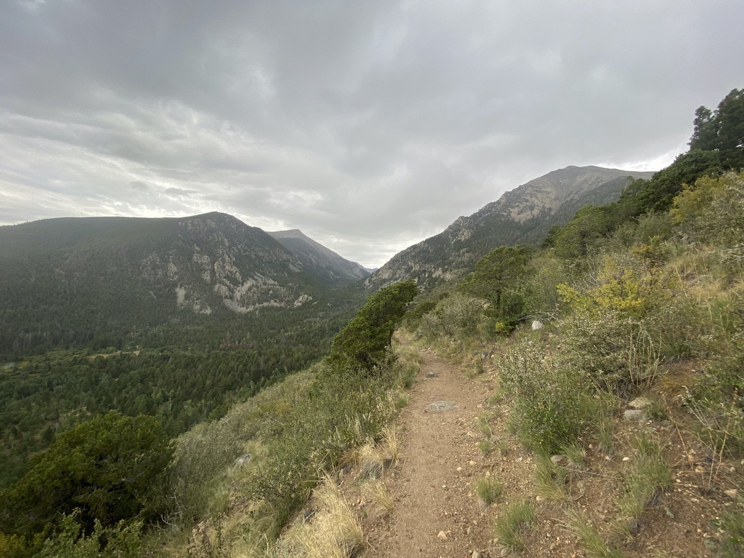
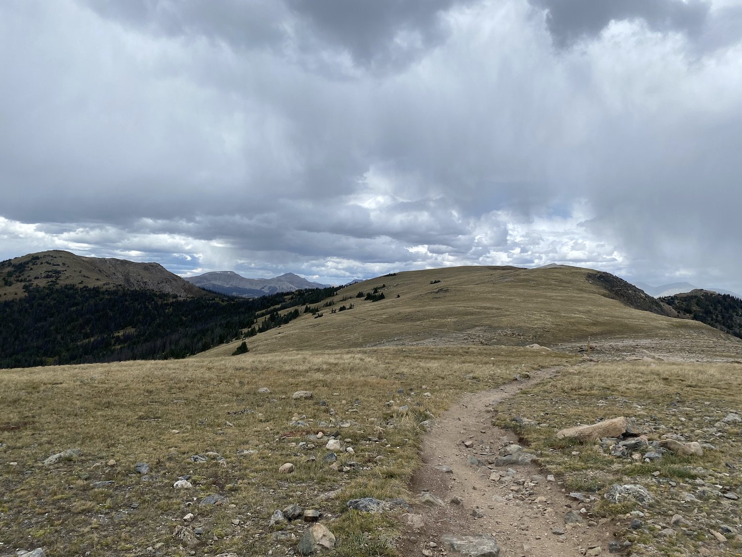
I was having trouble remembering this section, as I’d hiked it in the reverse direction on the Colorado Trail. It turned out to be a breathtaking walk above tree line once I rejoined the single track. And as the sun dipped low, everything was bathed in an orangey-copper glow. Pika “eeped” and marmot chirped, tiny birds burst up from the knotted grasses trilling happy songs. I hiked the shadow line of the mountain as its ridge cast the lower valley in a deep purple shade.

My euphoria over the vivid evening colors and mind-boggling view carried me up to the Divide and then down into the dark. But the night settled over me and reminded me of how sensitive my feet had become. I stumbled over sharp chunks of granite, rolling my ankles and pitching forward when I lost my footing.
There wasn’t a flat patch of dirt to place a foot on and I found myself whimpering each time my toe hit a jagged shard of rock. I passed several tents and one person with a fire. I longed to stop, to throw my tent up in any old place and just lay down. But I had 3 miles to go before the Middle Fork South Arkansas River, my planned stopping point.
Then I had my first meltdown. I felt like was watching myself from a third-person vantage as I cried out and flung my hands wildly in front of the glow of my headlamp—at the bugs—I was upset about bugs. There were two moths spasmodically gyrating in the beam of my light and they kept bumping into my face.
That was what did it—not my feet, not my exhaustion, not the bruises on my hips and shoulders from my pack straps—moths. I groaned at my weakness, drank some water, and kept walking until I reached the river.
I ended up camping in a portion of forest so wracked with beetle-kill, I could barely find a bare spot of earth on which to build my hobbit house, for all the dead, pock-marked trees laying this way and that.
When I finally laid down, I tossed and turned, sleeping sporadically; my hips ached if I laid on either side for too long and my toes were zinging inside my camp socks.
Tomorrow was my final day on trail. I had made it this far, could I cover 32 more miles before 6PM the following evening? I really hoped I could.
Day 4: 32.7mi +8,830ft (4AM on 9/4/23 through 5:15PM on 9/4/23)


I woke up to my alarm at 3:30AM. My body said no, not yet, but my brain said yes, let’s go, so my brain and my body started packing up. I drank a protein shake, ate a cookie, and rather than sticking my grody hiking socks I’d been wearing for the last 3+ days back on my feet, I decided to hike in my “sacred socks”.
If you know me, you know this was a blasphemous decision, one I did not make lightly, my sacred socks do not ever leave my tent or backpack, well, until now. But my hiking socks were crusted with salt and I did'n’t want a rash to stop me from covering the last 32 miles in good time.

I hiked up and away from the Middle Fork South Arkansas River with haste, I was over the ragged, beetle-ransacked forest, the sharp rocks and close, humid air. I felt like I had slept in a deep, dark hollow, like the sun would never cast its light there no matter how long I stayed.
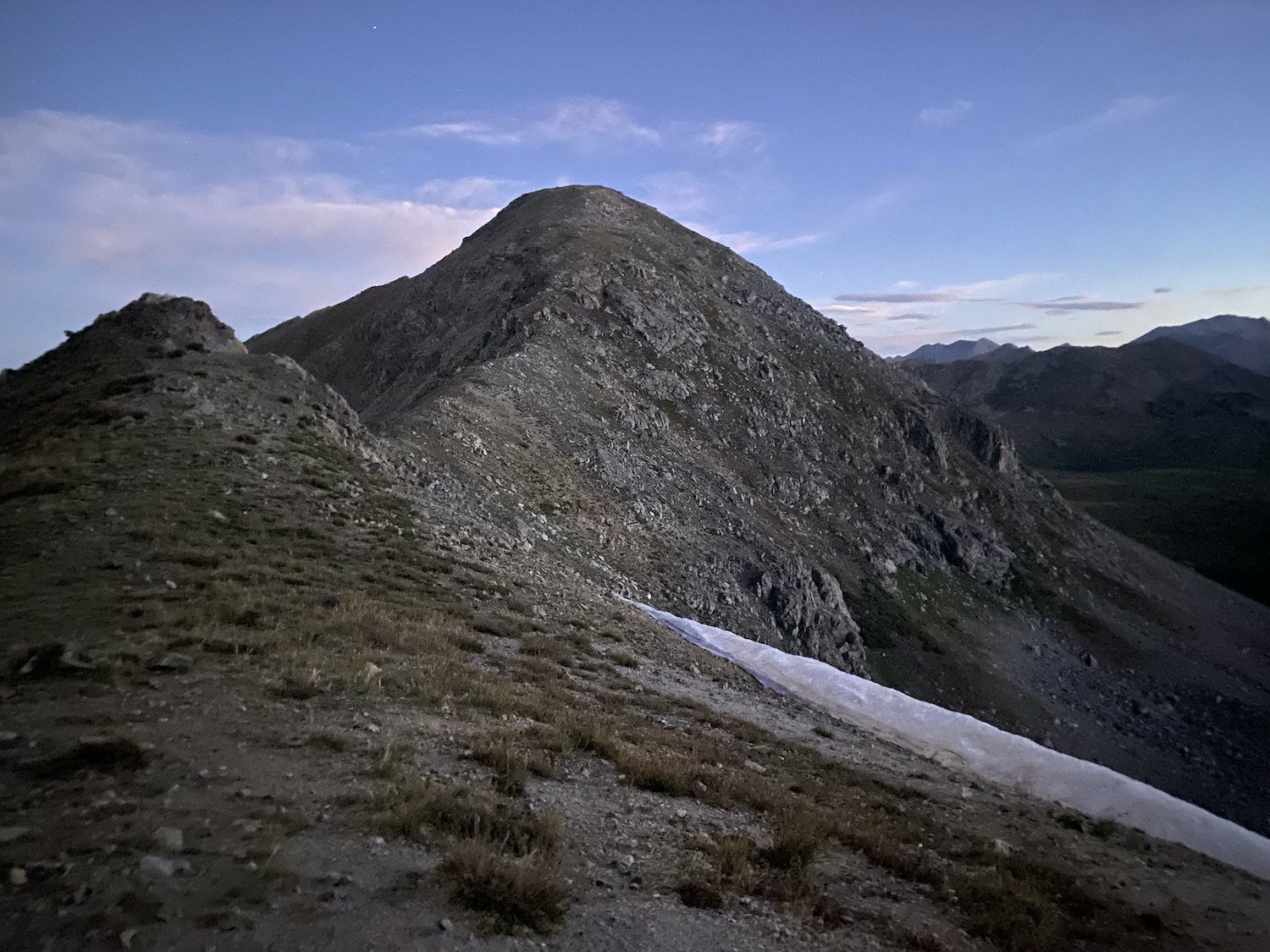
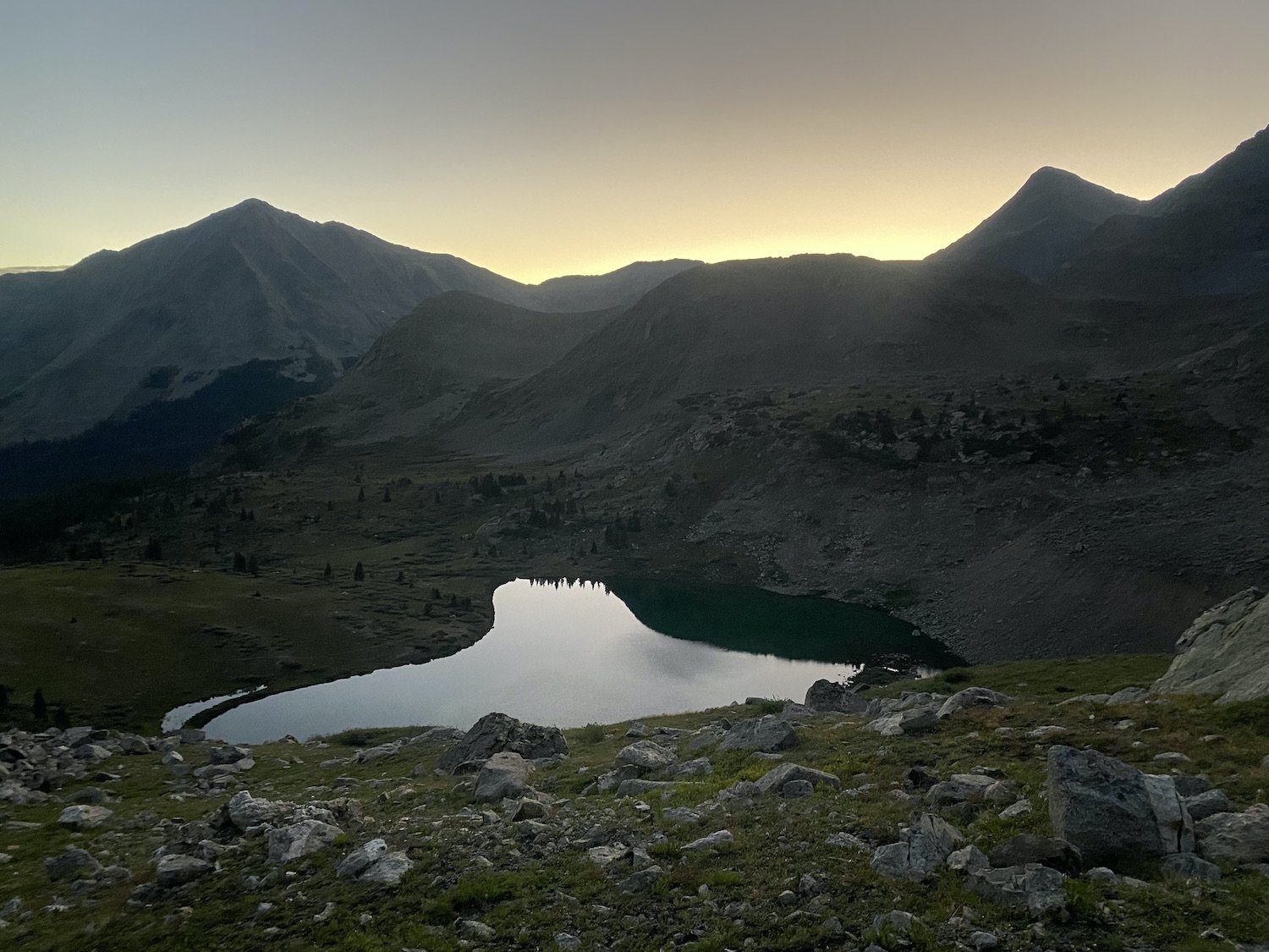
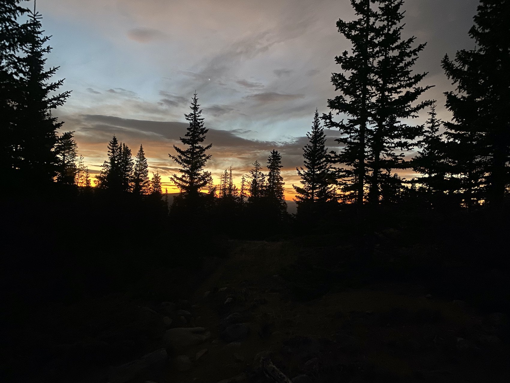
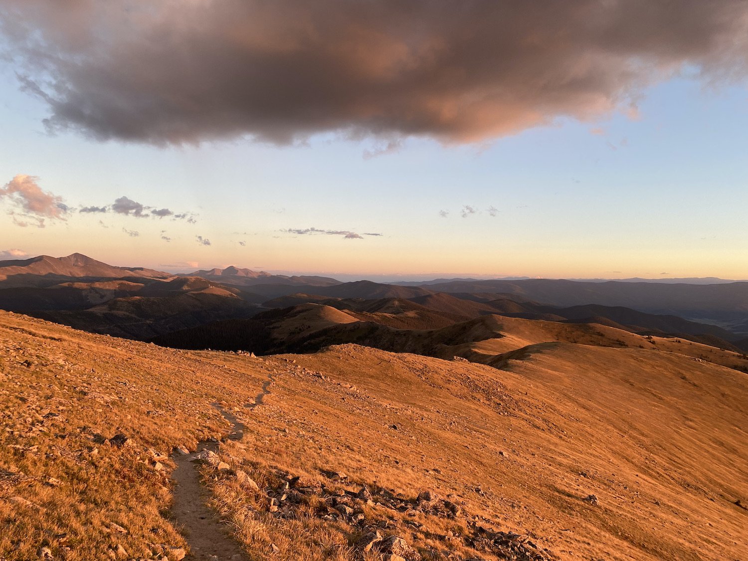
I made quick work of the climb up to Chalk Creek Pass. Once again, I stood on a high saddle in the soft pre-dawn hours, wrapped all-round with pastel pinks and smoky blues, deepening into the fading bruise of the night. The stars were pale freckles on the face of the heavens, smiling down on this peaceful valley. Lake water so still, it reflected each sentinel tree, each craggy peak, even the spirit of the place danced delicately across its glassy surface. I was there to watch the world wake up, to watch and remember.

I continued my journey into the daylight. I hiked along an old railroad bed with spectacular views, and then up and over another two passes around Mt. Helmers. The walk was beautiful and not overly strenuous. I did not take any significant breaks; I ate on the go, filtered water with my pack on, slapped sunscreen on my face and legs mid stride (almost). I was on a mission.
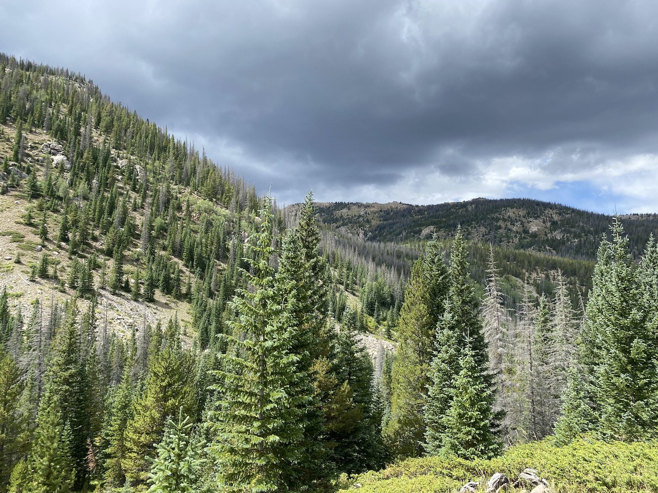
The devastation of Colorado's native Bark Beetle has grown massively due to warming global temperatures, and a lack of forest fires due to poor forest management practices. Even though my day was halfway over by 11AM—distance wise—I still had the bulk of ascending left to do. When I reached the North Fork Chalk Creek, the remainder of my day would carry me steeply up to the Divide and keep me there, winding me through high basins and over passes. The weather report I pulled from my Garmin told me the weather was clear, but when I looked to the sky the clouds were stacking up.

I messaged Logan and asked if he’d heard anything about storms, and then I changed my mind and told him I didn’t need him to check, I was going to go for it regardless. I’d met a few hikers who were planning to camp up there and I allowed confirmation bias to soothe my worried mind.
I began the nearly 3,000ft ascent, and fell into a steady step, listening to my playlist and trying to keep my breathing as even and unlabored as possible. I had developed a bit of a cough from the altitude in the last day or so, and hated the associated wheeze.
When I reached the first saddle, I remembered just how rocky the trail was on this portion of the Collegiate West Route. I looked down at my feet in silent apology. Just 14 more miles, I thought.
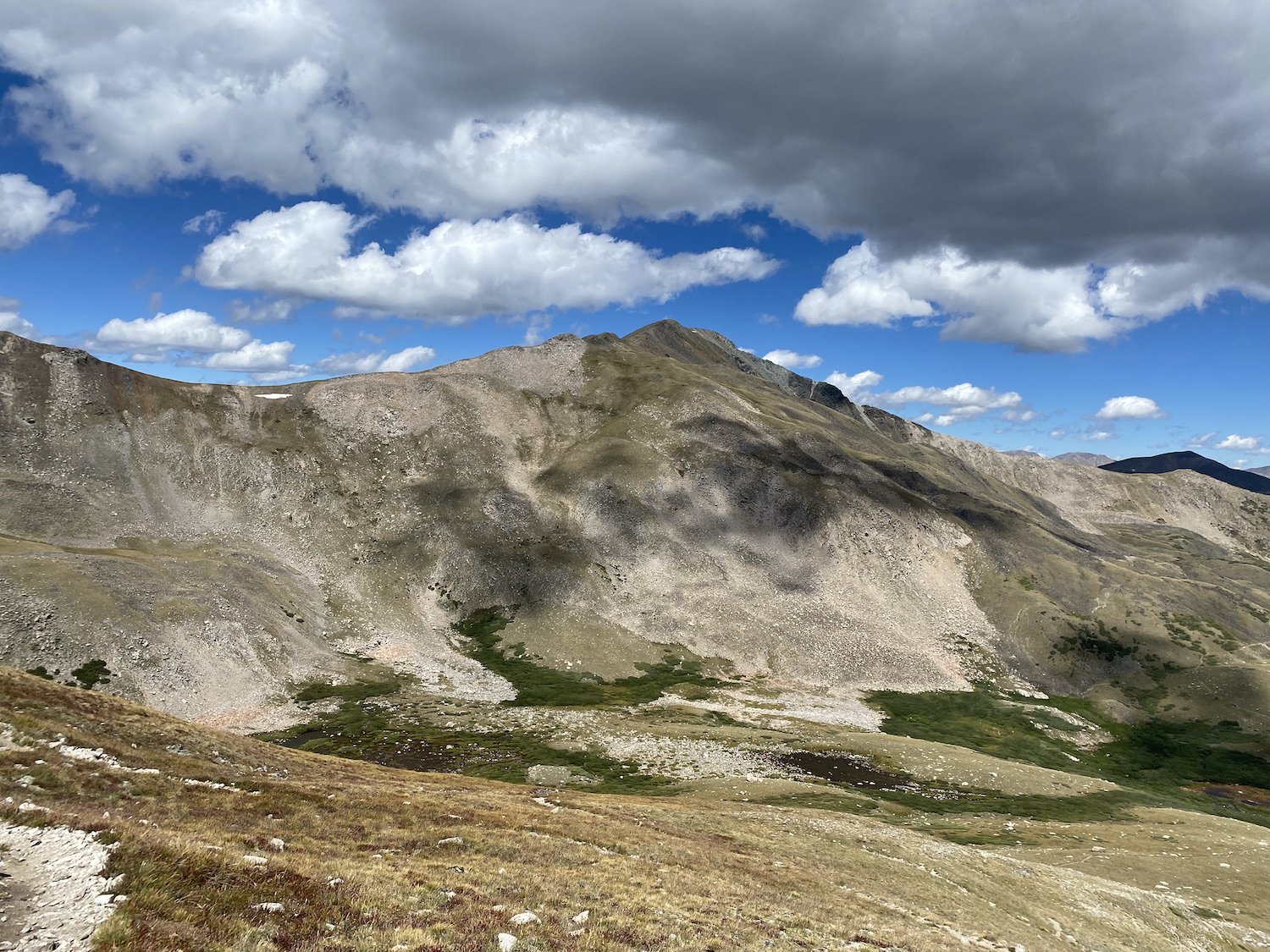
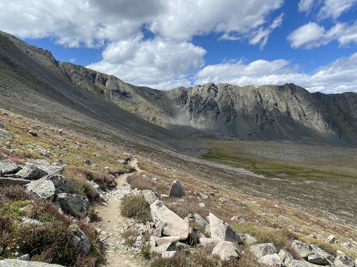
Despite the rocky terrain, the trail work was immaculate and really impressive. At times, I was reminded of hiking up Mauna Kea in Hawai’i and the impressive, snaking paths which wound through the lava rock. The views were incredible—sickeningly so—and I drank in every ounce of mountain majesty I could.

The day would have me climb over 8 passes. And as time wore on, the wind escalated in violence especially at the tops of these passes.
The morning had been blustery, but nothing compared to the gale-force winds I was experiencing now. So strong were the gusts over the second to last pass, I nearly dropped to my hands and knees crawling.
In many ways the wind was a gift, because I didn't think about my feet or my fatigue, all I cared about was trying to keep my feet on the ground. And as I stumbled through my last 2 miles, being pushed this way and that by rogue gusts, it occurred to me that I’d done it. I’d really done it.
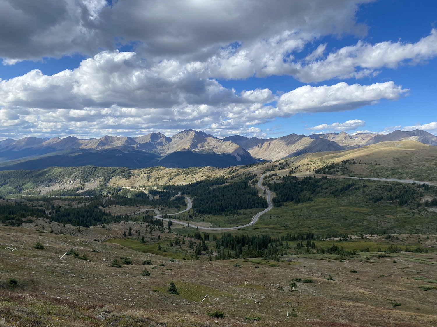
The hwy leading up to Cottonwood Pass with the Sawatch Mountains in the background. When I placed my hand on the sign marking Cottonwood Pass, I stopped my watch, saved my activity, and looked around in a daze. No one milling around the parking lot knew what I had done, or even registered my presence. They were happy enough to snap their pictures and rush back to their cars. Logan wasn’t there yet, and that was okay because I needed a moment to equilibrate.
Prior to embarking on this journey, I’d asked my grandmother for her help, I’d asked her not to let me quit no matter how hard it got. She’d been there with me, I am sure, for the parts that mattered most, and she always will be. I miss you BB, thank you for looking after me.
Logan arrived shortly, bearing pizza and a change of clothes for me. I was ready to go home.

