
The Grand Enchantment Trail: First Waters TH to the San Pedro River

Sunset in the Superstition Wilderness, Angel Basin
“And we might, in our lives, have many thresholds, many houses to walk out from and view the stars, or to turn and go back to for warmth and company. But the real one—the actual house not of beams and nails but of existence itself—is all of earth, with no door, no address separate from oceans or stars, or from pleasure or wretchedness either, or hope, or weakness or greed”
—Mary Oliver, Wordsworth’s Mountain, Upstream p.114
Day 1: March 24th, 2025 // 5.7mi, +886ft
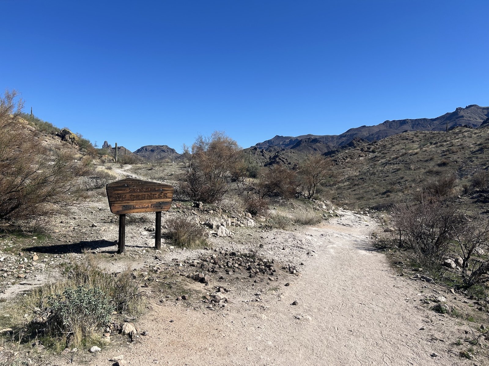
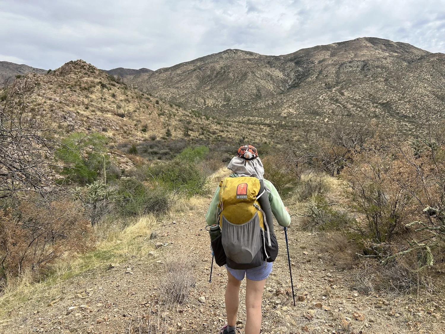
First Waters Trailhead
I was scared when Darryll left me at the First Waters Trailhead outside of Pheonix, all on my own, with only the water, food and gear I had in my pack. As the rumbling noise of his engine receded and silence prevailed, the reality of my situation dawned on me rather harshly. I’d chosen this; I’d chosen to be dropped off in the middle of the desert so that I could walk 760 miles back in the direction of home. It was easy to romanticize the desert from the comfort of my couch, to dream of hot sun and sandy ground while getting buried in snow at 8,900ft. I’d longed for this moment for months and dreamed of nothing else but departing from this trailhead on a grand adventure, so why now, did I feel so full of fear and self-doubt?
“I’m crazy,” I said to the saguaro and the mesquite trees and the rocks.
But what of it? I shouldered my pack, weighed down with an excessive three liters of water, and began my walk.

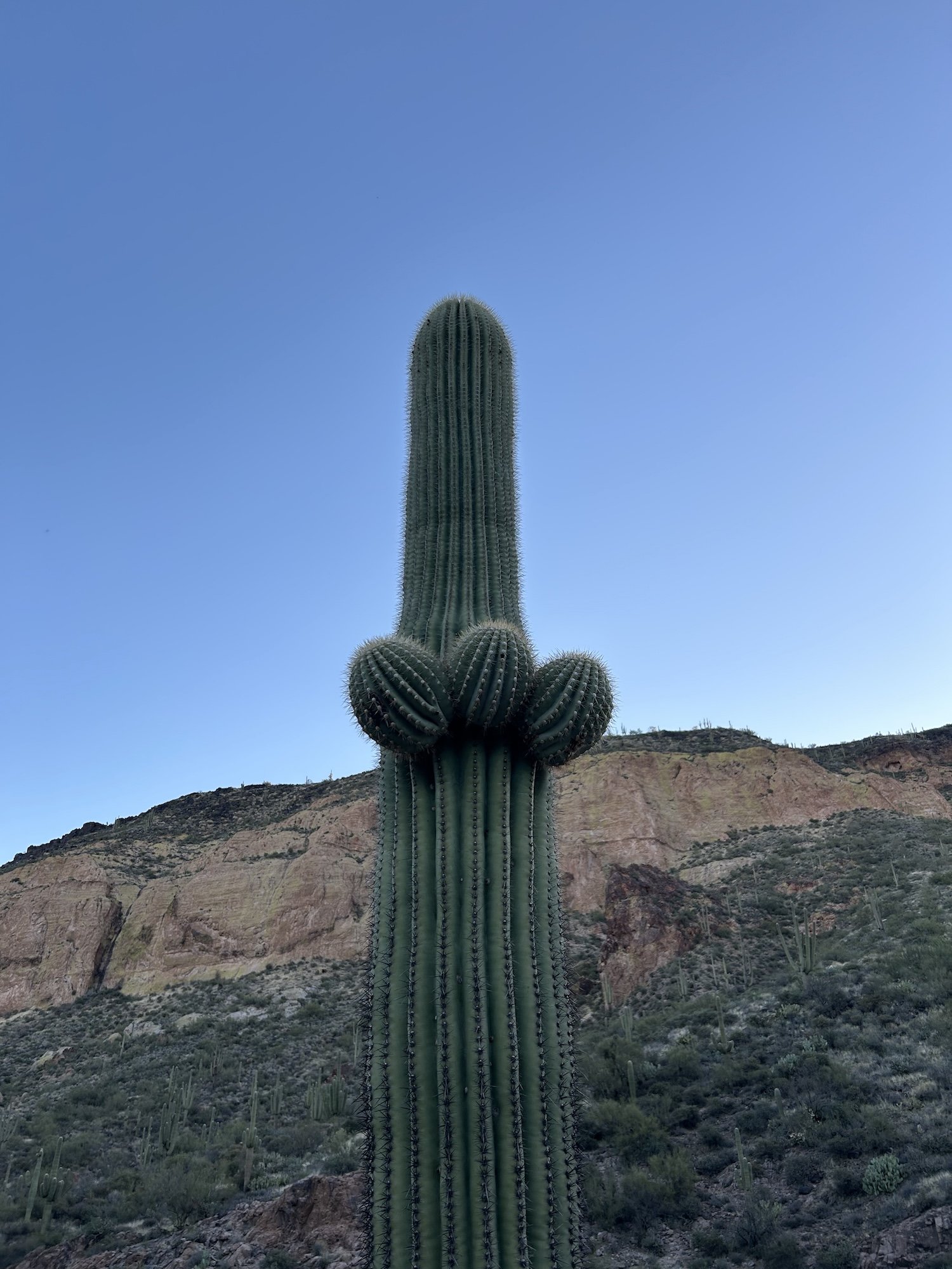
Weaver’s Needle in last light
The distance I covered my first day on trail was brief, given I’d spent the whole day traveling 600 miles from Crested Butte by plane and by car, just to get to the trailhead. I remember feeling an absence of anger in those first few miles, shocking, because I’d become accustomed to persistent feelings of rage since the previous autumn.
In my journal I wrote, “This place makes me feel so small and my rage quite silly, like I am an ant shaking my fists at a boulder. I feel frightened by the desert’s sharp edges and cracked earth, its jagged pumice and the algae coating the little bit of water left in potholes. But this is someone’s home, after all—the canyon bats emerging at dusk, the ball-shape nests nestled in thorn bushes home to tiny birds, the quail exploding from the bush, the earth colored lizards basking on warm rocks. These animals thrive here; at the least, I can hope to survive here.”
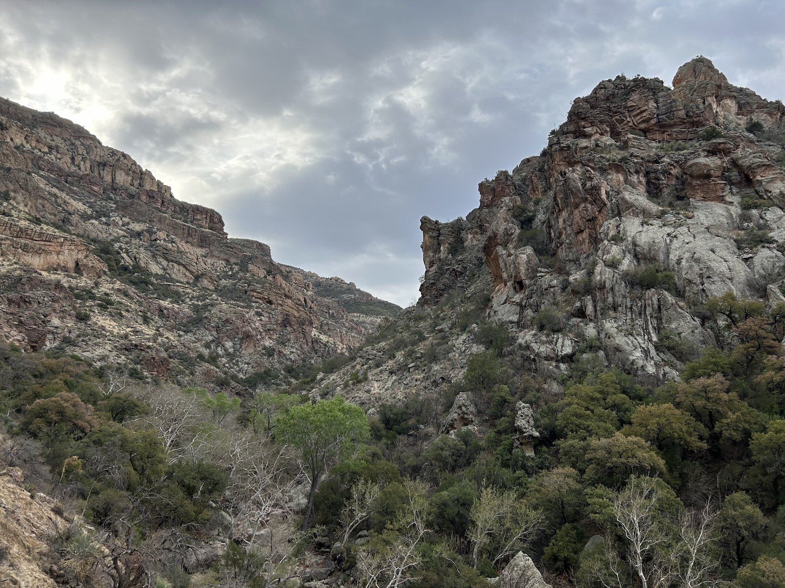
I set up camp in East Boulder Canyon as dusk cloaked the valley in lavender and dusty blue.
Perky saguaro at dusk
The Primus fuel canister Darryll had picked up for me was a dud; I was grateful he’d run this errand for me, regardless, since my flight into Pheonix was late. It wouldn’t be an adventure without a few cold, crunchy meals, since now I had no way to cook the ramen or cheese grits I’d brought.
I’d made a note on my shuttle request that I needed to stop at an outfitter—an outdoor store, I’d clarified—to get camping fuel since I couldn’t fly with it, and the dispatch officer called me while I was in the Denver Airport.
“You need to go to Urban Outfitters?” He asked.
“What? No, an outdoor store, like a camping store. Here,” I said. “I’ll look one up.”
“How about the bag store?”
I was silent a moment. A bag store? I opened up google maps and found an outfitter that was close to the airport in Pheonix.
“How about this place.” I told him the name of the store.
“That’s not really on the way. The bag store is though,” He said.
“I don’t need a bag, I need camping supplies. I’ll pay extra for the stop.”
I wasn’t sure I’d gotten my point across when we hung up, but then Darryll called and told me that the dispatch guy couldn’t fathom that women actually camped, but that he’d pick up a canister for me.
It was a warm night, bordering on hot, and I was so wound up I barely slept. I tried to calm my mind to no avail, the great distance ahead pressed into me. I tossed and turned.
Day 2: March 25th, 2025 // 22.6mi, +4879ft

Hedgehog cactus blooms
“I drank nearly 6L of water today. It was so hot I didn’t think I would make it here [to Angel Basin] or anywhere at all” —journal entry
Later, I would find out that Pheonix broke heat records on this day, that the temperature climbed to 99F, but as it was, I was just painfully hot and thirsty all day long, and by the time I made it into camp that evening, I looked as if I’d been mauled by a herd of furious felines. I would spend a fruitless half hour trying to pick hairlike thorns from my thighs and then give up, succumbing to hunger and exhaustion.
Despite the roughness of the terrain and vagueness of the “trail” on this day, I greeted every spiny cactus and complimented the sparse, but no less vibrant, blooms. It takes so much energy to make a flower, to spare even an ounce during a heatwave seemed absurd, and so each blossom struck me as an act of beautiful defiance.
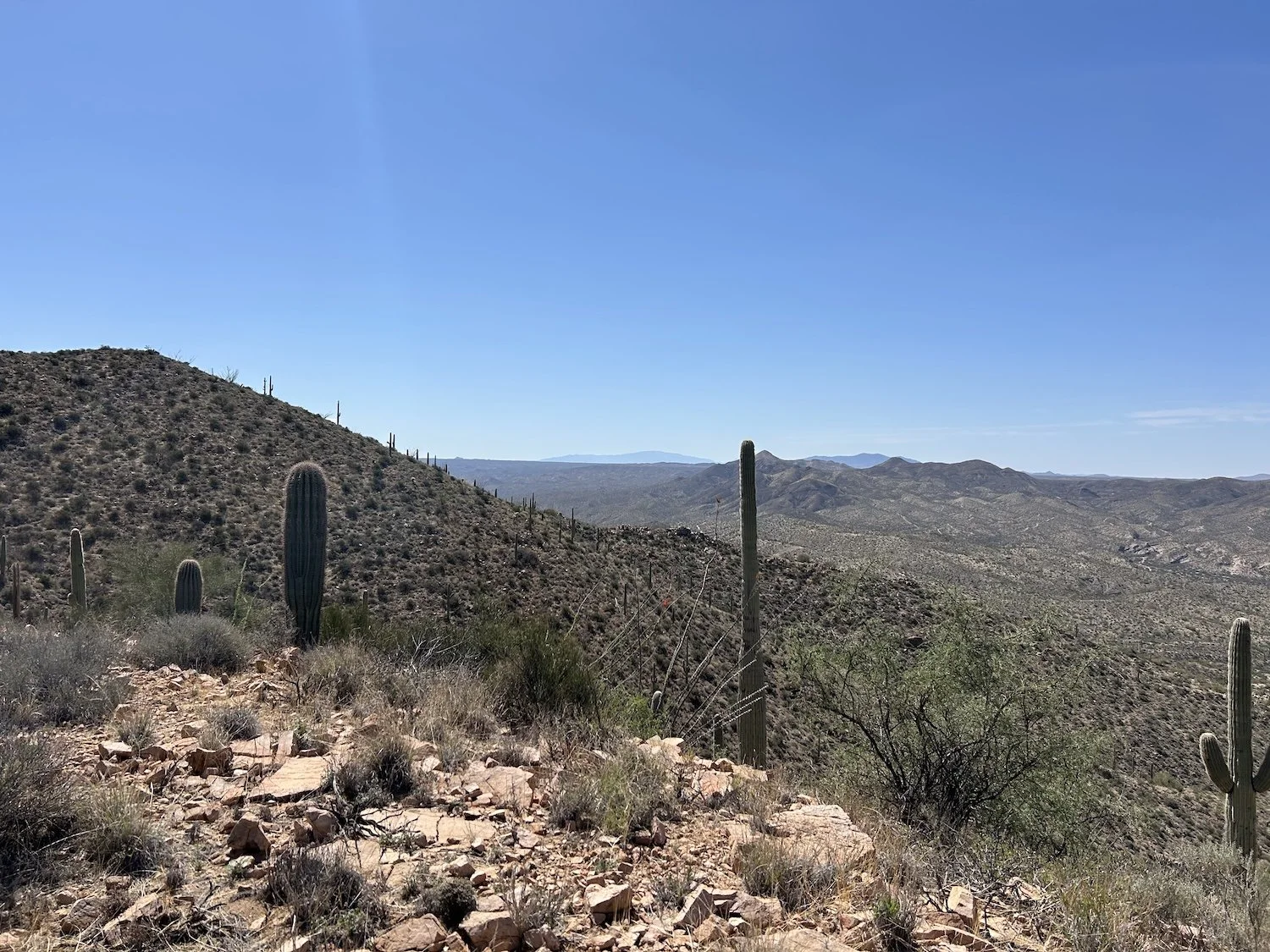
A vast expanse of desert at high noon
I struggled to match my gps track with the surrounding terrain and my steps felt wildly unsure on the Hoolie-Bacon Trail, which seemed to wind on forever in no particular direction. Anxiety welled up in me in response to my confusion over the terrain. The heat made every mile feel arduous and when I stepped away from the route to search for a pothole that occasionally held water, fear nearly choked me. It’s not that I was lost or out of water, I just felt acutely aware of my dependence on not getting lost, that and finding water at some point.
From several feet away, I could see the pothole held a good amount of green-tinted water and I ran to it, relieved that water did exist in this place.
Before any adventure I tell myself it will be easy, but I tell myself that lie so that I make it out the door, get myself to the trailhead. None of my walks are ever easy, of course, but I had a sneaking feeling this one would be a new flavor of hard.

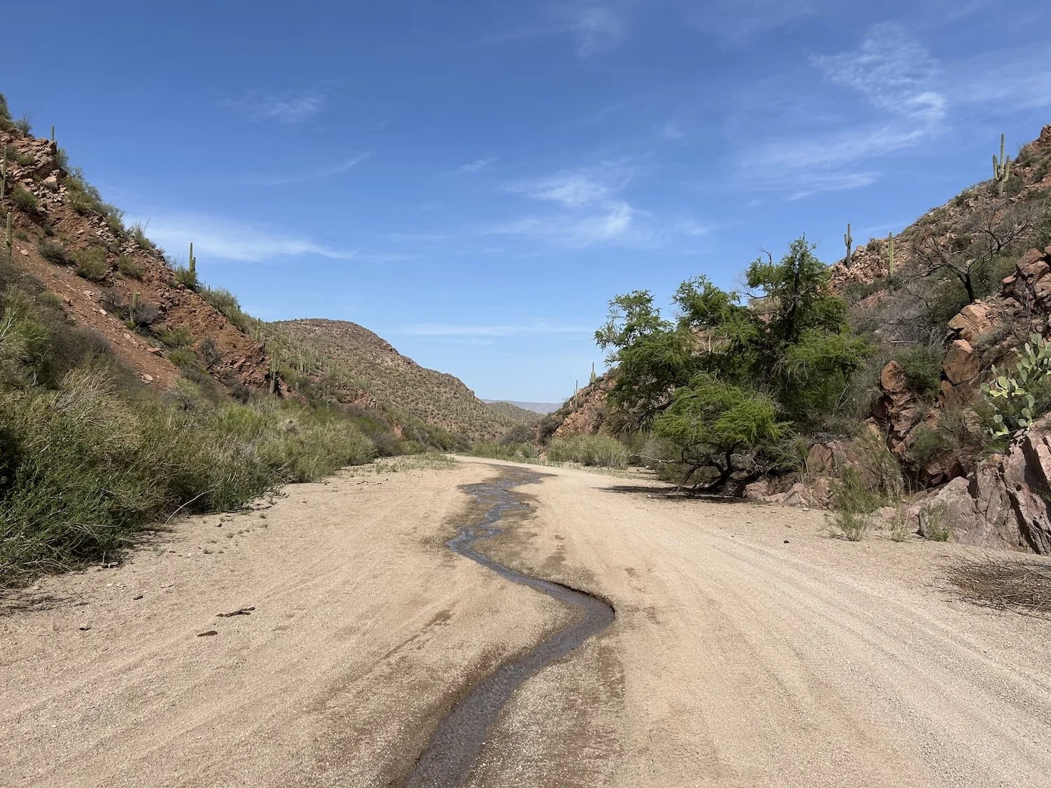
LaBarge Box
The cat-claw and holly were especially hungry for me that night as I fought my way the final miles to camp. My skin felt so sensitive and raw I thought I might cry as each new thorn-coated branch hooked into my flesh. My own fault for wearing shorts despite Brett Tucker, the route creator’s, strong recommendation not to.
I avoided stepping on a single one of the giant palo verde beetles peppering the trail as I descended into Angel Basin. Their glossy black shells caught what remained of the evening light and I couldn’t help but admire their long, delicate antennae as I stepped over each and every one.
Initial descent to Angel Basin
That night I wondered if I’d finally kicked my rodent paranoia, since I caught myself putting in earplugs without a second thought before bedding down. But probably I was just too exhausted to care. My body felt brutalized, every muscle ached, and I could barely keep my eyes open. Sleep took me quickly.
Day 3: March 26th, 2025 // 22.9mi, + 3346ft
Rogers Canyon
I was slow to leave Angel Basin in the morning. It was such a nice, quiet camp and the trials of yesterday still clung to me. When I did finally pack up and discern where my route would take me, any hope I had for an easy start was dashed. Rogers Canyon was, at its inception, full of catclaw, and though I tried many ways of walking it, the thorns seemed to be everywhere—in the wash and alongside it. I screamed once in pain and frustration, then resolved to keep quiet and forge ahead.
One particularly nasty branch of claws dug into my shoulder and jerked me to an abrupt stop; tears gathered in the corners of my eyes. I looked up, searching for strength in the cool blue-grey of the sky and saw a cliff dwelling.
I’d read about the more ancient and historical aspects of this hike and had nearly forgotten about them in all the toil and adverseness of this adventure. I dropped my pack and clambered up a steep rise out of the wash, to my left. Thorns grabbed at me but I ignored them. I reached the dark window in a wall built out of rocks, worn down and fitted tightly together, and turned around to admire the view these people would have had of the canyon.
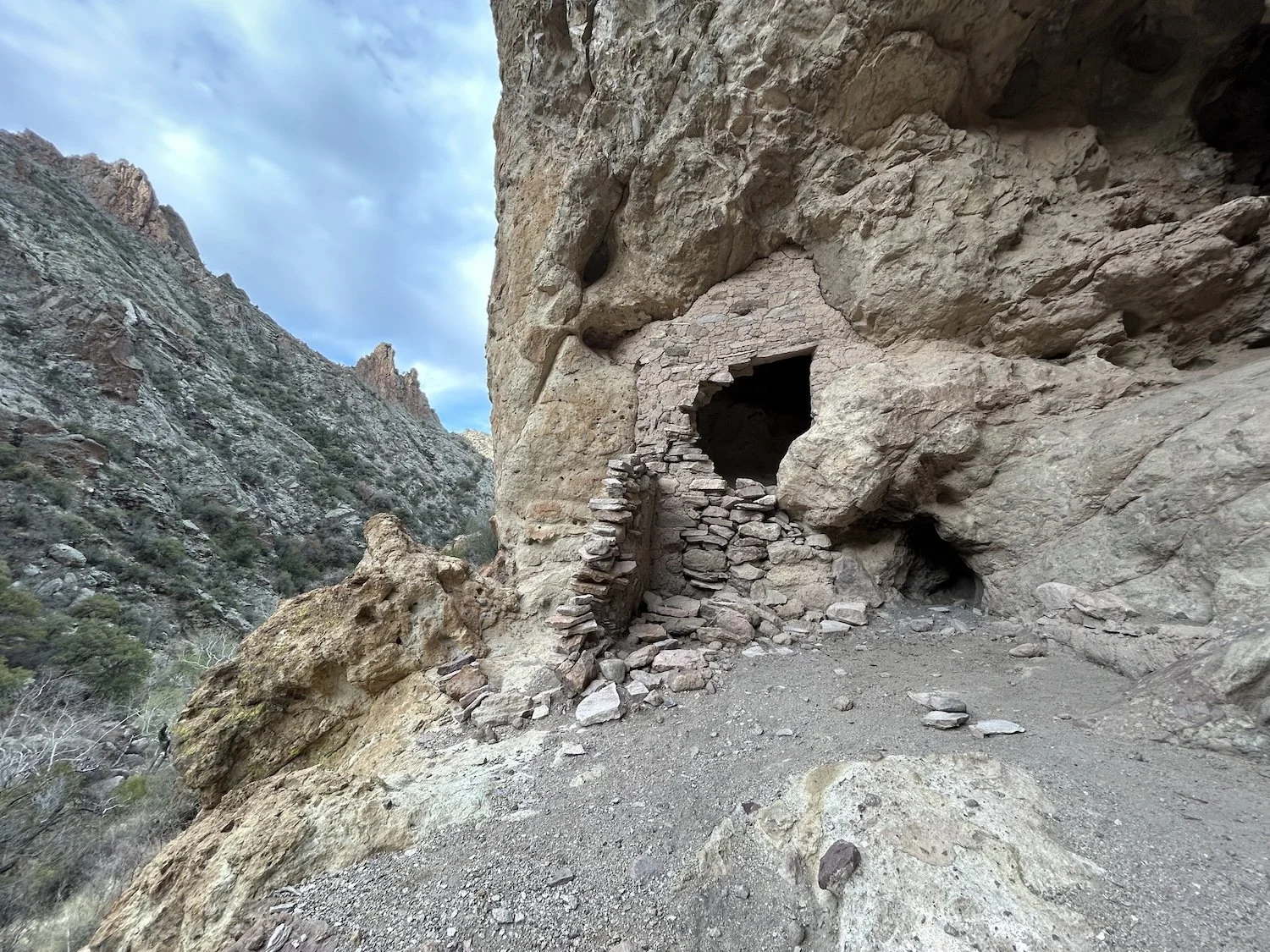
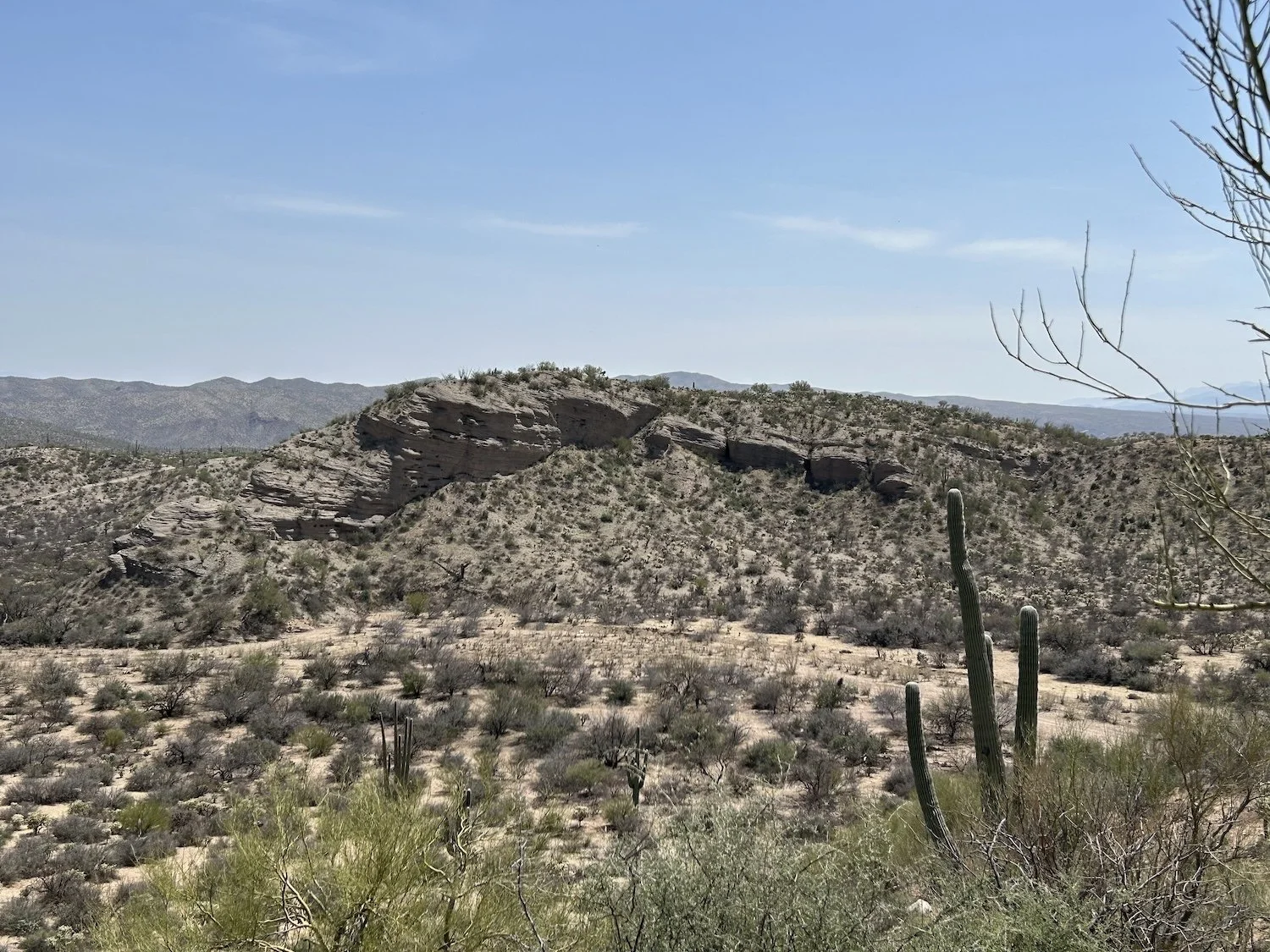
Rogers Canyon Cliff Dwellings, built and occupied by the Salado people about 600 years ago
Above the grabbing vegetation, the scenery was breathtaking, especially beneath the subtle grey sky of morning, which served to bring out the gentle rose and cream colors of the rock, shades of rust and gold, the sage and evergreen of the vegetation. The fight I waged with the environment this morning suddenly felt laughable; I’ll bet the Salado People moved through this canyon with grace and reverence. I was nothing more than an unexperienced, bumbling fool.
“I’m sorry,” I said, my voice hushed. I wasn’t sure who I was apologizing to, the canyon or its people.
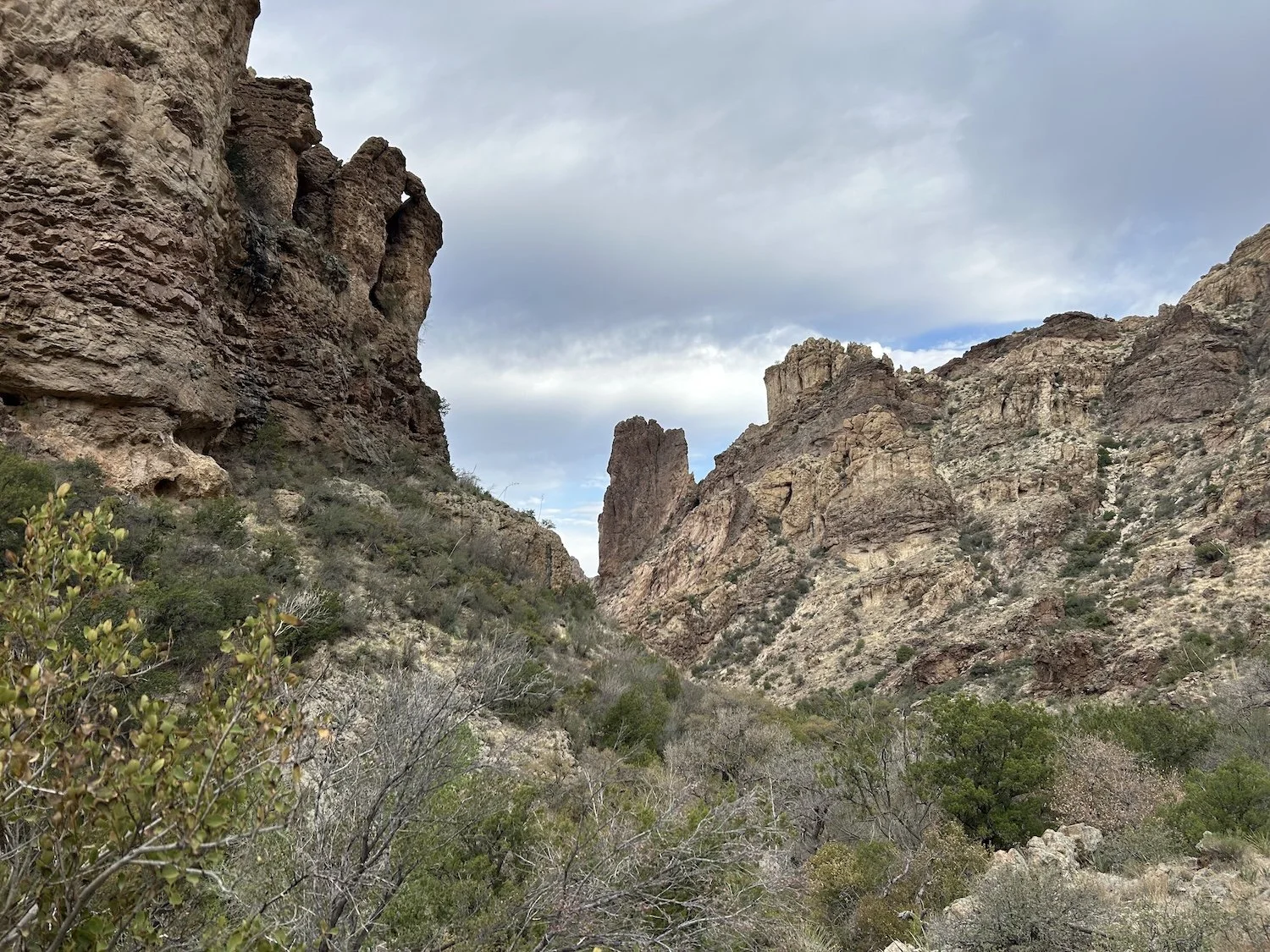
Rogers Canyon
I continued my journey up canyon, walking alternately through deep sand and across large, water-smoothed slabs of rock until the Arizona Trail joined me and with it, a bona-fide trail. I would walk the Arizona Trail for the next two days before leaving it at Beehive Well in favor of a walk down Putnam Wash to the San Pedro River; until then, I felt a great sense of relief over walking something familiar.
Before I left Rogers Canyon, I met three men out for a day hike from their camp along the creek.
“There’s another girl just ahead of you, hiking alone! You should catch up with her and hike together,” one of them said.
I smiled wanly and popped another gummy bear into my mouth, wishing them happy trails as they hiked away.
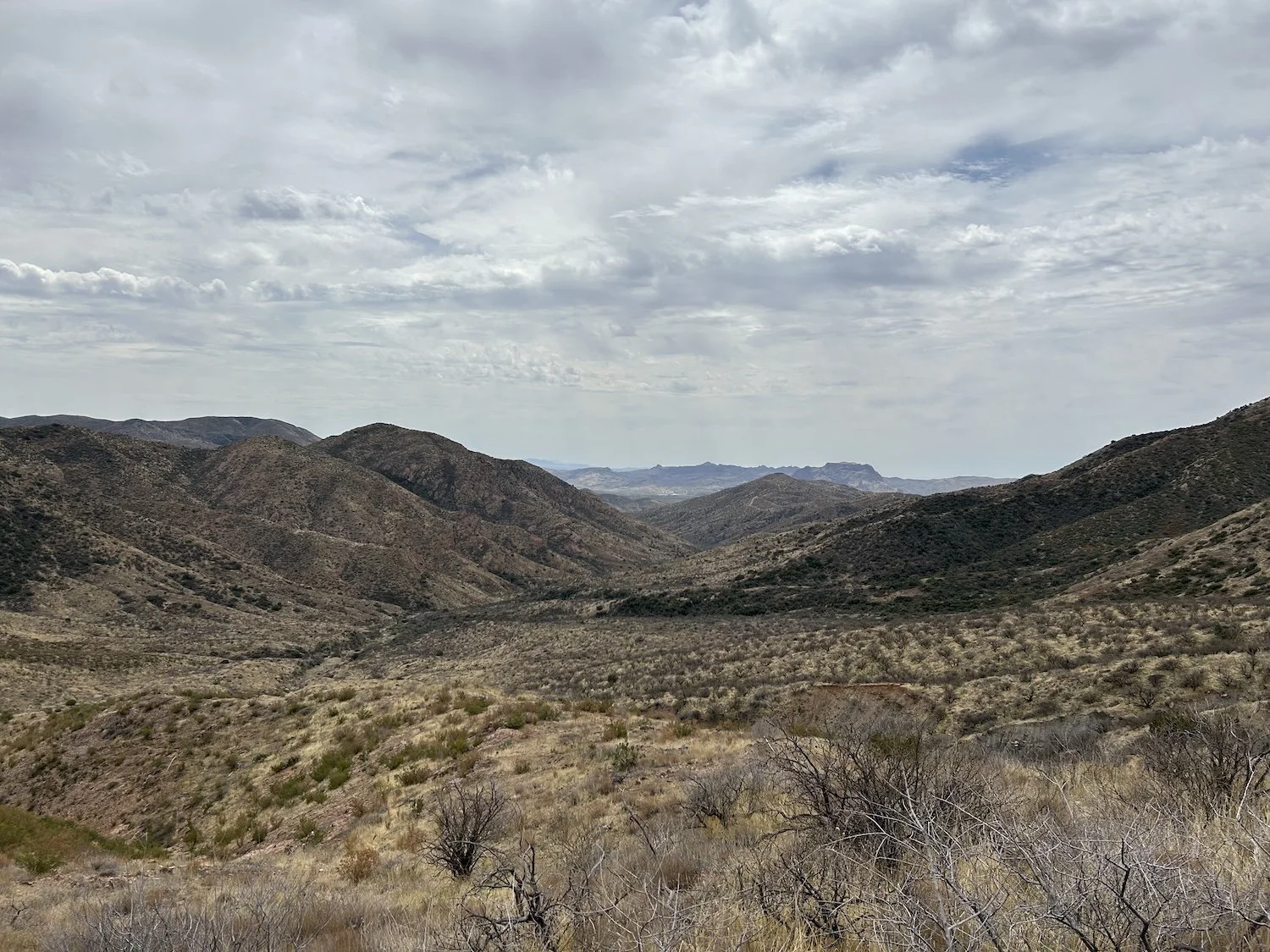
The view down valley towards Superior, AZ
The trail turned into a long dirt-road climb after I departed Rogers Canyon, one I remembered from my thru-hike in 2021. It was pleasant and easy travel with sweeping views. At the top of the climb I saw a group of hikers sitting down, having snacks. I said something awkward like “feels like I’ve come a long way” when they asked me how my hike was going, which was a ridiculous thing to say because really I hadn’t come all that far and today was only my third day.
I shrugged off my awkwardness and kept hiking, eager to reach Superior this evening and buy a fuel canister that actually worked with my stove.
I stopped once for water on the long descent, at which point, a hiker caught me.
Sara Spolrich on the long descent to Picket Post Trailhead and the town of Superior, AZ
“Are you Ivey?”
“Hi! Yes,” I said.
“It’s Sara, from Strava.”
“Oh my gosh, totally!”
We hiked the rest of the way down together, chatting about the desert and her trip. She had made a loop with the Arizona Trail and other trails in the Superstition Wilderness. Her experience sounded similar to mine when she deviated from the AZT—over grown trail, thorns for days, dry, hot—it’s funny how much the AZT is like a highway compared to everything else out here.
Sara had a rental car at the trailhead and she drove me to the grocery store in Superior. I hadn’t bothered to check the time until I’d bought some more snacks; it was getting late. I called a few motels in town but they were all full, and so I began the 5 mile walk on the highway as darkness fell. Sara had given me her fuel canister, so at least I could eat hot food tonight.
I was so exhausted and felt very out of sorts by the time I reached Picket Post Trailhead. I walked a little ways down the trail, pitched my tent, cooked dinner, and called it a night.
Day 4: March 27th, 2025 // 20mi, + 3766ft

The Old AZT
The day was hot without a cloud in the sky or a tree to shelter under. I decided to walk the extra 2mi r/t to the rain collector on the AZT before joining the Old AZT, which the GET uses through the White Canyon Wilderness. It was new terrain for me, and I wanted to make sure I had enough water just incase the way was dry.
At the rain collector I met several AZT hikers and spoke for a while with Keenan, Elle, and Jackrabbit. The shade was so nice and I was nervous about what was to come.

White Canyon Wilderness
I began my cross country trek to find the Old AZT, which proved to be very stop and go. At first I went the wrong way, then I went sort of the right way but it was very steep and I was out of breath and confused because I didn’t see a single cairn or lick of disturbed earth. I started to doubt whether or not I could do this, if it was a rather bad idea and maybe I should just hang my head and take the new AZT all the way to the Mexico border—then I found a cairn and my faith was rekindled.
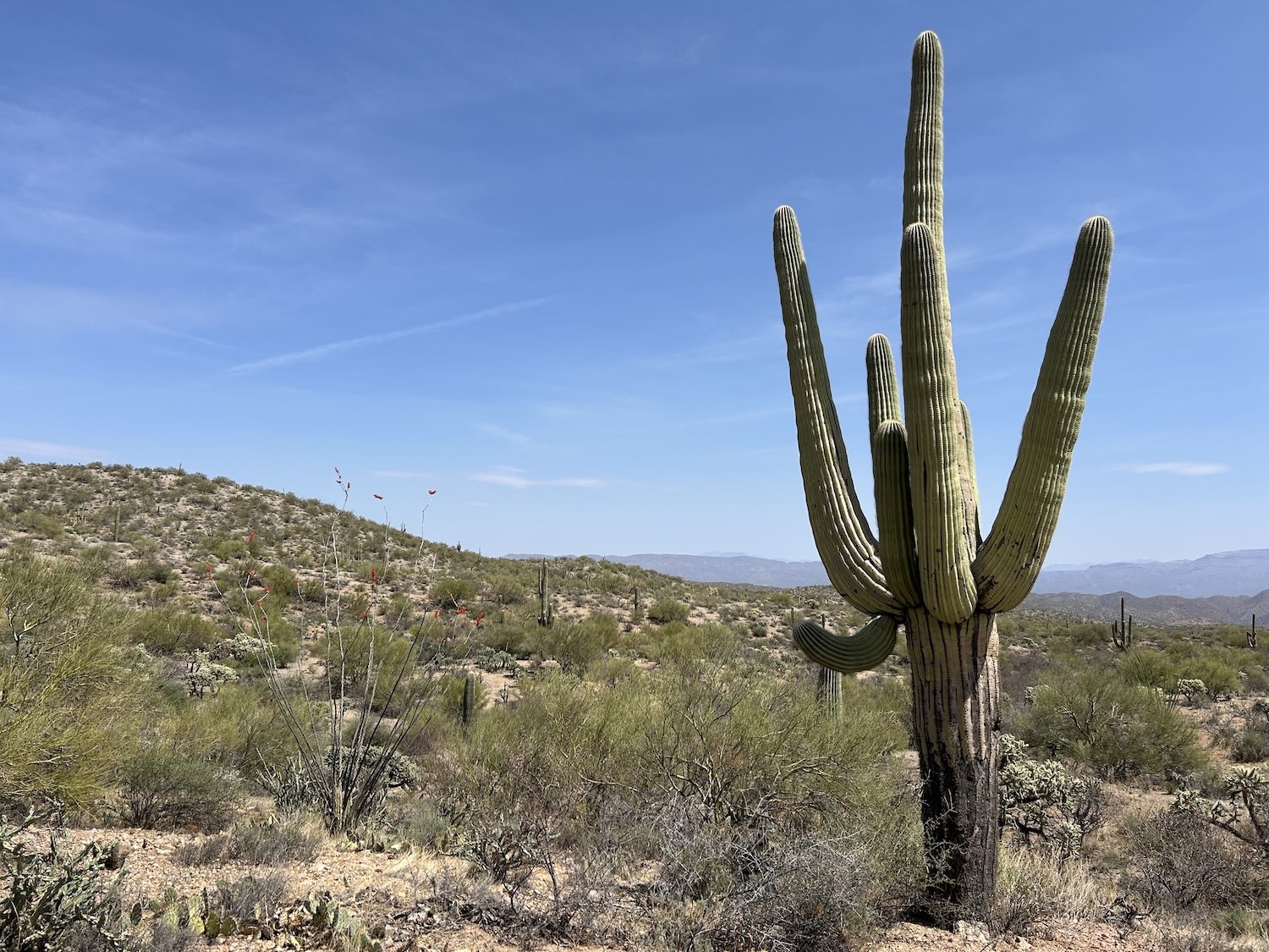
The trail petered out several times, but by then I was on a roll and understood the terrain better. The views were staggering and I felt like a real explorer. The ocotillo was blooming and the saguaro looked rather stately and I thought that my dad would love to see this place.
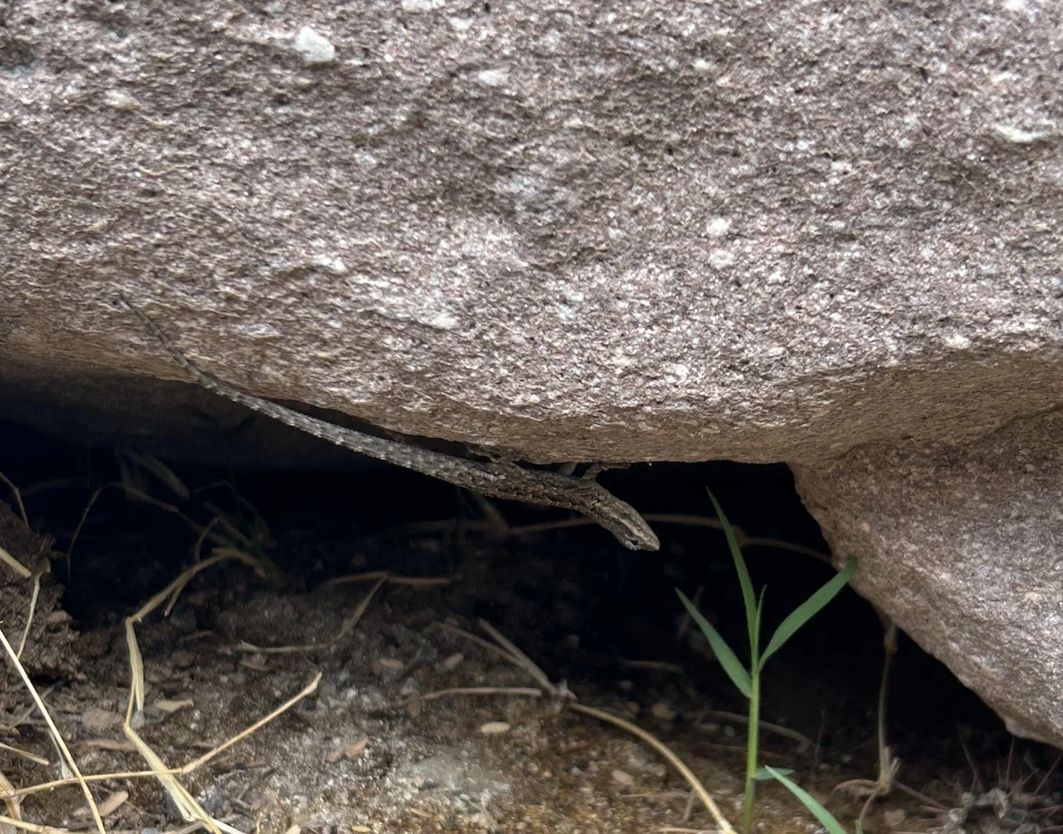
Small lizard friend in Walnut Canyon

Walnut Canyon
“A juicy, red plum in a pebbly, shaded wash—there really is nothing better after a long day. The buzzards wheel above me against a cobalt sky marred only by a fuzzy zigzag of clouds, like in a garden spider’s web. I am waiting for a Knorr Pasta side to heat, fancied-up with dried carrots and broccoli. The shiny blue flies are having a fit, but they will get none of this.” —journal entry from Walnut Canyon
Bats darted this way and that overhead in the dusty purple light, and the call of the Great Horned Owl echoed off the surrounding canyon walls, now a brilliant orange like heated iron in the last light of the sun.
Day 5: March 28th, 2025 // 14.69 mi, +1749ft

Hiking out of Walnut Canyon
I awoke to the descending call of canyon wrens and watched their rust colored bodies dart about on similarly colored rocks as I wound my way through the narrowest part of Walnut Canyon. The air was shaded and cool between the tall walls of sandstone, and I tried to enjoy it despite my shivering because I knew today would likely be another hot one as soon as I left the canyon and rejoined the AZT.
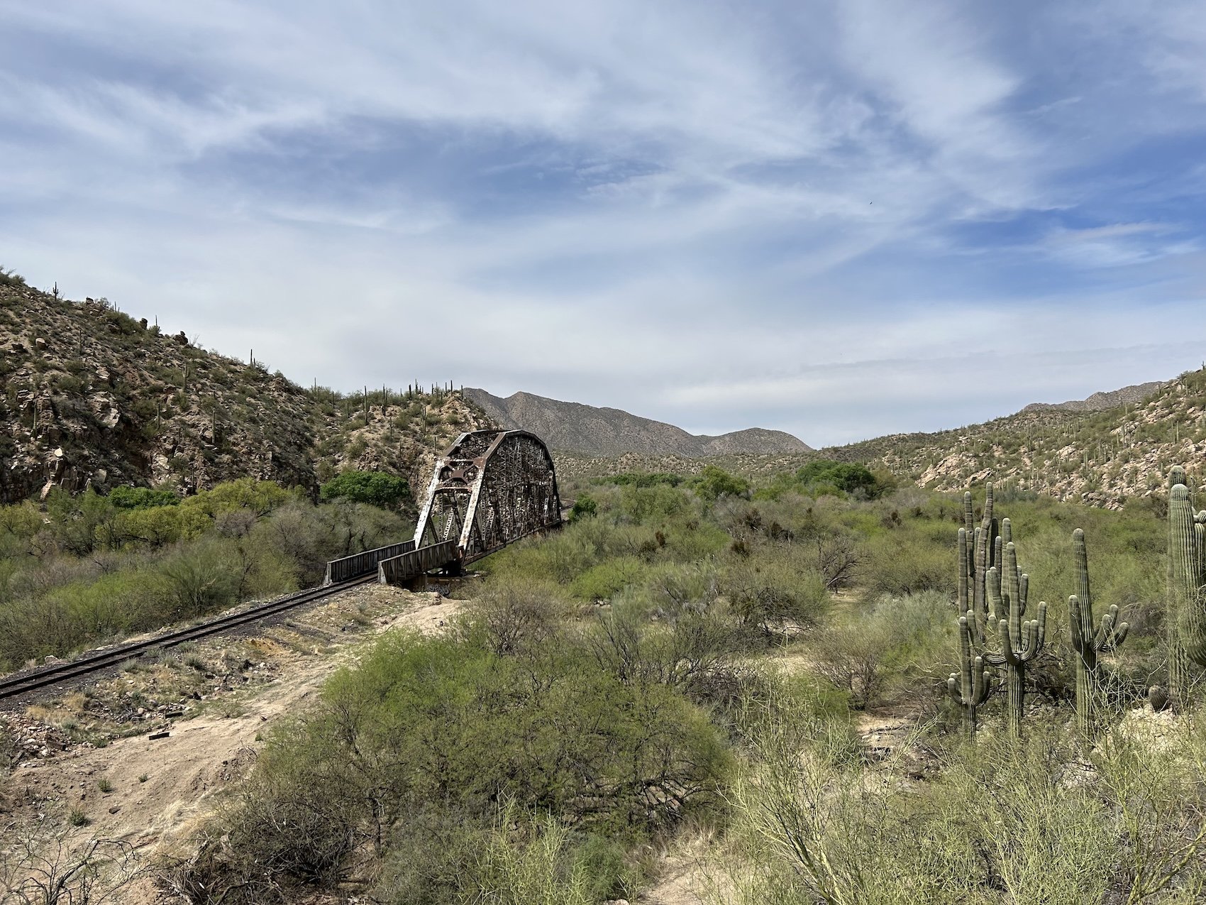
Train trestle along the Gila River
Along the Gila River, I kept my head down and my pace fast. It wasn’t a particularly scenic part of the AZT in my opinion and I was eager to get to the road crossing and the water spigot in Kelvin—the next viable source since the Gila was so polluted. I’d filtered some water from the chilly potholes in Walnut Canyon but had already put quite a dent in my reserves.
I passed many hikers who had left Kearny that morning, all of them looked fresh and excited about the miles ahead. I wasn’t planning on going into Kearny; I had enough food and wanted to make miles so even as they tempted me with talk of pizza and showers, my resolve did not crack.
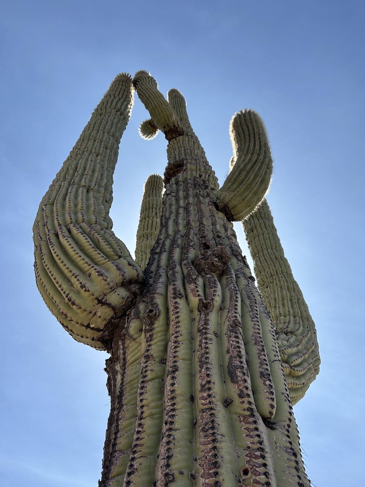
A very old saguaro
I reached the picnic table at the Spigot along East Florence-Kelvin Hwy and dropped my pack, pulled my sun-hoodie over my head and soaked it in the water. The wet fabric was like air-conditioning against my skin when I put the shirt back on. And then a beater of a car pulled up alongside me.
“Where you goin’?” A wreck of a man with a dirt-stained elbow slung out the window of his car eyed me, a cigarette pinched between his chapped lips.
“I’m walking.” I turned away and busied myself with my phone.
“Huh.” He spat, eyes walking slow and stupid across my body. “Well, where you come from?”
“Nowhere.”
He stared, chewing his cigarette. His eyes were rheumy and his skin like leather. And I didn’t like the swollen, ratty trash bags piled up in his back seat.
“I don’t need anything from you. Have a nice day,” I said.
Another car approached on the road; he took one look at it, pulled a U-turn and sped off a little ways down the road before pulling off into a dumping area.
“You need a ride to town?” The man driving the approaching vehicle called out to me. I saw several thru-hikers sitting in the backseat. Safe.
“Yes, thank you. That would be great,” I gathered my things and piled into the front seat.
James was a veteran and self-appointed trail angle for Kearny in the truest sense of the word “angel”. He’d certainly saved me in a moment of need. James had moved back to Kearny to care for his aging mother and saw a need in the trail town that he could fill. He loved talking to hikers, hearing their stories; he felt it gave his day a bit of excitement and renewed purpose. He dropped me and several other hikers off at the local hotel, offering to give me a ride back to the trail in the morning.
Gratitude flooded my chest. I was still reeling from my encounter with the potential kidnapper-rapist-trash bandit, and had no interest in hitchhiking. I booked a room, had a glorious shower—my first in 5 days—and went for pizza. Logan and I caught up over the phone and he wished me an early happy birthday—I turned 32 tomorrow! I’d almost forgotten.
I spent the evening catching up on my journal, charging devices and studying the route ahead. Day after tomorrow I would leave the AZT behind once and for all, and venture into increasingly remote terrain.
Day 6: March 29th, 2025 // 22.7mi, +4636ft
Norm’s IGA
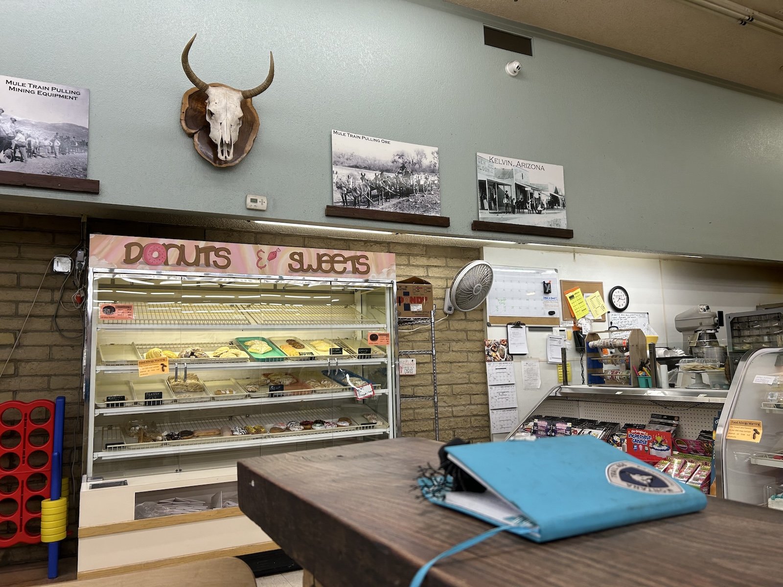
I got my free coffee and donut from Norm’s IGA, pretending it was because it was my birthday and not just because I was another thru-hiker, and then met James outside for a ride back to the trail. He was a good person in the way you can just tell if someone is, or isn’t. There wasn’t a mean spirited bone in his body and everything about him felt safe (I’ve encountered so many UN-safe men in my life, so I feel it’s important to acknowledge the good ones).
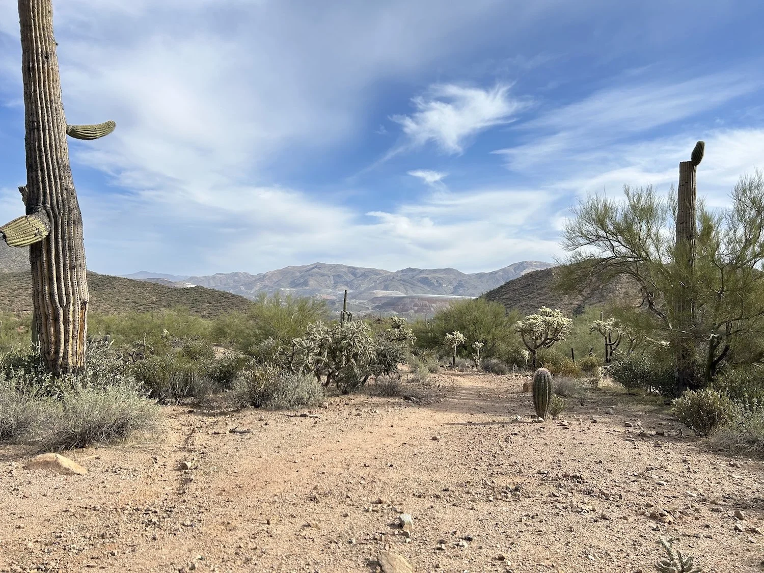
The Arizona Trail through the Tortilla Mountains
I promised myself the day would be memorable even though it was full of so much sameness that I completely blacked it out the first go-round in 2021 on the AZT; I felt sure I couldn’t possibly forget it this time, but I nearly did.
The sun beat down on me and my overloaded pack as I wound my way through a remote stretch of the Tortilla Mountains on the AZT. I didn’t encounter any other hikers on this day until dusk, when I encountered two men hiking toward me on the AZT. One of them mentioned he’d lost his water bottle a ways back and could I pick it up for him if I found it. I told him sure, but sadly, I never saw it.
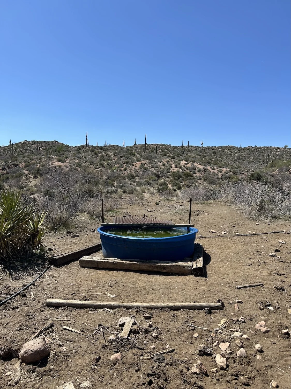
A cattle trough filled with warm, green water
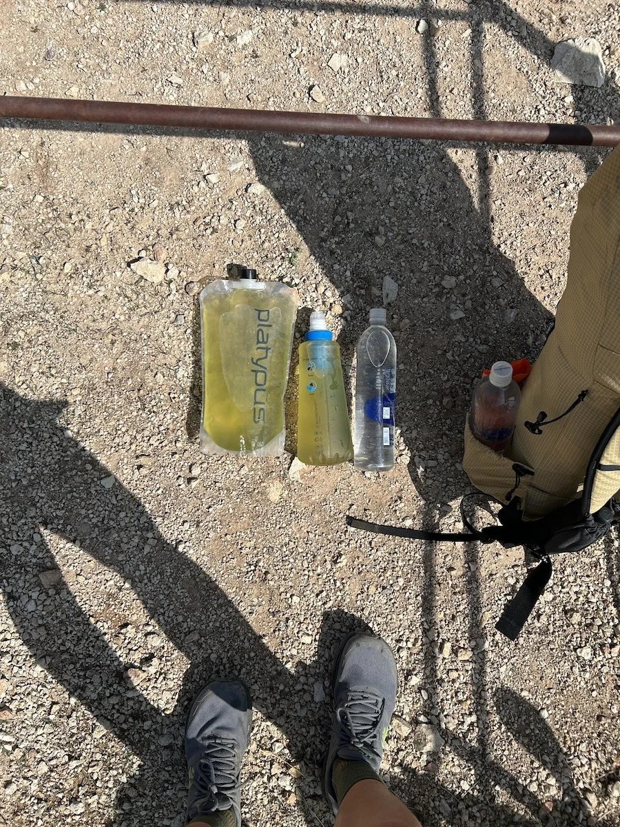
Green water from a wildlife drink tank
Despite the heat, there were two descent water sources on this stretch of the AZT—both a livid green, but they filtered clear. I continued to walk past pink flagging tape tied to low shrubs and trail signs and knew it was course marking for the Arizona Monster, a 300 mile ultra that utilized this portion of the AZT.
I have no recollection of being here.
It’s not a race I have a strong desire to participate in, mostly because I’ve now walking this portion of the AZT twice and I think that’s plenty for me, but also because it is a rather monotonous stretch of desert. The variety of saguaros is the most entertaining bit of magic out here, and I can only imagine what sort of hallucinations I might succumb to jogging past them, sleep deprived, in the dark.
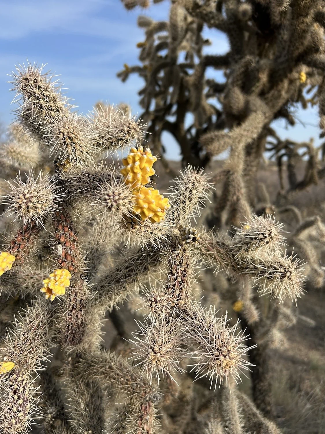
Fruiting Cholla
I camped beneath a really large juniper tree on the bank of a wash. It took a bit of work to clear the cow pies out of the way, but once that work was done, I had a very flat, very cozy tent platform. I cooked dinner, listening to the chatter of coyotes, and thought this was a pretty great way to spend my 32 birthday.
Day 7: March 30th, 2025 // 23mi, +1631ft
Ocotillo and Saguaro
Transition is so hard. All day I was looking forward to parting ways with the AZT, to get away from the busyness and the foot traffic (not that there had been much as of late), but when I got to Putnam Wash, I was terrified. I wandered over to Beehive Well and stared at the cows crowded in the shade, the excess water spilling over the edge of the trough. I felt out of place and suddenly unsure of myself.
I didn’t bother collecting water, I had plenty, so I took off down the wash before I lost my nerve, talking reassurances to myself the whole way.
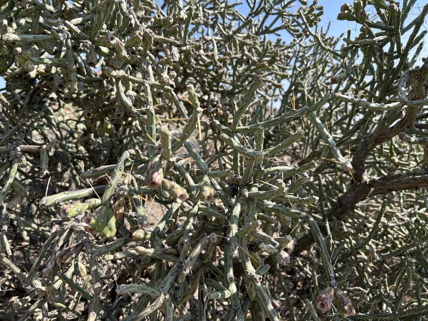
Pencil Cholla
Earlier in the day, at a random gate along the AZT, I’d met a man who recognized me from the YouTube video I’d made of my AZT thru-hike. I was honestly flattered he’d watched it considering he’d hiked the AZT many multiples of times. His trail name was Cheez-it.
Beehive Well area
I gathered water in Putnam wash but didn’t take a break. I felt nervous and the only way I knew to soothe those nerves was to cover ground quickly. When I reached the junction with the San Pedro River—at least, the river should have been right there—I had a hard time figuring out where I needed to go. I’d expected open sand or gravel bars and a large-ish, sparkling body of water, which was not quite what I got.
Putnam Wash
The San Pedro was thin, sluggish, and opaque with agricultural runoff, shielded on either side with fairly dense vegetation—green vegetation—and trees. It was in that moment I learned what the word “riparian” meant, a word I’d never needed to know before, given I’d always lived in such close proximity to trees and shade and lush plant life, that having a word to distinguish it was totally pointless. On this journey, though, corridors like these would be a rare treat, even if the going was a bit slow.
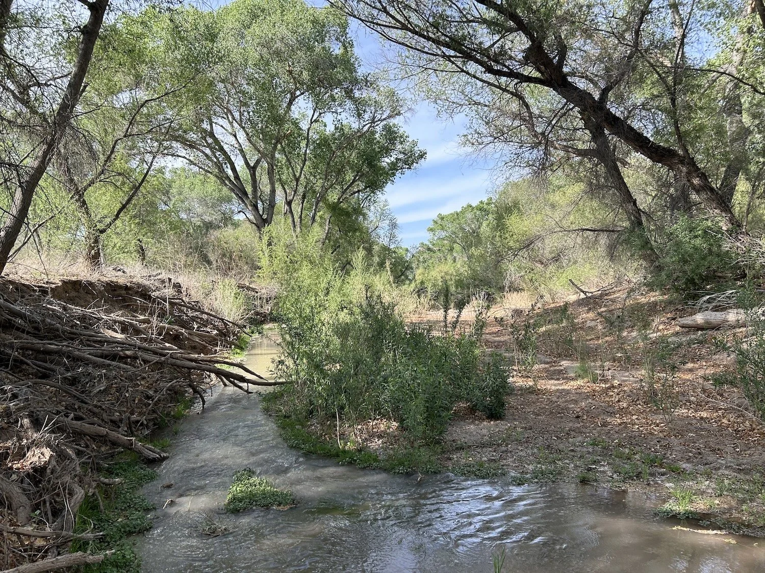
Riparian Corridor along the San Pedro River
I relaxed into the change in environment and decided I’d camp somewhere along this river, before the road.
That evening, once I’d made camp and cooked a dinner of jalapeño cheese grits, I worried my entire tent would become encased in ants by morning—there hadn’t been an ant-free space to pitch it. Shiny black and red bodies scuttled over the ground and up the outside of my mesh door. I committed right then and there to always bring my shoes inside.
Cozy in my sleeping bag, with the first stars revealing themselves in the night sky, I reflected on my first week on the Grand Enchantment Trail. I did not expect this trail to be easy, but in truth, it felt shockingly hard. I worried I didn’t have it in me to persist. But if there is one thing I have learned from thru-hiking, it’s to never make big decisions about my overall trajectory at the end of a hard day. It’s better to eat food, go to sleep, wake up and see what the morning brings.