
The Grand Enchantment Trail: Safford to the Mogollon Crest
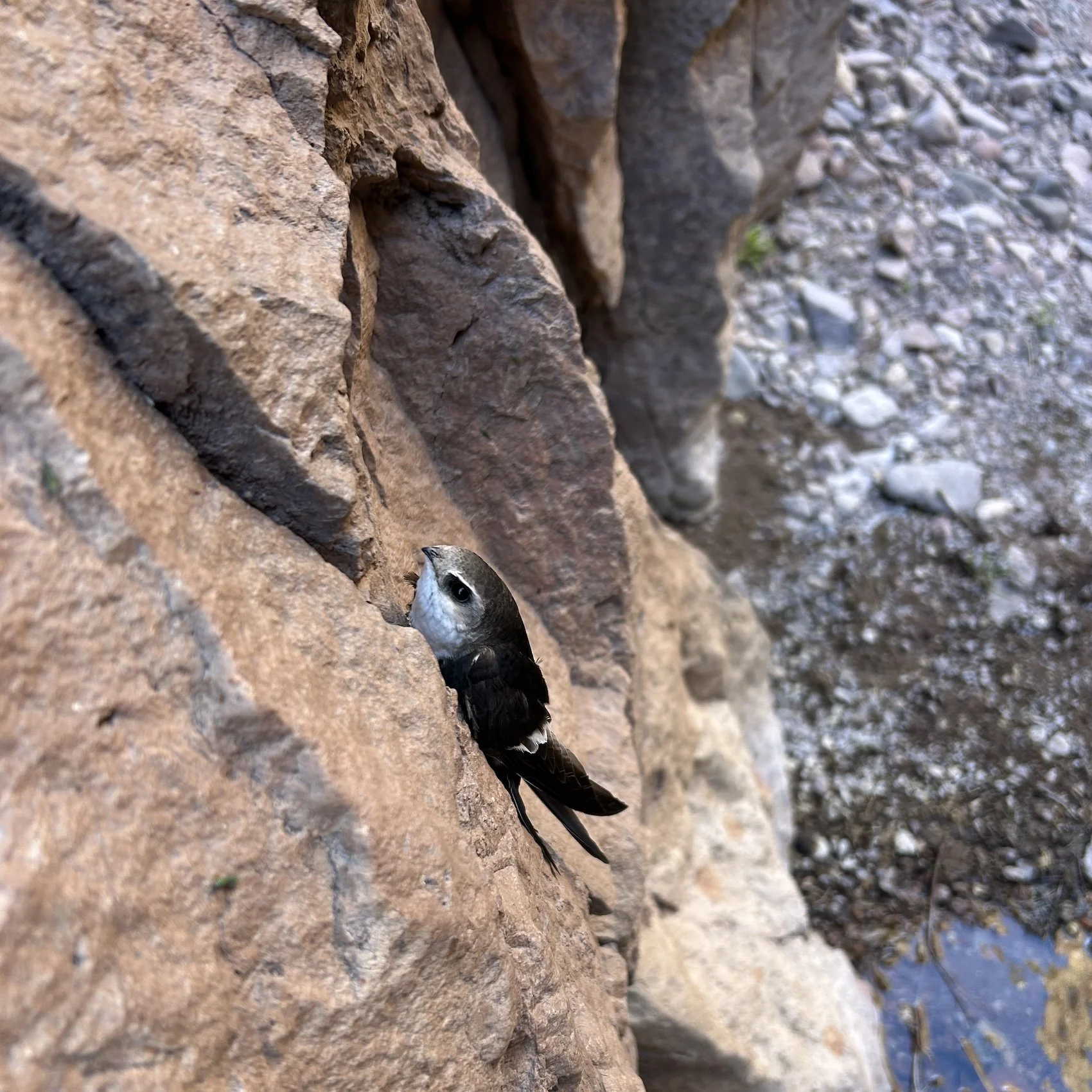
White Throated Swift in Cooney Canyon, NM
“If the desert is holy, it is because it is a forgotten place that allows us to remember the sacred. Perhaps that is why every pilgrimage to the desert is a pilgrimage to the self. There is no place to hide and so were are found” —Terry Tempest Williams; Red
Day 15: April 7, 2025 // 23.34mi, 2976ft+
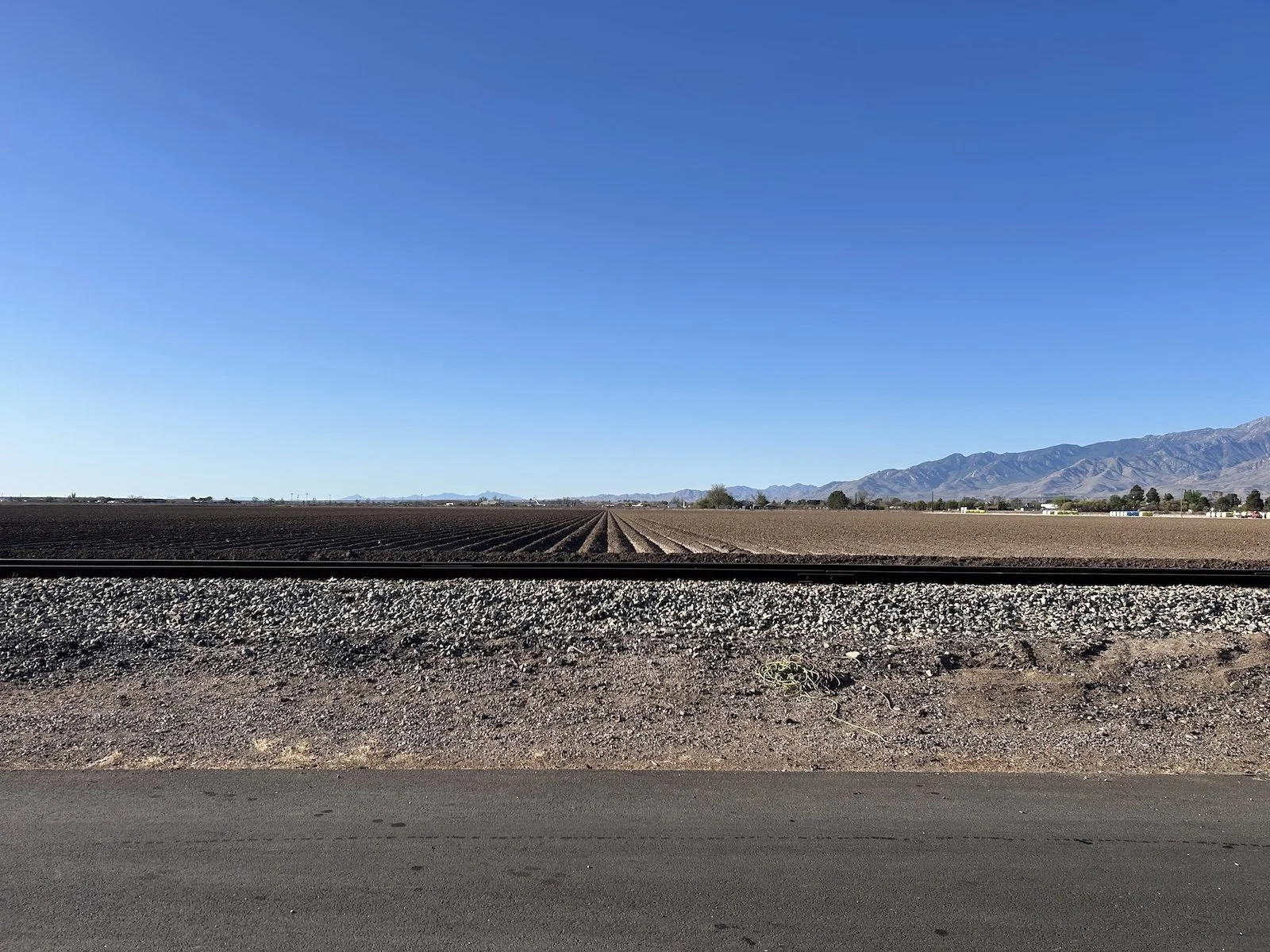
Cotton fields outside of Safford
The wind blew so ferociously the day before, the lid of the dumpster in the Motel 6 parking lot flew off its hinges and slammed into a car. This morning the air was calm.
I was walking by 7:30AM and promptly fell into a culvert in a tilled cotton field. I judged the ground to be solid as I transferred my weight onto the foot already hovering over the muddy edge of the ditch, and was genuinely shocked when I sank to my knee. I curled my toes in my shoe, desperate not to lose it in the muck, and with a great heaving suck, I freed it. So much for clean socks.
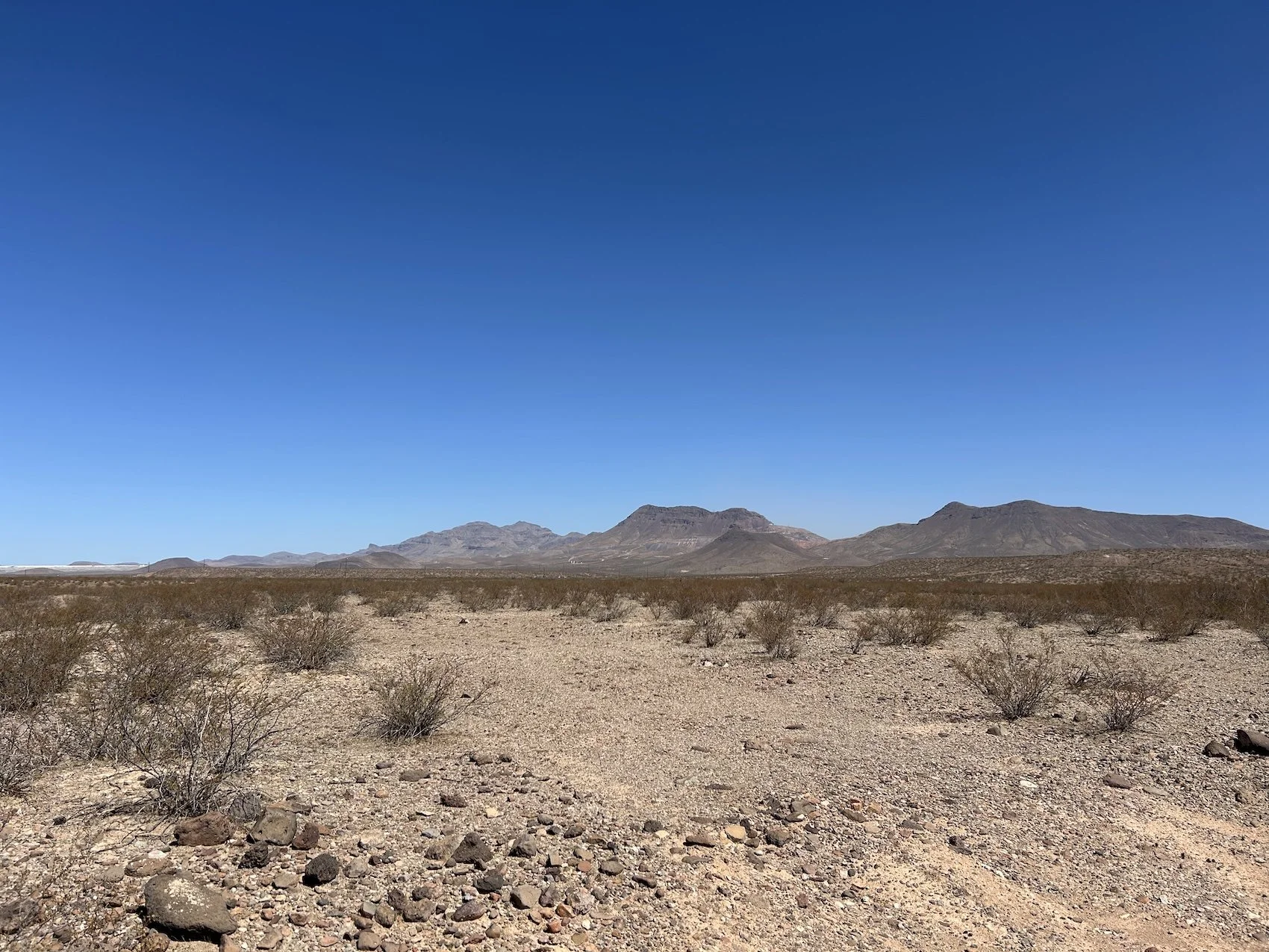
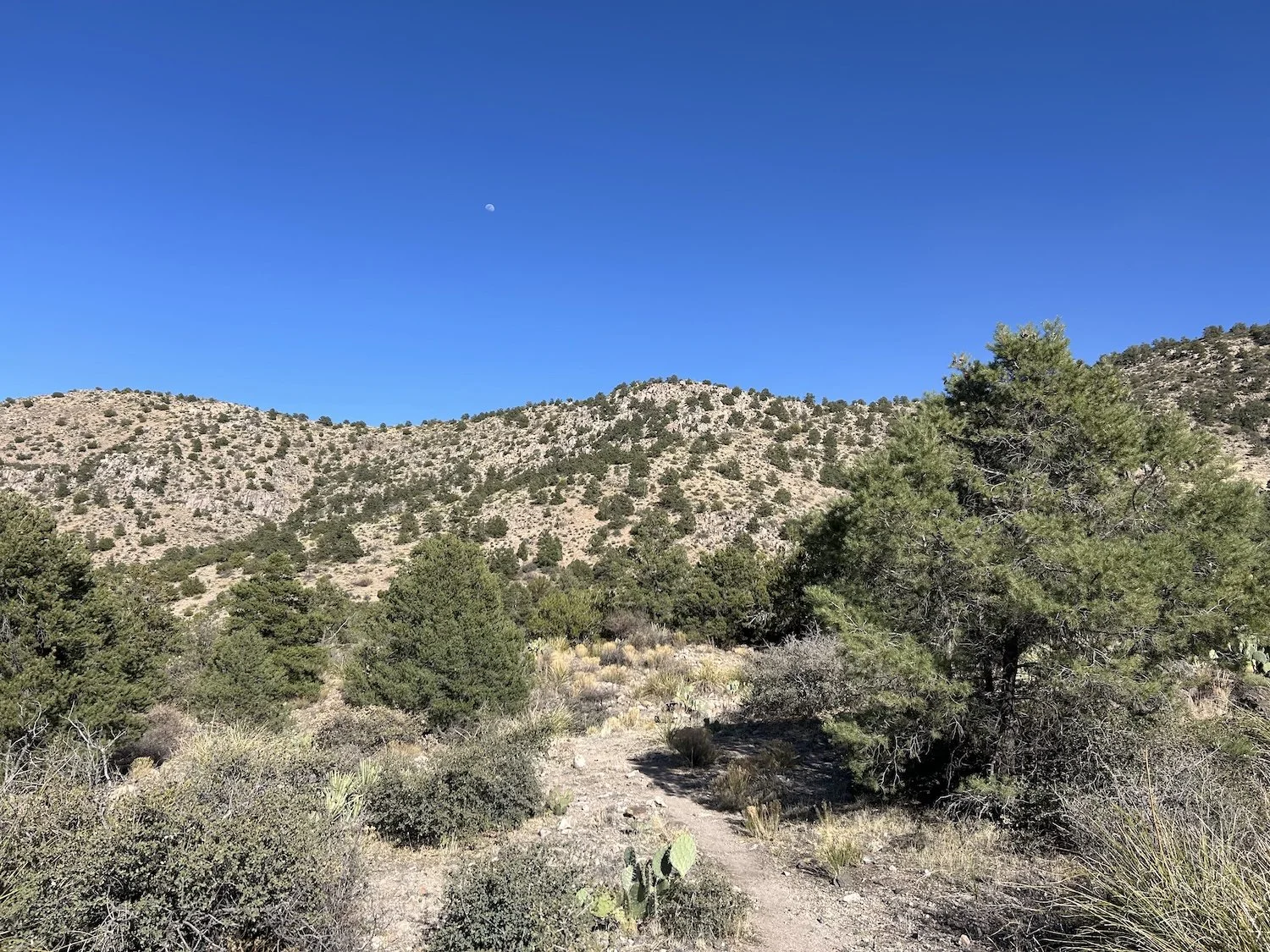
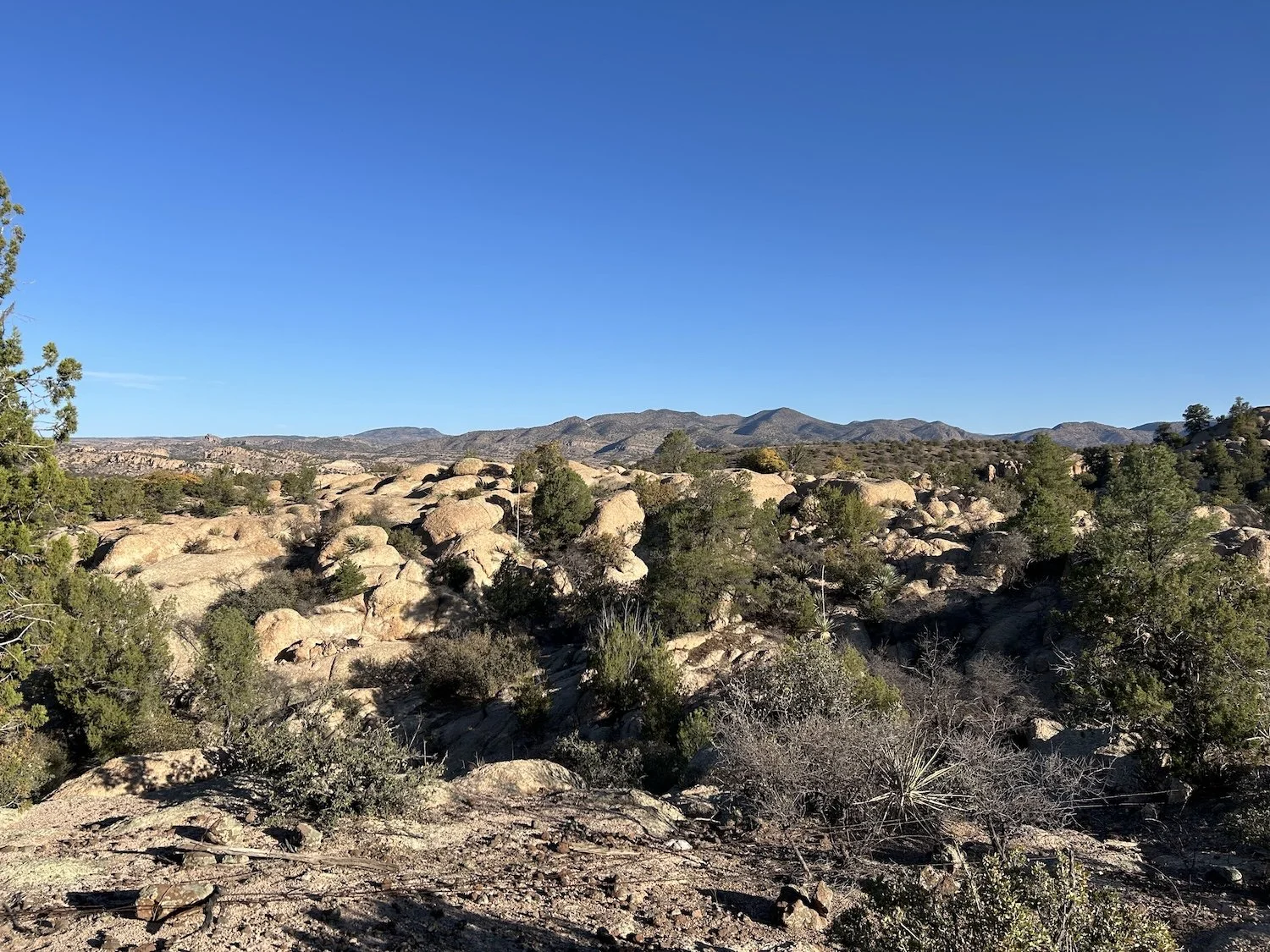
Dry desert beyond the cotton fields
The walk demanded little to no attention and soon my mind began to wander to my aching shoulders. As usual I was carrying far too much food.
When I reached the power plant before Solomon Pass I was desperate for a lie-down, but there was not a spec of shade to be found in the knee high scrub, especially not at high noon, so I carried on, using my fingers to prize the majority of the weight off of my stinging collarbones.
I labored up the gravel road to the pass. It should not have been a hard walk, I told myself, which truly only made the struggle of it worse. Days out of town are the hardest; it felt like a bungee cord stretched between Safford and my pack, tugging against me every step of the way. I picked up my pace, convinced that clearing the pass would release me from the gravitational pull of town.
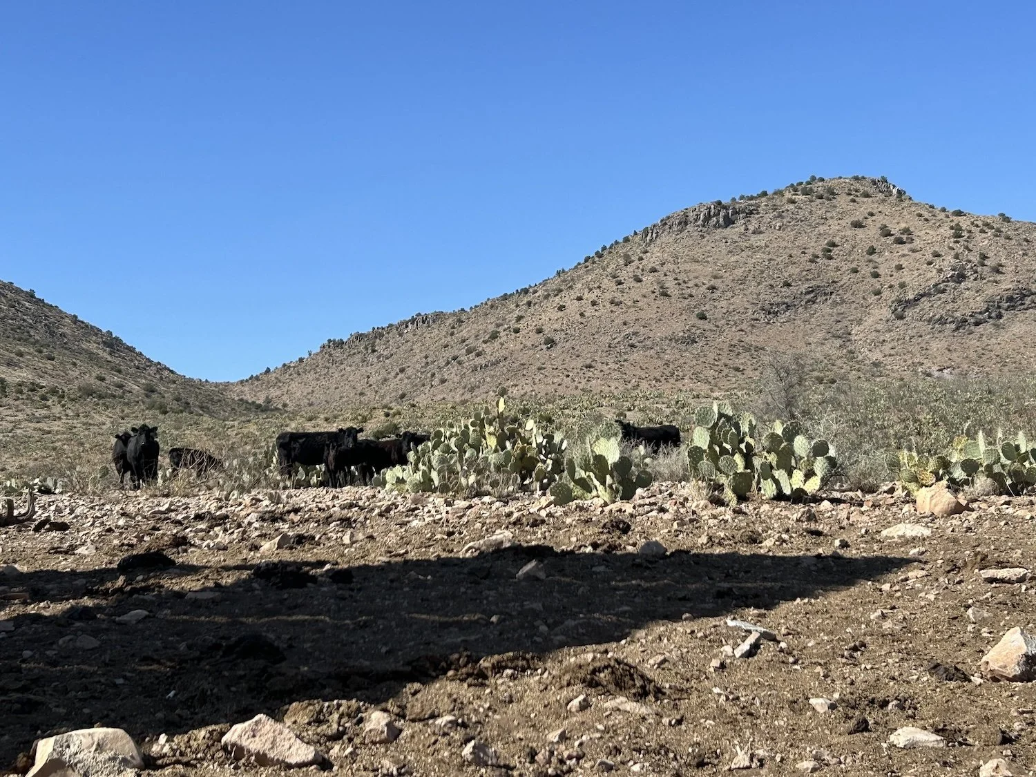
The shade from Rattlesnake Tank and a herd of skeptical cows
When I reached Rattle Snake Tank, I roused a herd of cows out of its shade—I would have shared but they didn’t seem keen on me. I spent the hours prior wrapping around the Safford Mine, since it’s rubble field now filled-in the more direct wash.
As I walked, I’d watched toy-sized dump trucks drive to the lip of the earthen wall and dump piles of tiny pebbles down it. In reality, those trucks stand around 26ft tall and have a hauling capacity of anywhere from 300 to 450 metric tons. I was the toy, the flea, the tiny spec inching across time and space; they were monsters.
I dumped electrolytes into my remaining Liter of water before refilling my empty bottles at the tank. I’d go a bit further before making camp and this would be my last water source of the day.
The western terminus of the Old Safford-Morenci Trail
I camped a short distance after joining the Old Safford-Morenci Trail, a route built in 1874 that used to be the sole connector between the Safford mine and the towns of Clifton and Morenci. It is a rugged track that, over time, erosion has rendered impassible to horses.
I chose a sandy wash for camp that night and committed to eating all of my peanut M&Ms, which were simply too heavy to carry for even one more day.
Day 16: April 8, 2025 // 18.56mi, 3258ft+
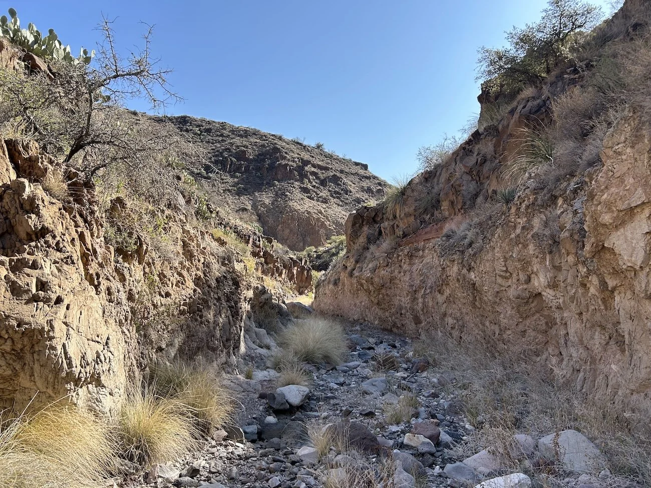
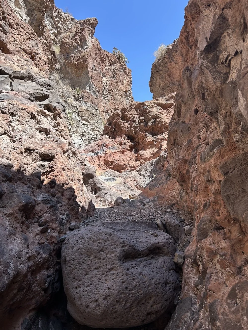
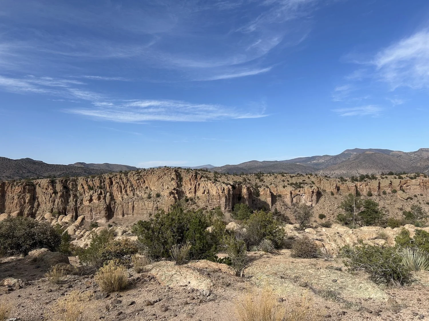
A very rugged wash along the Old Safford-Morenci Trail
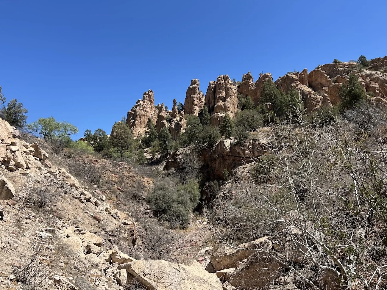
It wound up taking me 10.25hrs to hike 18.5mi today and it was not because I was tired, but rather the terrain was demanding every step of the way. The washes and slots were strewn with sharp pumice and chunks of limestone and unstable river stones. The guidebook warned that even though the way would be obvious, it would be slow going due to the nature of the terrain.
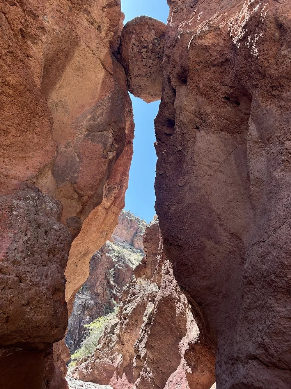
I didn’t take a single flat step as I navigated overgrown trail and stony canyons; occasionally, I forsook the weaving trail to remain in the wash, only regaining the trail if I encountered an impassible pour-over. I enjoyed the day despite the arduous travel and was particularly amazed by the narrow slots and wide array of colors and textures.
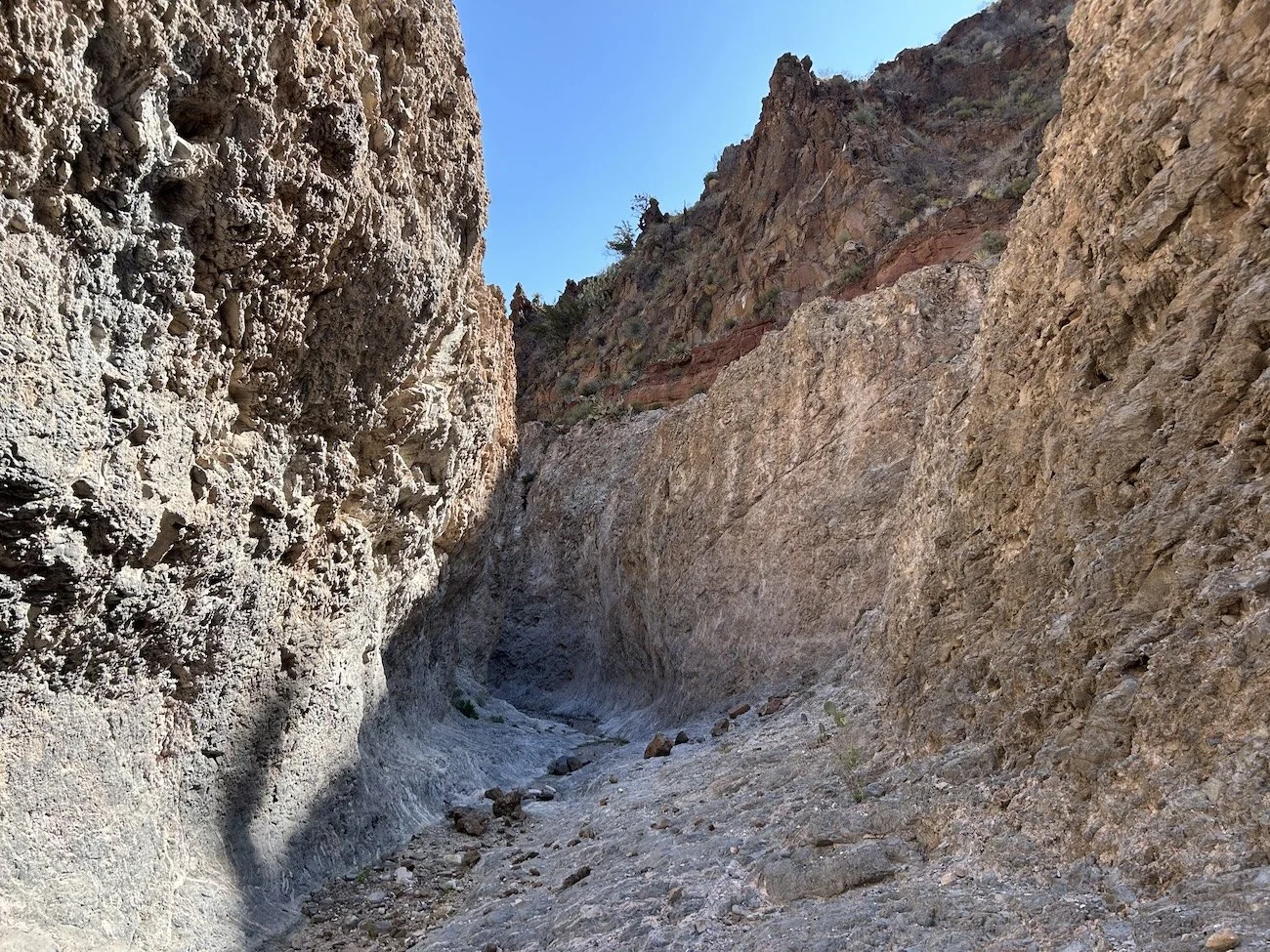
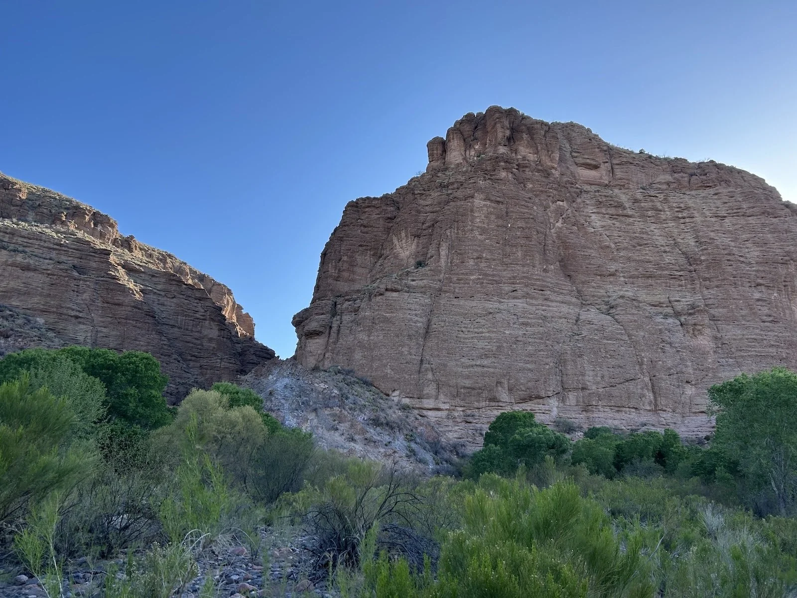
A narrow slot along the Old Safford Morenci Trail
Reaching Bonita Creek, a narrow, riparian corridor in an otherwise dry landscape, felt like a little miracle. I craned my neck back and peered up through the green canopy of cottonwoods to search for a hidden cliff dwelling; I smiled when I noticed something that looked like a darkened window in the rust colored wall of rock.
I filled my water and sat listening to the creek babble. It was early for lunch but I didn’t want to waste such an excellent break spot.
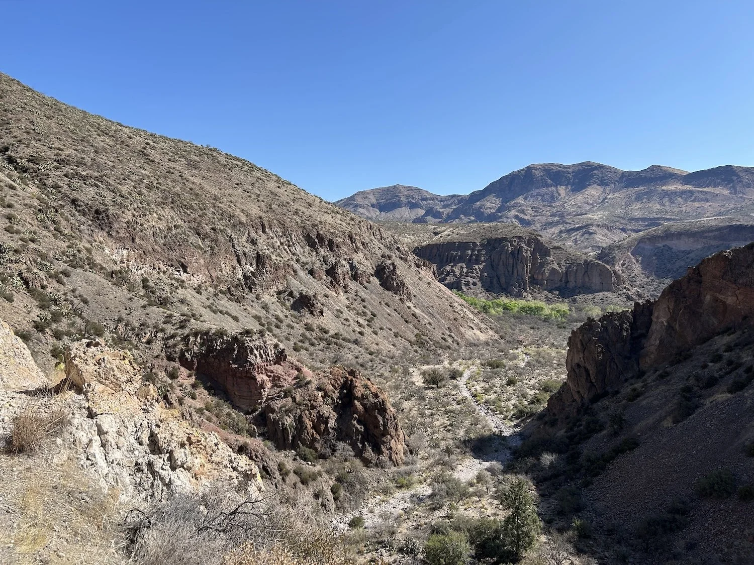
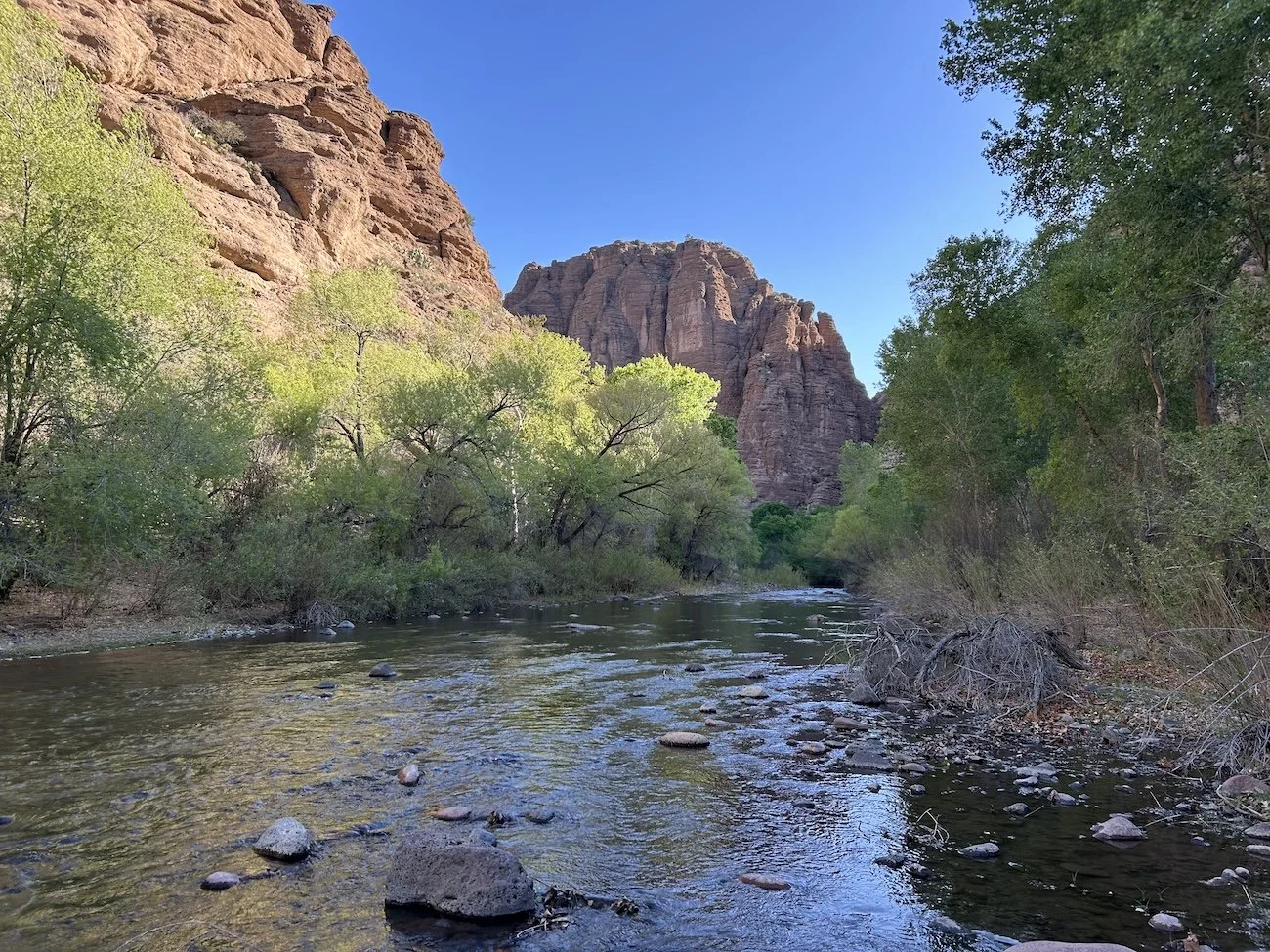
View of the riparian Bonita Creek Corridor down canyon
After Bonita Creek I entered Midnight Canyon which was by far one of the coolest slot canyons I’d hiked through yet. Boulders hovered above me, wedged between the narrow walls, as I wound my way through the soft, sandy bottom. It felt special; it felt secret. I was in a place relatively few people got to enjoy and I’d walked all the way there from Phoenix.
Wedged boulder in Midnight Canyon
The climb out of Midnight Canyon
The climb to Turtle Ridge almost killed me, so studded, as it was, with prickly pear. The needle coated paddles reached into the already whisper-thin path creating a nightmarish maze of thorns to navigate. Stepping over and around each heart-shaped pincushion without getting stuck through felt like a matter of pride, until I slammed my shin into one needle-riddled face, balked, lost my balance, and stepped forcefully into another with the side of my shoe. I howled.
The knifing sting was incredible and pulling out each needle required a firm grip and surgical precision; the barbs seemed to burrow deeper the more I moved. A cactus doesn’t want to get eaten any more than mouse does.
In a particular moment of painful wrenching to get a barb out of the tip end of my big toe, I sensed I was not alone. My head shot up and I scanned my surroundings. A person! I could barely believe it.
“Hey!” I waved, perhaps a little too much.
“Hi.” He hiked closer through the sea of prickly pear. “Are you hiking the GET?”
“I am; you too?”
“Yeah, my girlfriend and I are shuttling each other with a car and a motorcycle. We flip-flop the sections, pass each other in the middle, and move the vehicles as we go.”
“Oh that’s so cool. You’re the first person I’ve seen since Safford.”
“You might run into her and our dog up ahead.”
“You’re hiking with a dog!” I couldn’t believe it. “Aren’t the thorns just awful?”
“He’s pretty good at avoiding them. Mostly.”
We exchanged some trail beta and carried on our separate ways. Part of me was sure I’d hallucinated the whole thing.
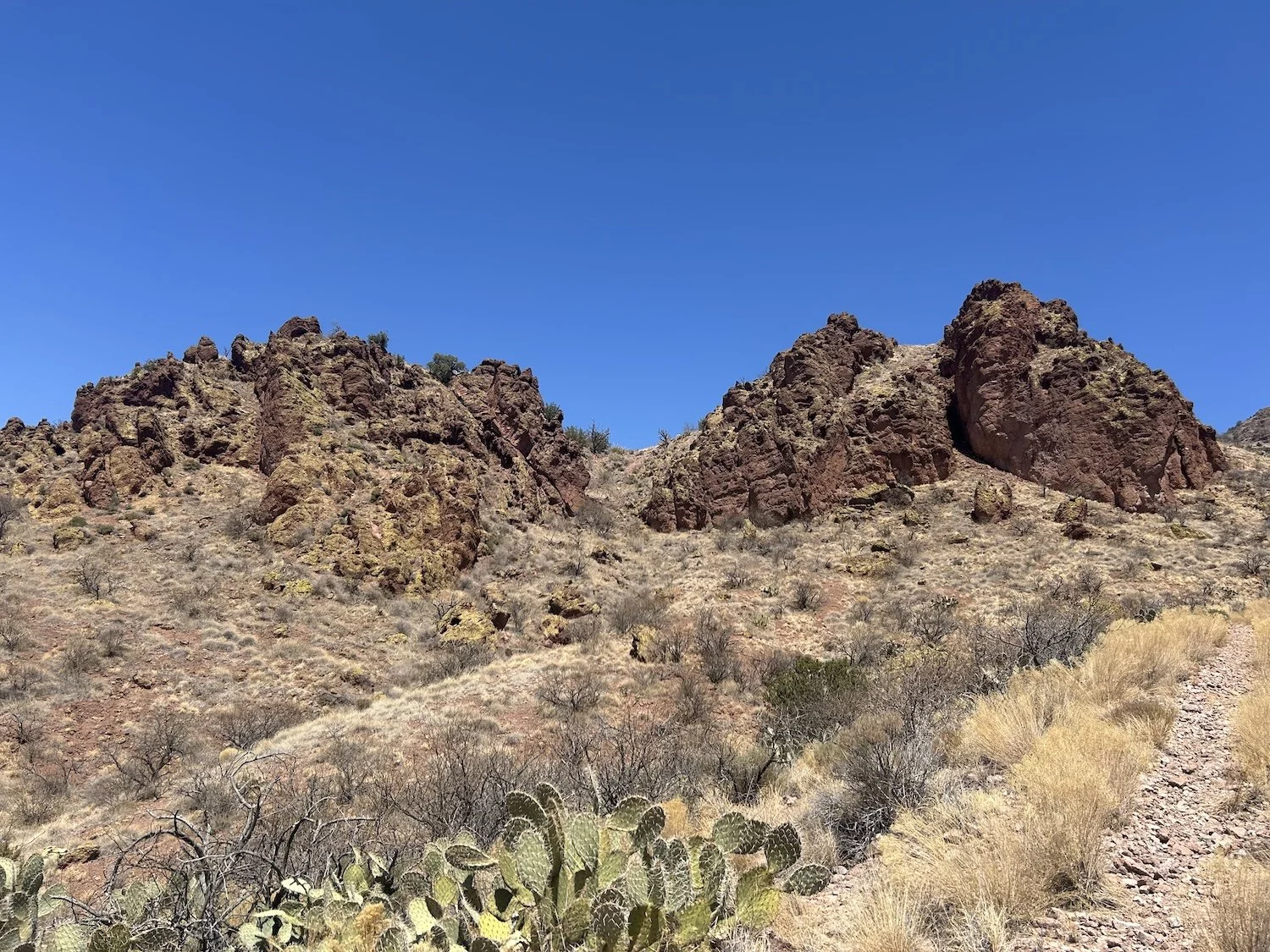
Nearing the top of Turtle Ridge
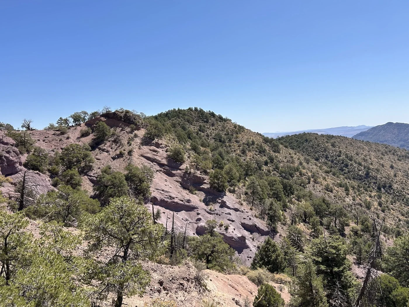
I took a moment near the top of the climb to sit in the shade of large juniper and take in the view. I’d been so concerned about not getting stabbed on the way up, I barely noticed just how high I’d climbed. The landscape felt alien, and in large part I still wasn’t sure if I belonged here. I was a mountain person, right? The desert rippled with vague hostility beneath its pretty rocks and dramatic canyons. It was a harsh moonscape, beautiful for all the ways I failed to understand it, alluring in a way I could not put my finger on.
The descent in Smith Canyon was a brutal way to end the day. The path was rough and by the time I reached the dirt road at its end, my right pinky toe felt like it had been stepped on by a horse at least twice.
I hiked the road to Eagle Creek under the now weak rays of the sun, thoroughly tired, and made camp as soon as I found a decently flat spot along the shore that wasn’t coated in ants. There were flat spots galore, but the “fewer ants” stipulation was hard to achieve. I couldn’t sit in any one spot for too long before they erupted from the earth all around me, hungry for whatever tiny grain of sugar I might drop.
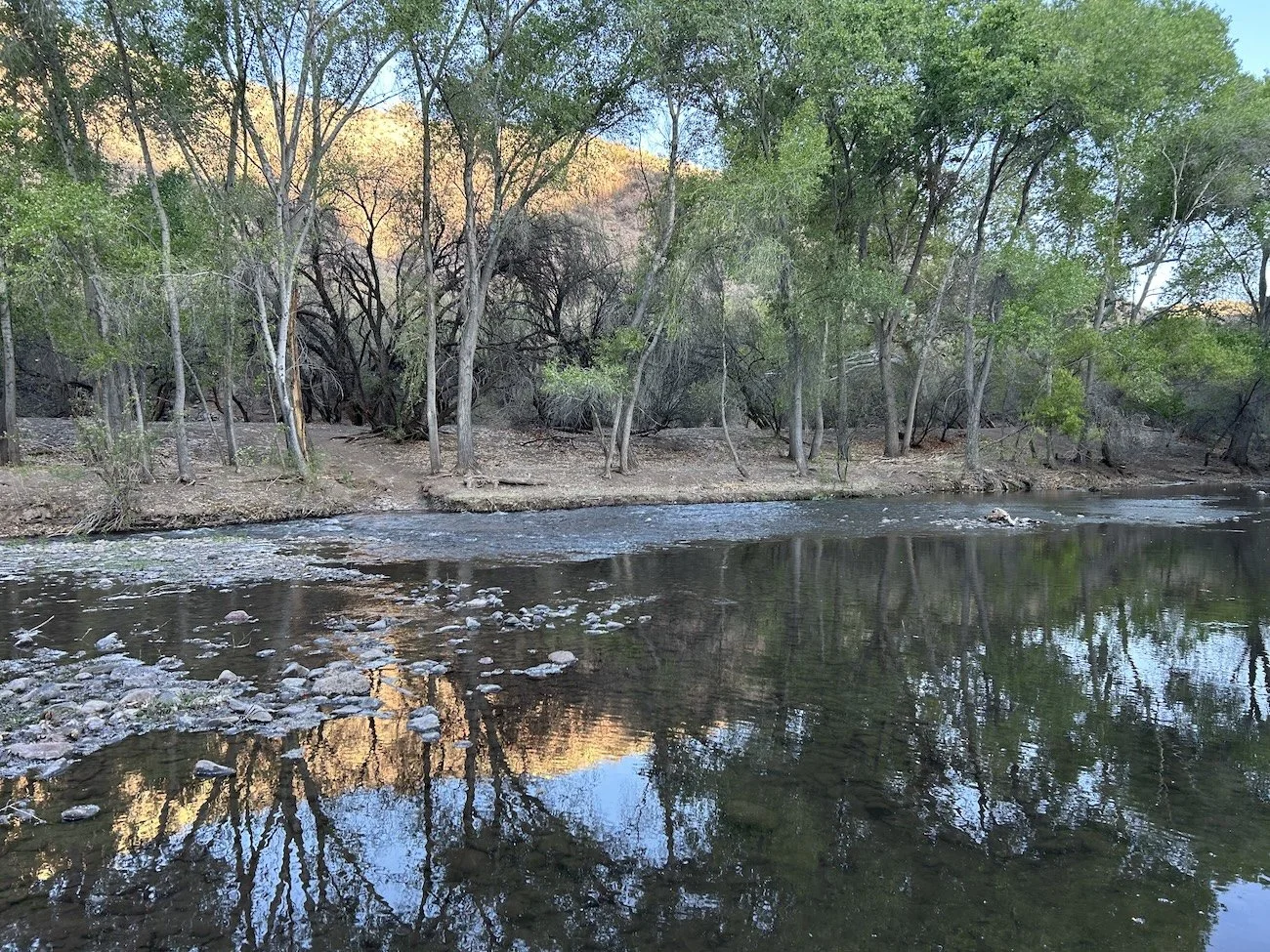
Eagle Creek
Day 17: April 9, 2025 //22.03mi, 4469ft+
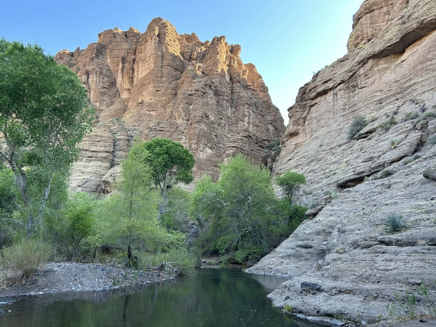
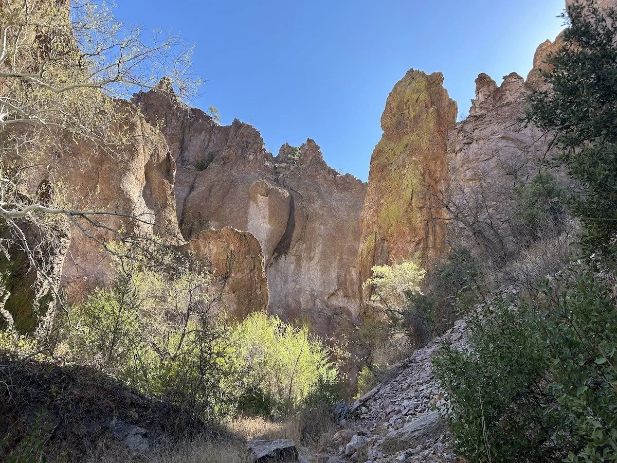
Cliff walls above Eagle Creek
In hindsight, I made this day a lot harder than it needed to be. If I could go back and change anything from my GET experience, it would be ending my day early, before departing from Eagle Creek, and then tackling the Painted Bluffs Primitive Route the next day with fresh eyes and legs.
Alas, I did what I did and the result was that I became frustrated and panicky and wound up crying several times. If you are an aspiring GET hiker, this section of trail might be an opportunity to introduce an element of ease into your desert experience.
Lush foliage along Eagle Creek
Today was largely driven by anxiety; let’s start at the beginning.
I woke up beside Eagle Creek with the knowledge that I would ford the creek upwards of 50 times, back and forth, for 9 miles, until I left it in favor of a side canyon and the start of the Painted Bluffs Primitive Route. The water was chill but not brutally cold, and for a time the walking was pleasant. I followed a 4X4 track, which wound back and forth across the creek and carved its way through thick walls of Tamarisk lining both shores.
When the track petered out, as I knew it would, I was left alone to battle the Tamarisk at every ford. Occasionally I found a path, likely a cow path, a ways back from the shoreline, which I followed until it ended at a wall of rock or lead me back to the creek. The whip-like branches of Tamarisk smacked me in the face and the arms of thorny bushes dug into the hood of my sun hoodie, ripping it off my head at least a dozen times.
I began to get irritable.
Deep pools in Eagle Creek
I wanted to camp at the departure point from Eagle Creek, I wanted this day to be over because I knew my mindset wasn’t good, and yet, for some stupid reason I kept walking. I think I felt panicky, standing next to Eagle Creek, looking ahead at what was to come. So much wilderness stood between me and—what? The next highway? My next resupply?
Anxiety welled up so greatly in my chest, I knew I could not make camp at noon and pass the hours until dark alone with my thoughts.
I guess that is why I kept walking.
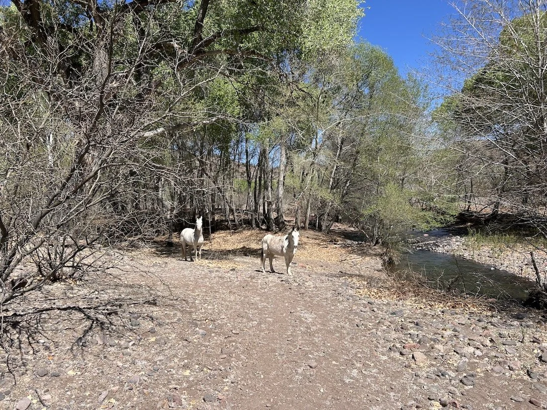
Two white mules along Eagle Creek
Twelve miles stood between me and a potential hitch into Morenci or Clifton and I thought that would be no big deal. Even if I walked 2mph, I’d make it there by 6. Seemed reasonable.
Except that it wasn’t reasonable at all. My pace was greatly slowed by pumice, deep, sandy washes, and convoluted, overgrown trail. I didn’t see a single footprint—this wasn’t unusual per-say, but in my already heightened state of anxiety, it made me feel like I was the last person on earth.
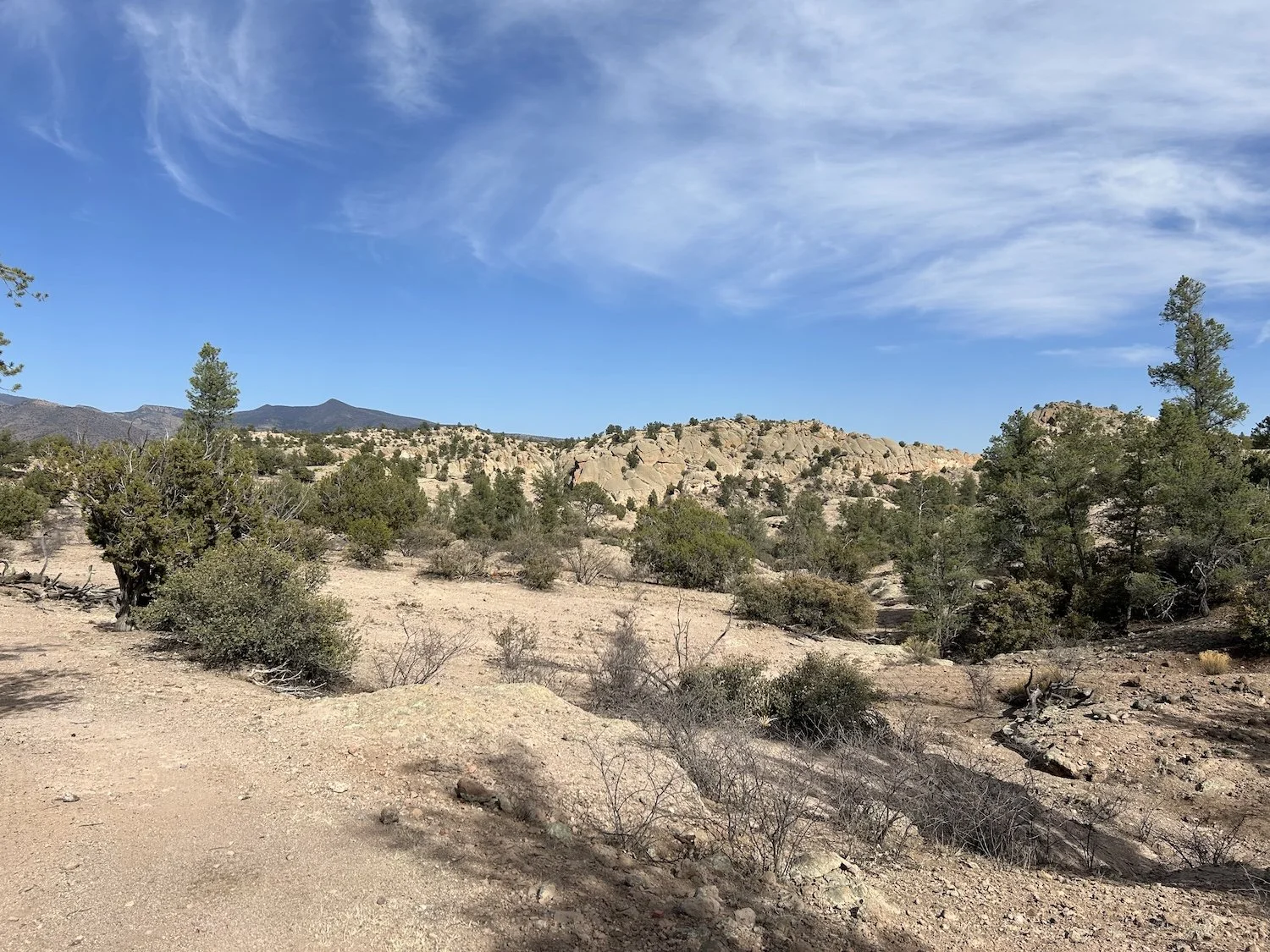
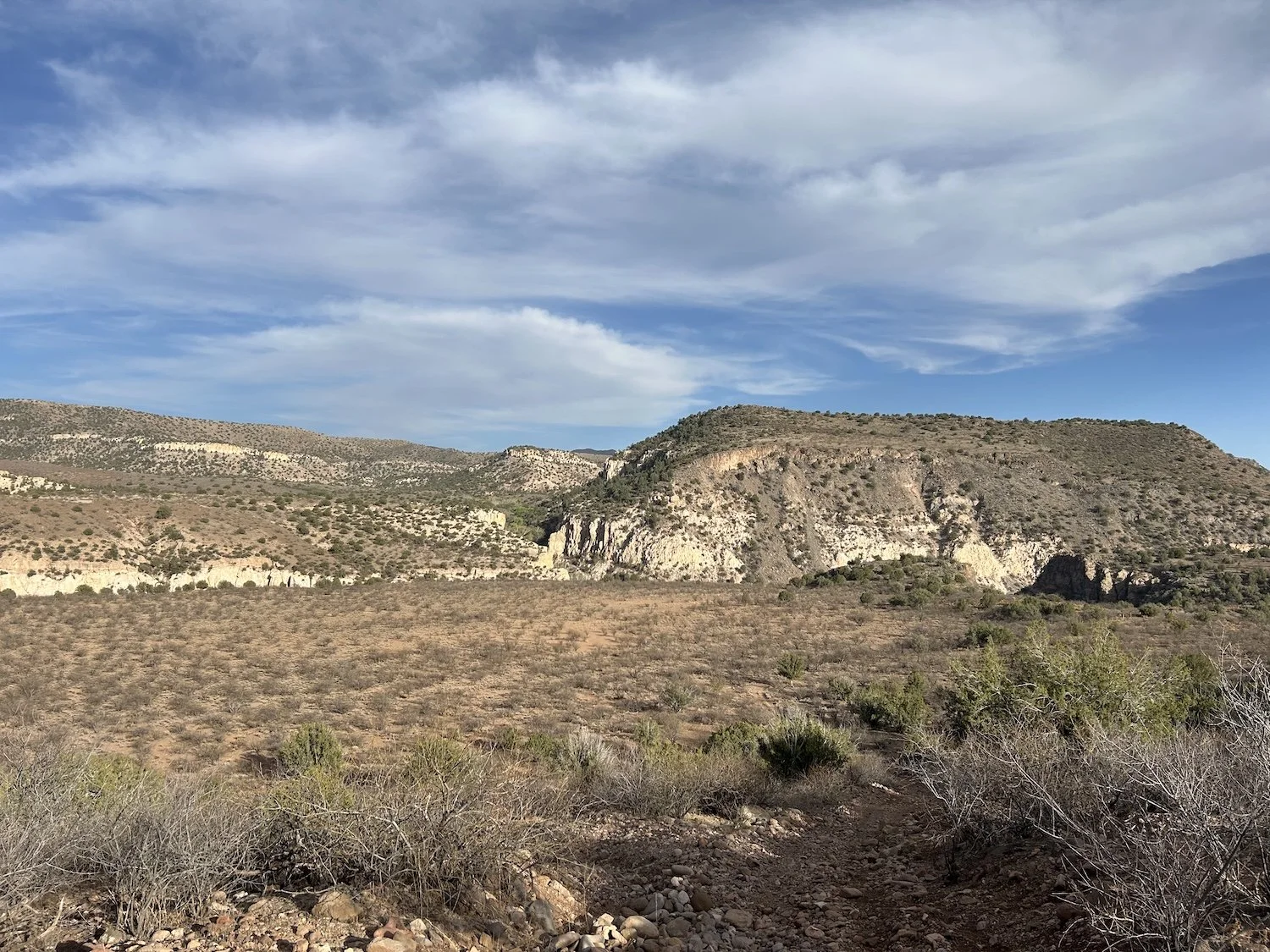
Upper Painted Bluffs track
My feet were tender from days of stepping on sharp, volcanic rocks. Every time I thought the trail would descend, it just kept climbing. Forever. Relentlessly. Into and out of overgrown washes but always up.
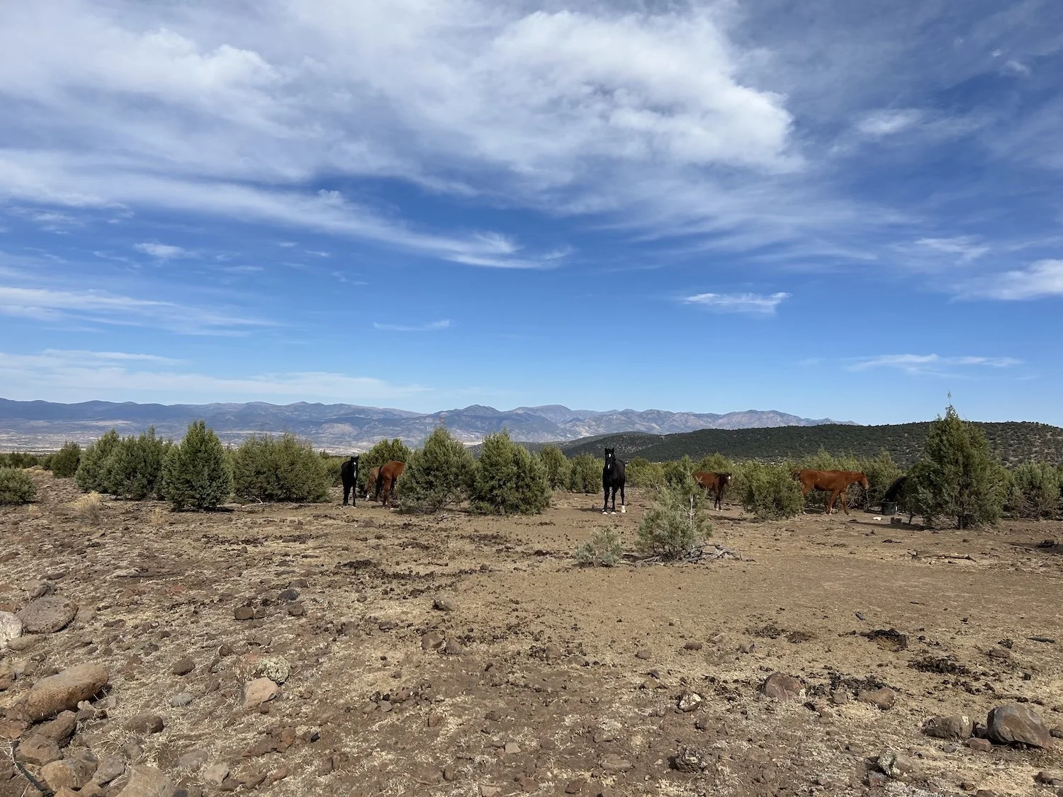
I saw a group of healthy looking bay horses in one particularly rough stretch. I sensed them like I had the hiker the day before. I raised my eyes from my battered feet and my staggering gate came to an abrupt halt. Their tails switched nervously, ears pricked in my direction.
“Hey there,” I said. My voice was rough from disuse; my heart raced with surprise.
They stomped and shied, uncertain how to best to get away from me in the narrow wash.
“It’s okay.” I angled my body away from them and gave them wide berth.
Rocks scattered beneath their hooves and strands of black mane flew as they spooked and charged up the opposite side of the wash, stopping once to ensure I was walking past them, rather than toward.
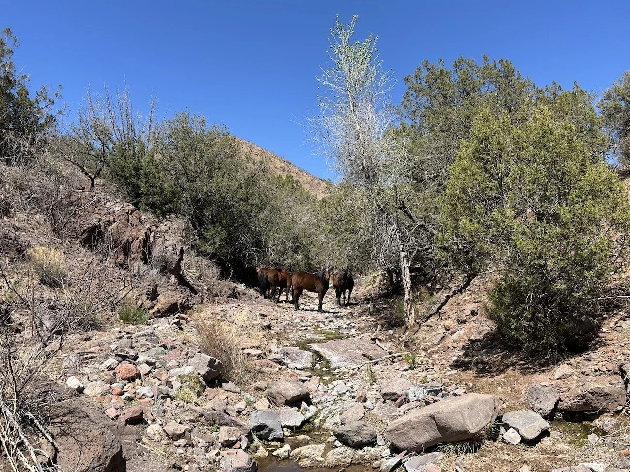
Horses in a wash
Beyond the horses I found a sizable pool of water, caught in the smooth scoop of a pothole; it was cleaner than the mucky puddles in the belly of the wash. I shucked my pack and dropped to my knees before it like it was an alter. It was only after I’d filtered two liters and eaten a pop tart that I noticed a skunk sulking in the shade of an overhang not 6 feet from me.
Patience worn thin, it emerged from its dark hidey hole and eyed me, tail perked at a certain angle that made the hairs on the back of my neck raise. This was the last thing I needed.
“Okay, it’s all yours. Thank you for sharing your water with me.”
I slipped my pack onto my shoulders never taking my eyes off the skulky, tuxedoed figure and stepped carefully away from the grotto in the wash.
Painted Bluffs Primitive Route near Pinto Spring
When I arrived to the drainage that lead upwards to Pinto Spring, I was alarmed to find a sleeping bag huddled amid a jumble of rocks and chunks of cement from a damaged basin. The bag looked bloated, swollen. My brain whirred, could a person—a body—be inside that sleeping bag? I prodded it gingerly, heart pounding. The sun-bleached fabric gave easily beneath the tip of my trekking pole. Empty. But still, I was shaken. I gazed upward; it looked like a mess of catclaw and holly. I could waste time in the blaring heat trying to find Pinto Spring and pictographs or I could make miles—I’d barely come six.
And this is what I regret most; by rushing and stressing in the heat, I lost the spirit of adventure.
I wish I’d gone looking for those Anasazi pictographs, I do. I honestly don’t think I’ll repeat the Painted Bluffs Primitive Route because, by nature, it is remote and difficult to get to; so I’ll never see those pictographs.
Lessons on “trail” come in many forms, regret is the worst kind in my opinion. I have few regrets when it comes to past thru-hikes; I try to follow my personal ethic and make choices I can live with later, but I am always learning. That is the point of going out in the first place.
On this day I was positive I would quit the GET when I got to the highway. I flung myself in and out of the remaining washes, clawed my way to the top of a remote saddle and threw myself down in the shade, dirt smudging my face, tears blasting canyons through the filth coating my cheeks. I lay down on my side, curled into a quivering ball in the sand; ants exploded all around me and I didn’t even care.
End of day over the Coronado Trail
I made it to the highway and waited an hour without seeing a single car. I was down to a half liter of water. I pulled out my phone and dialed the number of a man named Frank, given to me by someone who hiked the GET last year.
“Hi, Frank? I’m walking the Grand Enchantment Trail and I’m at the highway near the Apache National Forest Sign. I’m trying to get into Clifton?”
“Oh. You’re where? Well yes. I can drive up there, it’ll take me about 45 minutes. I’m not doing a thing, just watching the television. I’ll be there.”
It was nearly 8PM when I saw headlights cut through the dark. The pick-up truck pulled to a stop beside me and I opened the passenger door.
“Hi, Frank? Oh my gosh thank you so much for coming to get me.” I tried to hide my shivering as I threw my pack into the bed of his truck and clambered into the passenger seat.
“I brought you some water and take this.” He handed me something in a crinkly wrapper, a Nature Valley bar.
“I can’t thank you enough for driving all the way up here.”
“It’s no trouble. Weekends I work security at the pub, not that they really need security down there. I’m retired, but I like to have something to do. I don’t do much on weekdays.” Frank steered his truck towards the lights of the Morenci mine and into the storm of dust generated by the myriad conveyor belts carrying rubble every which way.
The size of the operation was astonishing. I’d never seen anything like it. I’d passed the Safford Mine from such a distance that the machinery looked fit for dolls. This was something else entirely and it went on forever—down, down, down we drove, past layers of excavation and debris and earth movers the size of apartment buildings.
“I worked there for a long time, in the smelter. They don’t have the smelter anymore, wasn’t good for air quality. It was so hot in there your eyes dried out and you couldn't see for hours afterwards. I didn’t take my mask off except to take a bite of my sandwich, then I slapped it back down to chew and swallow.”
For an instant, light filled the cab of the truck and I caught a glimpse of Frank’s profile. He was a sturdy man, his hair pulled back and low into a thin ponytail above the collar of his jacket.
I didn’t know what to say to him. I felt as though I’d stepped into one of those complicated gray areas that made my skin crawl. The glaring lights and winding road made me feel suddenly ill. When I’m hiking, it’s easy to feel like there is a “right way” to interact with the world, a way of least harm done. And then I get picked up in the dark by a man who actually worked at a mine because that was the best job in a town like Clifton; the mine was the town and while it created an unconscionable level of pollution, it generated the necessary materials so that I could have the glossy phone I use as a navigational tool to fuel my wilderness sojourns. The note of pride in Frank’s voice when he described his job at the smelter wasn’t lost on me either, and I thought if I opened my mind just a bit wider I might be able to understand, to grasp something important.
“I can’t imagine,” I said. “What a wild experience to have; I’ve never met anyone who worked at a mine.”
“Well, after the mine I took a job as a janitor, fell off a light post and broke my back in several places.”
I can’t remember why Frank climbed up the light post, though, I’m sure there was a good reason, but I do remember thinking that the man sitting next to me in the dark contained multitudes, and I felt lucky to have met him.
Before he dropped me off outside the Union Hall, I asked Frank if he’d picked up many hikers before.
“Oh just one or two. A friend of mine used to but he can’t anymore; he asked if I would be willing to answer the phone if someone called. I don’t know for what reason or where people are going, but I am happy to help.”
I waved to Frank’s taillights as he drove off feeling as though I’d had a brush with some kind of grace.
Day 18: April 10, 2025 // 0
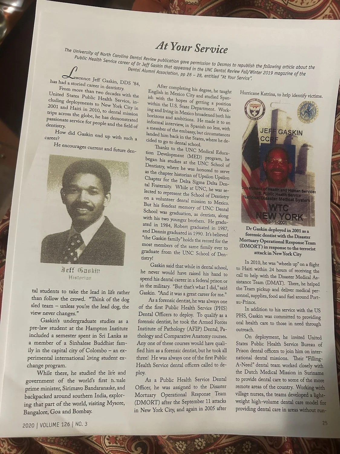
Jeff Gaskin article page 1
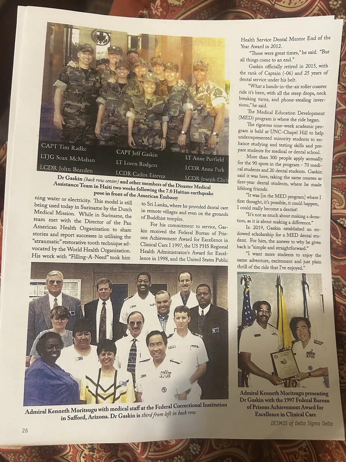
Jeff Gaskin article page 2
Jeff Gaskin was waiting for me at the Union Hall when Frank dropped me off. He, like Frank, was genuinely kind. I’ll let his article speak for itself, since I find myself at a loss for words. He took me in and fed me as he had done for other people who have walked before me. His philosophy was, simply, to say yes to life, and I think he is the reason I didn’t quit the GET in the Clifton.
Thank you Frank and Jeff, for being kind to a random stranger; your generosity is more than I could ever repay, so I will do my best to pay it forward.
Day 19: April 11, 2025 // 23.77mi, 3678ft+
Pinal Trail away from the Coronado Trail (Hwy 191)
Today was a good day; I enjoyed the walk and spent more time looking up at my surroundings than down at my feet. I had tried to reserve an Uber ride out of Clifton but as the guidebook mentioned, there are no Uber drivers operating with any regularity in the area, so I did the only other thing I could do and stationed myself at the corner across from the dollar store and stuck my thumb out.
Truck engines roared as they geared up to do the climb out of Clifton, up to the mine. No one looked at me through their windshields. I tried to keep my spirits up by smiling and waving at every vehicle. After about 30 minutes a woman pulled over in an SUV and rolled down her passenger window.
“Hi!” I said. “I am trying to get up the highway a ways, about 15 miles or so?”
Her phone was attached to her dash and she had someone on video call.
“I don’t know these roads and I only stopped because you smiled and waved. I’ve never picked up a hitchhiker before. This is my husband.” She gestured at the man on the screen.
I poked my head in the window and smiled at him. “Hello, I’m hiking from Phoenix to Albuquerque and I am just trying to get back up the mountain to my trail. I came into town to get more food night before last.”
“Get in!” She motioned for me to open the door. “I am headed to Tucson, is where you are going on the way?”
“I don’t think so,” I said.
“Well, just get in. I need to stop by my sister’s place in Morenci first, anyways.”
I climbed into her clean car and shut the door. I could feel her nerves at having picked up a stranger off the highway.
We stopped in a nice neighborhood of homes and she gestured for me to come with her into one of them. The home was dark compared to the bright light of the morning and I had to squint until my eyes adjusted. There was a parrot squawking and the news was blaring and I felt overstimulated. Then a kid came out of one of the bedrooms and asked me why I had a backpack.
“Oh, I’m walking to Albuquerque,” I said.
“Really? Like, are you camping?”
His name was José, he was 9, and he had plenty of questions about backpacking which I was more than grateful to answer while Victoria, my ride, chatted with her sister.
“José,” Victoria said. “I’m going to drive this lady up past the mine. Will you come with me?” She looked at her sister then. “I’ll bring him back afterwards.”
And I suddenly knew José was, in her mind, a bit of protection against me, the random lady covered in scratches and sunburn she’d picked up off the street. I smiled and thanked her.
View from Juan Miller Road
José was openly excited about the adventure and Victoria was cautiously curious, but she warmed to me the longer we drove. We talked about life and why I was walking and while I probably didn’t do a great job of explaining my trek, I think she gathered enough information to decide I was the safe kind of crazy, not dangerously unhinged.
When the time came for me to hop out and start walking, she seemed reluctant to let me go and sent me off with super-food powders and throat lozenges and prayers. I waved to José and he grinned. I hoped he’d get the chance to backpack someday; he seemed pretty keen.
After I walked several miles on the highway to maintain a continuous footpath, I joined a trail in the Ponderosa trees. It was such good walking, I could have cried tears of joy. Beyond the trail I walked briefly on an excellent dirt road which had two streams flowing directly across it. I stopped and soaked my shirt on one of the streams and made a granola, peanut butter tortilla.
Approaching Blue River on Clear Creek Road
The final leg of my journey took me along a careening 4X4 path closed to vehicle traffic that wound steeply up and down, in and out of arroyos in an off-camber fashion. The nature of it was wonky, but the views were spectacular.
I heard an engine approaching and stopped on top of a rise. It was a razor driven by someone in a US Forest Service uniform.
His name was Alex and he was stoked to see someone using the trail. I explained that I was hiking the GET, that a dozen or so people hiked it each spring and fall in part or in full. I told him how much I was enjoying this stretch of trail, which, it turns out, he was in charge of managing. We parted ways and I kept trucking towards the Blue River.
View from Clear Creek 4X4 Road
The guidebook warned that the Blue River could be a wide and treacherous crossing if the river was high, that the roar of the river could often be heard on approach, but when I arrived its flow did not even come above the rubber soles of my trail runners.
I hiked along the far bank until I found a suitable place to camp in the grass.
At dusk, as the sky grew a soft shade of lavender, tiny winged things emerged into the darkening sky; they flapped furiously, zigzagging into the night.
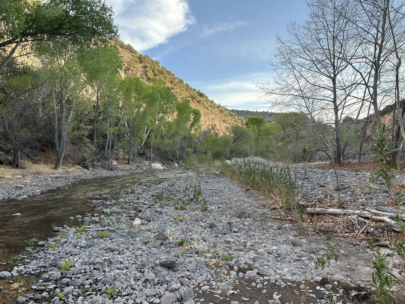
The Blue River
Day 20: April 12, 2025 // 25.86mi, 5236ft+
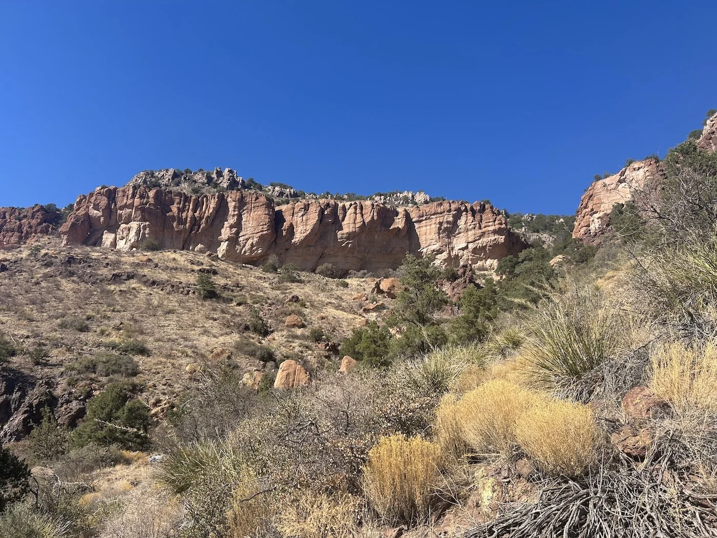
Morning light illuminating a wall of peach colored stone near
The canyon I climbed into, away from the Blue River, appeared lit from within and shone in hues of peach and cream; the stone looked as soft as hide.
When I reached the Wild Bunch Trail, the going became rugged but the navigation was easy enough. I encountered a long-dead cow early on, a heap of bones, skin and sinew, directly in the flow of the stream and was glad I had not gathered water yet. Beyond the carcass, the trail continued to climb, eventually leaving the canyon and gaining a ridge.
A view from the upper reaches of the Wild Bunch Trail
When I reached Morris Gap, I kept my eyes peeled for a spring. As I hiked away from the gap, I noticed a crumpled fence on the uphill side of the trail, which guarded a small cave in the rock. I hiked up to it and inspected the hole; inside was a shallow pool coated in a layer of neon-green duckweed. Good enough for me, I decided, and used my pot to scoop water into the bladder of my filter. I did my best to collect only the smallest amount of the ultra-minute lily pad-looking algae, knowing it could clog my BeFree.
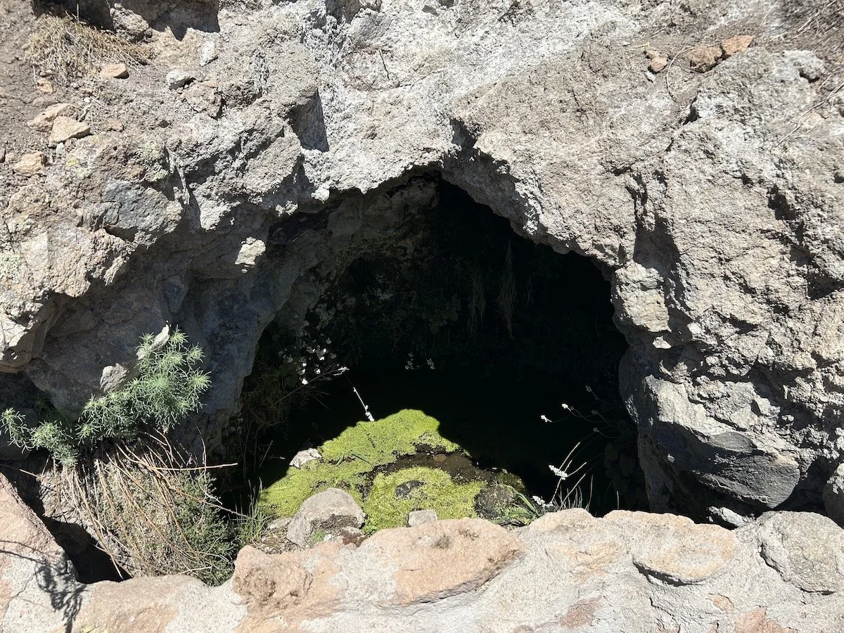
Cave Spring
At an unnamed saddle, I joined the Horse Canyon Trail which wound me past and over Maple and Charlie Moore Peaks before dropping me onto the Charlie Moore Trail. As I wound my way through dense foliage and over piles of rock, I considered the dramatic change in the terrain. It no longer felt like I was in the desert at all; I was at 7,600ft among the ponderosa trees and gamble oak. The environment was still painfully dry, but the soil wasn’t comprised of sand or shards of limestone anymore, and while there were still thorns aplenty, I didn't see a single prickly pear.
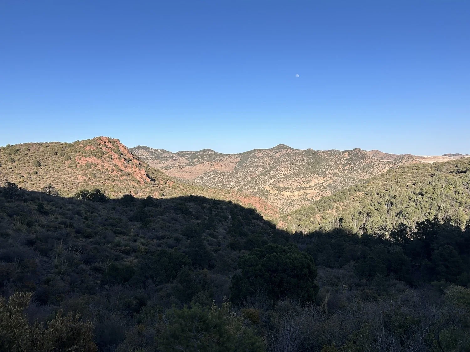
Maple Peak and Charlie Moore Peaks
I lost a little over 1,000ft to reach the border of New Mexico.
I teared up when I saw the battered gate marking the transition. Just beyond the gate stood a chestnut horse, its coat gleaming like copper wire under the hot sun. As soon as I undid the chain, the horse began to walk down the road and, after locking the gate behind myself, I followed. The horse didn’t rush and neither did I; I’d made it through Arizona—I’d survived Arizona—maybe I could finish this thing after all—halfway or just about—I couldn’t quit now, could I?
Crossing the AZ/NM border
I’ve crossed many invisible borders and each time I have felt things—relief, excitement, sorrow, regret, nostalgia, joy. This line felt significant because I believed it meant things would get easier. I believed it meant there would be more water now and maybe less thorns. I thought the trails would be easier to follow and more populous. I thought I was getting closer to home.
I believed the horses were a sign that I’d made it to the promised land.
A herd of horses at the New Mexico Border
I camped a few miles before Alma and a couple in a van stopped at dusk to offer me a muffin, disproving my theory that my tent placement was rather stealthy. They knew about the GET and thought my trip was so cool. I felt a little nervous after they left. Nice as they were, I didn’t like people to know where I was camped; suddenly I felt rather vulnerable.
Day 21: April 13, 2025 // 26.18mi, 6699ft+
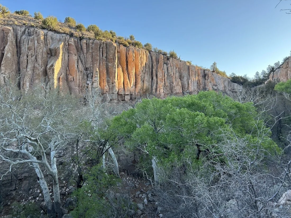
Cooney Canyon Trail along Mineral Creek
No one bothered my tent as I slept; I woke early and packed up before more traffic happened upon me and began hiking briskly toward Alma and the general store. Once there, I purchased some snacks to tide me over until Gila and ordered a burrito from the restaurant next door. The warm eggs and bacon and potatoes were truly delightful as I sat outside on a bench in the crisp morning air. I was filthy, maybe the smelliest I’d been yet on this trip, and tired. But I felt hopeful, too, and maybe even a little excited for the day ahead.
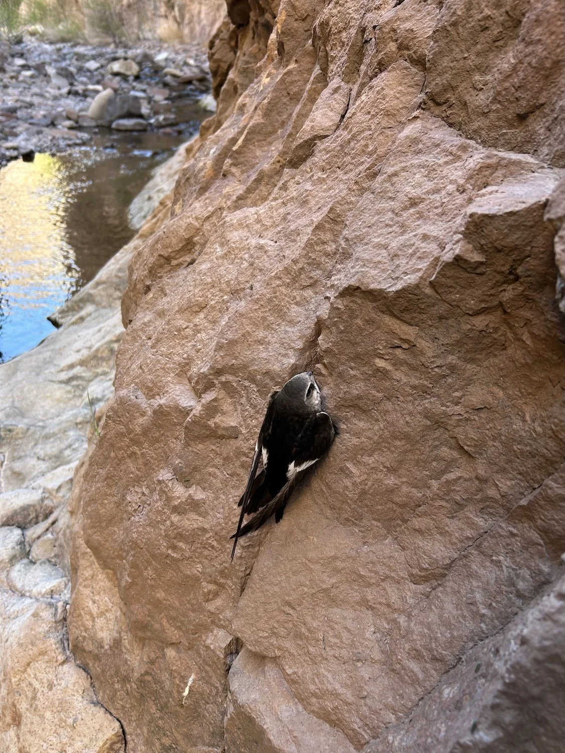
White Throated Swift clinging to a wall inside Cooney Canyon
“The smell of a cottonwood tree is warm spices and sweetness; behind those welcoming aromas is the cool, slippery promise of water. Cottonwoods grow where they can sink their roots into wetness; water is the source of their vividness, each of their leaves glowing like the pulp of a lime. A cottonwood and water are synonymous in the desert.” —except from my journal
I walked Mineral Road to the start of Cooney Canyon. The walls of the canyon were the color of rust and buckskin; a soft, warm light trickled over the upper edges of the walls and dripped down the rocks like syrup. I smiled into the rays as I traipsed through the shallows of Mineral Creek, pausing once to dunk myself in an emerald pool. There were plenty of day hikers in the near reaches of the canyon, but they faded the further I walked. Once again, I’d stepped into an unexpected Eden.
The trail away from Mineral Creek was well put in and relatively steep as it climbed toward the Crest. When I joined a road for 7 miles, I saw Katy and Joseph and their dog Hugo driving toward me in a truck. Joseph was the lone GET hiker I’d met on the Turtle Mountain climb before Clifton. They were scouting out the trailhead and trying to decide where to leave their vehicles for the next section. It was great chatting with them and hearing more about their experience thus far. They were a little behind me due to how they were shuttling their vehicles, but unlike me, they’d actually hiked the Santa Teresa Wilderness and done Ash Creek (the section that was destroyed by fire and flood in the Pinaleños). I was impressed and inspired by them; Ash Creek sounded down right terrifying due to all the erosion, though.
Bursum Road
The walk along Bursum Road was quick if not a bit dull, but it reassured me to see that there was very little snow lingering above 8,000ft. I’d been nervous about conditions since I wasn’t carrying micro-spikes, but it was clear I would not need them.
The Mogollon Crest Trail
At the trailhead for the Mogollon Crest, I sat down in the dirt beside the informational sign and ate a handful of Cheetos. My body felt tired and I wasn’t sure how much further I’d hike that afternoon.
A low rumble approached from the direction I’d come and several off-roading vehicles came into view. They pulled-up in the expansive parking area of the view point and three people emerged.
“Hello.” I waved, gathering my belongings around me so that I wasn’t blocking the sign.
“Are you hiking the CDT?” A man in jeans and T-shirt shaded his eyes and walked over to where I was sitting.
“The GET, from Phoenix to Albuquerque.” I took a swig of water.
“I wondered, we don’t usually get CDT hikers up here. Do you want a sandwich?” He motioned for his wife, who was still near their vehicle. “It’s turkey and cheese; we shot the turkey.”
“Have you seen any turkeys?” An older man in a flannel shirt stepped up beside him.
“I have, but not since the AZ border, unfortunately.” I took the sandwich from his wife who was holding an insulated cooler.
“We’ve got homemade pickles, too, if you’d like some. And here, take an apple,” she said. “We’re about to head home anyways.”
I thanked them profusely. The sandwich was delicious; the meat was tender and there was just the right amount of mayonnaise on the soft, white bread. I waved to them as they peeled out, back the way they’d come.
My energy recouped, I shouldered my pack and headed for the trail.
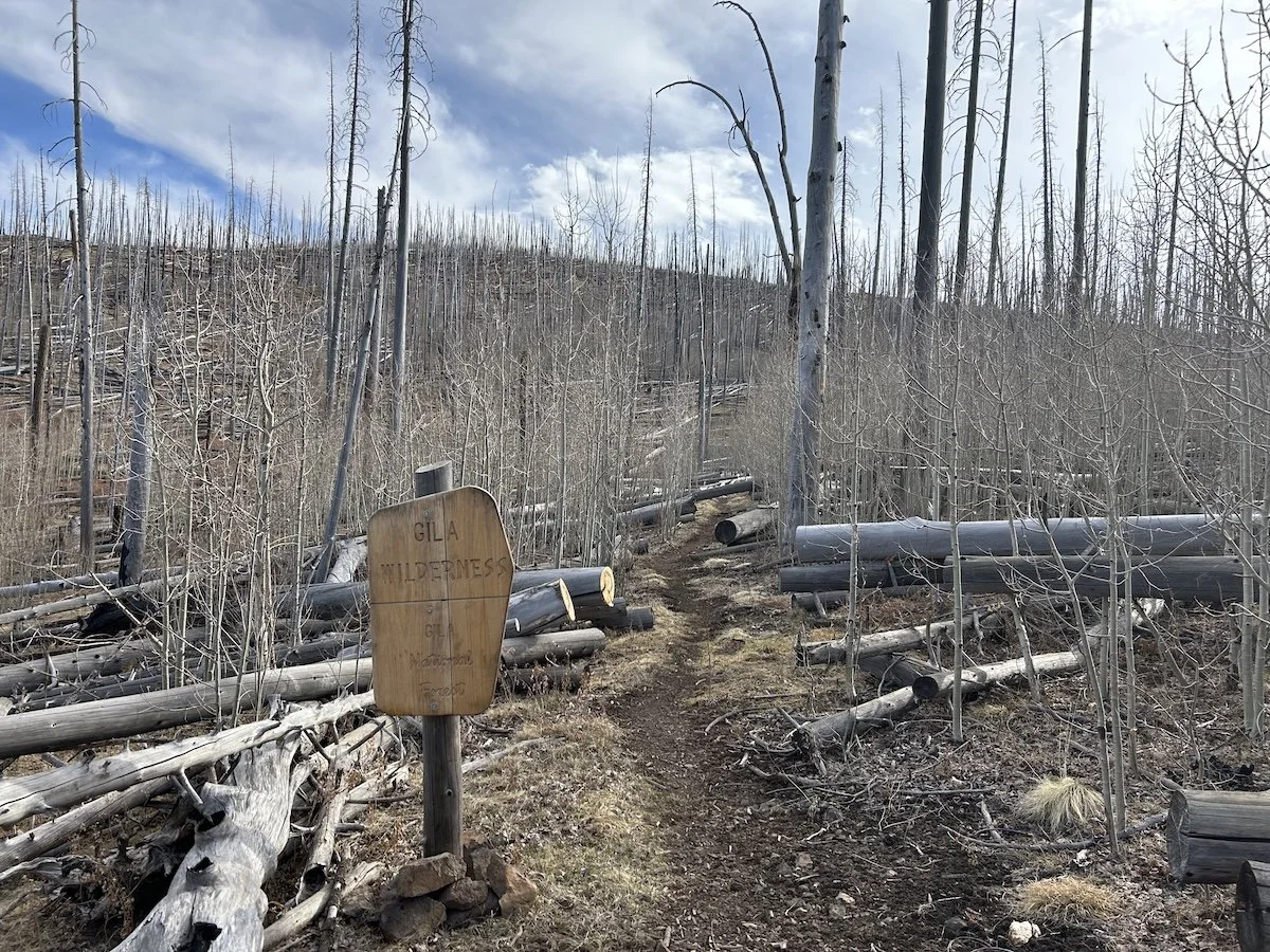
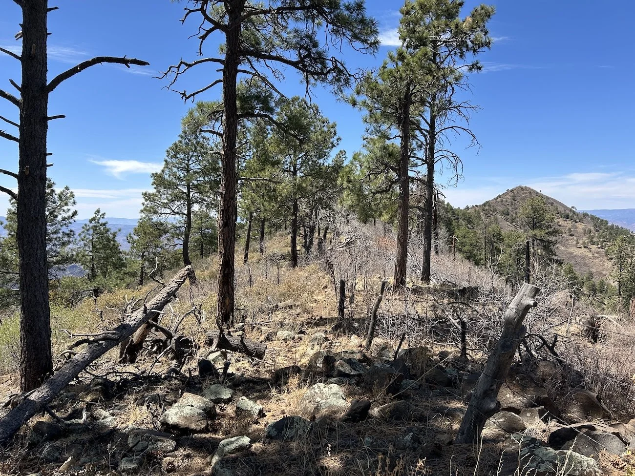
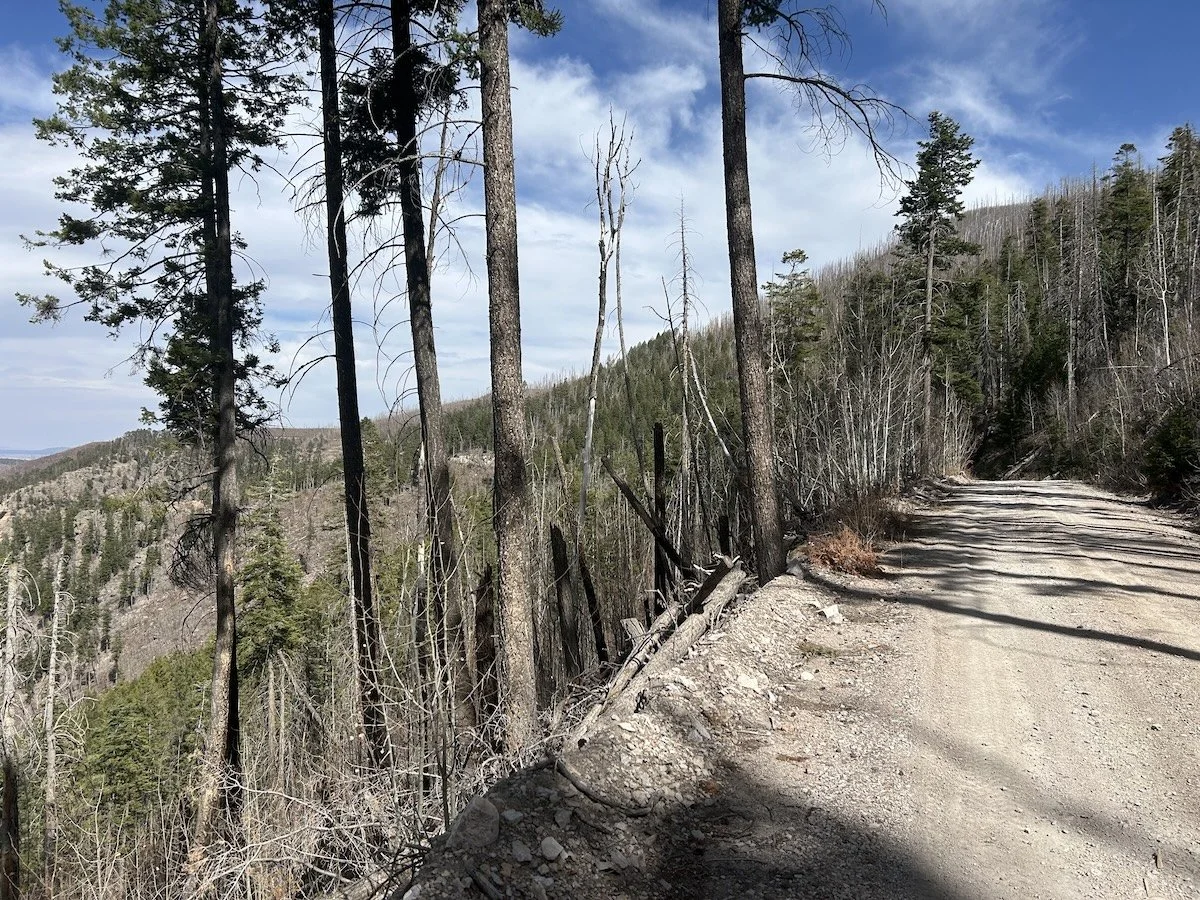
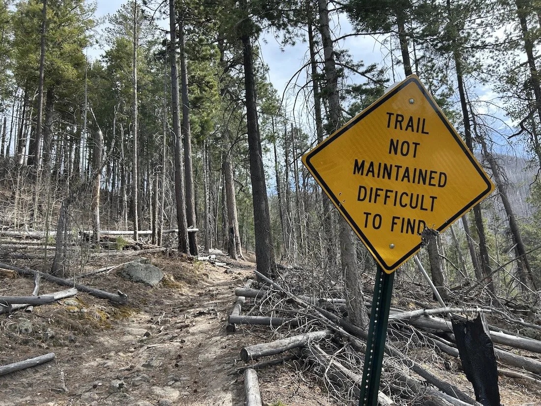
Burn scar in the Gila Wilderness from the 2012 Whitewater Baldy Fire, which burned 297,845 acres of the Gila National Forest; the fire was started by two separate lightening strikes.
“At 9100 feet you can hear the trees scream; the wind plays through their sun bleached bones, silver toothpicks beside charred matchsticks. A chorus of howls. It is not the sound wind makes combing through living things.” —excerpt from my journal
The clearing effort along the trail was massive. All in all the walking was outstanding; the few dead trees I had to clamber over, compared to the sheer volume that was cleared, felt like a gift. The miles I walked that evening along the Crest were the perfect ones to end a day on.
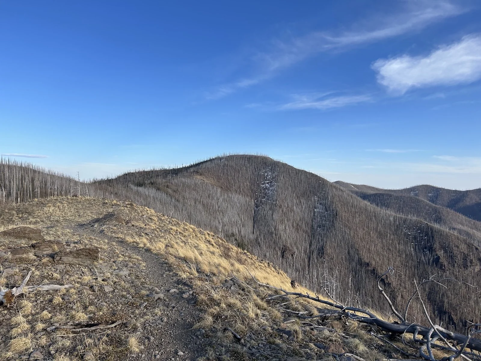
A sea of silver trees along the Mogollon Crest Trail
I stopped at Bead Spring and gathered some of its bitterly cold water and then continued on to camp at Hummingbird Saddle.
The evening grew cold quickly and I wrapped myself in every layer I had while I cooked a dinner of ramen and instant potatoes, but I resolved to watch the sun set through the skeletons of the trees and see the first star come out before bundling myself into my sleeping bag for the night.
So far, New Mexico felt like exactly the sort of adventure I’d been hoping for.
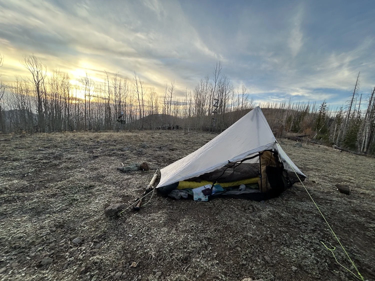
My tent at 10,400ft on Hummingbird Saddle